QUOTABLE: “When you hate, the only person that is suffering is you because most of the people you hate don’t know it and the rest don’t care.” ~Medgar Evers
On Monday, June 3, it was time to retrace our steps north and begin the post-Great Adventure part of our journey. This was all going to be stale road AND interstate, so you know I spent a lot of time paying bills, writing, etc. We went north on AZ-90 up to I-10, then took that all the way up to Phoenix. For lunch I found The Peppersauce Cafe, an off-the-beaten-path place that had some delicious tuna salad served on a bed of greens and veggies. Awesome!! Then we took the 303 Loop up to Surprise, and US-60 to Wickenburg. This is our second time in this town having passed through a couple of years ago heading over to California. At that time we noted that it appeared to be a nice place for a visit. We were too early to check in, so our first stop was for groceries at Basha’s in town, then we headed over to Horspitality RV Park & Boarding Stables around 2 PM. There was an issue with our site, which made me totally irritated (I’ll talk about that later). At this park you follow a golf cart out to your site . MW and I have a pretty good system for getting into sites and set up. I told the guy that, and he said “that’s great”, then proceeded to give different signals behind my back (I turned around and caught him). I try my best to keep calm and let things roll off, but Lord have mercy, I wanted to smack that man. I was flustered and MW was getting irritated. We don’t typically park in sites that are perpendicular to the road, and a concrete pad to scrub the tires and cause step issues, plus a fence at the back to keep my bike out of, made it a little tough. (Or maybe it was just that we were both grouchy by then. Who knows?!) We got it mostly in, then waited for the guy to leave to finish up. It wasn’t straight, but it was straight enough for both of us when we FINALLY made it into the air conditioning! It was HOT!!!


Tuesday was a lazy morning, hanging out at Priscilla. I spent some time editing the hundreds of pics for the Great Adventure blog post and generally enjoying not running around. By mid-afternoon it was time for a treat. If you’ve read this blog for long, you know that we are members of the USNA Alumni Association RV Chapter. At a chapter event in Colorado Springs a couple of years ago, we met Bill & Cindy Moore who live in the Phoenix area. I was so focused on the upcoming Great Adventure for Liam when we first arrived on the 21st that I didn’t even think to contact them. Then, of course, we had no time during the big event. As we were driving back through Phoenix on Monday, MW asked me where they lived. OMGosh!!! I totally forgot about contacting Cindy! (We meet lots of people along the way, and a few of them become good friends. I felt a connection with Cindy the moment we met.) Thankfully they were available, and this afternoon we drove back over to Surprise, Arizona, for early supper and a good long visit at Plaza Bonita. (Sadly, when we were at Usery Mountain Regional Park a couple of weeks ago, we were about 5 minutes from their house! Next time I promise to do better, y’all!!) We really enjoyed catching up, though, and hope to be able to meet in Wyoming in a few weeks, too. The drive over and back on AZ-74 was beautiful, and we realized that we looked at houses in that area back in 2011 when we almost got transferred. MW’s memory was jogged by the long-range firing range we passed along the way. LOL


Wednesday we got out early, first heading to Spurs Cafe for breakfast. Wickenburg really does have a cute downtown and seems to get a lot of tourist traffic, although it is busiest in the cooler months. Did I mention it was HOT??


Next we headed to higher elevations to check out The Shrine of St. Joseph of the Mountains in Yarnell, Arizona, about 30 minutes northwest. The scenery as we headed up into the Weaver Mountains was spectacular, showing why this curvy mountain road is popular. We found the shrine with no problem and did a bit of exploring. The statues were sculpted by Felix Lucero, a WWI veteran from Tucson, who was hired by the Catholic Action League of Arizona. Although built by Catholics, it has been self-sufficient (surviving on donations) and independent from any specific denomination since then. It is a place for all to pray, meditate, and wonder and the creative gifts given by God. The shrine has a statue of Joseph holding young Jesus, explanations of the stations or way of the cross, Jesus in prayer, the crucifixion, the empty tomb, and other scenes. It is spread out on a rocky hillside and is very well done. It must get a lot of traffic, because there appeared to be full-time caretaker. We enjoyed it and the walk in the cool breeze at 4,780′.


Reluctantly, we headed back down off of the mountain and into the heat. Back in Wickenburg we stopped in at the Desert Caballeros Western Museum to learn a bit more about the history of the area. Long before the town existed, the area was the part-time home of two bands of the Yavapai Indians. These nomads moved around their area all year chasing food sources and spent at least part of their time growing crops along the Hassayampa River. White settlers thought these tribes to be Apaches, and many were later sent to the San Carlos Apache Reservation. It wasn’t until the 1930s that they were recognized as a completely different tribe. Later the area was home to Basque sheepherders, as well as miners and farmers. As with many towns out west, its birth grew out of mining as merchants and others arrived to help the miners spend their money. Of course, typically where there was mining, there were troubles. One incident in 1871 ended with six people killed on the nearby stage route. The Apache-Mohaves were blamed at the time prompting troops to be sent to get them under control. Later, though, it was believed that the real culprits were Mexican bandits masquerading as Indians to throw everyone off the scent. In 1890, the Walnut Grove Dam northeast of town collapsed. Considered the worst natural disaster in Arizona Territory history, the town was wiped out by a 40′ high wall of water in only two hours. The resilient people rallied, though and rebuilt. Later they did their part for the WWII efforts as Echeverria Field became a training facility for Army Air Force glider pilots. When “dude ranches” became fashionable, the area reinvented itself again, this time into “The Dude Ranch Capital”. Since then tourism ranks high on their list of industries. The museum was pretty informative, and I particularly loved the diorama room, where depictions of the area through time were laid out in very intricate models. There was also a pretty cool general store setup based on Brayton’s Commercial Company, which was located on the museum site from 1906 until the 1960s. (There was a storekeeper projected onto a transparent screen, so you could see the goods on the shelves behind him. He moved around as he talked about the locals. Pretty cool!) The original museum was in the old store building until it burned down in 1972, and the current building opened in 1975. Oh, they also had the Cowgirl Up! art exhibition and sale going on where you could vote for your favorite piece. Of course, my vote went to an adorable cow painting. Before heading back to Priscilla, we drove around town to get a few pics.


Hospitality RV Resort and Boarding Stable is not a bad campground, but is adults only. Located right at the edge of Wickenburg, Arizona, you can get to anything in town within minutes. Facilities include a recreation building where a variety of occasional activities are held, a borrow library with books and DVDs, picnic area, clean bathrooms and showers, a laundry room, horse shoe pits, a dog park, propane sales, and the covered stable area with training arena and turn-out pens. There are about 20 tent sites and 95ish RV sites that are mostly back-in, some with 30-amp, but most with 50. RV sites were wide, with parking for a vehicle and a concrete patio, giving you lots of space for sitting outside. There were no picnic tables, fire pits, or grills, though. There were also a few park model cabins around presumably for rent. As hot as it was, we appreciated the large shade trees around most of the sites, but their handling of our reservation and the brusqueness of the lady in the office would keep us from giving them any more bucks. (See below.) For this visit in June 2024 we paid a little over $63 per night for 50-amp full-hookup back-in.


RESERVATION RANT: We booked our site, a 50-amp pull-thru, 4 months before arrival and paid in advance. When we got to the campground, the front desk lady gave us a back-in. I told her that we booked a pull-thru, to which she replied that there was no pull-thru available. She followed with “If you told us it was a necessity, then it would be written across the top of the registration sheet in red.” So you’re saying that I have to request the type of site I want, pay you for it, AND let you know that I really need it??!! When she gave us the receipt, it clearly had “Pull Thru Full Hookup” checked and the payment amount. In looking at their website, it said that pull-thru sites cost more, so MW went back to ask about that the next morning. Nope, she said. They are the same price. What the heck??!! We felt like they purposely give away the pull-thru site when someone wanted it for more days than we were staying. Not cool! Backing in is not typically a problem, but these sites were perpendicular to the road, which is not something we do often and the reason for the pull-thru request. As it turned out, because of the location of the sewer pipe, the fencing behind the site, and my bike rack on the back of Priscilla, we were unable to empty the tanks there, either. A similar reservations snafu happened to us before at a private campground near Albuquerque. Then someone moved us to a 30-amp site because someone else wanted the 50-amp we reserved. At least that time a very nice lady (not the one who caused the issue) apologized and fixed the problem.


Thursday was a relatively short day, so we headed out about 9 AM taking US-93 north to I-40 west. We passed the campground exit and went on into Kingman, Arizona, to Rutherford’s 66 Family Diner for lunch where the greek salad was awesome. After that we backtracked to Blake Ranch RV Park & Horse Motel east of town. Setup went smoothly, but dang, it was blazing hot!!


Friday morning MW walked to Dunkin’ Donuts down the road for coffee while I slept in a little bit. When he came back he sent me out behind the RV to look at the gift something left us. It was a headless kangaroo rat! Yuck!! (I did not give y’all a pic of that!) He surmised that it was probably dropped by a raptor flying over, because something on the ground would have finished the job or taken it along. We left it alone in case the hunter returned. (It was gone the next day, but it’s possible our neighbor removed it.) This campground has one of the best laundromats I’ve seen onsite with a dozen or so washers and dryers at good prices, so I headed over there to get the chore done for the week. Then later, I drove to Culver’s in town to concentrate on some writing and have a bite. (I tried their fish sandwich, which was pretty good.) After about 4 hours the Great Adventure post was mostly done, so I headed back to Priscilla with a food bribe for my proofreader. LOL.
SIDE NOTE: A few days ago I noticed these weird smudges down the side of Big Jake. It looked like someone rubbed all down the sides of the doors on purpose, and was easy to see, because that truck is DIRTY!! As I was finishing up the last post, I realized what it was. At the drive-thru animal park in Williams, Arizona, a mule deer took a liking to whatever dirt is on Big Jake and LICKED all the way down the side! I had been wracking my brain trying to figure out the mystery, then saw a pic I snapped of the little fellow doing it. Just goes to show you my memory really does stink!

Saturday we walked down to the truck stop for breakfast at Iron Skillet. The service was a little bit slow despite our waitress, Joy, running her tail off. Turns out that her co-workers called in, which she said happens just about every Saturday, leaving her stranded. She did a great job of keeping everyone apprised of the situation and juggling too many customers. One truck driver came in and started to grouse a bit, but we told him she was doing a terrific job. In the midst of her running around a woman came from the other side of the store and cleared ONE table. I told her that I was sure Joy was glad to see her, and she retorted “I’m her boss, so I’m helping out.” She finished that ONE table, then disappeared, never to be seen again. Some boss!


After finishing up, we headed to the Visitor Center in Kingman to see what we could find. It was set up very nicely with lots of information and two large gift shops. There was also a museum about the area where the $10 price of admission got you into two other museums in town. Deal! While many of the towns in this part of the country cropped up because of mining, Kingman is different. It was founded along the Atlantic and Pacific Railroad (became Santa Fe) between Needles and Albuquerque. Building began even before the track was completed in 1883, but once it was done, things grew fast. Within 5 years the county seat was moved from Mineral Park to Kingman, and by 1900 there were more than 500 people living here. The railroad brought lots of people, and the Beale Wagon Road did, too. Travel to this area wasn’t without its dangers, though. In 1858 several families headed west on the newly completed route. As they approached the Colorado River, they split into smaller groups to water their animals. The Mojave Indians seized the opportunity to attack the emigrants, killing around 9 and wounding another 15 or so. The Rose Party Massacre, as it came to be known, was enough to send the surviving emigrants back to Albuquerque, abandoning most of their belongings. In 1926, the Mother Road, Route 66, came through town and brought with it lots of nomads. Just a few years later in 1929, Charles Lindberg dedicated the Transcontinental Air Transport airport. Then the onset of the Great Depression and the drought that exacerbated the “Dust Bowl” pushed more than half a million people west in search of jobs. There are many photos of the downtrodden camping out along the highway on their way to what they hope will be a better life. More growth was spurred by the Kingman Army Airfield, which arrived during World War II. This really is a nice town where you can enjoy museums, restaurants, hotels, and plenty of beautiful scenery.


INTERESTING NOTE: As I said above, hundreds of thousands of people headed west during the Great Depression and the drought. These were Americans who were relocating in an attempt to find jobs to feed themselves and their families. California, which became a state in 1850, had an interesting response: They started “bum blockades”. Basically police officers sent by the elite to function as a makeshift border patrol and keep the “hobos” out. The San Bernardino Sun headline said “BLOCKADE OF HOBOES EFFECTIVE”, and the Sacramento Bee even reported a “box score”. In one week in February over 1,000 people were stopped, some of whom were simply winter visitors. State officials said that 200 persons a day were entering the state, and the yearly total was more than the gold rush of 1849. They said Uncle Sam should help the state with the refugees. The citizens were up in arms because, according to news reports, these people were “undesirables”. Isn’t it interesting that a state that wants the country to keep its arms open to MILLIONS of illegal aliens, many of whom, according to Border Patrol sources, are ACTUAL undesirables, tried to close their border to AMERICAN CITIZENS? Odd that people who didn’t want folks from other states to relocate during a crisis don’t think that Texas, Arizona, and New Mexico should be able to protect their own borders now. Funny that their biggest issue was a lack of funds to accommodate the onslaught, yet they believe we, as a nation, can continue to foot the bill for the millions that have and continue to arrive. Hmmmm.
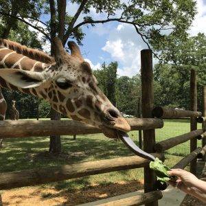
Next it was on to my favorite part of the day…spending time at Alpacas of the Southwest, which is just across from the campground. Owned by a nice couple who had never considered owning an Alpaca ranch until the wife watched a TV show about them. She called her husband at work and before long they had 5 new mouths to feed. That was in 2003, and today they have a nice-sized herd. Agri-tourism makes up a large share of their business, but they also sell and have rugs made out of the harvested fleece. We got to meet a couple of sweet animals up close and personal, feed them, and learn about raising them. Unlike llamas, which will spit on you, alpacas are mostly sweet, gentle animals with cute personalities. They only have teeth on the bottom and don’t bite. We fed them kibble from our hands and leaves, some from our mouths!! It was awesome, and MW is seriously in danger of owning a small herd in the future. I think Sneedville would be a good place for them!


Sunday was busier than I expected when we got up in the morning. First, we drove up to Chloride, Arizona, an old mining town about 40 minutes from our campground and 4,022′ up. Founded in 1862 when silver was discovered in the nearby Cerbat Mountains, the town is now described as a “living ghost town”. The post office, which opened initially in 1873, then closed for a bit before reopening in 1893, is the oldest continuously working post office in the state. The Butterfield State Line and Santa Fe Railroad both served the community, and the jail and houses original to the town are still there. During the mining heyday, there were more than 2,000 people in town working about 75 mines that pulled gold, zinc, copper, lead, turquoise, and other ore out of the earth. Today there are only a few hundred residents scattered around the hills. Our main reason for the trip was to attend services at Chloride Baptist Church, which is the oldest consistently attended church in Arizona. It started in the late 1800s, originally in a Pullman railcar, and the current building was built in 1917. Pastor Ralph Wells gave a nice sermon with two points from one of Paul’s letters to the church in Corinth: Give quietly without being showy, and if what you are doing is too easy, maybe it is not the path God wants you on. Logically, as soon as God gives us a path, the devil is going to start throwing stuff in our way. He spurred me to get back to something that I have been strongly drawn to but have let other things get in the way of. (More on that down the road.) After church, we headed over to Yesterdays Restaurant for a bite of lunch, and as it turned out, a little karaoke. They have Sing-a-Long Sunday every week…FUN!! We hung around longer than planned, because they had a peach pie coming out of the oven. I don’t like peaches, but MW is a fan, and how often do you get it that warm and fresh??!! Chloride is not a touristy town, but truly a community trying to survive. We enjoyed the visit.


When we finally left, we headed on a drive we originally planned for Saturday, but just didn’t feel like doing. Man, we were both glad we did it today. We took the old Route 66 up the mountain to Oatman, Arizona, a very touristy little spot with one truly unusual quality…there are wild jackasses just roaming around everywhere. (Not people, y’all.) Apparently, this was also a mining town, and when it dried up, the miners just left everything, including the burros. They have since multiplied and, judging by the large number of poop piles we saw on the road going up, are all around the area. A couple of the stores sell feed, so they like the tourists. After we didn’t go up on Saturday, MW considered driving this route on our way over to California on Monday. Thank God one of the guys at the campground told him about the 40′ restriction, because it is not marked on the map and is not on the DOT site, either. The road was very narrow going up over Sitgreaves Pass (elevation 3550) with a steep drop-off on the right side. On the way up a couple of rental C-class RVs that were afraid of hitting the rocks on the hillside on their right, tried their best to move us off the pavement and down the hill. We think towing Priscilla up and over that would have been a white-knuckle experience the whole way. It was worth the drive, though, as the views were absolutely amazing. We parked in town and walked around a little bit, checking out the candy store and getting some ice cream. The place has a western flair similar to Tombstone, but is much smaller, and they even have a gunfight in the street several times a day. It was too hot to linger very long, but we enjoyed the walk, and loved the jackasses! On the way back we picked up some groceries before turning in.


Blake Ranch RV Park & Horse Motel was really nice. Just off of I-40 and a few miles east of Kingman, it gives you easy access to everything in town. You can also get to the Grand Canyon from here, although it would be a long day. Amenities include a recreation hall, laundromat, office/store, onsite propane sales, horseshoe pit, dog park, RV storage, covered horse stalls, wifi, and a bathhouse. Their website and brochure both list cable TV, but that hasn’t worked since 2023, and there are no over-the-air channels. Cell signals were strong, though. Lodging opportunities include a private bunkhouse in the corral area and the campground. The latter includes 57 gravel, 50/30-amp, full-hookup sites in both pull-thru and back-in. The sites are well-spaced, some with trees, but most out in the open. Bathhouses were older, but clean, and the property was well-maintained. The only negative was the noise from I-40 and the truck stop at the bottom of the hill, but this is not a bad place for a stopover. For this visit in June 2024, we paid just under $57 per night.


On Monday, June 10, we hit the road heading further west, first on AZ-68. We crossed the Colorado River into Nevada at Laughlin and continued west on NV-163. At Searchlight, we hit NV-164 and crossed into our third state for the day, California. That is where we saw these giant, crazy bright lights on the other side of the valley. Turns out it was the Ivanpah Solar Power Facility at the base of Clark Mountain. There are three boilers on 459′ tall towers. The solar field with thousands of heliostats, each with two mirrors, focuses the sun’s light directly on the boiler receivers. The water boils, creating steam, which in turn drives steam turbines. I had never even heard of such an animal. It was pretty cool-looking from miles away, for sure.


At I-15 we continued west over to Baker, where we found The Mad Greek for gyros (okay) and checked out the thermometer museum. Yes, you read that right. It seems that the world’s tallest thermometer is located in Baker and commemorates the hottest day ever recorded. The mercury on July 10, 1913, hit 134.1 degrees at Furnace Creek Ranch in Death Valley. A day about which the ranch caretaker was quoted as saying, “It was so hot that swallows in full flight fell to the earth dead and when I went out to read the thermometer with a wet Turkish towel on my head, it was dry before I returned.” Whew! The thermometer is 134′ tall and can measure temps up to, you guessed it, 134 degrees. Local Businessman Willis Herron spent $750,000 in 1991 to have the steel sign built next to his restaurant. Imagine his dismay when, before it was even lit, wind took it down. Not to be deterred, it was rebuilt, but this time with a LOT of additional concrete. The new version, which weighs in at almost 77 thousand pounds, is still standing today. The sign and restaurant changed hands a couple of times, and one of the owners actually turned it off in 2012 because the electrical costs were too high. After a while of not being maintained, there was talk of tearing it down. Barbara Herron, widow of Willis, was having none of it, though. In 2014 the family re-acquired the property, and she used her savings to have it restored. It was relit on the 101st anniversary of the day it celebrates.


Back on the road, we took CA-127 up to Shoshone and the Shoshone Village Campground. The scenery all day was amazing. Just before Shoshone, the road was flanked by white hills that almost looked like concrete.


As the evening cooled off a bit, we walked around the campground and up the trails in the adjacent hills. This park is adjacent to a natural warm spring, which fills the pool, and a nature trail. There are also small ponds in a rehab area where they are trying to bring back the Pupfish and Amargosa vole that used to be in this part of the Mojave. We didn’t see either of them, but did spot a rabbit and some skunk poo. The views were terrific, though.


Tuesday started at 5 AM, and unfortunately I had a migraine. Soldiering on, I took my meds, and we hit the road. Any other time I could have taken it slow, but you do not want to be hiking at our destination once the sun is on you. Trust me! Walking from the shade out into the sunlight you feel a little bit like a vampire about to turn to ash!! It was 90 degrees when we left at 5:39 AM. We headed north on CA-127 to CA-178, where we passed through Jubilee Pass in the Black Mountains and dropped into Death Valley. We drove north enjoying the scenery, and stopped at Badwater Basin, the lowest elevation in the western hemisphere at 282′ BELOW sea level. The area smells funky, but the water isn’t actually poison, just very salty. The entire valley is filled with salt flats, just like the area around the Great Salt Lake and Bonneville Salt Flats in Utah. Most of the valley is sodium chloride, or table salt, but there are also calcite, gypsum, and borax.


We went a few more miles up the road and stopped to take the short hike to Natural Bridge. There was a sign at the beginning of the trail that said basically that desert hiking is not so different than any other hiking EXCEPT excessive heat, no water, rugged terrain, spiny plants, poisonous creatures, and too much water in the form of flash floods. And if that isn’t enough to give you pause, the hot wind works a bit like your convection oven to cook you as you walk. Well, that made it ever so appealing! Seriously, we wore hats, took water, and kept an eye out for spiny things, and anything that could bite or sting us, and we were going less than a mile round-trip before sunrise. It was already 95 degrees, though. We did beat the sun back to Big Jake, but not by much. Thankfully, the rest of the day was mostly inside the truck. We continued north, driving out to Devils Golf Course, which looked almost like a different planet. Called a saltpan, it is filled with jagged salt formations that actually make noise as they expand and contract in the heat. While it looks like a sturdy crust, it is very delicate. Next we took the loop out to Artists Palette, which gets its name from the beautiful color variations in the rock. We finally made it back to sea level at Furnace Creek by around 8 AM. It was 100 degrees. We stopped for breakfast at the 1849 Restaurant at The Ranch At Death Valley. After spending several hours driving through the beautiful nothingness that is Death Valley, we were surprised to find the resort grounds green and lush with foliage, flowers, palm trees, and even a fountain.


After lunch we went to the Visitor Center and stopped at a monument to the Death Valley 49ers Gateway. Then it was back on the road, heading southeast on CA-190 through Furnace Creek Wash in the Amargosa Range. Along the way we took the drive out to Dantes View, located at 5,475′ almost directly above Bad Water. If you are passing through this area and only have time for one stop, make it this one. The views up and down the valley are spectacular. Overall, Death Valley is worth the trip. I strongly recommend coming in cooler weather, though! LOL After getting back on CA-190, we took CA-127 back to the campground.


By the time we got back to Priscilla, I was wiped out. Between the lack of sleep and my migraine meds, I just needed to crawl in the bed for a bit. After checking the weather, we bailed on the planned Las Vegas Aviators baseball game in Las Vegas. Neither of us were interested in sitting outside in 100 degrees for 3 or 4 hours! Instead, we went to The Famous Crowbar Cafe & Saloon in Shoshone. Now to give you a mental picture, this town has a tiny museum and a handful of other tiny buildings. There is no stoplight, but there is one gas station. It cannot be more than 1/2 mile from the campground on the north side to the thing that is furthest south. The restaurant is rustic, at best, and we really had no expectations of excellence. The bartender recommended the trout, so that is what we both had. OMGosh!! It was cooked whole over an open flame with lemon and whatever other goodness he would stuff in there. About 40 years ago, I took a trip to Montana with my ex, who was then the boyfriend, and my mom’s boss/boyfriend. We stayed in a little cabin on a trout stream. There was a fire pit and a tiny little restaurant on the property. The owner went trout fishing during the day, and what he caught was supper. IT. WAS. AMAZING!! This fish tasted like that. We were both stunned and delighted AND stuffed to the gills. (Pun intended.)


Wednesday we took a ride over to Pahrump, Nevada, going the long way via Tecopa Hot Springs then NV-160 north. We were mostly alone until hitting the 4-lane, and amazingly the only guy we passed was a truck with a TENNESSEE tag!! Our first stop was for lunch at China A Go Go. I’ll admit to not being impressed when we walked in. It looked like a fast food joint, but the food turned out to be terrific. As we pulled in, MW noticed what he thought was a cell phone in the parking lot. We took it in with us, then tried to find out who it belonged to. It was heavier than a normal cell phone and had odd apps. After a few minutes of trying to get some info out of it, MW realized that it was something to do with jail…the Nye County Jail, to be exact. The app that gave it away had a handcuff icon and said “Out of Cell”. There was also “inventory” and “at meals” among others. I called the county number and got through to a man at the jail. I explained the situation, told him where we were for them to pick it up, and even offered to drop it off later. He seemed doubtful and told me to hold while he talked to his supervisor. In about a second, the supervisor was on the line thanking us for finding it. He got the information on where we were and said his deputy would pick it up immediately. (We could recognize him by the kevlar vest and nice mustache. No joke!) I guess it was a bigger deal to the supervisor, because the deputy showed up just a few minutes later. He thanked us for calling them and said it must have fallen off of his utility belt. Good deed for the day…check. On the way into town there was a billboard for a place called Pinkbox Doughnuts. It caught MW’s eye, so that was stop number two. It was inside the casino, and we were shocked at the cigarette smoke that hit us in the face as we walked through the doors. I thought that was banned everywhere now! We held our breath as we walked to the other side, which thankfully seemed to be non-smoking. It was totally worth it when we got to the bakery. This is another must if you happen to be near one in Nevada. Our final stop was actually the reason for the drive, Bookworm Haven bookstore. It was a pretty good place, and I had a good visit with the lady working there while MW browsed. (He always takes longer than me!) It was finally time to head back to Priscilla, and we took the short route on NV-372 to CA-178. Have I mentioned lately that it is HOT??!!


When we first arrived at this campground, I asked about the beautiful trees that shade the sites. They are Salt Cedar and grow up to 59′ tall in salty or alkaline conditions. The leaves look like segmented green pine straw and sometimes have a salty crust. They were initially brought over for erosion control from Asia and Africa. Like kudzu, which was introduced here for the same reason, it is considered invasive. They are beautiful, though, and the sound of the wind blowing through the fine leaves is lovely. That reminded me of the Australian Pines in south Florida. Oh, and the leaves taste like salt. We appreciated the shade that they provided in the 113 degrees in Shoshone!

Shoshone RV Park is a basic, community RV park on the north end of the village of Shoshone, California, near the south entrance to Death Valley. Although it feels really remote, Pahrump, Nevada, which is a fairly large town, is only 25 minutes away. Facilities include a laundromat, bathhouse, library, community room, and fire pit. There are 25 full hook-up sites with either 30- or 50-amp electric and several tent sites, too. Visitors can swim in the pool fed by natural warm springs, hike on local trails, and check out the rest of the village. Over-the-air TV coverage and cell signals were nonexistent, but there is okay wifi at the park. This would probably not be a destination park, but is fine for visiting Death Valley. For this visit in June 2024, we paid a little over $33 per night.


Thursday it was time to move on up the road, and that required a little back-tracking through Death Valley via CA-127 north and CA-190. We passed Furnace Creek, then about 18 miles north of that, turned southwest and stopped to take a look at Mesquite Flat Dunes near Stovepipe Wells. After that we began the climb up over the Panamint Range. On the other side is a long, steep (9%) grade that runs for about 9 miles. TOWING HEADS_UP: MW noted that, had we been eastbound, towing up that climb would have been rough in the heat. We stopped for late breakfast at Panamint Springs Resort, where the gravy was too salty, but everything else was pretty good including the nice lady working there.


After lunch we continued west, stopping at Rainbow Canyon, which is used for low level navigation training for the military. In fact, much of this area and parts of Death Valley are included in one of the largest military aircraft training areas in the United States. Sadly, we didn’t get to see any of the fighters pass through, but we were looking, because that would have been too cool! As we crossed over the last of the mountains for the day, we caught sight of the beautiful Sierra Nevadas capped with snow in places. What a contradiction this day was! The final leg was CA-136 up to Lone Pine, where we stopped at the Boulder Creek RV Resort south of town.


CRAZY SIGN: As we were beginning the climb out of Death Valley, there was a road sign that said “Avoid Overheating – Turn Off AC Next 20 Miles”. At the time it was 91 degrees at 9:37 AM. I don’t think so!! Wonder how many folks actually do that? MW just kept an eye on the temp until we were over the pass.
Friday I headed to town early to get the laundry done at the Lone Pine Laundromat, which wasn’t bad. Before I was done, a teenage boy came in to wash some clothes. I helped him get things going, and we ended up talking a bit. His Dad was working in the area, and he was also taking time to visit his Grandpa. He had the sweetest smile and talked about his family, fishing, and the desert. I always enjoy talking to young people, and it is especially nice to find ones with their heads on straight. After finishing up, I spent a few hours writing, then headed back to Priscilla.
Saturday morning we headed over to check out the Manzanar National Historic Site. This, like Tule Lake National Monument that we visited a couple of years ago, is the location of a World War II Japanese internment camp. While Tule Lake mostly relied on imagination with only one original building and no Visitor Center, this site is very well done with several original buildings, some rebuilt buildings, and a nice museum with a movie, many artifacts and stories, and a really cool scale model of the park. To understand the ugly history of these camps, read the Tule Lake post, but here are a few highlights:
- This camp was built on 1 square mile that was once the abandoned town of Manzanar, California.
- More than 10,000 people were confined here and somewhere around 105,000 were sent elsewhere.
- Over 60% of them were American citizens born in this country who just happened to be of Japanese descent.
- About half of the detainees were children, and there was a school that met California standards within a year of the camp’s first detainee’s arrival. Early grades were taught by detainees, but once in high school, they were taught by certified Caucasian volunteers.
- When sent to the camps, the detainees lost their homes, farms, and businesses.
- The community was arranged in 36 blocks of 14 barracks each. They ate in a mess hall, washed clothes in a public laundry, shared latrines and showers with no privacy, and an auditorium.
- The initial housing was very sparse. Detainees were given a cot, mattress, and two blankets. There were no places to sit or storage places for their meager belongings. The side walls and floors were just board, and every storm brought loads of sand inside.
- In 1942, the government started upgrading to make things a bit more livable.
- After the initial shock, many of the detainees did their best to create a life within the fence. They planted gardens, bartered, played sports, kept house, and taught their children as best they could.
- Mothers with babies would have to get up in the night and walk to the mess hall to mix up formula.
- Scientists and nursery men who were detained worked on the Manzanar Guayule Project, which created rubber desperately needed by the United States during the war. They were given little credit for their contributions.
- Detainees at Manzanar and eight other centers who caused problems were sent to Tule Lake, California, which housed over 18,000 people during its tenure.
- Many other countries including Canada and parts of Latin America had similar programs for their “Jap problem”.
- After almost 4 years of detention, the Army announced that Nisei males (first generation Americans, i.e. children born in the United States or other countries to parents born in Japan) would be drafted from the camps. That took a lot of nerve!! Understandably, there were protests and resistance.
A couple of quotes from residents:
- “There were no trees, nothing green, it was all brown . . . By the time we arrived there, they were in the middle of a dust storm. You couldn’t open your mouth because all the dust would come in. You could just barely see, and the only way to keep your eyes clean was to just cry and let the tears wash your eyes out . . . It was a horrible feeling and there was total confusion.”
- “My attitude changed because I thought it’s sort of like an adventure for a teenager . . . But when I started seeing that my dad is losing his business, we’re losing all our property. He lost his new car that he worked so darn hard for. What for? . . . Then when finally we went to camp is when I realized the injustice of the whole thing.”
- “With below-freezing temperatures, early arrivals had no heaters; nor was there protection from the severe dust which came pouring through the openings in the eaves, the wide cracks in the floors. By night, sleepers could gaze up at stars through knot holes and slits in the roof.”
- “Going to school at Manzanar, at elementary school, [we] were taught by the camp residents . . . As I got to junior high school, we had Caucasian teachers . . I kind of resented the fact that they were teaching me . . . I didn’t realize the heart of those people who wanted to help . . . and I had a deeper appreciation for their sacrifices, because they weren’t teaching in the most ideal conditions. And dealing with rowdy boys was not their pleasure. But I really began to appreciate their effort, and their caring for people in camp.”
This one from a teacher was rather poignant: “Part of my teaching assignment at Manzanar . . . was the U. S. Constitution. This study was a state requirement for all high school students, so in our tar-paper barracks school room, behind barbed wire and search towers, I collected dimes to help get four cases to the Supreme Court challenging the internment. To the dismay of the students and their teacher, all [but one of] the cases were lost on the ground of ‘military necessity’.”


This area has a rich culture, and the museum touches on that, too. For thousands of years the Owens Valley Paiute tribe lived along the streams near Manzanar that flowed off of the Sierras. They created an irrigation system to grow foods, hunted game, and traded with tribes over the mountains. Then in the 1860s, gold and silver were discovered in the area, and that brought prospectors. Behind them, ranchers and farmers emigrated from the east, often using the irrigation systems created by the Paiutes. This and scarce food caused conflict, and in 1863, the Army intervened and moved the Paiutes out. In 1905, the city of Los Angeles decided to build a 230-mile-long aqueduct to bring water from Owens Valley to their population. At the same time George Chaffey, an agricultural developer, bought a ranch and started piping water from local creeks and planting thousands of apple trees. The new town of Manzanar began to grow and dozens of families moved in. For almost 20 years, apples were in. Then Los Angeles began to buy up additional water rights and property, including Chaffey’s orchards. By then the aqueduct was sucking the water completely out of the valley, leaving the dry riverbed. While some residents accepted the situation, some declared war on the aqueduct, and it was bombed many times. It was all for naught, though. Within 10 years, Los Angeles owned virtually everything, and Owens Lake, the huge lake in the middle of the valley, was dry. The residents experienced another blow when the Inyo County Bank, which housed the money residents had received from selling their property, failed. As families lost their savings and businesses throughout the valley collapsed, the town’s death nell was sounded. Later the bank owners, Mark and Wilfred Patterson, were convicted of embezzlement. By 1934, all of the families had left, and the town of Manzanar dried up. Today tourism is big in the valley, but the town is no more.


By the time we finished there, it was time for lunch. We headed to The Grill downtown for sandwiches. Then we checked out The Museum of Western Film History. Have you ever watched a western movie or TV show and noticed desert scenery with a lot of big, boulder hills around? If so, chances are pretty good that you’ve gotten a glimpse of this valley. Near the town of Lone Pine, California, Mount Whitney, the tallest mountain in the lower 48 at 14,505′, jutts out of the Sierra Nevada Range. The jagged peaks that sport year-round snow are in sharp contrast to the Alabama Hills that run alongside. (Were the people who named these hills from Alabama? No. Miners sympathetic with the Confederate cause named their claims after the CSS Alabama, a raider that wreaked havoc on Union shipping.) The small formations are rounded and often appear to be piles of stacked up boulders, some reddish in color, with flat areas between and around them. Hollywood figured out a long time ago that this is the perfect site to film bandits chasing a stagecoach or a cavalry ambush or the surface of a distant planet or even the location of worm monsters. The open, flat valley with the Alabama Hills on one side and the Sierra Nevadas in the background makes an easy, spectacular screenshot. I have seven favorite western actors…Dale Robertson, Audie Murphy, Randolph Scott, John Wayne, Robert Duvall, Sam Elliott, and Tom Selleck. (I know, it’s a lot, but they are too good to weed out! These men can sit a horse!!) The first five spent time in this area filming so that I could fall in love with them later. I really appreciate that, because I’d rather watch a western than most anything else. Many of the old western series shot here regularly, and in more recent years the casts of Star Trek V: The Final Frontier, Tremors, and Django Unchained made their way into the valley. This museum showcases the film industry in the area with a 15-minute movie and quite a few artifacts from the productions, as well as some of the stars. There is also a pretty cool Stetson display showing the hats worn by several western stars and a video on how they are made. All in all, it is a pretty good museum and a nice gift shop.


There is a quote about the Duke by Scott Eyman from his book, John Wayne: The Life and Legend, that I thought was pretty good: “He was so American, so like his country – big, bold, confident, powerful, loud, violent, and occasionally overbearing, but simultaneously forgiving, gentle, innocent, and naive…John Wayne was his country’s alter ego.” Maybe that’s why so many people love him in both western and war movies.
There was another quote that I liked from The Duke, himself: “We must always look to the future. Tomorrow – the time that gives a man just one more chance – is one of the many things that I feel are wonderful in life. So’s a good horse under you . . . or the only campfire for miles around; or a quiet night and a nice soft hunk of ground to sleep on. A mother meeting her first-born. The sound of a kid calling you dad for the first time. There’s a lot of things great about life. But I think tomorrow is the most important thing. Comes in to us at midnight very clean. It’s perfect when it arrives and it puts itself in our hands. It hopes we’ve learned something from yesterday.”
Sunday morning started with services at Mt. Whitney Baptist Church. There we were welcomed with open arms by Pastor David Swieringa and several of the congregants. Remember last Sunday when one of the sermon points was that if what you are doing is too easy, it might not be the path God wants you on? Well this week the message was about doing the work of God with humility and generosity. That’s two in a row! God is definitely telling me to get back on the project! After visiting for a bit after the service, we had lunch at Mt. Whitney Restaurant. Our only other stop was a quick grocery run, then it was back to Priscilla for a relaxing afternoon. Well, there was a bit of writing and a walk around the campground for pics, too.


Boulder Creek RV Resort is a pretty nice private park. Although the sites are fairly close together, it was generally quiet except for a bit of highway noise. Located a few miles south of Lone Pine, California, it provides easy access to restaurants and stores, plus quite a few attractions. Campground amenities include an office/gift shop, swimming pool and spa, playground, horseshoe pit, basketball court, large clubhouse with kitchen, fenced dog run, laundromat, propane sales, and wifi. The coolest things there, though, were the birds in the clubhouse and the tortoise enclosure. Visitors can stay in one of several cabin/park models or the campground, which includes RV and tent sites. The former are mostly pull-thru and, all except the tent sites, are 50/30-amp full-hookup. Sites include fire rings and picnic tables, and the campground can accommodate rigs up to 55′. For a private park, this was not too bad. It was well-kept and the facilities were nice. There were also lots of trees to provide shade…a definite plus. It seems to attract a lot of overnight folks, so there was a mass clearing out every morning. With a lot to do in the area and the pool/spa and clubhouse onsite, it would not be a bad family destination. For this stay in June 2024, we paid $95 per night.


One odd thing at the campground was the pet cemetery (or possibly sematary). I’m not sure what these folks are doing to their animals, but there seemed to be a LOT of pet graves. OR…maybe that is the campground’s solution to dogs left unattended, barking at all hours, or running around off-leash! (Just kidding.) I’m sure the folks are harmless.


Along those same lines…we passed a billboard offering “Complete Cremations Under $1,000”. That begs two questions: 1) What does an incomplete cremation cost? 2) What does that look like exactly? Maybe cutting costs in that particular area is not the way to go.
Well, another 2 weeks down. Next up…Yosemite Craziness, A Train, And The Inescapable Prison. See you on the path!!
Talisa
P. S. Thank you so much for reading! Use the buttons at the top right or bottom to be notified of new posts, and please SHARE, SHARE, SHARE on social media!