QUOTE OF THE WEEK: “It’s the rough side of the mountain that’s the easiest to climb; the smooth side doesn’t have anything for you to hang on to.” ~Aretha Franklin
On Monday, June 26, we headed out about 10:15 AM for the short drive over to North Pole, Alaska. Both of us were better, but not 100%. The issue now is mostly energy, which lasts about a good 5 minutes. The drive was uneventful, and we stopped at a couple of rest areas along the way. Our lunch plan was not open, so we settled for sandwiches in Petunia and made it to the Chena River/Fairbanks KOA a little past noon. After setting up and resting for a bit, I headed into town to pick up prescriptions at Walgreens. On the way back, I got pics of another moose just hanging out in a canal along the roadway. For supper, we went to the House of Fire Pizza right up the road, which was pretty good stuff. My pizza had very thin crust, and Mr. Wonderful’s (MW’s) stromboli was packed with meats. Before turning in for the night, we packed up for our epic Arctic adventure. After traveling for several years with our “house”, it is very odd to actually have to pack.


Tuesday morning we were up and dressed early. We couldn’t pick up the rental car until 8 AM, and were waiting around to leave when we heard the most amazing howling noise. My first thought was wolf, but it sounded like a larger animal than that, so I looked up moose noises. No go. Then I checked out wolves in the Fairbanks area…yep, they are in the area. If that is what we heard, it was VERY CLOSE! Too cool, but I would have wet my pants if I heard that when we were out hiking! Oh, and in case you were wondering, I did think werewolf, but it never gets dark here right now, so I doubt they hang out in Alaska in the summer. By the time we picked up the rental, returned Brutus to the campground, and made it back through Fairbanks to head north, it was well past 9 AM. On the way out of town, we stopped at McDonalds for a breakfast biscuit, knowing we wouldn’t eat again until Coldfoot. Then it was north all the way, first on the Elliott Highway, then the Dalton Highway. This first portion of the drive up to Coldfoot is through mountain forests. The road was paved all the way to the beginning of the Dalton Highway, then mostly gravel with sporadic pavement patches. We quickly found out that, like the Top of the World Highway, the gravel was much better for the most part. The Alaska Pipeline pretty much parallels the Dalton Highway all the way to the oil fields at Prudhoe Bay, so you get plenty of opportunities to check that out. We stopped along the way at various overlooks, enjoying the drive. What we didn’t enjoy was the crowds. Most of the time we were either following along behind someone, or pulling over to let traffic pass. (Semis have the right-of-way all the way up to Deadhorse.) We never really felt alone or even that we were traveling a remote highway. It was beautiful, though. Oh and remember the mosquito discussion in Tok a couple of posts back? That was NOTHING compared to this part of Alaska! The weather was in the upper-60s, and they were swarming all around the car. Every time we got out, we had to kill a half dozen or so that came into the car for the ride. Thankfully, the Cutter repellent we used worked wonders. Although, just a word of warning…spray your naked rear end, too, because when you go into a privy, they will bite your butt!!


We made it up to the Arctic Circle and pulled into the parking area for a pic. It was CROWDED! There seemed to be quite a few buses that just bring tourists up that far, then head back to Fairbanks. As we were turning the corner back to the Dalton, an airplane zipped past on the road. Not sure how that would have worked if we’d arrived a few seconds earlier, but maybe he had someone watching for him. Along the way we passed Prospect Camp, where the coldest official temperature was ever recorded in the United States…-80F on January 23, 1971. (Snag, Yukon, beat that by 1 degree and holds the record for North America.) We also passed Pump Station #5. There are several large pump stations along the pipeline route that relieve pressure. In this case, it is slowing the oil flow as it comes downhill out of the Brooks Range, which we caught our first glimpse of near the station. During the day we also passed several areas that had burned in the past, a couple fairly recent. We arrived at Coldfoot around 5 PM and stopped in at the Arctic Interagency Visitor Center before heading over to the Coldfoot Camp. The camp is basically long, portable trailers that have rooms in them. It is very basic, but we were pleasantly surprised to find a bathroom in the room and decent mattresses. Bonus!! It is a work camp, though, so in addition to tourists passing through, there are plenty of workers staying there. After putting our stuff away, we headed over to the restaurant, which had a really good buffet for supper. The other surprise was cell service. I had just been told on Monday that there was no cell service or internet in Coldfoot or Deadhorse. Wrong! Verizon worked just fine, which meant I would be able to do a little catch-up writing during our down time. Yay! Oh and temps for the day reached about 68 degrees, which was warmer than we would have expected, but not bad at all. After supper, we headed to our room where I did a bit of writing, then we turned in.


Wednesday our plan was to head out early, but the bridge a few miles up the Dalton Highway would not be opened until 9 AM. (Road construction shuts it down overnight.) So after I slept like a log, we took our time getting ready and walked over for breakfast where I found the best oatmeal. There were a couple of helicopters parked outside, and we talked to some guys with the crews. They fly drilling equipment into and take survey crews to remote areas, and fly remote skiers in the winter. It sounded pretty cool, but they said it is very dangerous with unpredictable, instantly changing weather. We talked about the bugs, and I said we needed to get some more spray since we were running low. One guy disappeared and returned with spray and coils to run the pests off. So nice! (He was a pilot, and something about him reminded me of Gerard Butler.) We finally hit the road about 9 AM, and had no trouble crossing the bridge. This section of the drive had a lot less tourist traffic than the day before. I guess a lot of people drive up as far as Coldfoot and turn around. There was still some truck traffic, but we were alone on the highway a lot more often, and it was gorgeous. Starting at Coldfoot and continuing north to Galbraith Lake well north of Atigun Pass, the entire west side of the highway is a part of the Gates of the Arctic National Park and Preserve. The park encompasses the Brooks Range, Endicott Mountains, and parts of the Schwatka Mountains and includes 8.4 million acres of rugged, remote wilderness. Driving north on the Dalton Highway, the terrain slowly changed from heavily forested to sporadic open fields and forests near the road, and mountains in the distance. We stopped at the Farthest North Spruce wayside where we learned that, although the white spruce here look very young, many are over 200 years old. As you continue north from here, trees disappear except for small pockets in the mountains. Most of the terrain at that point was open scrub brush and tundra with giant mountains on either side. The first part of the drive had been grey and in the low 60s. As we approached the pass, it began to clear, and going over the top, the temp dropped by about 20 degrees.


The Brooks Range forms a 700-mile long line across Alaska, covering about 20% of the state. It is home to the country’s northernmost continental divide that splits the water flow between the Arctic Ocean and the Bering Sea. These majestic, rugged peaks top out at around 9,000′ with a few glaciers on their slopes. Atigun Pass takes you through the range and out onto the North Slope which runs all the way to the ocean. The drive through was absolutely spectacular, then the mountains slowly gave way to rolling hills, then coastal desert wetlands. (We’ll talk more about that contradiction later.)


The road north of Coldfoot was still mostly dirt, but had plenty of terrible paved areas where dodging potholes was exhausting. Then, about an hour south of the destination, the road suddenly becomes a gorgeous, lined paved road that was just about perfect. There are plenty of pull-offs along the way, some with privies. The last of those is at Last Chance Wayside, and I don’t recommend stopping there. Everything else had been very clean and well-stocked. This one had not been emptied in a LONG time, judging by the hole. People had also been putting bagged trash inside the room, so it smelled of that, too. Desperate times, though. The last part of our drive was through arctic tundra with the Sagavanirktok River flowing along the route. Further north there are beautiful, multi-colored, sand cliffs, and just a few miles before our stop, the river was mostly covered with a thick layer of ice. Temps had been as high as 71 most of the afternoon, but it dropped like a rock in the last 50 miles or so and was 48 with 15 mph winds at Deadhorse. After checking in to Deadhorse Camp around 3:15 PM, we relaxed in our room. This is a working camp, so plenty of local workers live here and work 12-hour shifts. Supper isn’t served until 6:45 PM to accommodate their schedules, but the food was worth the wait. We then sat up for a while in the tv room before turning in.


Before 1968, the farthest you could travel this direction by car was Livengood, ~60 miles north of Fairbanks. The discovery of oil on the North Slope began the push for a better road. Getting supplies and equipment further north at first required ice roads, where the going was slow and treacherous. Bridges were made of logs frozen into the rivers, and there were steep hills and places where you could just slide right off of the highway. The first regular road, the Hickel, was completed by early 1969, but poor engineering caused issues with thawing permafrost, and the route was abandoned within a couple of months. The Alyeska Pipeline Service Company then funded the first stretch of the “Haul Road”, which would run parallel to the planned pipeline, and made it all the way to the Yukon River by 1970. The final 358 miles, including Atigun Pass, were finished in only 54 days in 1974. Renamed the James W. Dalton Highway, the entire stretch is still rough by normal highway standards. However, both MW and I were pleasantly surprised that it was nowhere near as bad as we had been told. In fact, the dirt/gravel parts were some of the smoothest we’ve been on, and you know we’ve seen a LOT of dirt roads over the years! I still wouldn’t want to drag Petunia up the thing, though. The paved portions have a LOT of potholes larger than a tire! We were both really surprised at how many motorcycles drive it. That would be a REALLY rough almost 900 mile round trip, but it seems to be a rite of passage for some. The other thing that was shocking were the number of bicyclists. That’s just crazy! The ultimate insanity, though, was a guy who was walking and pulling a little cart similar to a rickshaw with his stuff in it. Wow! Y’all do recall the discussion about mosquitos, right?

I remember back in the 1970s when we first heard anything about the Alaska Pipeline. Although the original plans called for a completely buried pipe, an arctic expert consulted by the Interior Department pointed out the issues with heat and permafrost. So the plans were altered to be mostly above ground to resolve the issue. From the very beginning, environmentalists were up in arms and on the news protesting all the time. They said it would kill out the polar bears and disrupt caribou migration routes and oil spills would pollute the delicate, Alaskan landscape. Anti-pipeline ads went so far as to show a forklift carrying several dead caribou with the slogan “There is more than one way to get caribou across the Alaska Pipeline.” (The truth, however, was that the caribou pictured were legally hunted.) Despite the objections, all proposed alternatives were deemed to pose more risk than the pipeline across Alaska. Opposition also extended to the road project as well, noting that it would remain even when the oil ran out. That is probably true, because tourists now go to Prudhoe Bay to stick their toes in the Arctic Ocean, see the amazing wildlife, and just say they did. Plus, it is now actually Alaska Route 11. There was plenty of native opposition as well, and Alyeska lobbied Congress in favor of the Alaska Native Claims Settlement Act to help with those issues. Things were moving forward…SLOWLY. Then 1973 rolled around and the Organization of Arab Petroleum Exporting Countries (OPEC) announced an embargo against the United States because of support of Israel. Gas prices shot up, and people lined up at the pumps and the feds considered rationing. That was when most Americans learned that 35% of the oil needed in the U.S. came from foreign sources. “Wait…don’t we have oil in this country?” The game changed as politicians were pressured to solve the crisis. In November 1973, the Trans-Alaska Pipeline Authorization Act was passed in both the House and Senate by overwhelming margins. Everything was signed off by January 1974, and work began in March, as soon as the region thawed out and workers could be hired. At a cost of $8 billion, the Alaska Pipeline was the largest privately funded construction project when it was completed in 1977. In the end, the effects to the Alaskan wilderness were minimal. Alyeska installed several wildlife crossing points, but once construction finished, the wildlife pretty much treated it as a natural part of the landscape. There have been lots of pics of various animals hanging out around the pylons and some have enjoyed the shade under it. In the 46 years since its completion, there have been several issues related to the pipeline caused by everything from sabotage, human error, and natural disasters. The two largest spills were at Steele Creek and Livengood and were both the results of human intervention, one an unknown individual and the other a drunk stupid person. Overall, though, the almost 10,000 acres of easement have been minimally affected by the presence of the conduit snaking across the land. (Many argue that the Exxon-Valdez oil spill in 1989, when the ship ran aground in Prince William Sound and spilled 10.8 million gallons of crude oil into the pristine waters, was a result of the Alaska Pipeline. The fact is, though, that one way or another, ships would have been transporting oil out of Alaska.) In the years since its completion, nearly 20 billion gallons of crude oil have made it to Valdez to be shipped out to the rest of the world. To get it there, the pipeline crosses three mountain ranges (Brooks, Alaska, Chugach) and more than 500 rivers and streams. Sometimes it is underground, but most of the time it is above ground. Special insulation and support systems were installed to keep from melting the permafrost, and I’m told, in some places there are actually solar driven freezers underground to help with that, too. Along the route there are eleven pump stations to help get all of that oil up and down mountains while controlling the pressure on the 48″ pipe. Built to withstand earthquakes and self-monitoring for leaks, it is an engineering feat worthy of Modern Marvels. From an economic standpoint, the pipeline was a huge boon for Alaska and her citizens. The state gets a large percentage of all oil profits in the form of taxes, plus 12.5% of the actual oil, which they sell back to the oil companies. The native tribes also get a percentage of the action. State and local governments collect millions of dollars every year in property tax, too. The overall result is that Alaska, which was once the most heavily taxed state, is now the most tax-free state. Plus, thanks to the state’s Permanent Fund Dividend program, every Alaskan receives a portion of the interest earned on the fund each year. So no income tax, AND the state pays you.
POINT TO PONDER: Our politicians nixed the Keystone Pipeline, saying that we all need to go green and drive electric vehicles immediately. Except…electrical grids across many parts of our country are already over-taxed. Hot weather, cold weather, and any number of other issues can kick off a wave of rolling blackouts. We were caught in one in Huntsville over Christmas, when they shut everyone off for 20 minutes out of each hour. If we cannot generate enough electricity for our current needs, how are we going to handle the extra as the push to plug in instead of fill up continues?
Thursday we were up early to get showered. Unlike Coldfoot, the showers here are communal and down the hall. I didn’t enjoy that overnight, because getting up at 3 AM and hiking to the bathroom wakes me completely up. By 8 AM, we headed over to meet our tour group for the morning, led by Jack, who works here at the camp. We all boarded a bus for the misty drive through the Prudhoe Bay oil fields. MW and I were pleasantly surprised. We both expected a simple ride up there and back, but Jack gave us good information and answered questions all the way. At the ocean stop, we all walked around on the beach, which is mostly rock. I put my hand in, and several folks waded. (It would take a week for my feet to get warm again!) The water was about 40 degrees, and it was 39 or so outside with a pretty stiff wind and lots of fog. Jack stripped down to his swimsuit and went for a swim, surprising us all. He apparently does that every day! Funny, he didn’t seem crazy when you just talked to him! LOL. After hanging out for a while, we headed back to the camp. During the round trip we saw a lot of animals, including arctic fox, red fox, caribou, tundra swans, and lots of other feathered species. This area is the nesting grounds for many types of birds. Sadly, although this is polar bear territory, they have all gone offshore with the sea ice to hunt seals. Bah humbug! Honestly, they aren’t seen around this area much, even in winter. We did keep our eyes peeled for a grizzly, though, because they are definitely here and can be a nuisance in the camps.


The North Slope is a harsh environment that challenges all life. There are only about 6 weeks without frost, and it can snow year round. But with ~6″ of total rainfall per year (including snow), or about 1/2 of what falls in Arizona, the area should be dry as a bone. It is a wet marshland, though. A thick layer of permafrost sits just below the surface, so water has nowhere to go. Lack of heat and strong sunlight in summer keeps evaporation low, too. That combines to leave hundreds of little water holes, ponds, and lakes throughout the area. If you tried to walk across the grassy-looking fields, you’d sink into cold water! You can see these cracks all around where the land kind of sloughs off and drops into the watery areas. In places it looks like a jigsaw puzzle with the pieces separated a bit. A final interesting note…up here from May 10 to August 2, the sun never sets, and from November 18th to January 23rd, it never rises. Dang!!


Back in our room, I took a nap while MW did a little reading. Then we headed over for lunch at 12:45 PM, as it says on our meals sheet. Only they were done serving. We had planned to go to the gas station and the one store in town, so we first stopped at the largest hotel, the Aurora, to eat. It was a buffet and very good. (Seems like the workers really like buffets here.) The weather had cleared up into a beautiful afternoon, so after the other two stops, we headed south on the Dalton Highway for a few miles to see if we could catch sight of any more animals. There are two short spots along that route where there is a gravel gap in the pavement of about 50′ or so. The first one going south isn’t too bad, but the second has much larger rock, which made the car wobble a bit when we came up the day before. We passed a motorcyclist stopped on the side of the road just past the bad one, and checked to see if he needed help. He had lost control when he hit the rough gravel and wrecked. Aside from a sore knee, he thought he was okay. His wind shield on the bike wasn’t attached properly, though, so he was going to have to figure that out. At least it was running, though. We went south a little further, then turned back to Deadhorse. My afternoon was spent writing, while MW napped a bit. The communal dinner was good and gave us a chance to meet some motorcyclists from New York and Texas. After that, we turned in early in anticipation of an early start.


Friday morning we were up early for breakfast at Deadhorse Camp, then hit the road just before 7 AM. We hadn’t gone more than 75 yards or so down the road when I yelled “stop the car”. There, wandering through the south section of the camp, was a huge grizzly bear. He couldn’t have been too far away when we came out, sprayed each other down with bug spray, and got in the car. I sent a pic to Jack, who said he was a 3-year old who has been around for a while. He also noted that Mama was local, too, and HUGE!


The day started in a little fog, but it broke up within 20 miles or so, and it was nice and sunny until we got closer to Atigun Pass. We passed plenty of birds and a couple more caribou on the way south. As we approached the mountains, there were low clouds, and the roads became progressively more wet and slippery. Drizzle began shortly after that, and it all turned to soup. We had been mostly alone thus far on the drive, with just a few trucks passing and a motorcycle out in front of us. That road was treacherous in a car, but I bet it was miserable for him! We slowly made our way to the south side of Atigun where semi trucks were stuck on the hill and installing chains. As we cleared the mountains, the road slowly dried out again, and we made it to Coldfoot Camp a little after noon. Check-in wasn’t until 5 PM, so MW went to watch a movie at the Visitor Center about the building of the pipeline while I attempted to nap in the car. No luck there. It was too hot with the windows up, and mosquitos found their way in if I cracked them. It rained off and on in the afternoon, so I spent a bit of time later sitting in the restaurant writing. When we finally got checked in and were having supper, my helicopter pilot friend showed back up. We ended up talking quite a bit. He related stories about brown bear (grizzly) hunting down near Homer that made the hair on the back of my neck stand up. He and a buddy once counted 50 brown bears in one valley while out hunting! I learned, though, that they have bear fences, which are basically electric fences they string up around their camps. I said I don’t think I’d get much sleep regardless. He laughed and said that, sometimes, you can hear them breathing on the other side of the wire from inside your tent. If they touch it, though, they bolt off through the woods making all kinds of noise. He showed me a pic of a giant bear hide from one of his hunts. It was amazing!


THINGS THAT MAKE YOU GO HUH: The National Park Service has this neat little passport. It is designed to document when you visited each park, and like their Junior Ranger Program, gets people interested in seeing all sixty-three. Each park has its own stamp, and sometimes you have to ask the ranger on duty, while at other places, they just have the stamps out for you to do on your own. At Gates of the Arctic National Park and Preserve, they have the latter setup. At the stamp table, they had the above sign. Now really, what person put a National Park stamp into their government-issued, serious for identification and foreign travel, passport?? You know it happened more than once, too. How is that handled the next time they pass through customs? Oh sir, I see that you were at Yellowstone. Do they have customs there now? You know that isn’t an actual country, right?
Later that night as we tried to go to sleep, I was irritated at some jack wagon who left a bunch of dogs in his parked van outside our window. One would bark and get everyone started howling! I could clearly see the van from the window, and wondered how he had enough dogs in it to make that much noise. It wasn’t until we got back to Fairbanks and I was relating the story to a lady at the campground that I learned the truth. She said it was most likely one dog barking and a LOT of wolves howling. They had been at Coldfoot Camp a few days before us and heard them, too. Her husband saw one trotting across the compound, and one of the Coldfoot employees said there is a large pack around most of the time. Wow! Seeing a wild wolf is on my bucket list.
On Saturday morning we were up and out about 5:20 AM, trying to beat the traffic so we could have a more solitary drive. It worked. We didn’t see too many other cars until about 10 AM, which was awesome. It was grey and overcast, and there wasn’t much new to see. At least not until we got to the Arctic Circle privy. As we pulled into the small, gravel parking area, MW says “WOLF!” OMGosh! All I saw was his rear end disappearing into the woods. Darn it!! That was too cool, but I REALLY wanted to get a picture. I went to the bathroom first, and MW was standing by the car facing me when I came out. About 75′ behind him, standing in the middle of the road looking at us, was the WOLF!! I was afraid he would disappear again before I could get to my camera, so I hurried around the front. After watching for a sec, MW went into the bathroom. The wolf had just watched as I got the camera, then looked back behind him down the road. Next he looked at me again, and STARTED WALKING IN MY DIRECTION. Okay, not funny! He advanced about 10′ or so, and I got in the car. Then he stopped for a second before disappearing into the woods. It was SO exciting!


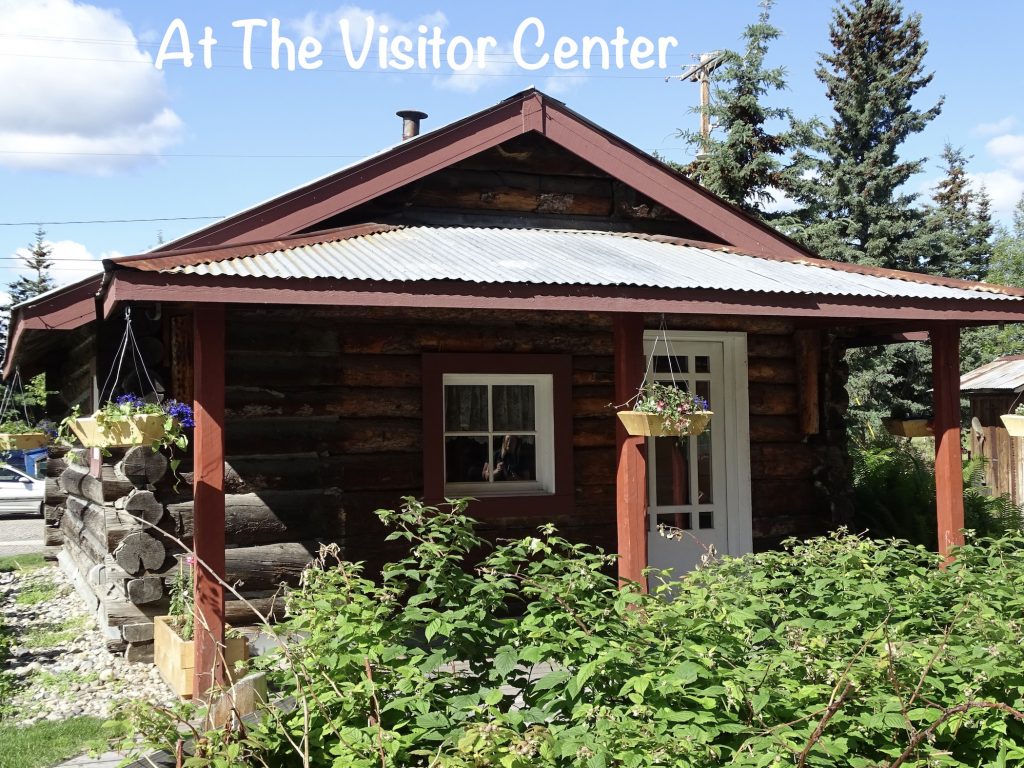
Back on the road, we took a couple of pics of stuff we saw on the way up. There was a car that must have been going super fast. It apparently went airborne and ended up on top of a log and crashed into trees. There was also a nesting pair of ospreys. Once we got back to Fairbanks, the first order of business was lunch, which we found at Big Daddy’s BarB-Q. Their sign says “Northern Most Southern BBQ”. As someone who has had pulled pork and brisket all over the country, I can tell you their brisket was pretty darned good. MW had this bowl called a Cowboy Sundae that was beans, meat of your choice, and coleslaw. He went with brisket, and said it was amazing. Next we stopped in at the Visitor Center, then headed out to the RV park to pick up Brutus. Then we were off to the car wash to take a little bit of the Dalton Highway off of our rental car before turning her in. It took a LOT of quarters and a good bit of work! Finally back at Petunia by around 2:30 PM, we were exhausted. BUT…the laundry needed to be done. We had scoped out a couple of places back in town, but I opted to just use the campground facility. When I finally sat down after completing the chore, I was wiped out and bedtime couldn’t come fast enough!


I’m going to stop there for now. Next up…Musk Oxen, Cool Cars, and Another National Park. See you on the path!!
Talisa
P. S. Thank you so much for reading! Use the buttons at the top right or bottom to be notified of new posts, and please SHARE, SHARE, SHARE on social media!