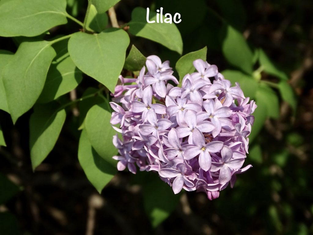
QUOTE OF THE WEEK: “Always do your very best. Even when no one else is looking, you always are. Don’t disappoint yourself.” – Colin Powell
Before I dive in, let me pass along a piece of advice that we received from more than one person during the planning of this trip: purchase The Milepost. It is an Alaska travel planner that has been around for 75 years and is published annually. The contents include all kinds of maps, plus detailed, mile-by-mile information on every route to our 49th state, some starting in the lower 48. It has notes on gas stops, which can be few and far between in some areas, and will tell you which trails lead to hidden gems. There are also pretty useful bits of information like “You may or may not find parking along the access road. It is especially difficult for large RVs.” In essence, if it is worth seeing, it is in this book. As we begin this week, we will be using it consistently.
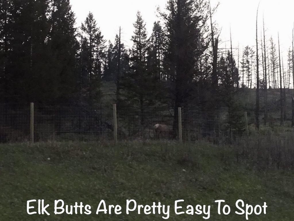
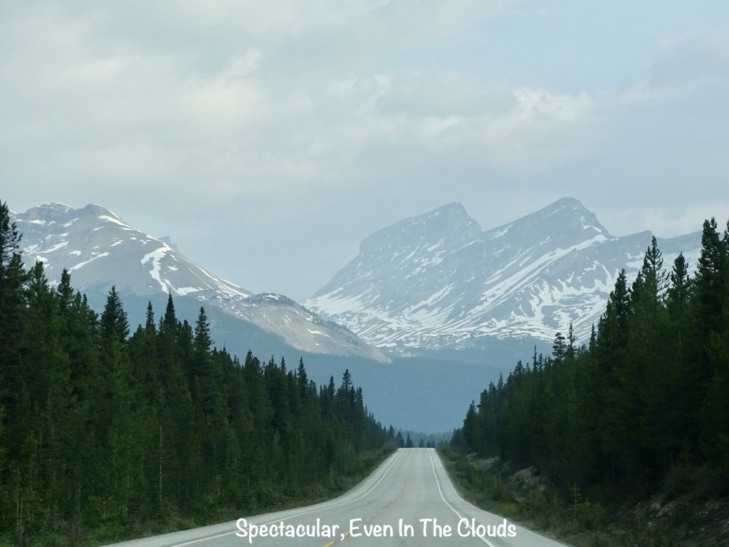
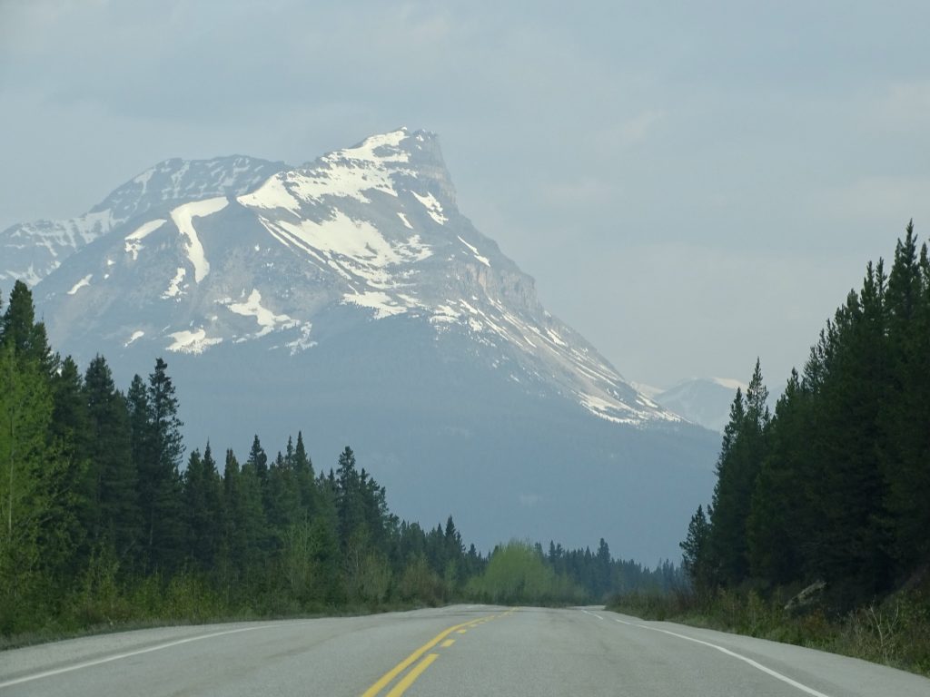
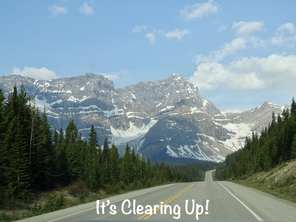
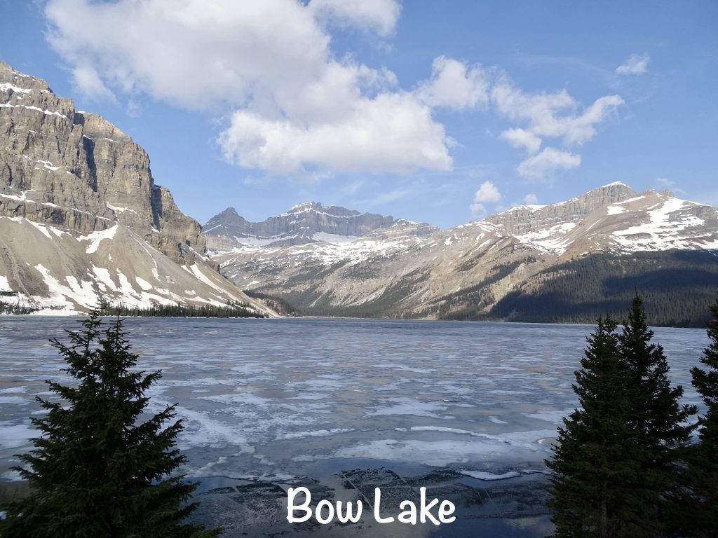
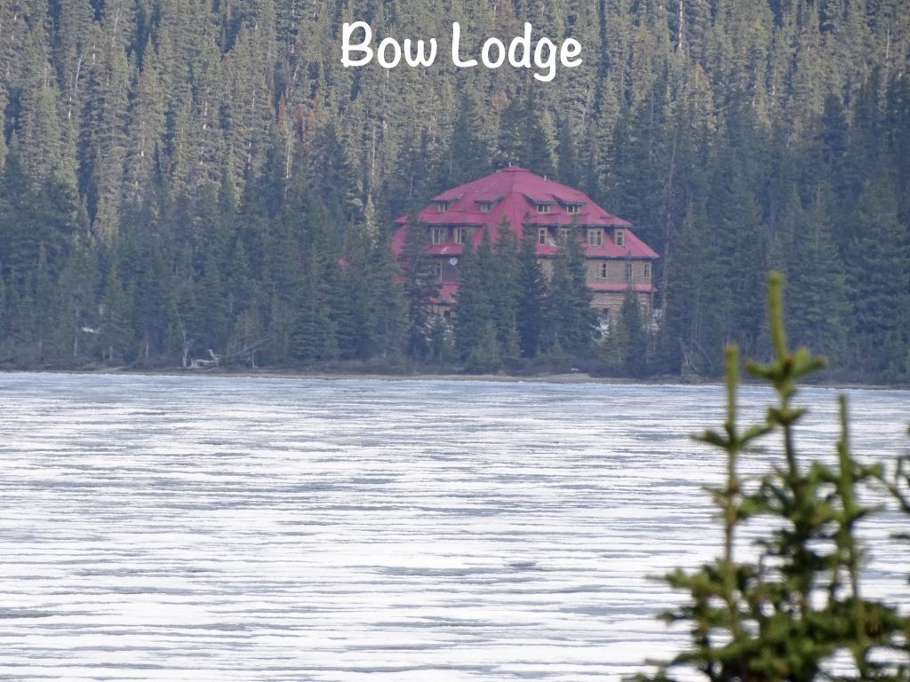
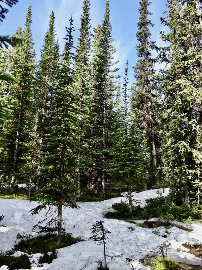
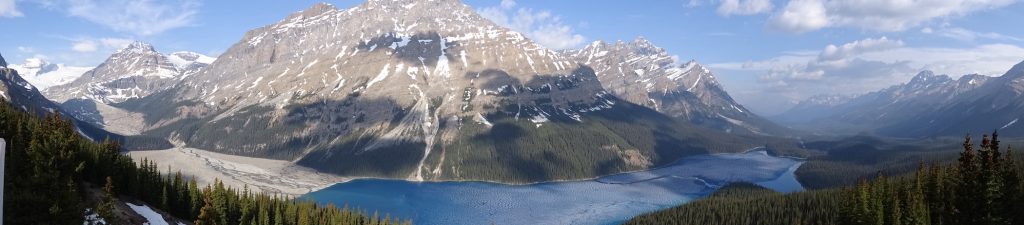
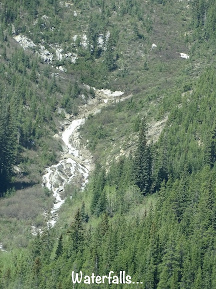
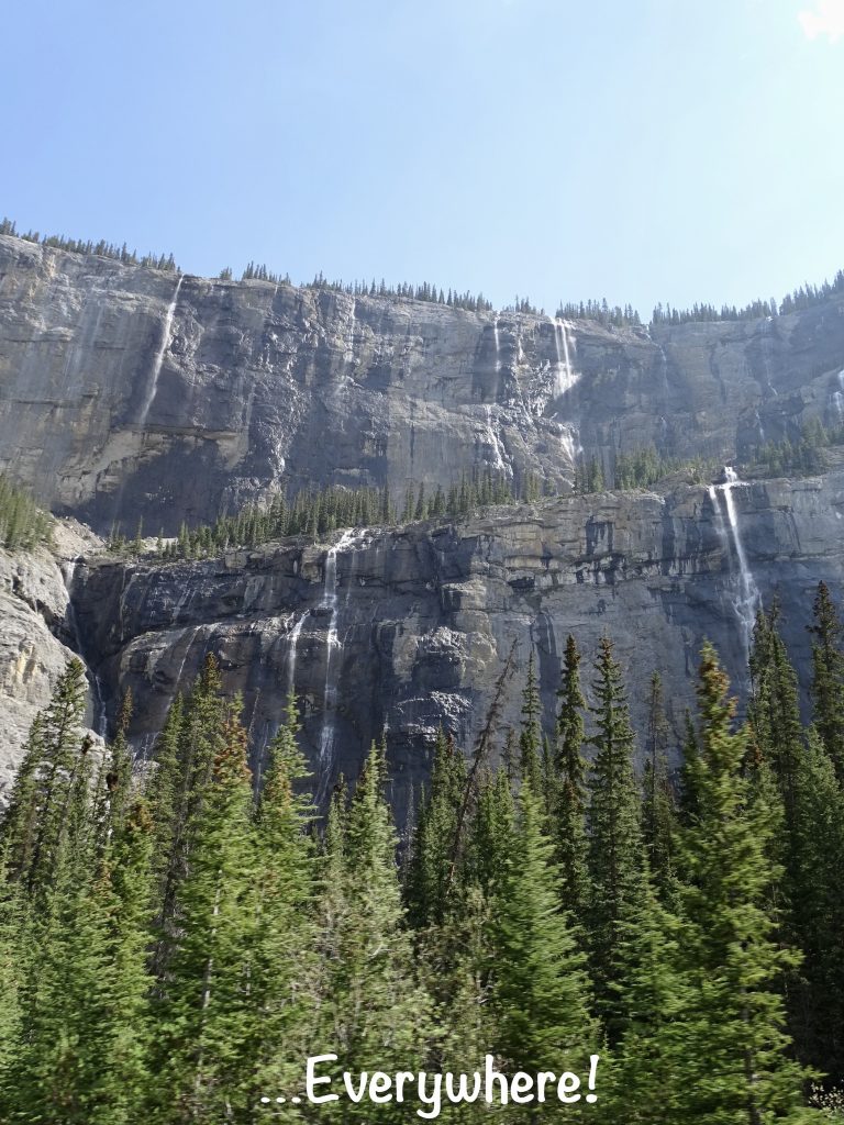
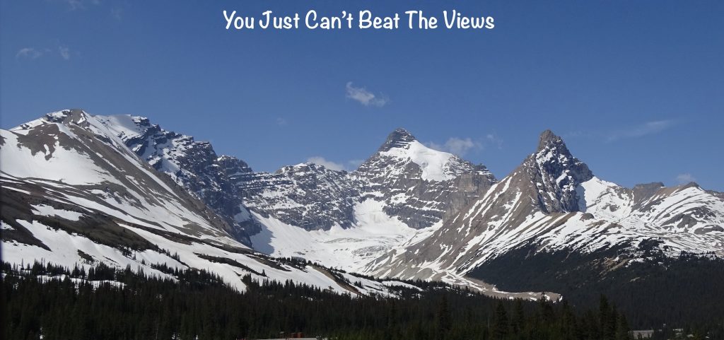
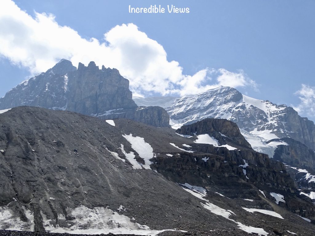
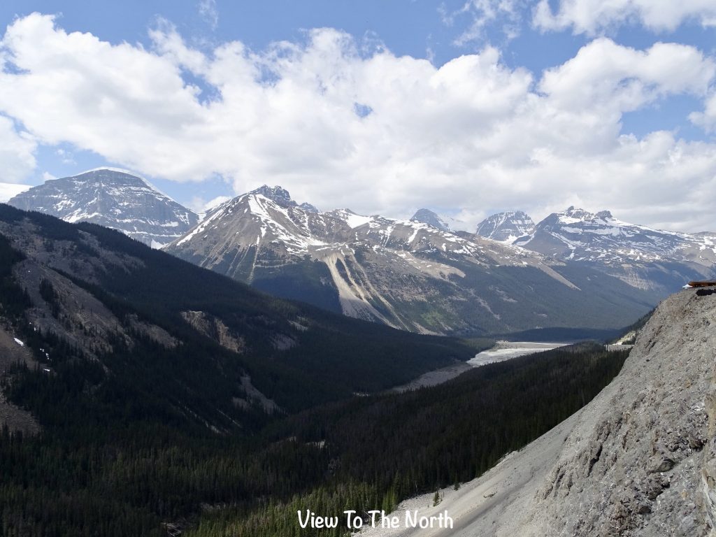
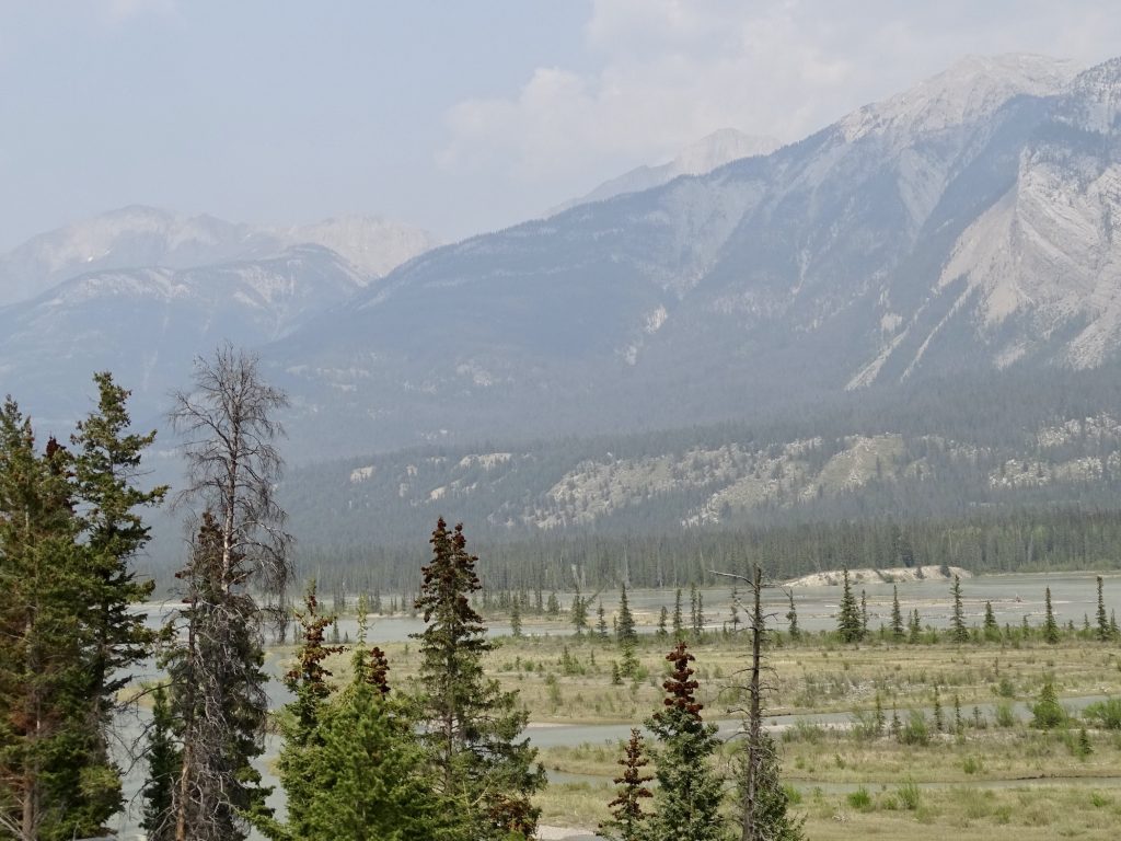
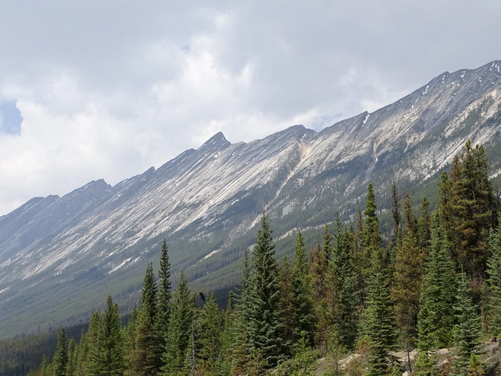
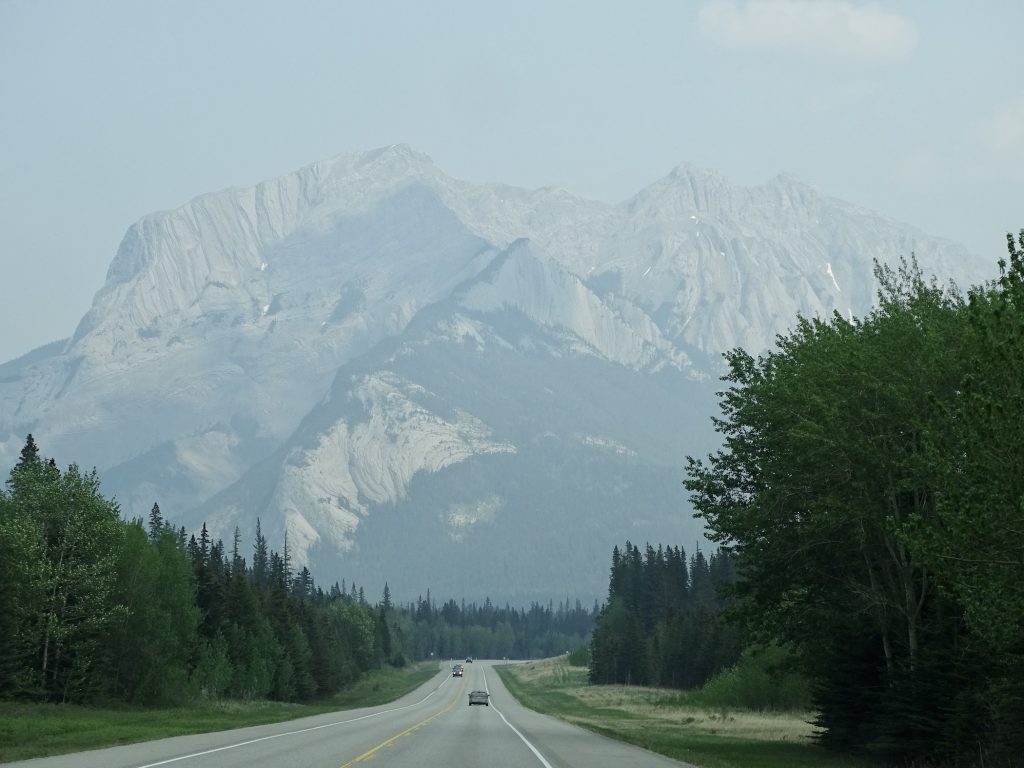
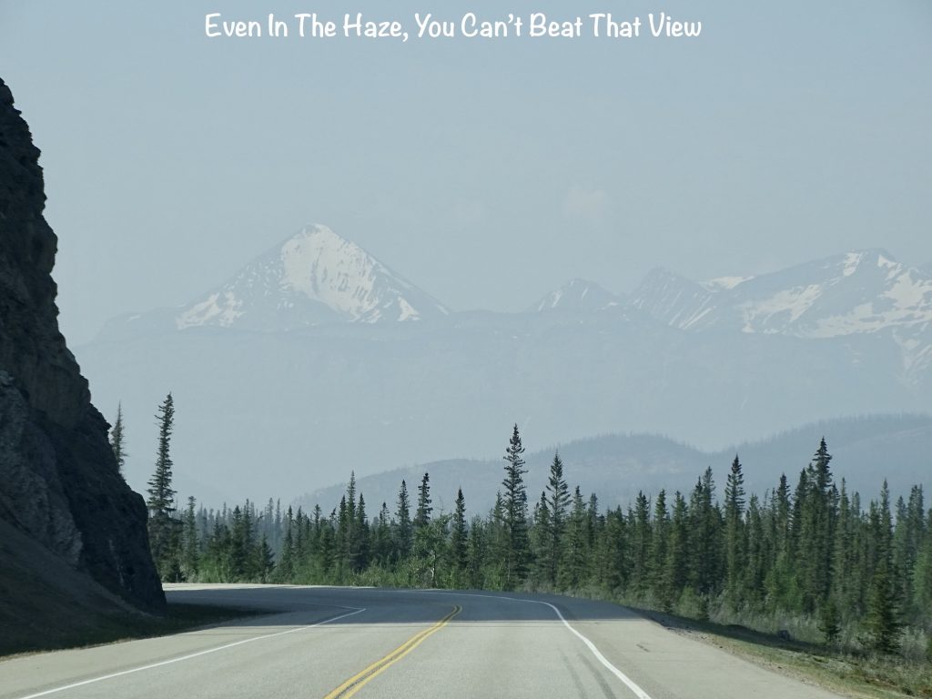
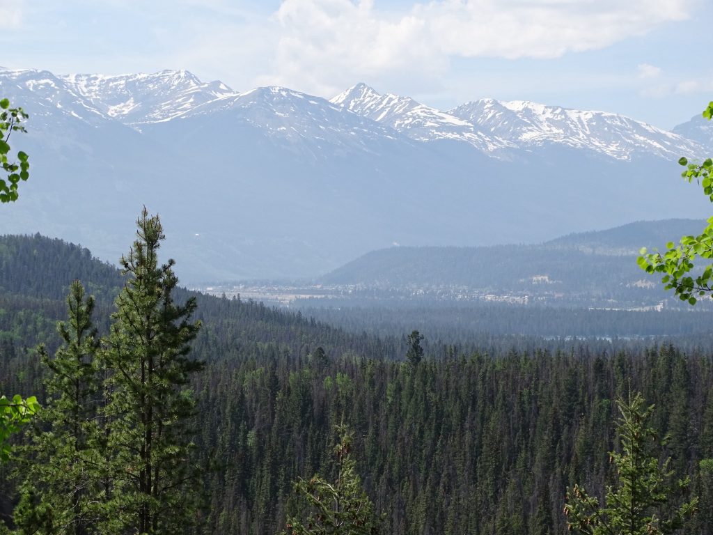
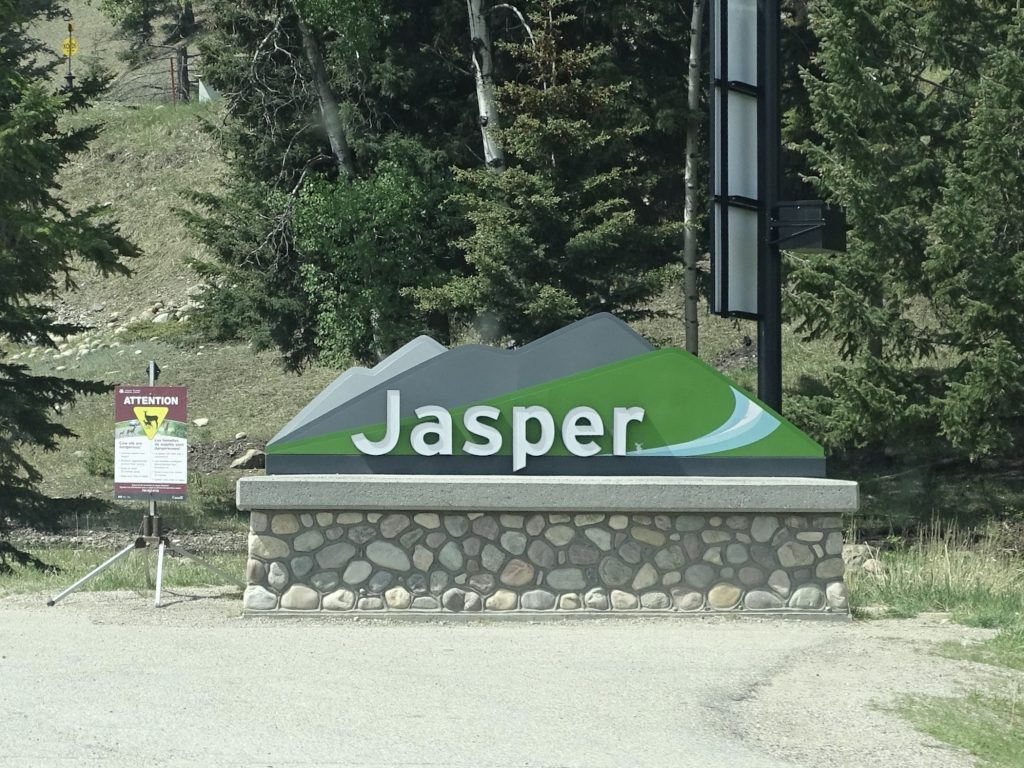
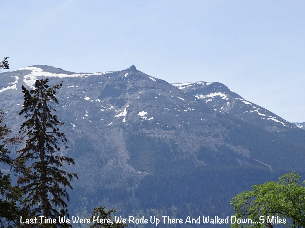
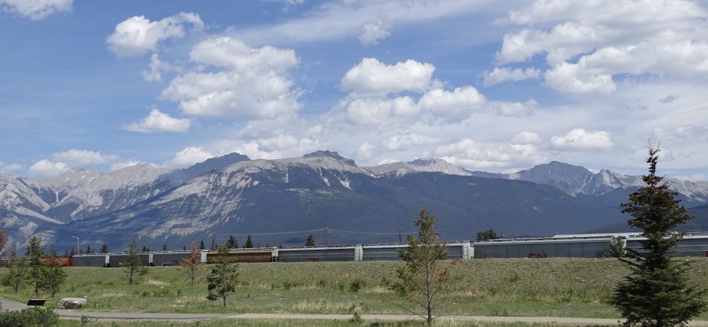
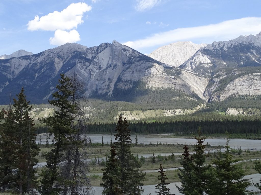
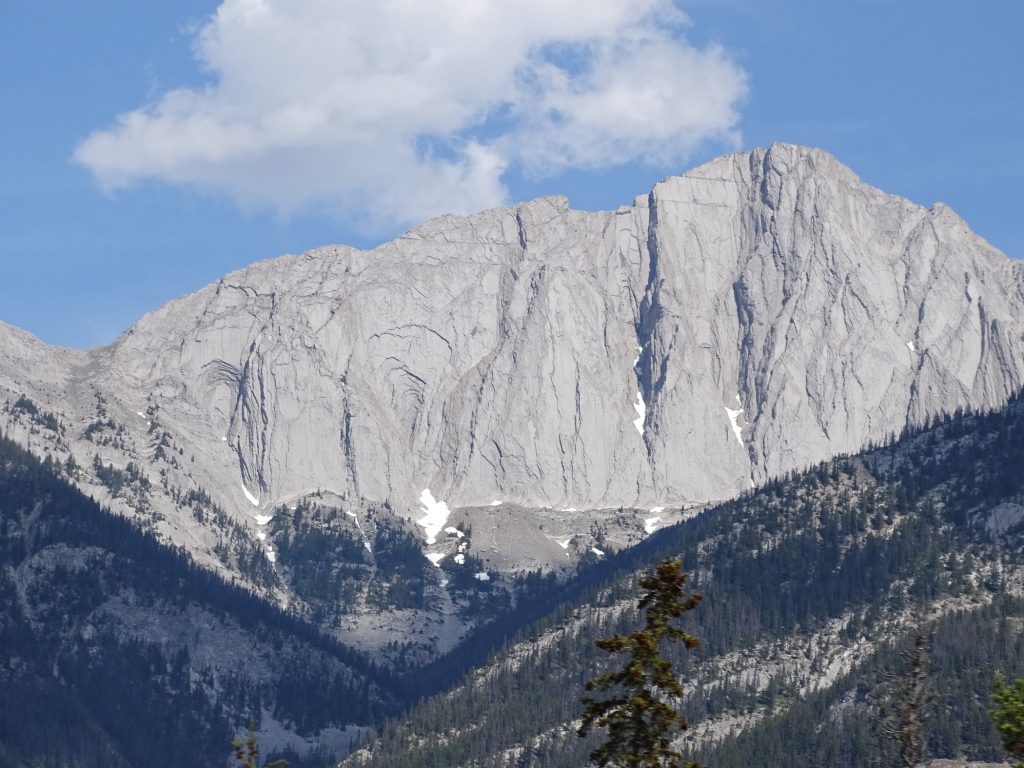
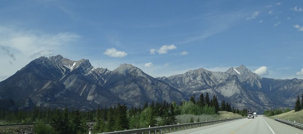
On Friday, May 19, Mr. Wonderful (MW) had a couple of cool stops planned, so we were up and out around 6:15 AM. Heading west on CA-1, we joined AB-93. It was mostly cloudy and smoky, enough to smell when we started out, but cleared up within a couple of hours and turned into a gorgeous day. Northwest of Lake Louise, AB-93 splits off and becomes the Icefields Parkway, a two-lane drive through some of the most amazing scenery in both Banff and Jasper National Parks (passes are required). In 1884 a geology professor named Arthur P. Coleman headed out along the Great Divide from Banff to Jasper in an attempt to find a giant peak described in botanist David Douglas’ diaries from 1827. He was unsuccessful in his search, but did discover the route that would later become the parkway. I can’t imagine traversing this area on a horse or sled or wagon. Even today it is pretty isolated. With the exception of the red roof of the lodge on Bow Lake and a couple of signs for hostels pointing off into the woods, the only development we saw for the entire drive were the two places I’ll talk about below. During the first part of our drive, there was almost no traffic, which was heavenly. This route is lined with snow- and ice-spotted mountains, and at times, there was actually snow on the ground, too. The weather was in the high 40s and a little windy, requiring a coat at times.
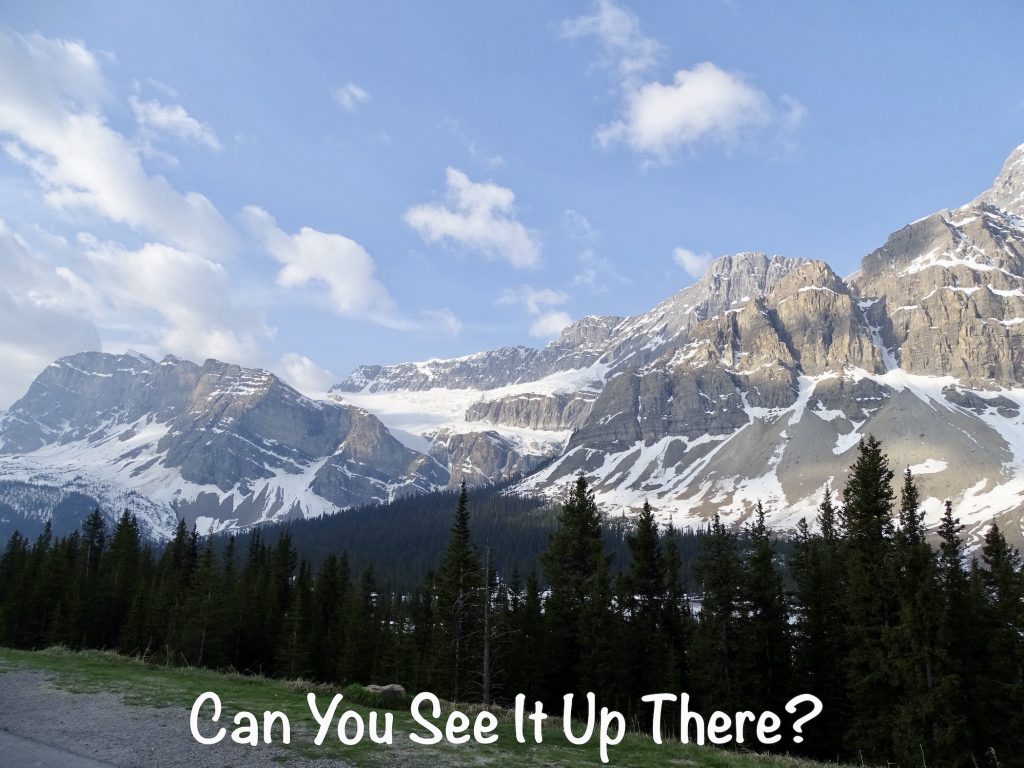
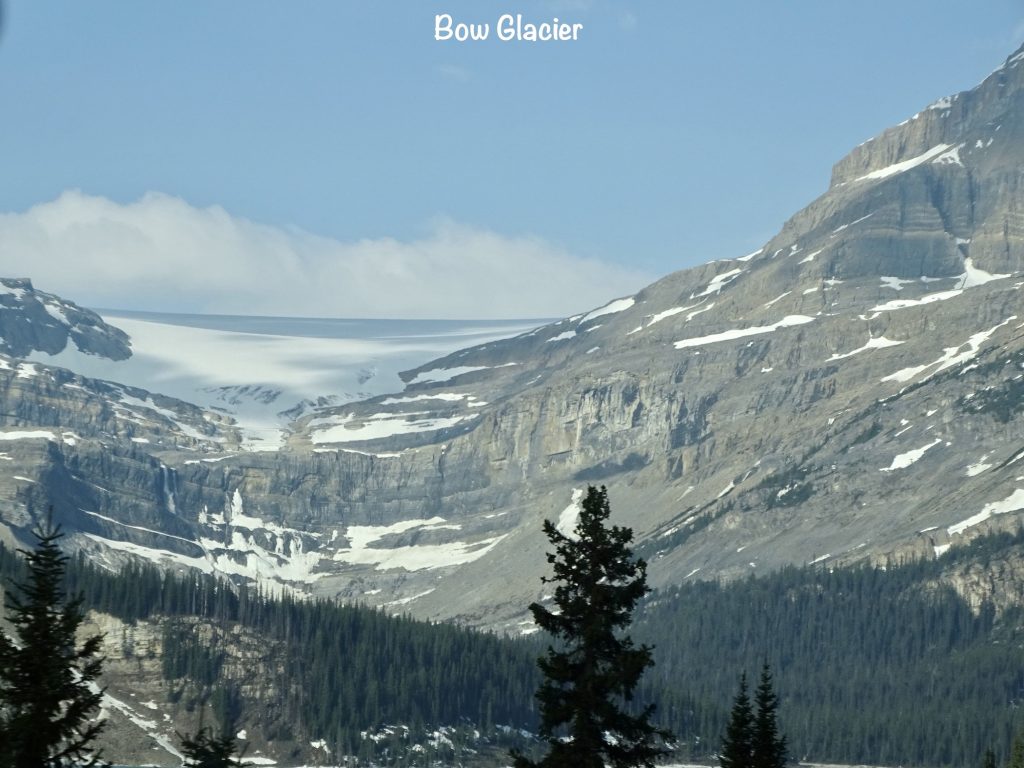
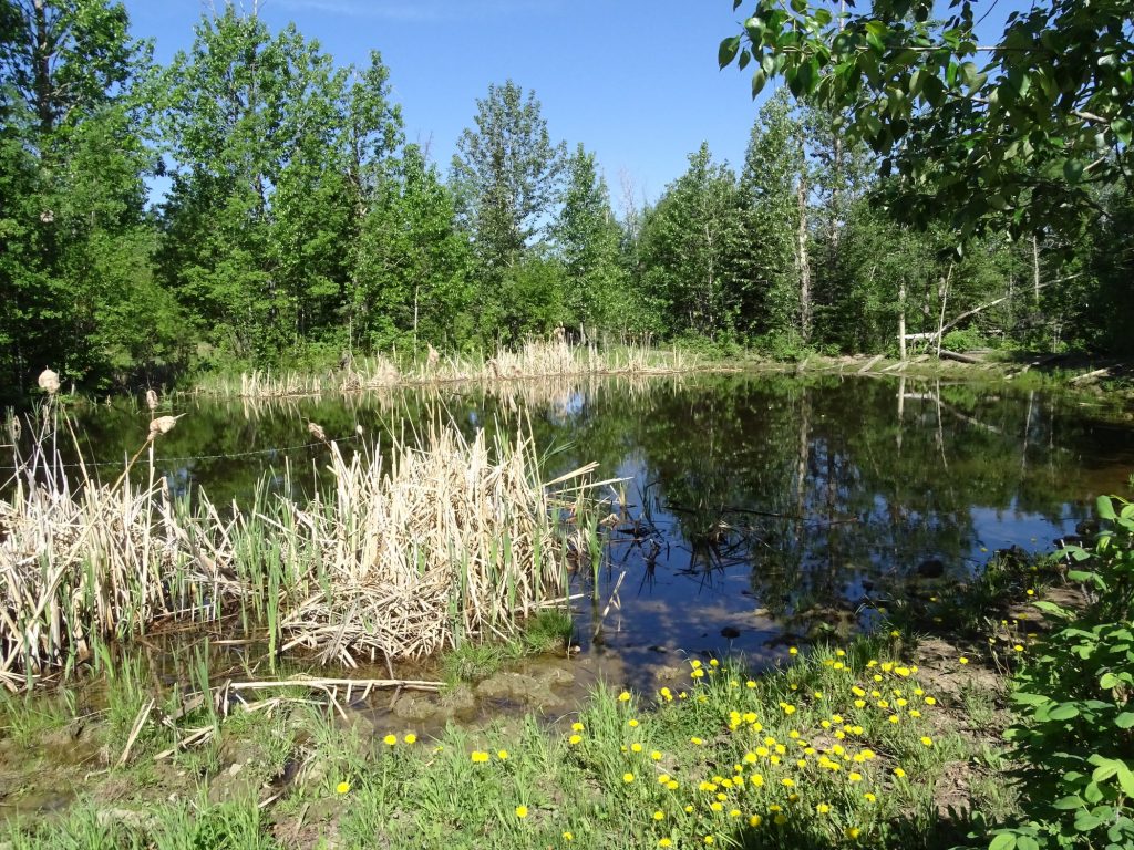
About 20 miles in, we made our first stop at a viewpoint for the Crowfoot Glacier on Crowfoot Mountain. When originally named, there was a third lobe giving it the look of a crow’s foot, but that has since receded. Our next stop was less than a mile further at an overlook of the larger portion of Bow Lake. We’ve been crossing back and forth over the Bow River for weeks, and this is where that all begins. Runoff from Bow Glacier feeds the lake, whose overflow becomes the river. The Crowfoot glacier also feeds into the river as it heads down the mountains. Both of these are outflow glaciers of the Wapta Icefield. Icefields are large ice shelves that feed out into glaciers. Where the glaciers move, an ice field is immobile. Wapta sits along the continental divide and feeds several glaciers that, in turn, fill the Bow and Kicking Horse Rivers and many other streams and lakes.
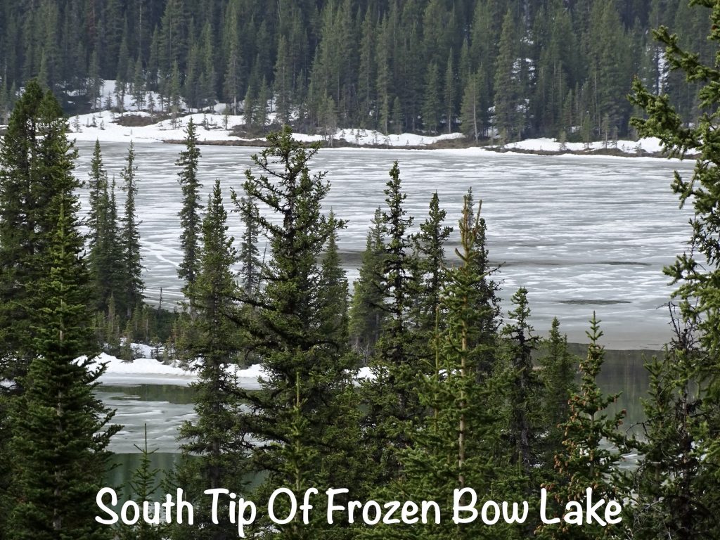
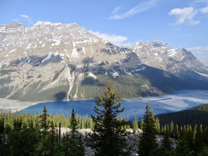
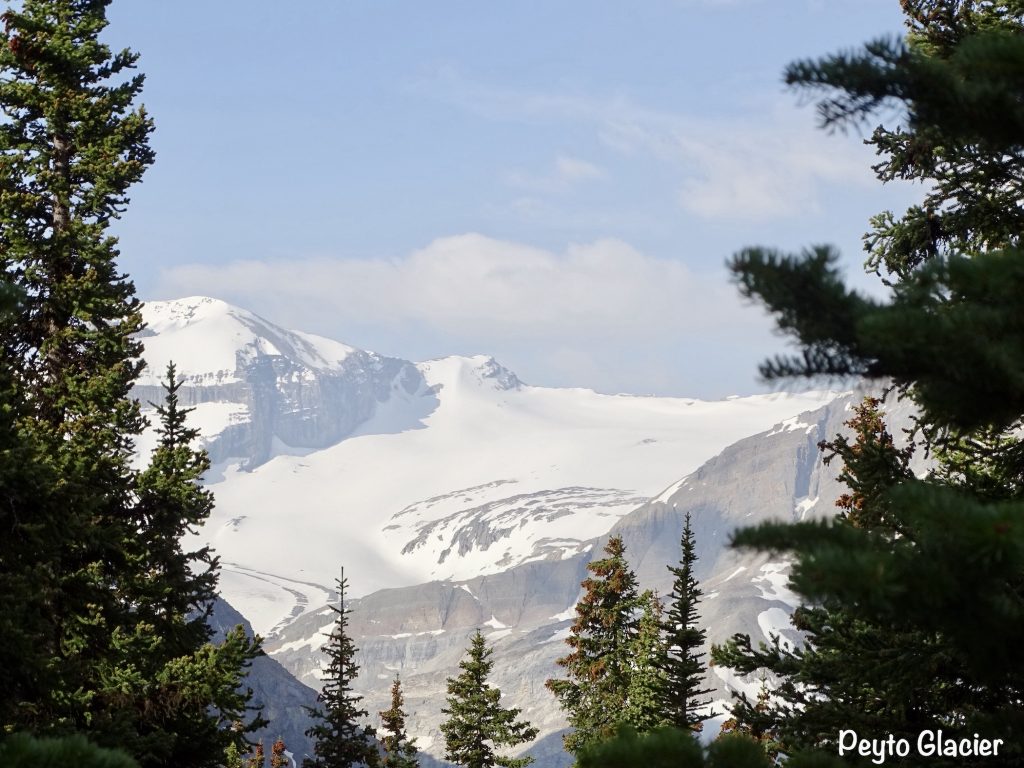
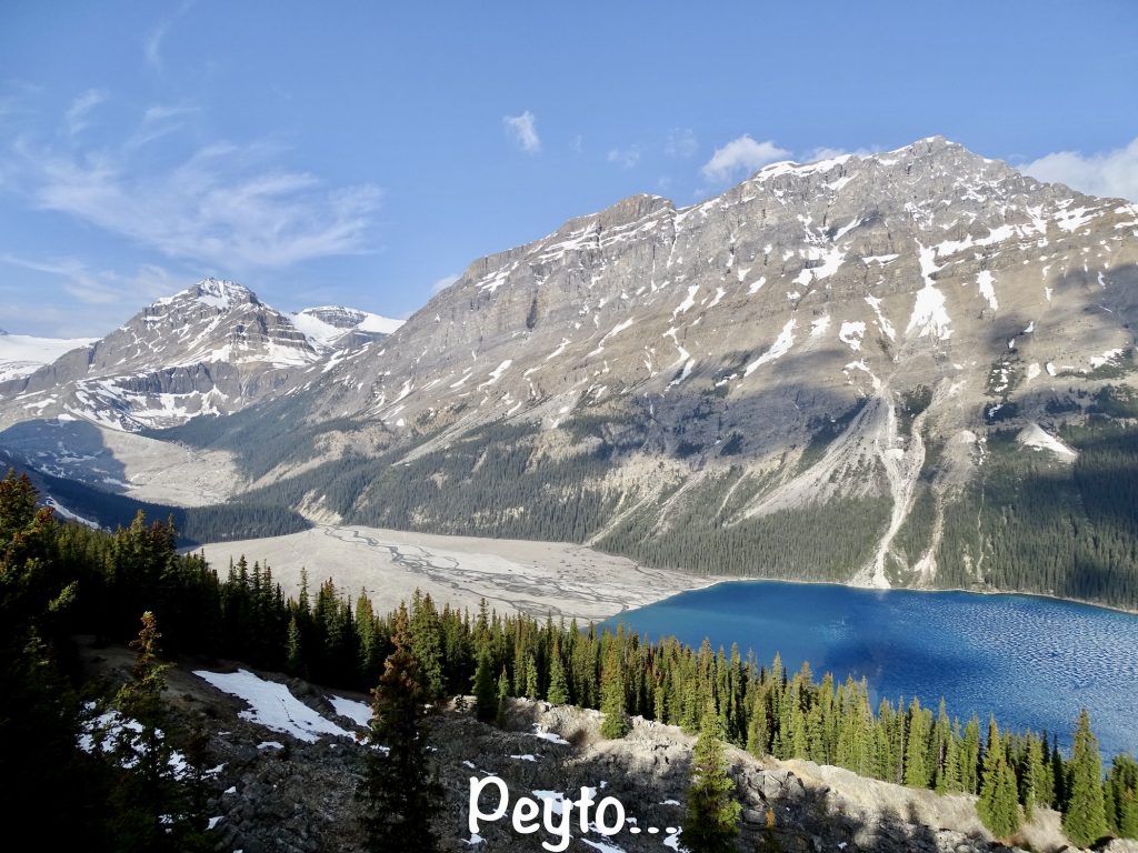
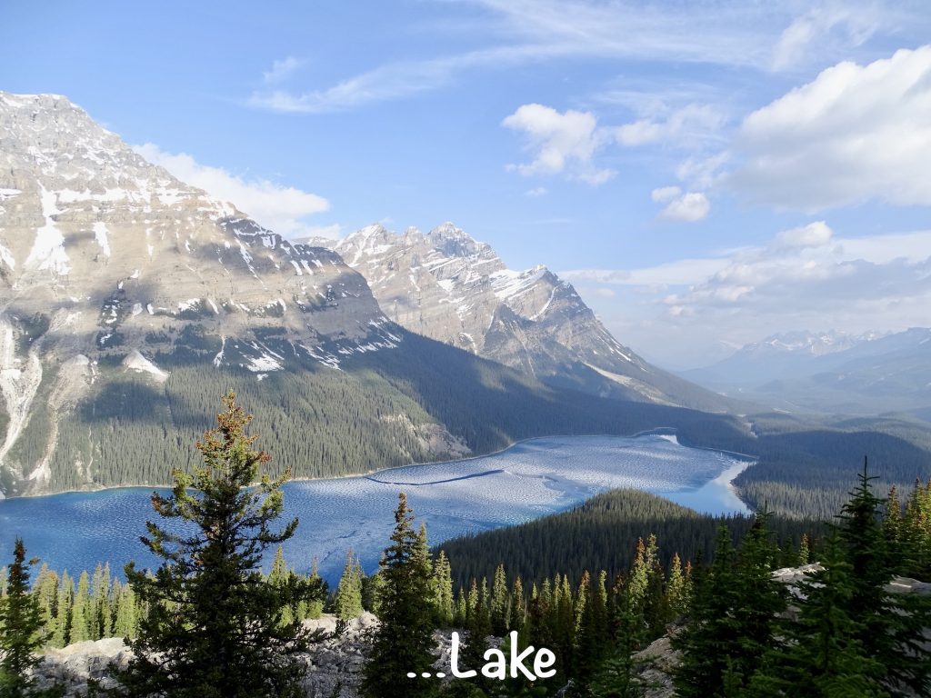
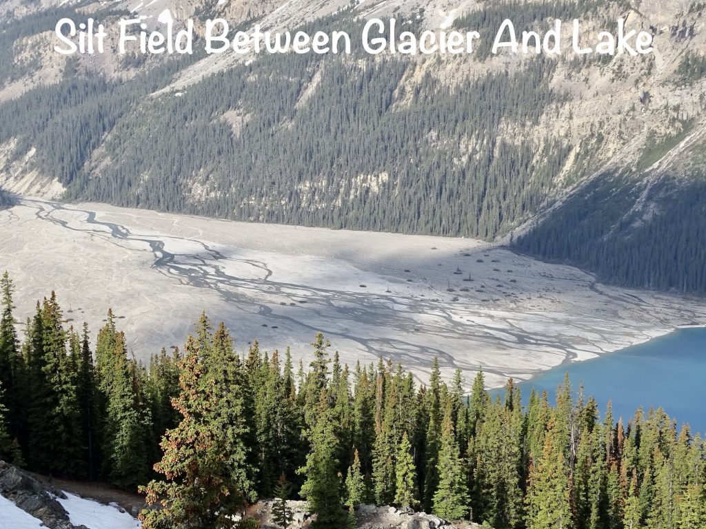
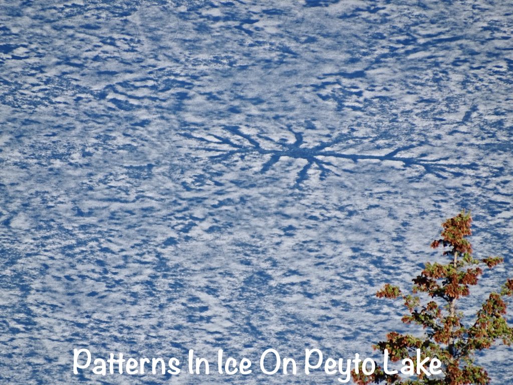
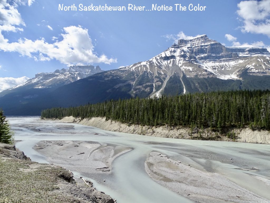
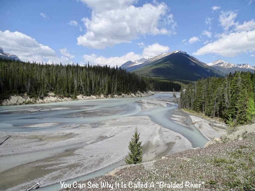
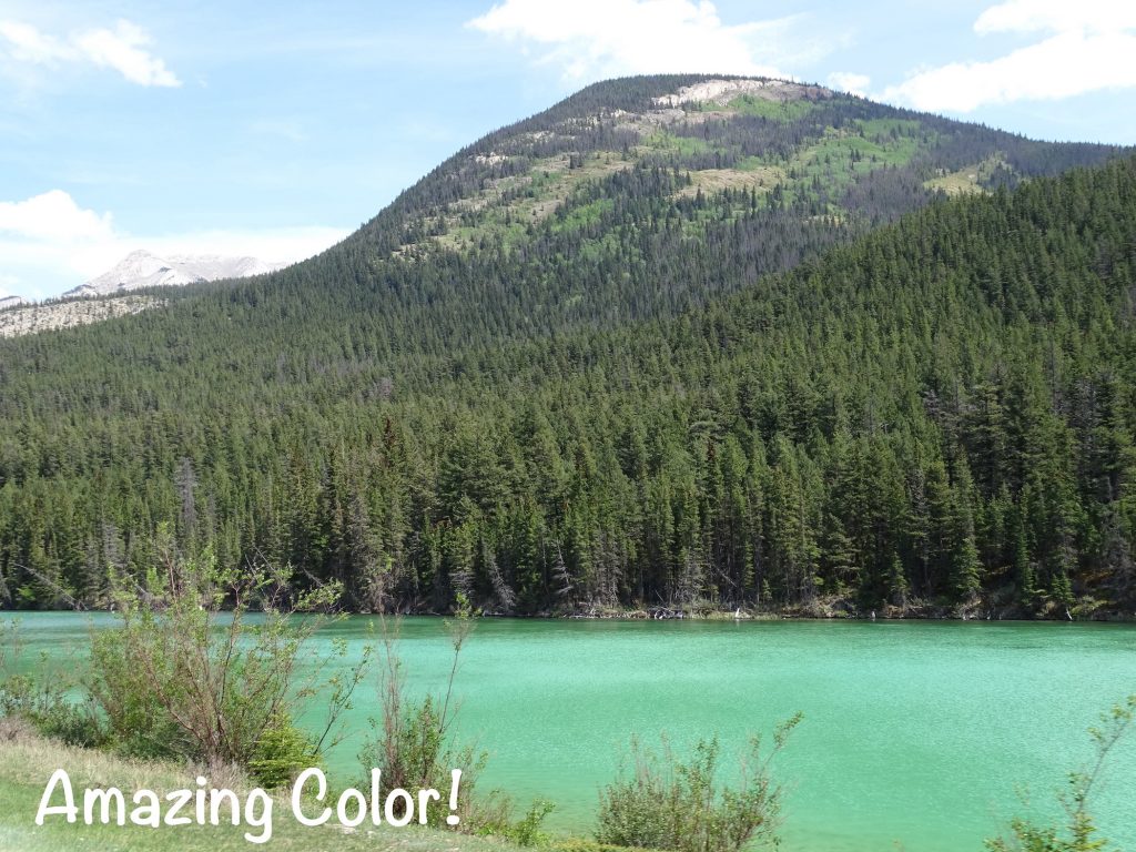
A few miles further up the road we stopped at the Bow Summit parking area. This is the highest point along the Icefields Parkway at 6,939′. There was still a decent amount of snow in the woods and parking area, although the latter had been plowed into large piles. According to the signage, snow covers the ground for 9 months of the year, and it can even be cold in summer. It was a perfect day when we were there, though, at about 50ish and sunny. We took the short, paved walk out to the overlook to catch sight of the Peyto Glacier (pronounced pee-toh), which is another feeder from the Wapta Icefield. This place was truly amazing. There is a huge area of silt, sand, rock, and stone deposited from the glacier at the mouth of Peyto Lake that looks like a giant beach from the overlook about 800′ above. The lake was a gorgeous brilliant blue and is sometimes more turquoise thanks to that glacial silt, known as rock flour or glacial flour. The fine particles of rock created when the glacier grinds against bedrock remains suspended in the water. When it flows out into rivers, the rock flour makes the water appear grey, light brown, iridescent blue-green, or milky. You have been seeing that in pics for the past couple of weeks. On our visit, the lake was still mostly frozen over with really cool patterns in the ice. I could have stayed up there looking at it for hours, but we had places to be.
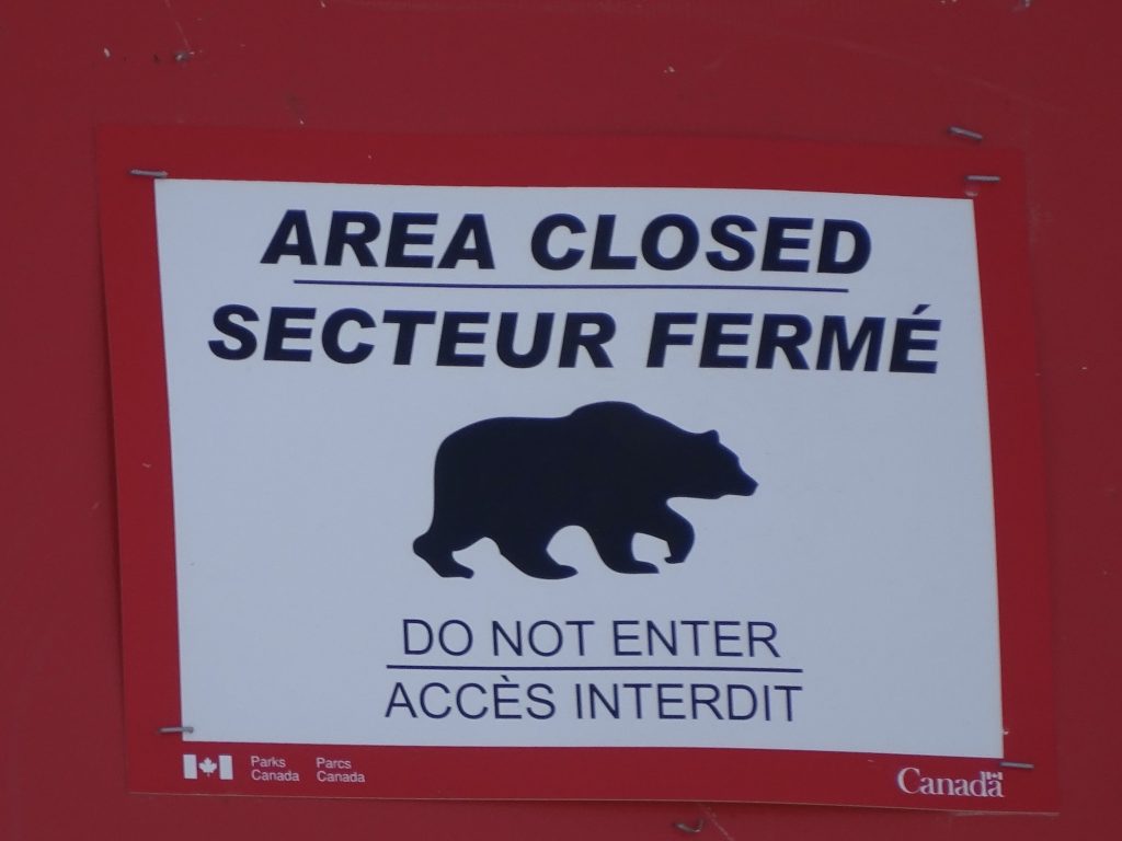
Back in Brutus, we drove another 22 miles or so to The Crossing Resort. This is only one of a couple of places with food and services along the parkway, and almost everyone stops in. As we got out, I noticed a half-acre or so area next to the gas pumps that was loosely fenced off with signs not to enter. The signs had grizzly bear silhouettes on them, and I wondered: 1) Do you think the bears actually stay in that tiny field when they show up? 2) What is in the field that attracts them to that instead of the food smells coming from the restaurant and motel next door? Hmmmmm. Our next stop was going to be over lunch time, so we decided breakfast was in order. The food was good, and our young waitress was from Italy and working there for the season. She said she worked hard to get rid of her accent and sound American, and I told her she needs to stop that. The accents from other countries are beautiful! This resort is pretty isolated, so she said they mostly stay there for the entire season with only the occasional trip into a town with a co-worker who has a car. It is a good crew, though, so she has really enjoyed doing it for a couple of seasons now. Plus, she can work for about 6 months here in the summer, then go back to Italy and enjoy her time with her family and friends. Nice deal!

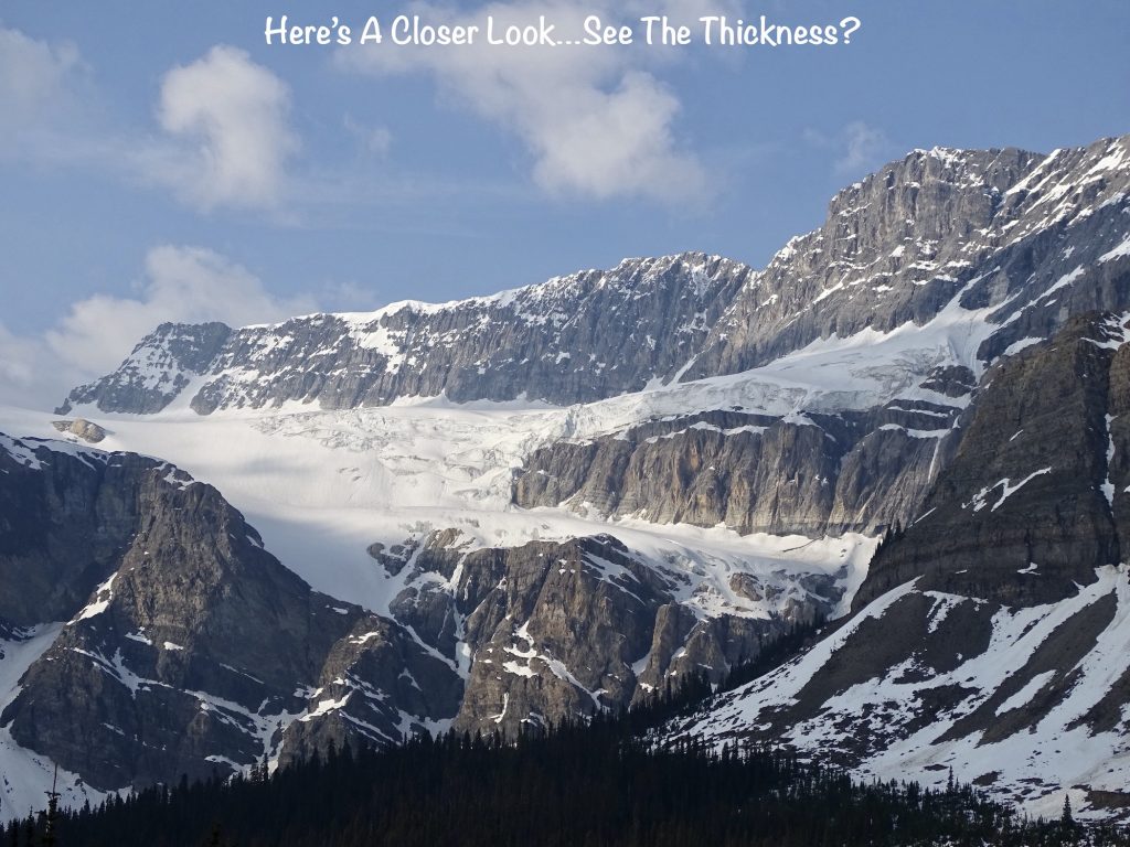
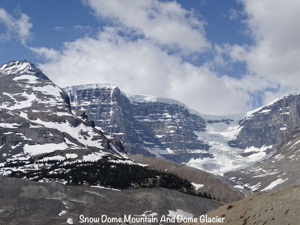
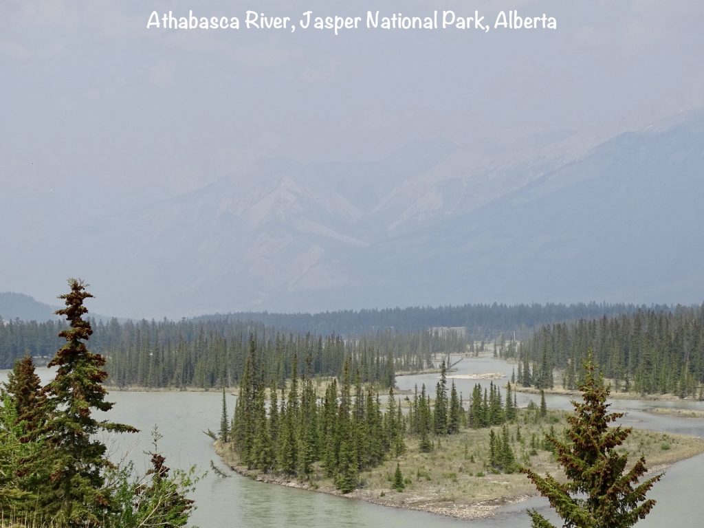
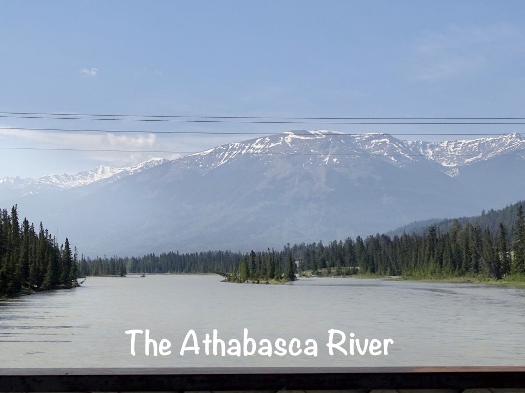
Full and ready to hit it again, we drove another 30ish miles through some more amazing scenery. Along the way we passed Snow Dome mountain and the Dome Glacier. This mountain is one of only two in North America that are triple divides. (The other is Triple Divide Peak in Glacier National Park.) Water from these mountains ends up in three different oceans. In this case, the Bush and Columbia rivers take some to the Pacific Ocean, the Athabasca River carries some to the Arctic Ocean, and the North Saskatchewan River ferries some out to Hudson Bay and eventually, the Atlantic Ocean. Three other glaciers flow from this mountain, too…the Stutfield, the Columbia, and our next destination, the Athabasca.
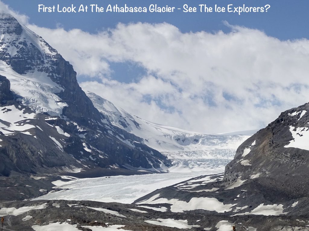
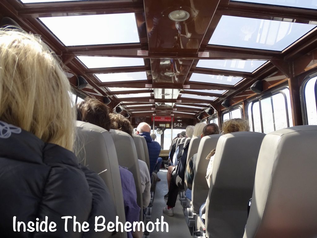
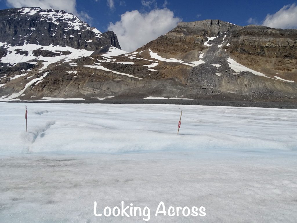
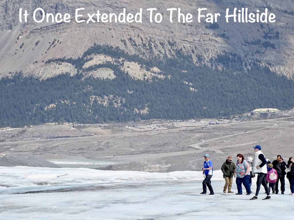
As we’ve already seen, the parkway passes right through icefield and glacier territory, and we were going to get much more up close and personal. The Columbia Icefield is the largest in the Rocky Mountains and sits along the continental divide and the border of British Columbia and Alberta. It covers about 125 square miles and resides partially in both Banff and Jasper National Parks. The huge, stationary sheet of ice measures anywhere from around 325′ to almost 1,200′ thick and gets about 280 inches of snow each year. This thing is so vast that, in 1932, three men on a ski journey from Jasper to Banff made a downhill run from the top of Snow Dome that was 9,800′ high and lasted for 31 miles!! The Columbia Icefield feeds the Athabasca, Castleguard, Columbia, Dome, Stutfield, and Saskatchewan glaciers and is the beginning of the Athabasca and North Saskatchewan rivers and the tributaries that eventually become the Columbia River. There are a dozen mountains around the icefield which range in height from 10,140′ to 12,293′. Our main focus for this visit was the Athabasca Glacier. Upon arrival, we headed to the boarding spot for our bus up to the staging area.
SQUIRREL: I am a woman of a certain age. Okay…I’m 60. For those of you who aren’t here yet, there are things that happen to your body due to aging and having children that sometimes cause you to need bathrooms more often. As we checked in, I thought I’d make a precautionary visit, just to be on the safe side. “No, there isn’t one here” (apparently it was downstairs in the shopping/eating area) “or at the staging area, and it will be 2-1/2 hours before you get back.” My first thought was, oh crap! Can I make it that long? My second was, where are we going for 2-1/2 hours?? My third was, why didn’t they say something about that in the ticket info. I don’t mind saying, I was a bit nervous. As we pulled up at the staging area, though, MW spotted an out building. The bus driver said I had time to make a quick run, and off I went. I passed a girl on the way who said it was for employees only, but I replied “no choice” and went about my business. Never get between an older woman and the last toilet for hours! Of course, that turned out not to be true, so my worry was totally unfounded. The entire round trip from where I talked to the first young lady was about an hour!
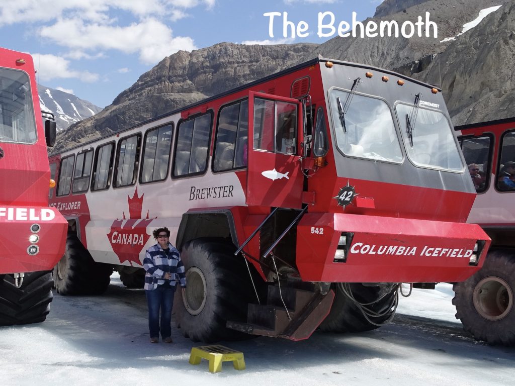
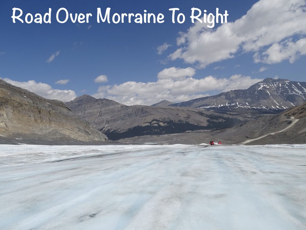
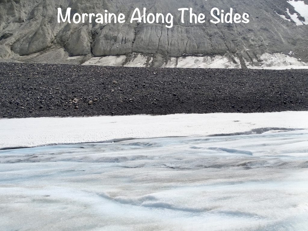
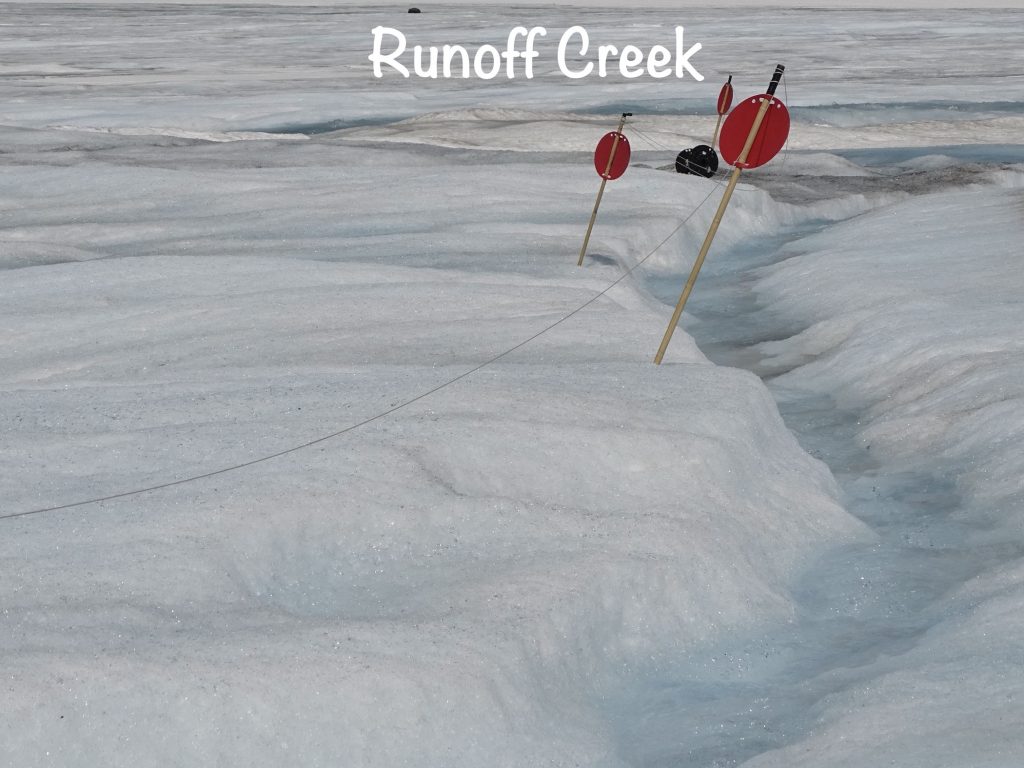
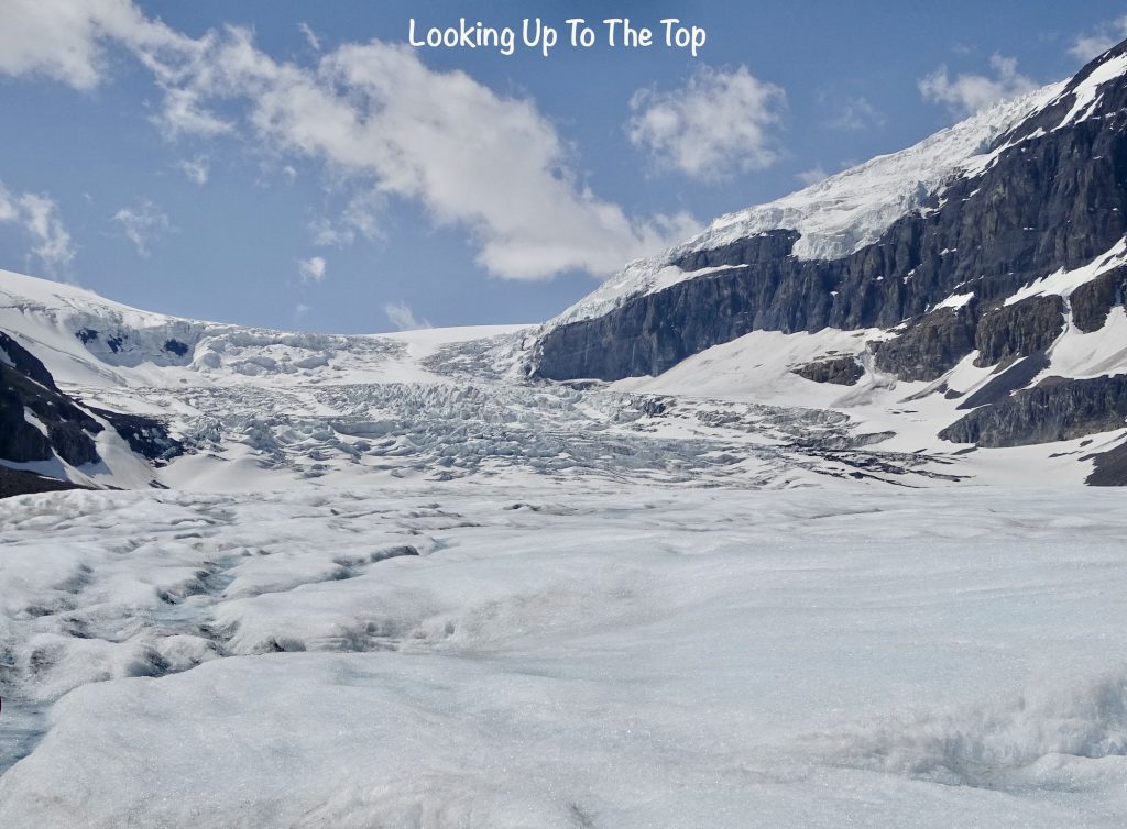
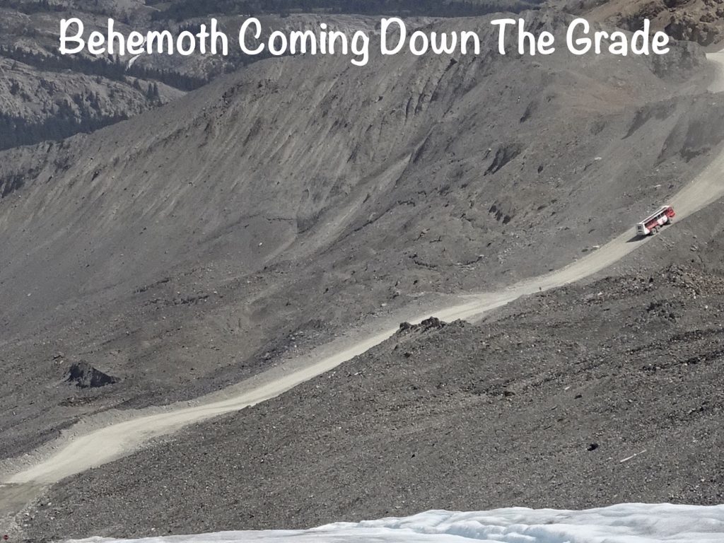
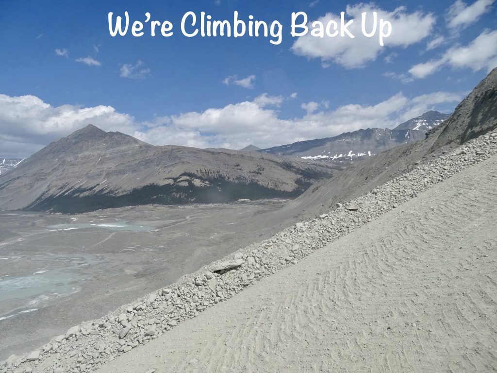
NOW BACK TO OUR REGULARLY SCHEDULED POST: At the staging area, we boarded an Ice Explorer for our trip out to the glacier. These giant vehicles with massive, wide tires are made, as the name implies, for driving on ice. They are 12’8″ tall, 42’8″ long, weigh in at 55,000 lbs. and can transport 56 passengers, plus in some cases, 2 wheelchairs. There are 24 of these vehicles in existence, and all but two are right here in Alberta. The others are permanently stationed in Antarctica. The trip out to the glacier took about 10 minutes, and we had to go down a 32 percent grade to get there. (Those massive behemoths can handle about 36 percent!) Along the edges of the glacier and part of what we drove over is morraine or glacial till. These huge piles of rock and debris are pushed out and away as glaciers advance and deposited to the sides. The morraine is over glacial ice, which is anywhere from a few inches to a few feet down. The terminal morraine ends up out at the leading edge of the glacier’s advances, then is left as large rock piles when it recedes. You can see those all the way back at the main building, which shows how far the glacier has been before.
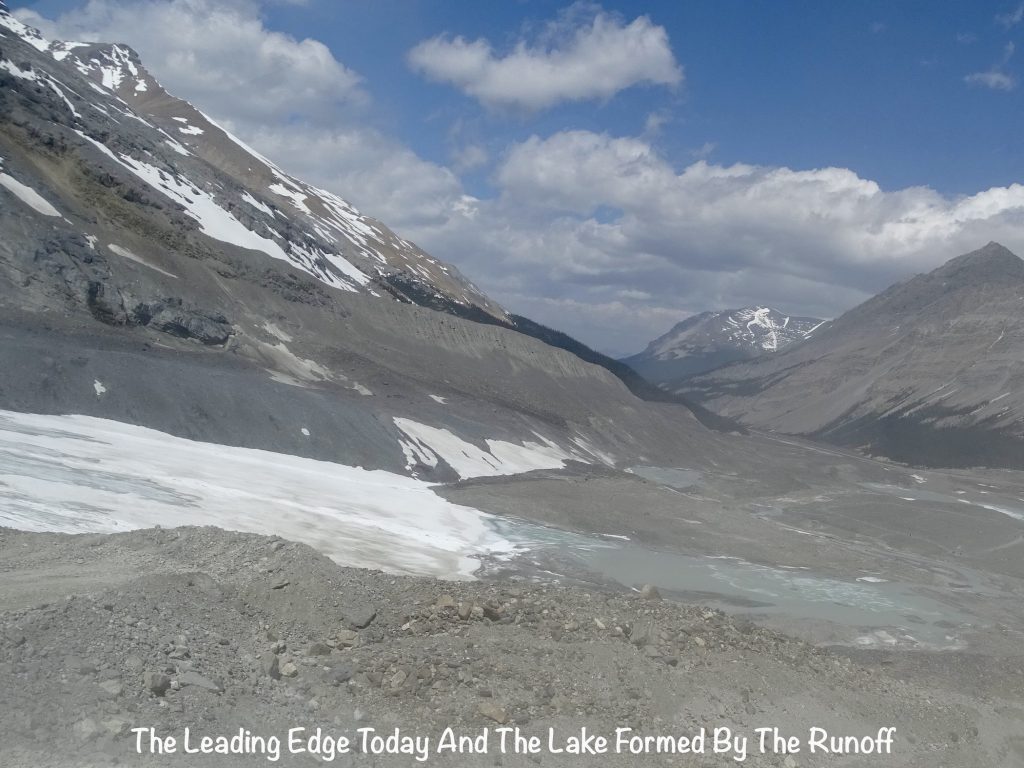
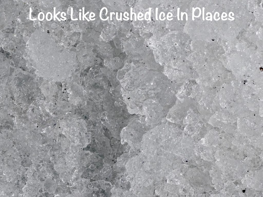
Since a glacier is a moving thing, crevasses and water chutes can open up overnight, so the company has an area marked off that is constantly inspected to ensure safety. I have to say, it was pretty darned cool. Definitely a sheet of ice, but I was amazed at how much water was running everywhere. Parts of the surface were smooth and slippery, while other areas were more like that crushed ice that you chewers enjoy. There was a little creek, really just a trough cut by the flowing water, that they encouraged us to taste and fill water bottles from as it was totally clean and pure. One woman bent over to fill her bottle, and her phone fell out into the stream. A guy chased it down, but I just knew he was going to break his neck slipping and sliding on the ice. The woman, on the other hand, waited and kept yelling “It’s okay! It’s okay! It’s waterproof!” LOL Although the sun was bright and temps had gotten into the low 60s, on the glacier it was much colder with strong winds coming over the top acting like a giant, ice cooled air conditioner. The bus stayed for about 30 minutes, but most people were back on after 15 or 20 due to the wind.
SIDE NOTE: One of the things mentioned constantly around glaciers is that they are receding, and if you listen to the popular narrative, our use of fossil fuels is the biggest problem. But these huge Ice Explorers run on diesel, and they are making (I’m guessing) 50-60 trips out there a day with the message that glaciers are precious, and we need to protect them. The reality, though, is that the trips are to make a profit. I’m all for free enterprise, but that seems a lot like politicians and celebrities who tell us we need to buy electric cars while they fly around the world in their private jets.
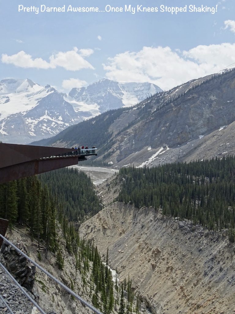
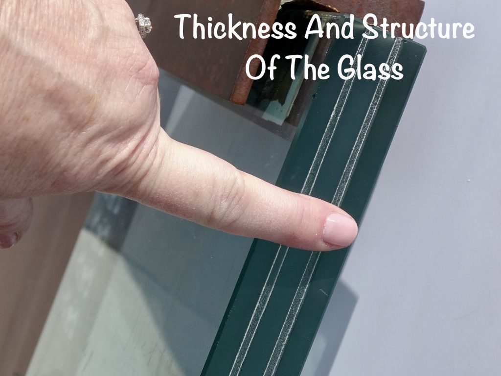
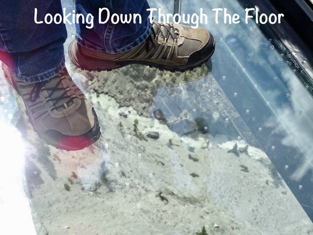
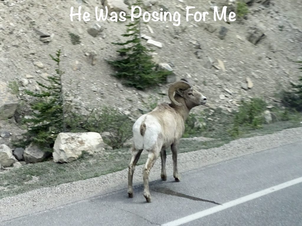
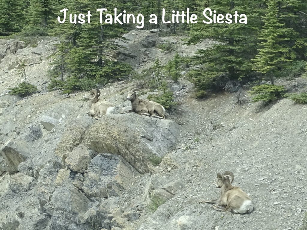
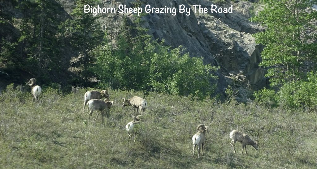
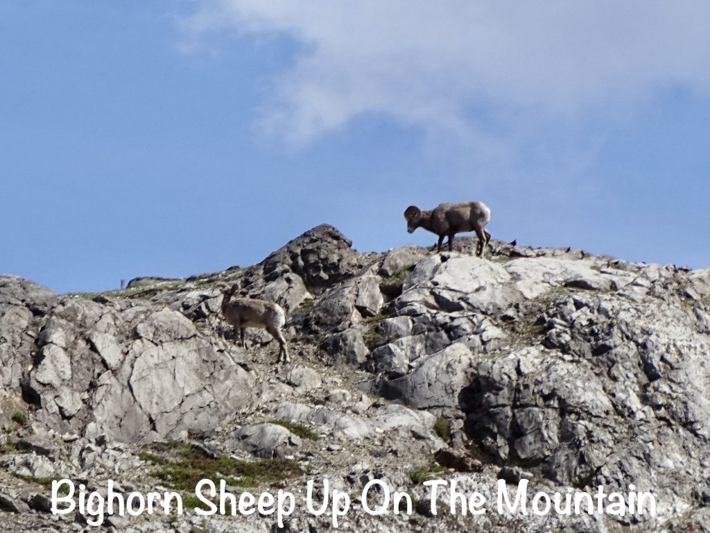
After riding the behemoth back to the staging area, we boarded a different bus to check out another cool thing a mile or so down the road…the Columbia Icefield Skywalk. This is a platform jutting out into the Sunwapta Valley about 980′ above the Sunwapta River. Technically, it is over the side of the canyon, but if it falls, it will be all the way to the bottom! Built of more than 193 tons of steel and 5-1/2 tons of glass…yes, you read that right…GLASS, it is shaped like an arch laying on its side. To secure it to the mountainside, they used 6,000 structural bolts, which looked that they could have gone a bit larger, honestly, but they say that thing can hold up the entire fleet of Ice Explorers. Hmmmm. I have a thing with heights, but I challenge it every chance I get. This caused my knees to shake a bit just as I stepped out on the glass, but after a few seconds, that went away. Out at the point, there was the slightest bit of bounce to the platform, or my brain thought so anyway, which was a bit unnerving. The views were incredible, though, and looking down through your feet to the canyon wall was pretty cool. After getting our fill of the sights, we caught the bus back to the main building. On the way back, we passed a small herd of bighorn sheep by the road. One guy was posing, pretty as you please.
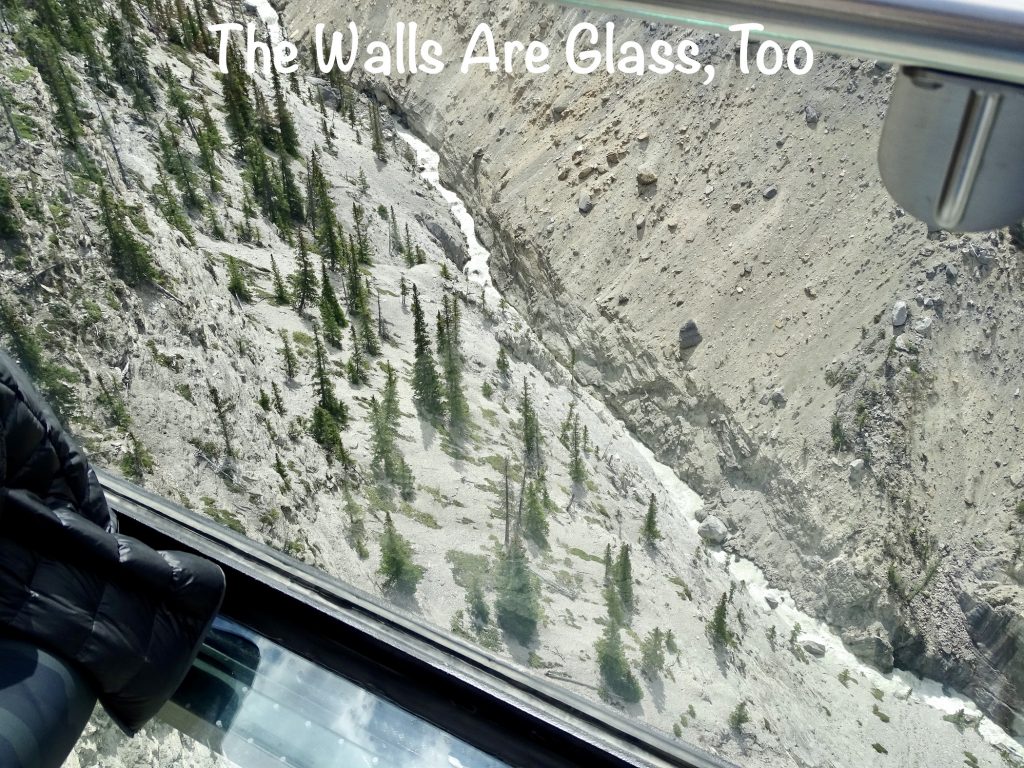
NOT COOL! There was a man a little older than me who was down on all fours crawling when I got out there, trying to get to the edge to get a picture. The two women he was with were laughing and giving him all kinds of crap because he was scared. That’s just wrong. He was clearly very afraid and still made it all the way out to the end. That deserves applause! After having his picture taken, he got himself up and slowly walked back to solid ground.
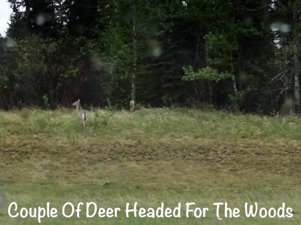
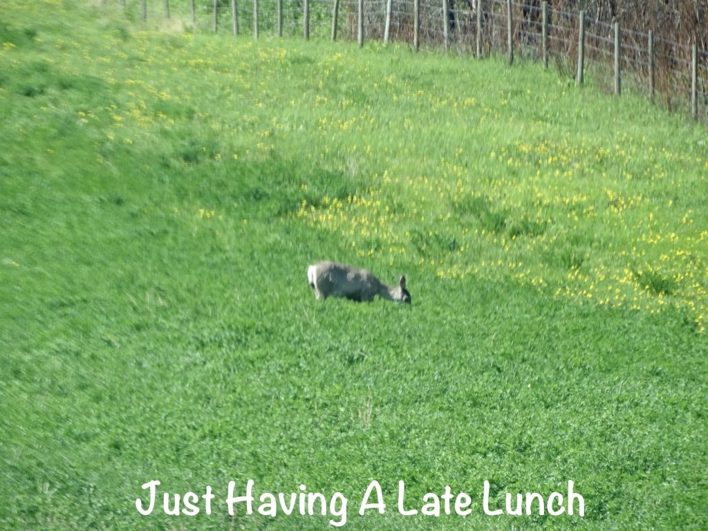
Back on the road, we continued on the Icefields Parkway to Wynd, where we turned north on CA-16 up to Jasper Gates Resort. It had been a long, gorgeous day of exploring and learning new stuff, plus we saw quite a few animals along the way: elk in the highway median in Canmore, deer near Banff, a Clark’s Nutcracker at Peyto Lake, a black bear along the Icefields Parkway, and bighorn sheep at the Glacier Sky Walk and on CN-16 north of Jasper. By the time we got setup, it was after 5 PM, and we were both pretty tired. On the way in we saw the Folding Mountain Brewery and took a walk over there for supper.
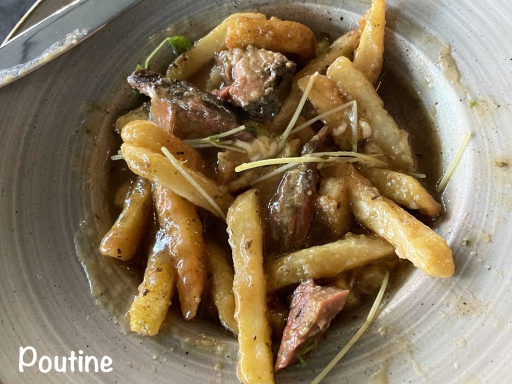
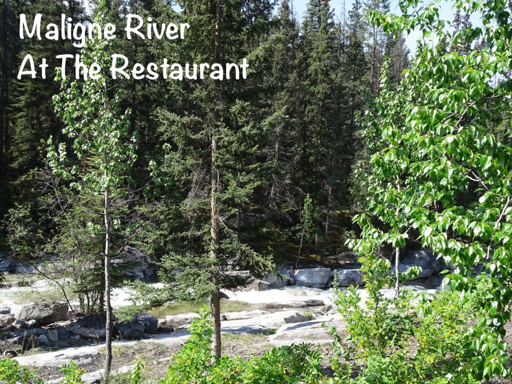
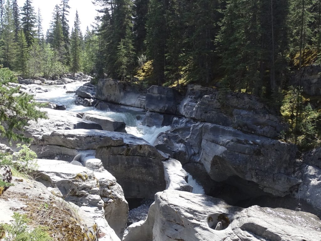
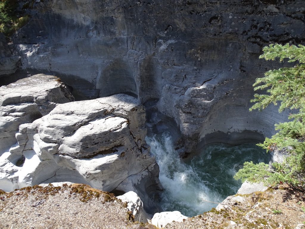
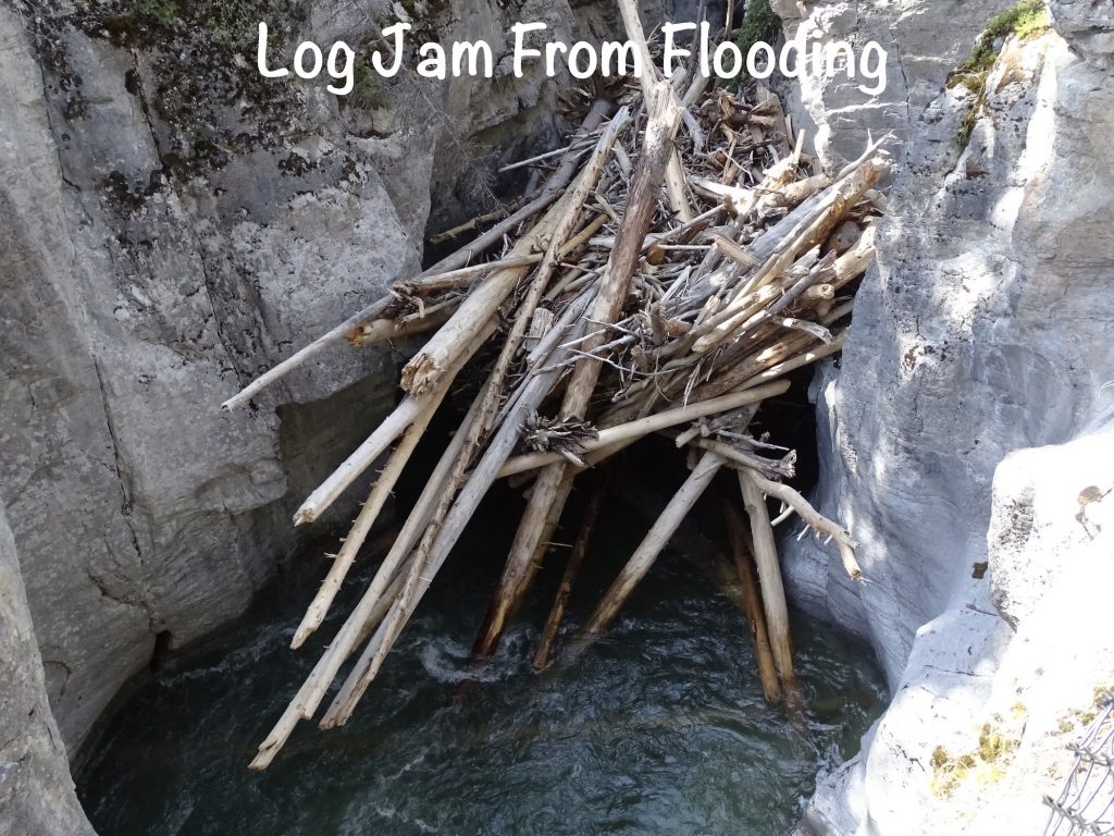
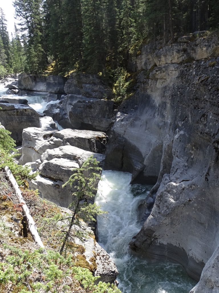
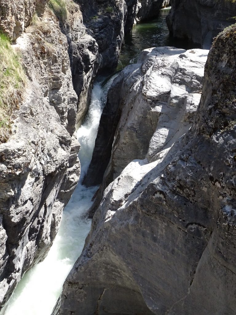
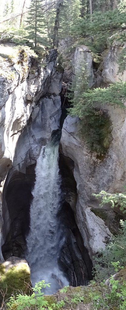
Saturday was a slow morning for me. It was one of those sleepless nights…too warm and tossing. On top of that were the lights. This campground has little post lights on top of the power poles for each site. Most just had a glow, but two outside of our bedroom window were like strobes in an 80s disco. Even with the shades drawn, it was like a flashlight blinking on and off in the bedroom. Ugh! When we finally headed out, our first stop was Maligne Canyon, where I was able to take care of a few gifts. Then we had lunch at the adjacent Maligne Canyon Wilderness Kitchen. I went with the smoked pulled pork sandwich, where the addition of smoked onion and smoked cheese on sliced sourdough gave it an interesting twist. MW said it was time for some poutine, so he had the smoked brisket version. Poutine is basically fries topped with gravy and cheese curds, plus whatever else the chef wants to add. It is common in Canada, and we’ve had it in the northern U.S. near the border, too. MW said the brisket melted in your mouth like that at the old BBQ Barn in Amarillo, which sadly, is no longer open. After lunch, we took the walk along the canyon. We dined inside, but they have a lovely patio overlooking the white-water of the Maligne River. INTERESTING NOTE: The original restaurant here was the Maligne Canyon Tea Room and shelter, which was completed in 1915. One of its first visitors was Sir Arthur Conan Doyle, of Sherlock Holmes fame, even before its completion. There is a pic of him sitting outside of the log structure in 1914. Wow! We think of ourselves as being in a much faster time now, but do you know that he could have come from London in a matter of less than 2 weeks? I checked it out…6 days to cross the Atlantic by ship and a few days on the train and, bam, you’re in Jasper. Wow!
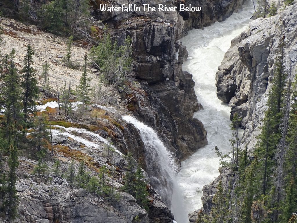
After lunch, we took a walk down the river, where it quickly dropped down into a slot canyon. The sound was amazing, ricocheting off of the rocks, and the waterfall views, incredible. There are trails in the canyon that can keep you busy for 20 minutes or 3 hours, so there’s a lot to enjoy.
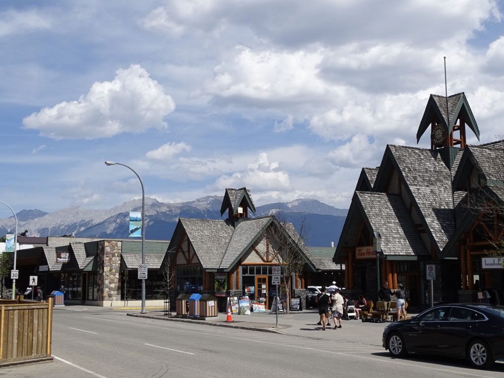
Back in Brutus, we headed on down to Jasper. After the crowds and urban sprawl of Banff, we were interested to see how this town had fared since our last visit in 2014. (That was an awesome trip from Vancouver to Toronto on the train, and I whole-heartedly recommend it!) While there has definitely been some growth, it hasn’t gone crazy like most places. Maybe the town/county government is keeping a tight rein, which is definitely not a bad thing. On this Saturday of Victoria Day weekend, there were no real crowds, which was definitely a surprise. Parking was easy to find on the street and cost about $5 compared to $9 in Banff, and if you could find it, was never near where you wanted to be. We walked around, checking out shops and stopping for ice cream at Grandma’s Place (very good). Then it was time to head back to Petunia.
Sunday we woke up back in the smoke. While it smelled pretty strong, visibility wasn’t terrible. As we headed north to Hinton, the smoke quickly got much worse and visibility was probably a mile or so. There are two big fires north and northeast of here that are the origins. Services this morning were at Gateway Community Church, which on the outside reminded me of a 1960s insurance building. The inside was warm and welcoming, though, as were the people. Pastor Daniel Peters gave a lovely sermon about Christians putting on our new selves when we accept Jesus. When we came out afterwards, we were amazed to find that the smoke was virtually gone. Cool! Lunch was at Canadian Steakout, a recommendation from one of the church members. He wasn’t wrong…the steaks were delicious. We’ve been seeing sticky toffee pudding everywhere, so MW took some home for later. He said it was basically like a sticky cake with caramel sauce on top. Before heading back to Petunia, we picked up ingredients for the crockpot.
Back at the campground, MW talked to our neighbor a bit, who is from just east in British Columbia (BC). He seemed to know the road to Alaska well and offered suggestions for places to stop. They talked about the current wildfire situation which is still a bit bothersome. The fires aren’t near our stops, but they are producing a lot of smoke, especially in the next two areas. He suggested reversing our circle and heading over towards BC now, then returning through here in the fall. The problem is that, changing all of the reservations and actually getting places to stay would be next to impossible. Plus, we have to end up in Washington north of Seattle to visit with family. So, we are staying the course and praying that the smoke clears out. We have seen that happen in a matter of hours more than once now. It is also projected to rain for the next week or so where we are headed, so that may help to resolve the issue, too.
The afternoon was nice. I finished up the last post and started working on this one, and we watched a little Perry Mason. There was even a nap snuck in there! I think I’m becoming my Mom. Sundays now typically consist of church, a nap, and ice cream, plus a little hiking/sightseeing when available. Not a bad way to live. The rain started moving in mid-afternoon, giving us a bit of off and on drizzle.
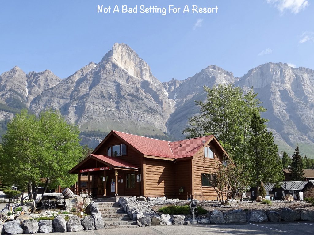
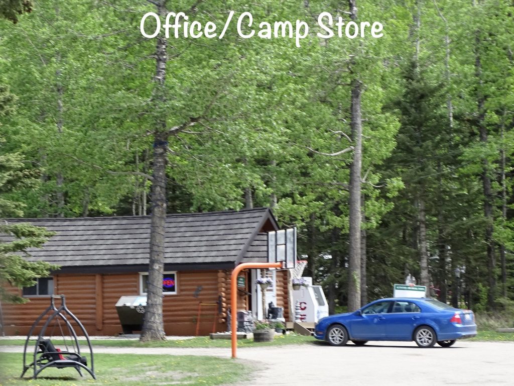
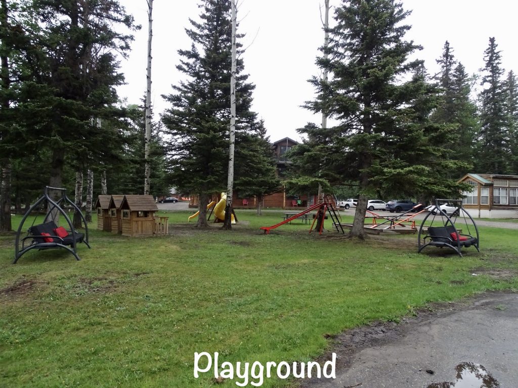
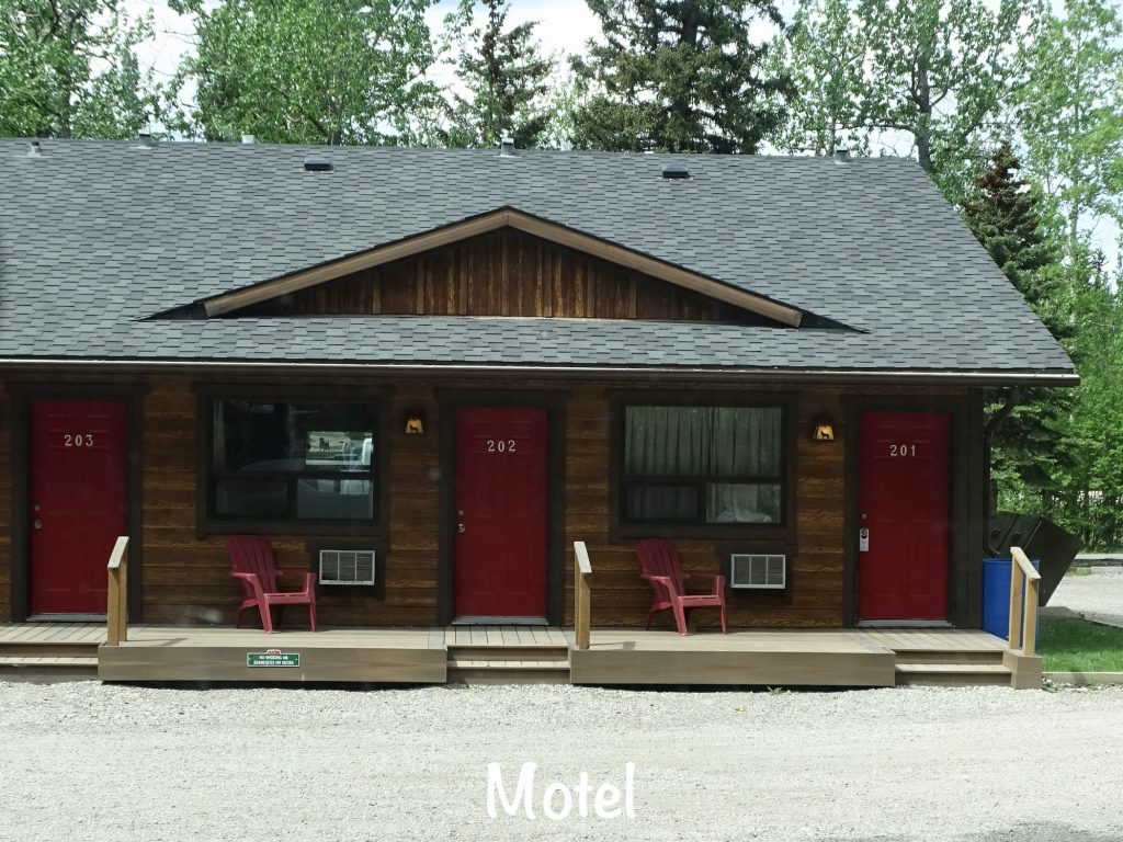
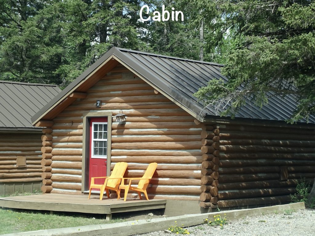
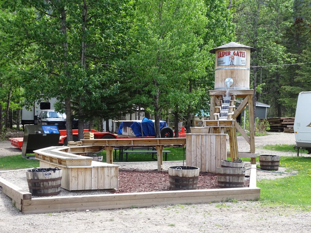
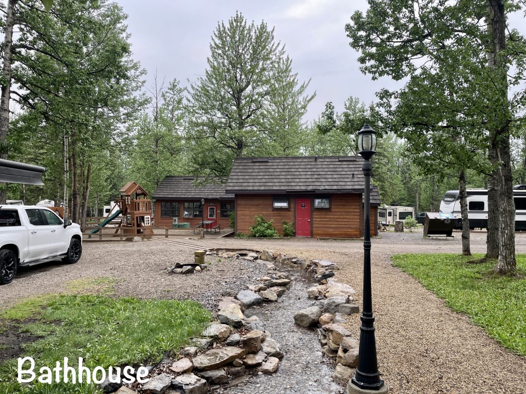
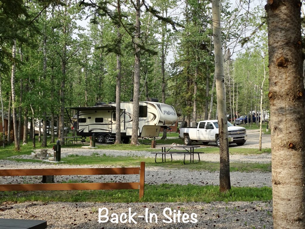
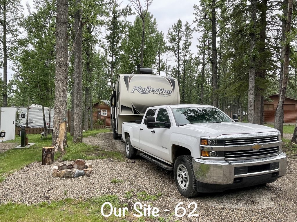
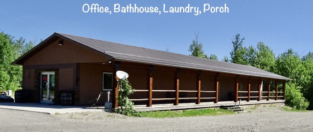
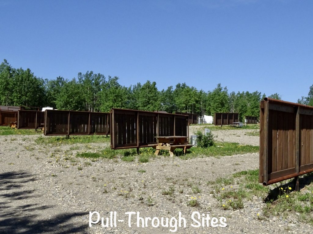
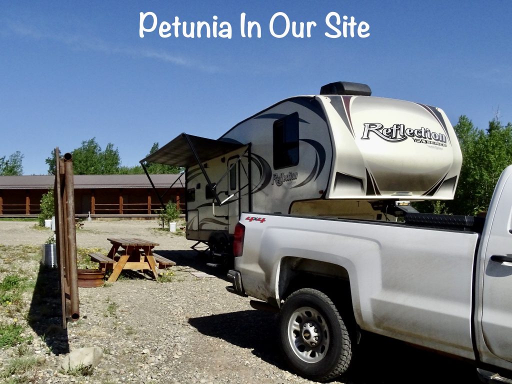
Jasper Gates Resort is a seasonal RV park that could certainly be considered a destination, especially for families who like exploring. Located 16 miles south of Hinton, 34 miles north of the town of Jasper, and minutes from Jasper National Park, entertainment options are abundant. Plus, as previously mentioned, the Folding Mountain Brewing Taproom and Kitchen is right next door! The property is located along CN-16, so you can hear road noise, and the sites, like most private parks, are stacked in pretty close. It is wooded and well-kept, and they are also in the process of expanding. Amenities include a camp store with groceries, movie rentals, firewood, wifi (although slow), playground, a giant chess board, and the Bear’s Den, a gathering room. They’ve recently added hiking trails around the park, too. Lodging options include a motel, cabins, rental RVs, and the campground. The latter has 73 campsites, 40 of which are full-hookup, pull-through. The park did have wifi, but only up at the office. Cell signals were moderate, but there was no over-the-air tv. We would stay again to explore the area. It isn’t one of those places we would hang out for peace and quiet, though. For this stay in May 2023 we paid $141.71 for 3 nights.
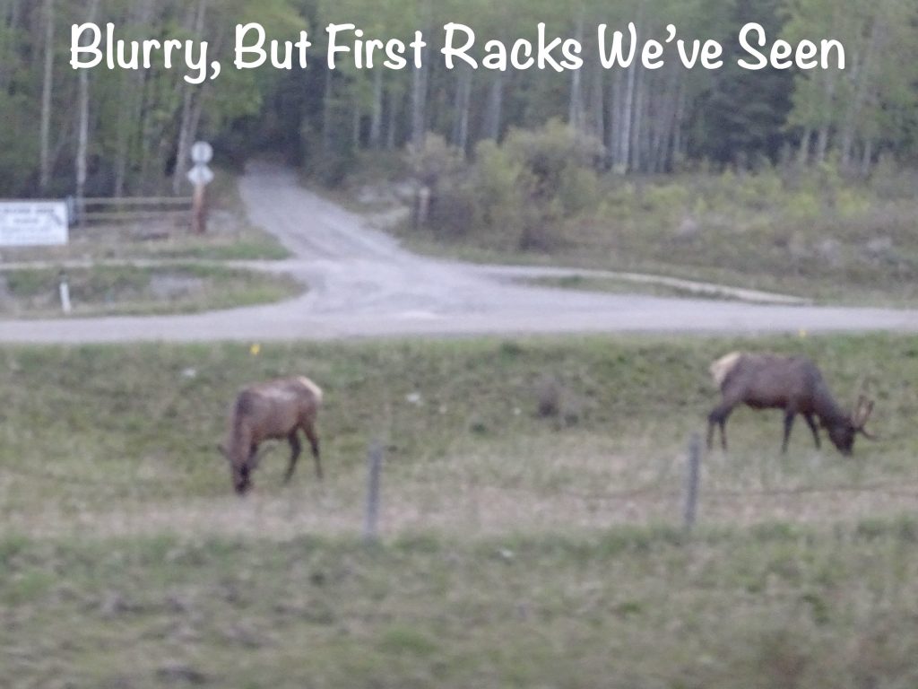
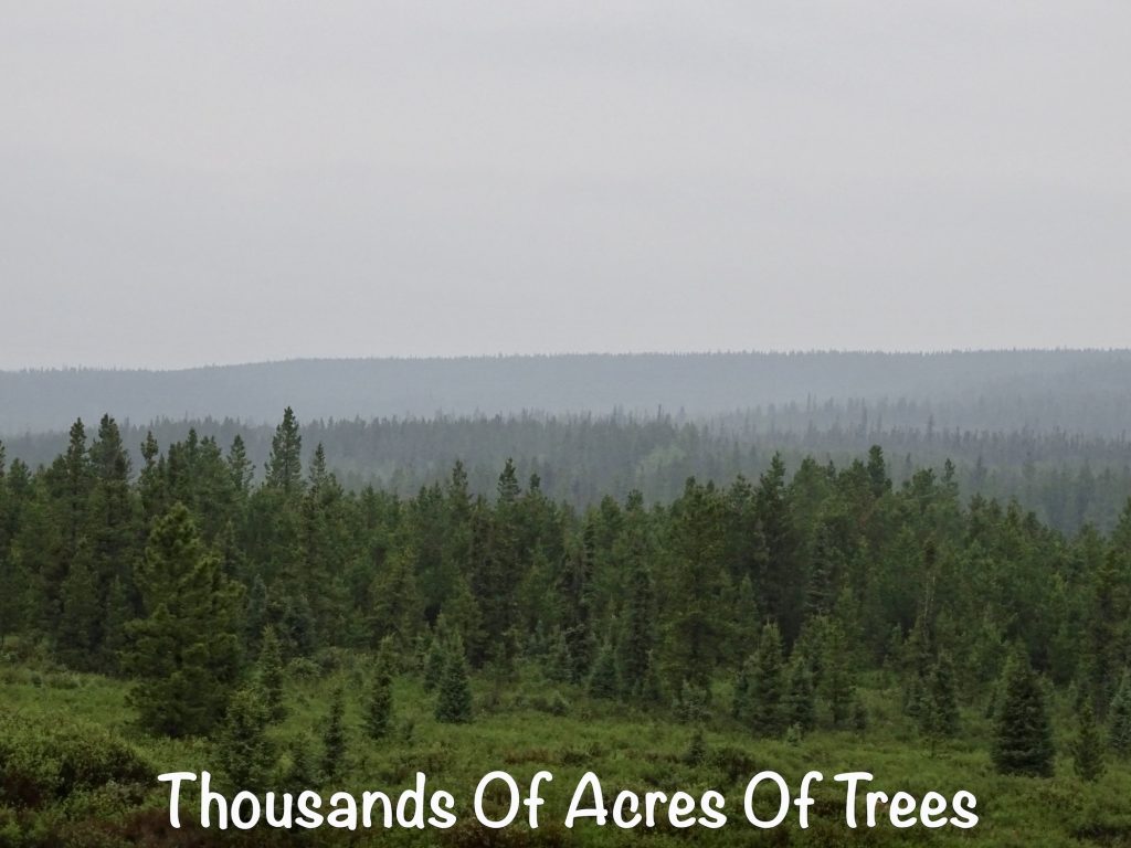
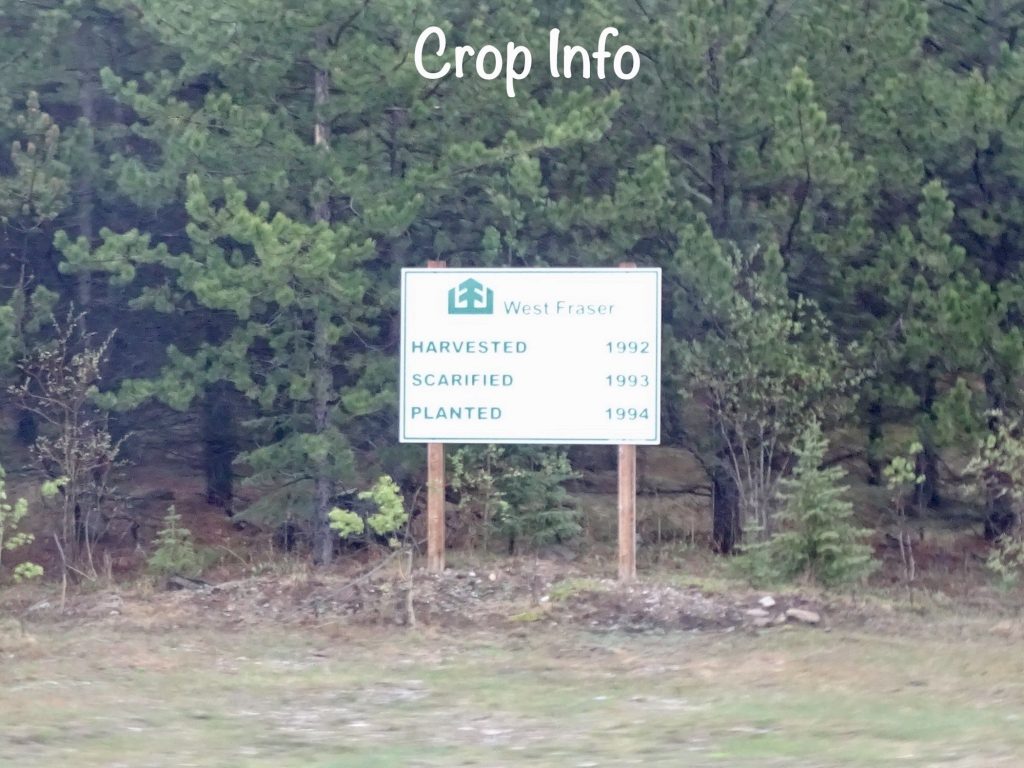
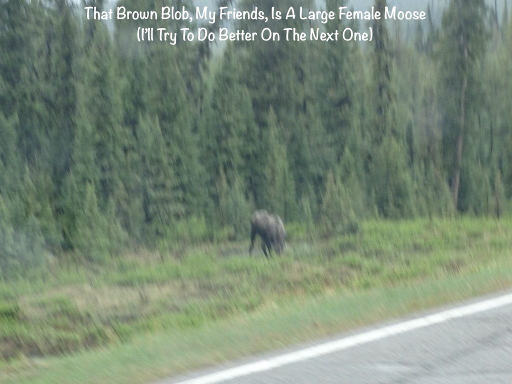
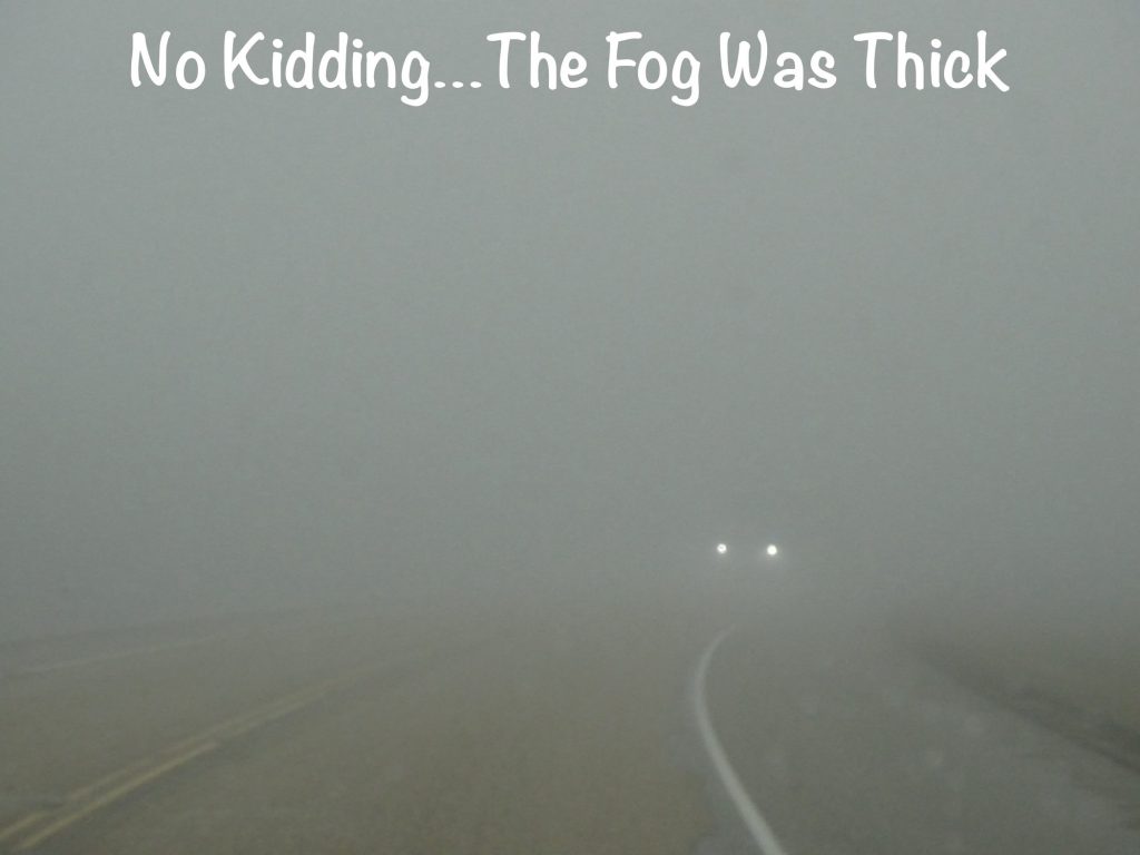
Monday morning we hit the road about 9 AM, first headed towards Hinton on CN-16, then turning northwest on AB-40, the Big Horn Highway. It was grey and a little drizzly off and on, which cleared out most of the smoke overnight. My eyes appreciated that. The first section of the drive, up to Grand Cache, was beautiful… mountains, hills, and thousands of acres of trees. Sections had signs noting when they were last logged, and there were all kinds of roadway signs about logging trucks, etc. Oddly, we didn’t see one logging truck all day. We did see a couple of deer and TWO MOOSE. Sadly, when there is rain on the windshield, my camera wants to focus on that. I’m not fast enough at driving speeds to compensate, so I only got one blurry pic. Sorry. A bit later we went through some pretty dense fog. Slowing way down, we were surprised at how many people passed us doing ridiculous speeds. I mean, we already saw moose and deer and signs for elk and caribou. Who wants to hit one of those in the fog, not to mention another car! We arrived at Grand Cache just in time for lunch and stopped in at the Big Horn Grill & Sports Lounge, which was very good. The special was liver and onions, which is one of MW’s favorites. They also had some pretty delicious chicken wings; they were tiny, but they gave you a bunch. For a town in the middle of nowhere with one road passing through, we were surprised at the number of hotels and restaurants. It is on top of a mountain, though, so I imagine the views are terrific when it isn’t raining.
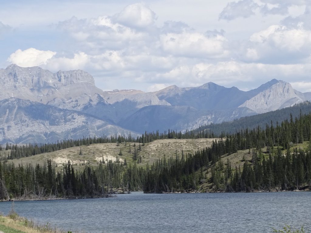
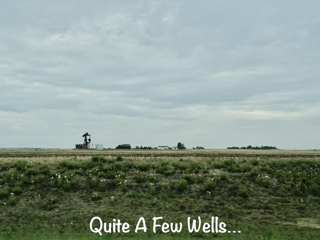
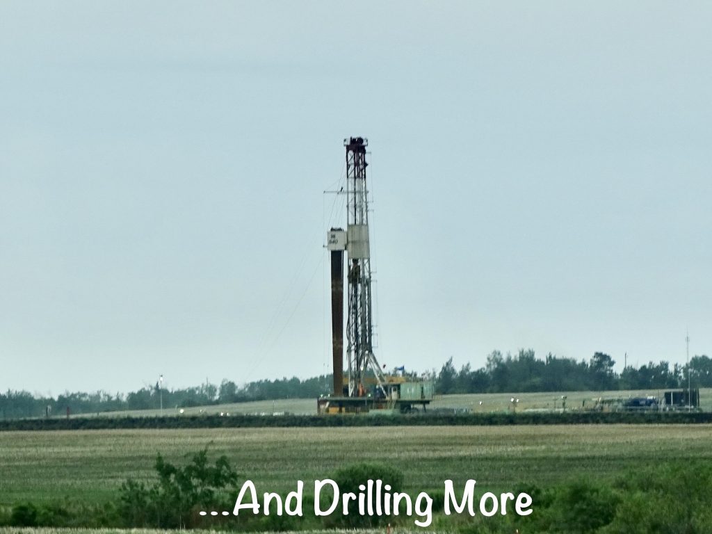
Back on the road we continued north to Grand Prairie and were in for more surprises. On the map, this route is covered up with river crossings and provincial parks, Canada’s version of a state park. We really expected it to be pretty scenic all the way up. Just north of Grand Cache, that started to change. First, as we were passing through an area with signs to watch for Bighorn Sheep, we noticed rock walls that looked like coal. Just a little ways further, there was a giant coal facility with stuff being transferred down the mountain. Soon after that, we caught glimpses of natural gas fields and some oil wells, which then turned into huge facilities. The traffic picked up drastically, and it was mostly commercial stuff. As we approached Grand Prairie, there was a lot of road construction and all kinds of commercial plants and facilities. Suffice to say, the second half of the drive was not nearly as enjoyable as the map suggested. We passed through Grand Prairie, which is a pretty large town, and headed a few more miles to Clairmont. Then it was a short hop on RR-62 to the Blue Sky RV Park. After setting up in the drizzle and mud, we both got comfortable for the evening.
The rain continued overnight and into Tuesday, at times pretty hard with some serious wind. We toyed with going out, then decided it would be a stay-at-home day. You know that means “pajama day” to me! I worked on some taxes, did a little writing, and caught a good nap. That was pretty much it. Blissful!
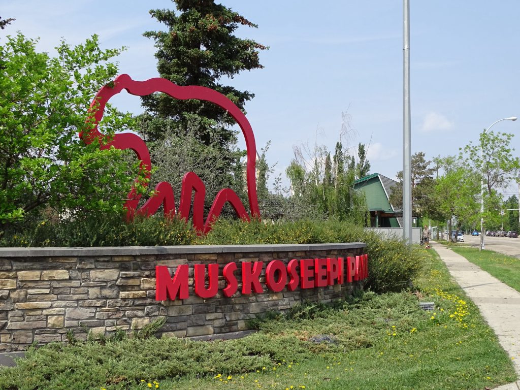
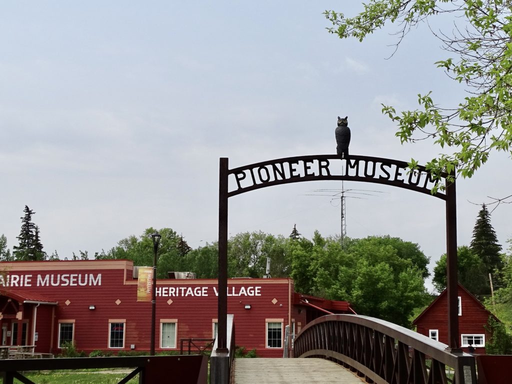
Wednesday, although it was still grey in the morning, it was time to get out and about. We headed into Grande Prairie to check out Canadian Tire, which I thought was a giant tire store, but really is more like Rural King meets Advance Auto plus car repairs, but on a grander scale. It is one of those places you wander around in for a while and are surprised by all that they have. Next we made a Costco run and took care of a few more errands. Lunch was at Major’s Homestyle, where the interesting thing was MW’s Ukranian Special, which had pierogis with onions, stuffed cabbage leaves, and kielbasa. He was pretty happy. After dropping the groceries back at Petunia, we headed over to check out the Grande Prairie Museum at Muskoseepi Park. The many inside exhibits included information on local First Nations (Canada’s native tribes), the Canadian National Railway, textiles, and the Mounties.
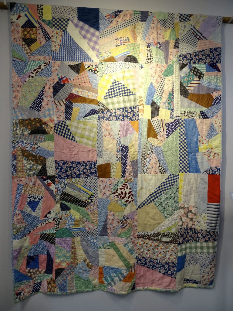
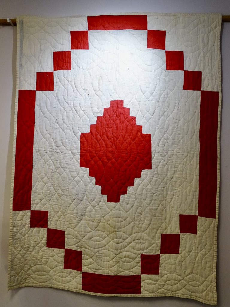
I particularly enjoyed the Wartime Quilts display. During WWII, women and children all over Canada sewed quilts for the soldiers on the front lines and in hospitals and for British families who had lost their homes in the bombings of England. They estimate that 400,000 quilts were shipped to Britain! These stories of coming together during the war always touch my heart. Today about 250 survive, most overseas, and the makers of the two below are unknown.
Another cool thing I had never seen was a birch bark biting. A very old art form, it was often used as a pattern for bead and quill work. Starting with a piece of bark, separated into layers, the artist would then make multiples folds and bite into the bark. The result was symmetrical patterns, similar to the way you do cutouts in folded paper.
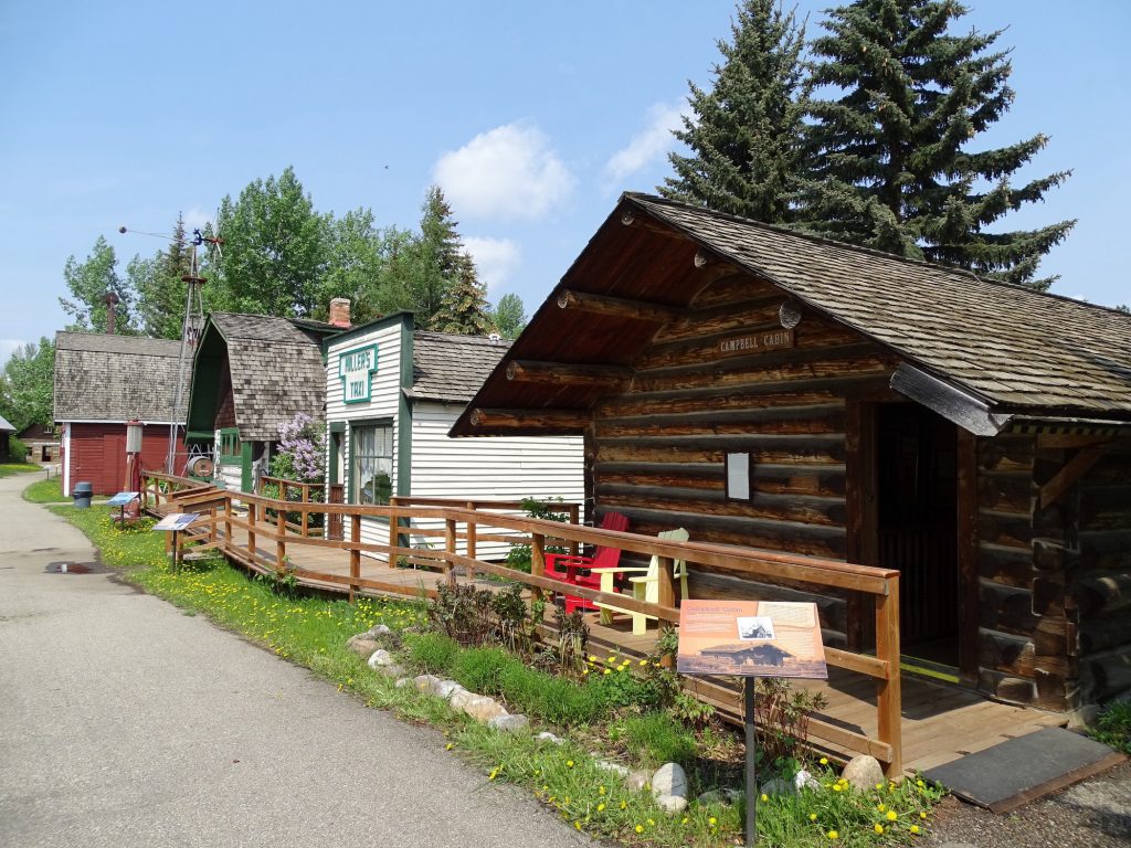
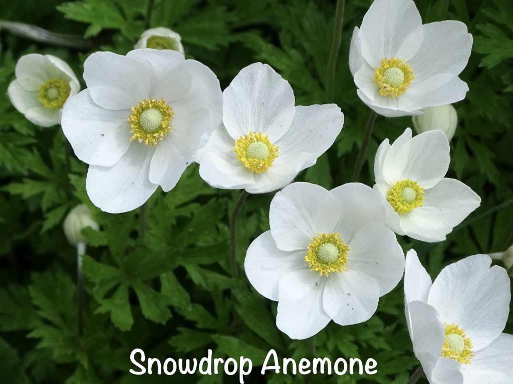
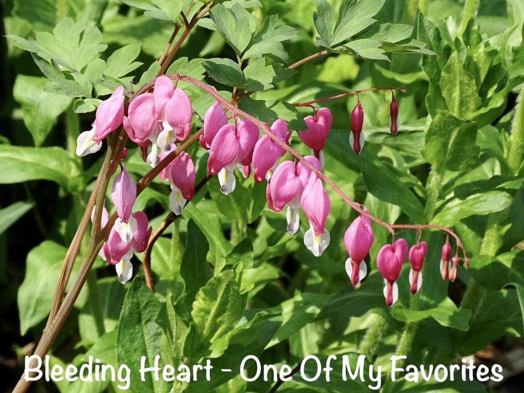
The outdoor heritage village had buildings from around the area. It was pretty nice and really well-done. The landscaping was all in bloom, so you know I enjoyed that part, too.
We also learned a few things about local wildlife. A few facts I found interesting: 1) Moose, elk, and other deer are ruminants like cows, meaning they have a 4-chambered stomach and regurgitate and chew cud. Blech! 2) Moose swim well and, within days of birth, can dive up to 18′ for plants at the bottom of a lake. Imagine being surprised by that as you take a leisurely swim! 3) Grizzly bears can run over 34 mph. Humans can’t. 4) Grizzly bears can remain active all winter without hibernation. Skiers beware. 5) A wolf can run over 43 mph. Humans can’t. 6) Male elk and moose both shed their antlers every year. That’s a lot of growing for a short period of use. 7) The male ruffed grouse is aggressively territorial, trying to keep a 6-10 acre area for exclusive use. If you get attacked by a bird in the woods, you’ll know.
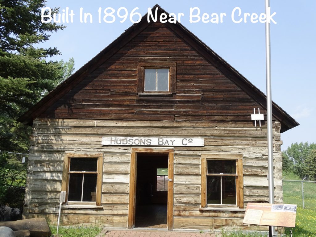
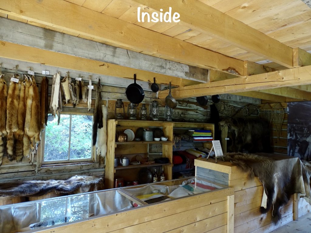
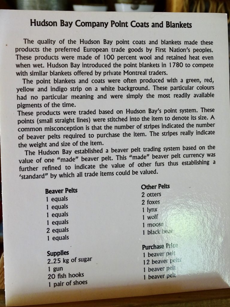
They had an old outpost for the Hudson’s Bay Company, which is still in business. Beginning as a fur trading business in 1670, it grew into the largest and oldest corporation in Canada. Today it still operates stores, and we saw one in Banff. At one time the company controlled all trade in the Hudson Bay drainage basin, and was the de facto government in Rupert’s Landing for more than 200 years. If you ever wonder why monopolies are a bad thing, this is a good example to check out. In the late 1700s, the North West Company became a competitor in the fur trade. An entire WAR was fought because of the competition between these two companies, and in the end, the government forced them to merge to stop the violence. That made a bigger monopoly. So much so that, for 50 years in the mid-1800s, it issued its own money! By the 1820s, Hudson’s Bay Company had knocked out competition in the Pacific Northwest as well. Expanding into goods and services meant that they had a stranglehold on supplies, and that meant total control over prices, and quite a bit of gouging, including to Russian-held Alaska and to those settling locally. Kings of misinformation, they went so far as to perpetuate a myth that the Canadian West was not fit for farming. That was “busted” by the Palliser Expedition of 1857-60. While their trappers explored and helped develop much of Northern California, they actively discouraged settlers from continuing west along the Oregon Trail into Idaho, Washington, and Oregon. The first successful large wagon train to reach the Oregon Territory in 1843 helped break their stranglehold there, and in a interesting twist, the same company director who had actively worked to turn away settlers then welcomed them to his store in Oregon City. John McLoughlin later became known as the “Father of Oregon”. in modern times Hudson’s Bay has been strictly a retail department store operation that, in addition to its own stores, has owned other brands like Lord & Taylor and Saks.

SIDE NOTE: On one of the buildings signs, there was a story about a man named Albert Johnson. He was an American who moved up to the Yukon to be a trapper. At the beginning of the narrative, it says that he was a “god-fearing man who did not drink or smoke and rarely used profanity”. Within the writeup, though, it also says “he was not a friendly man”, “nearly everyone who had ever met Johnson was afraid of him”, “unprovoked he had shot an RCMP officer”, and “he shot and killed 2 more RCMP officers”. Then it goes on to say that he was cornered and killed in 1932, and after his death, it was speculated that he had been a MURDERER WHO COLLECTED THE DENTAL WORK FROM HIS VICTIMS! Okay, I don’t know about you guys, but where I come from, behavior like that would NOT be classified as God-fearing! (Maybe the problem was that lower-case “G”.)
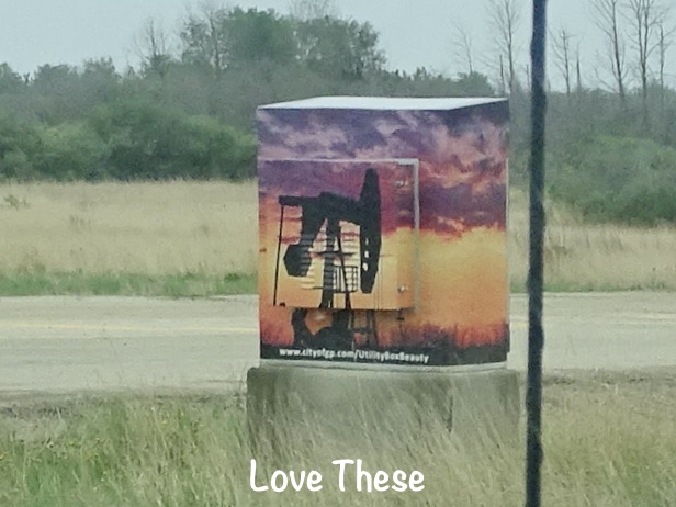
One thing I forgot to show you is the painted electrical boxes. I’m not sure where it started, but the trend has spread all over Canada. They use local artists to create wraps to cover up the otherwise boring and sometimes downright unsightly cabinets. What a terrific idea!
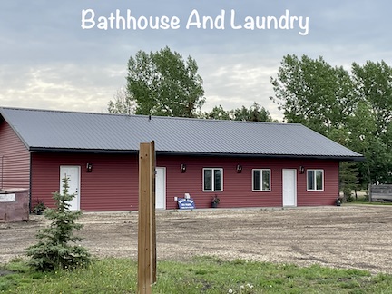
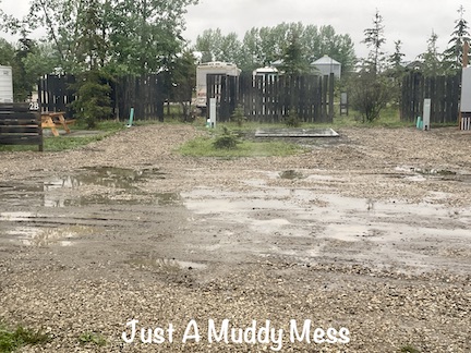
Blue Sky RV Park is located just north of Grand Prairie in Clairmont, Alberta, and is open year-round. A fairly basic campground, its amenities included a bathhouse with pay showers and a laundry. They advertised wifi, but it was weak during our stay. Campsites are all full-hookup with either 50- or 30-amp. Some are treed and others are out in the open and have patios, picnic tables, and fire pits. There are sizes to accommodate larger RVs, and the park has a lot of full-time residents. Cell signals were strong, but there was no over-the-air tv. For exploring the area, this location is good. However, our complaint was the mud. While there was a small amount of gravel used in the sites and roads, it was totally ineffective. With the wet weather during our stay, we couldn’t get to the truck or walk to the bathhouse without getting inches deep in the stickiest bog I think I’ve ever seen. Without a change in their roadways and site prep, we would not return. It was even made worse during our stay as they were running a bobcat back and forth down the road moving dirt to other areas. For this stay in May 2023, we paid $140.17 for 4 nights.
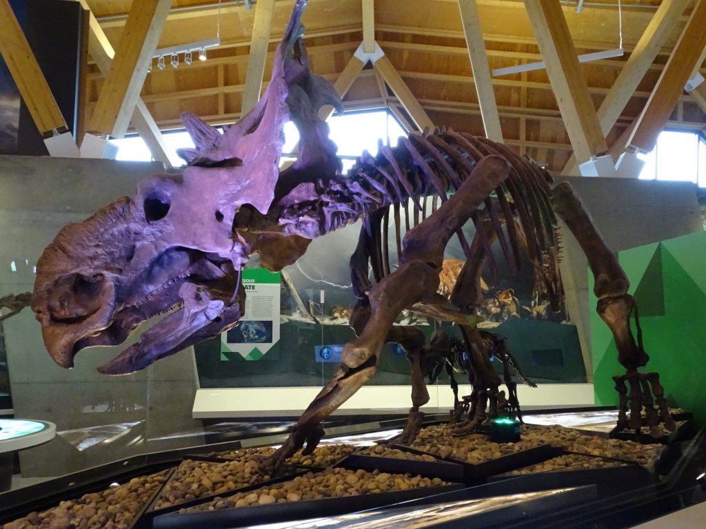
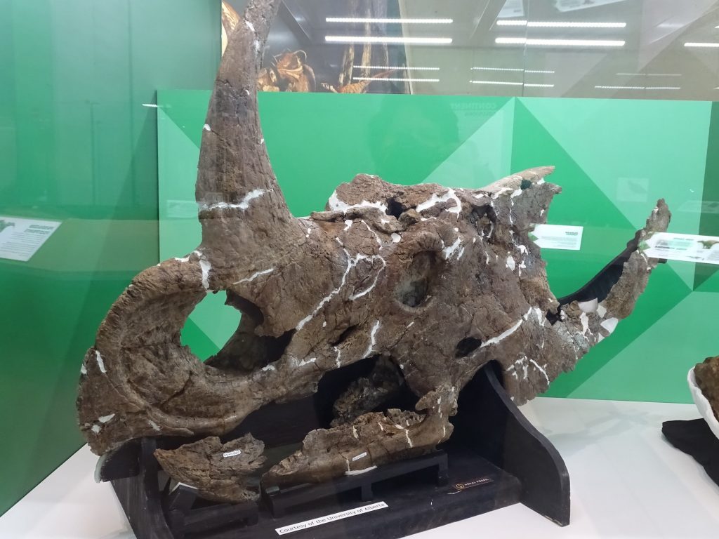
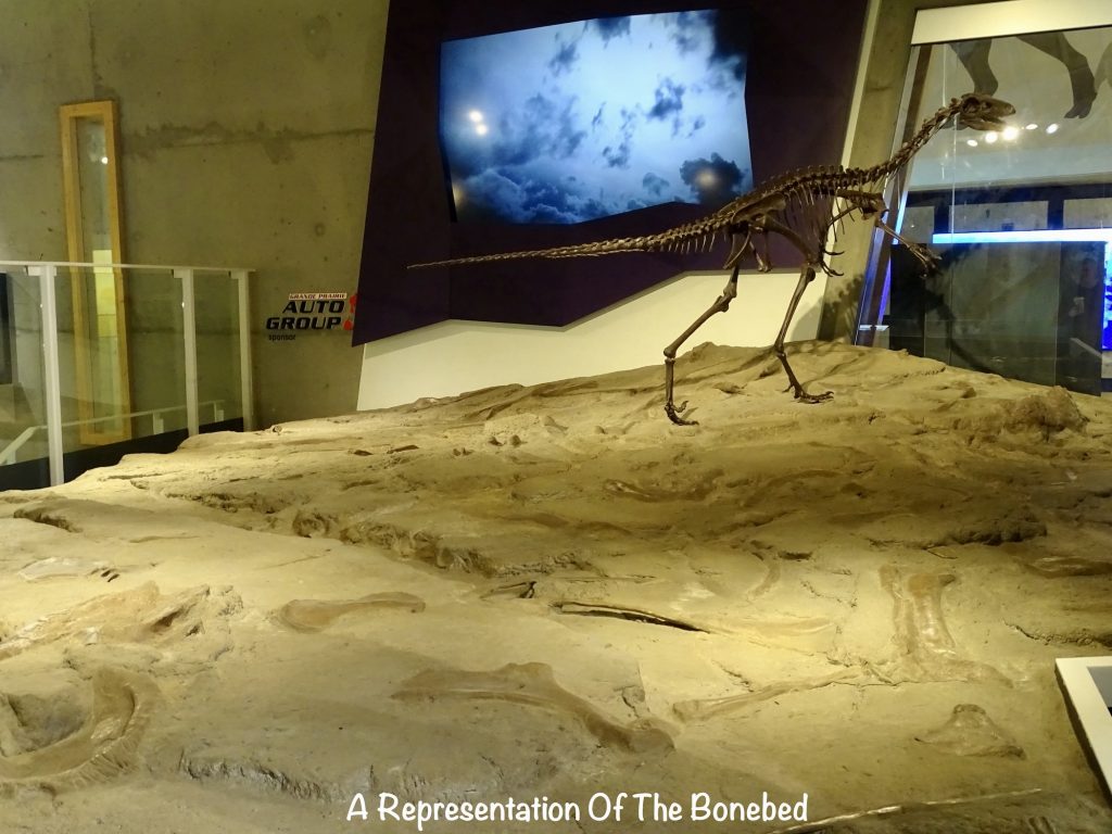
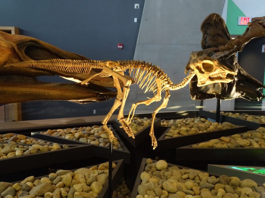
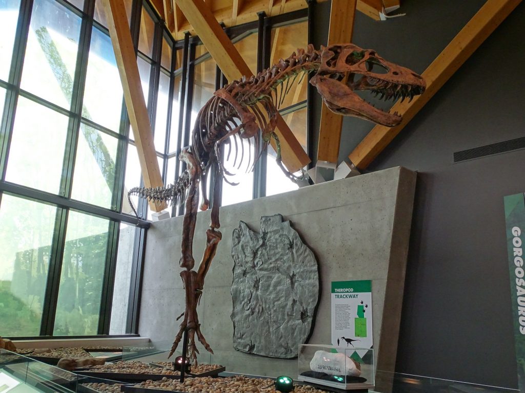
Thursday morning we were able to get out slowly thanks to the opening time of our first stop. I love it when that happens. There was a little writing and a haircut for MW before we headed out about 9:45 AM. Just a few miles down the road in Wembley, Alberta, we stopped to take a look at the Philip J. Currie Dinosaur Museum. A bonebed is an archaeological location where a lot of animals died at one time, and in 1972, one was discovered at Pipestone Creek. Many different dinosaurs and other fossils have been pulled from the pit since, along with areas of tracks in mud, and this museum tells that story. It was pretty interesting, as dinosaur museums go.
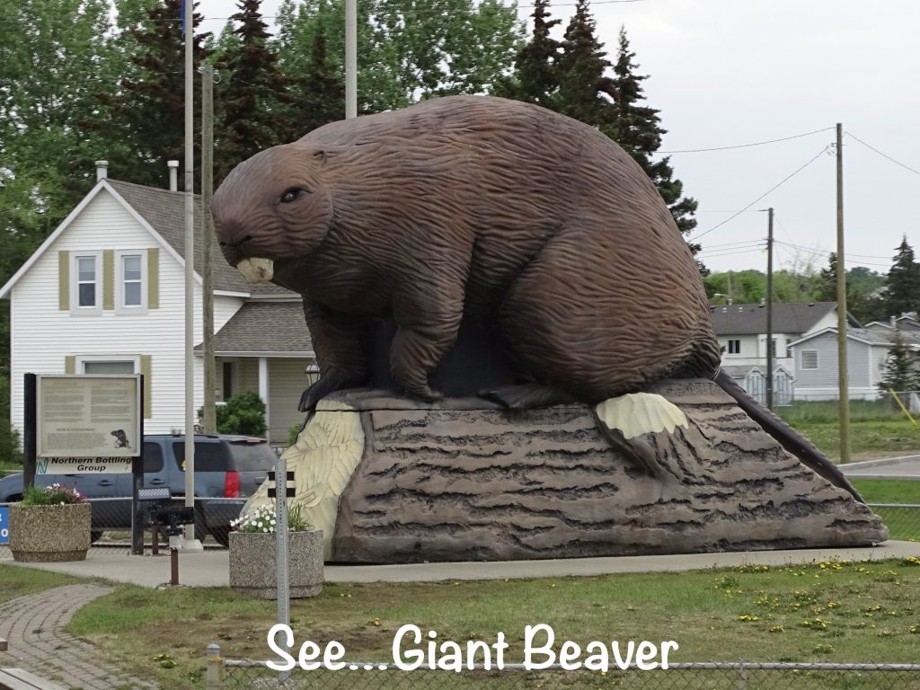
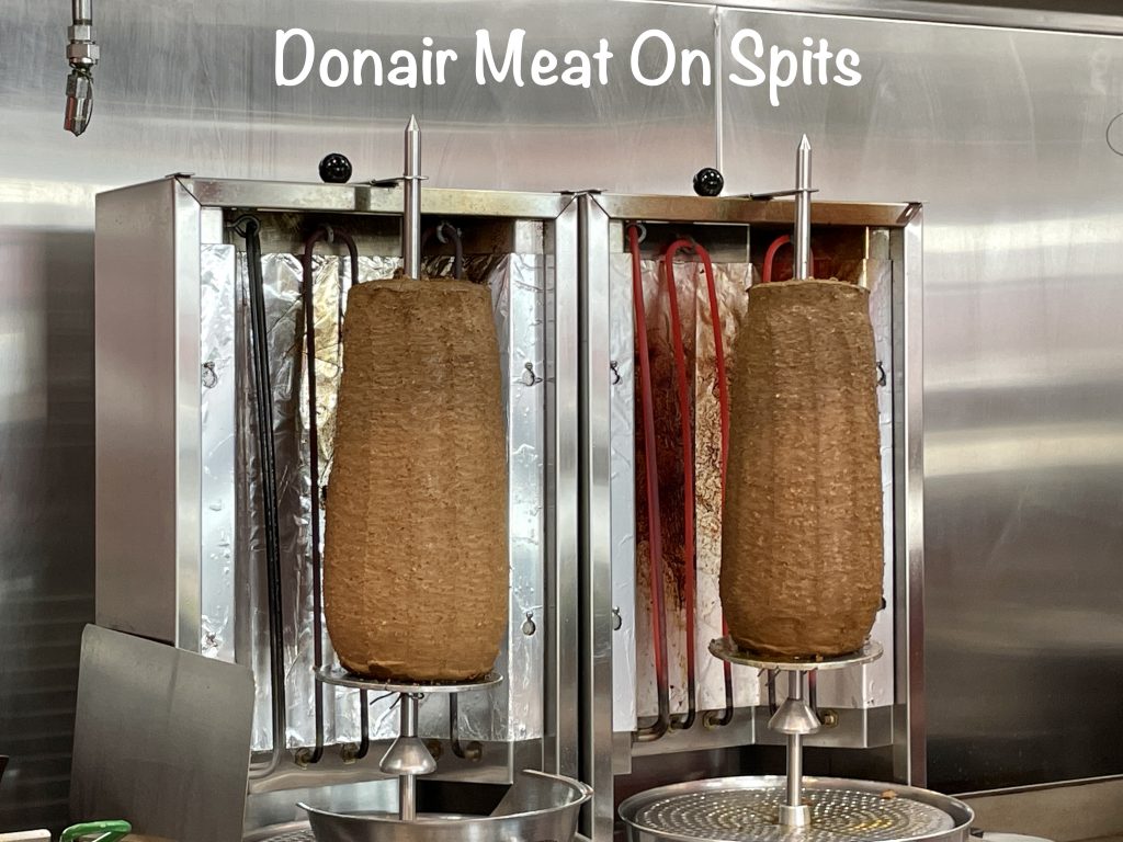
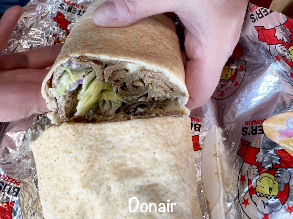
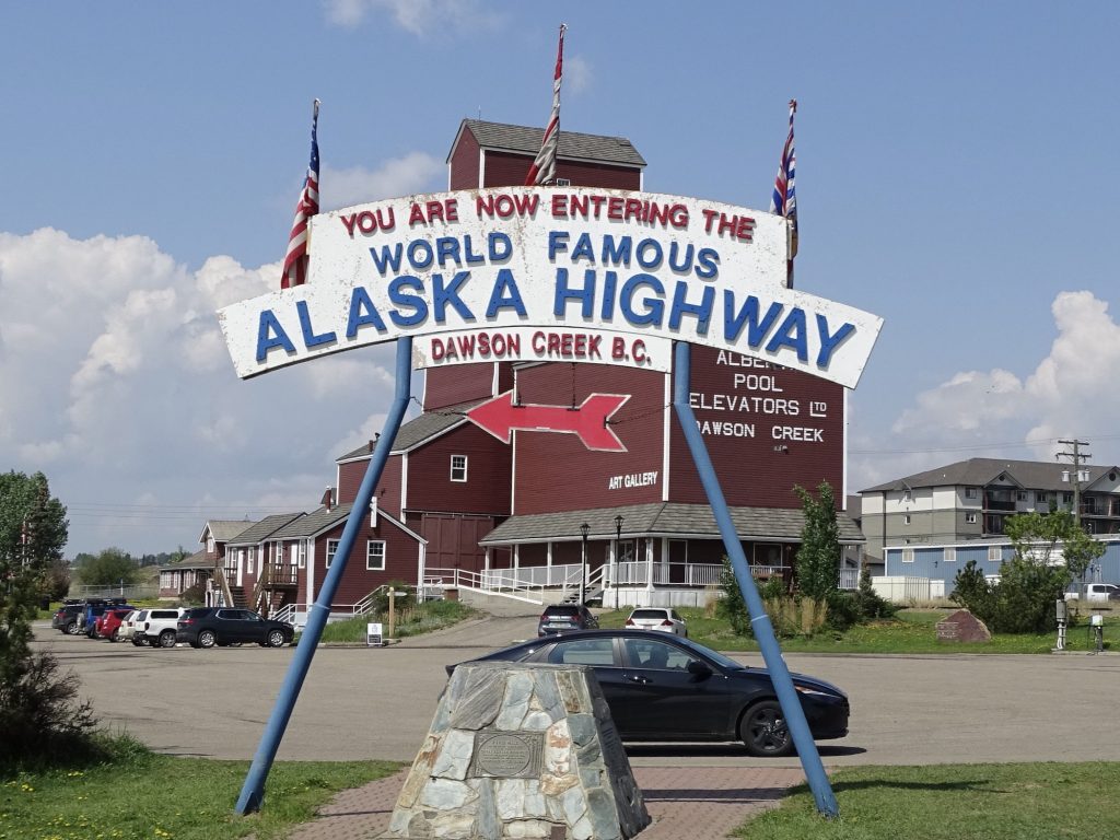
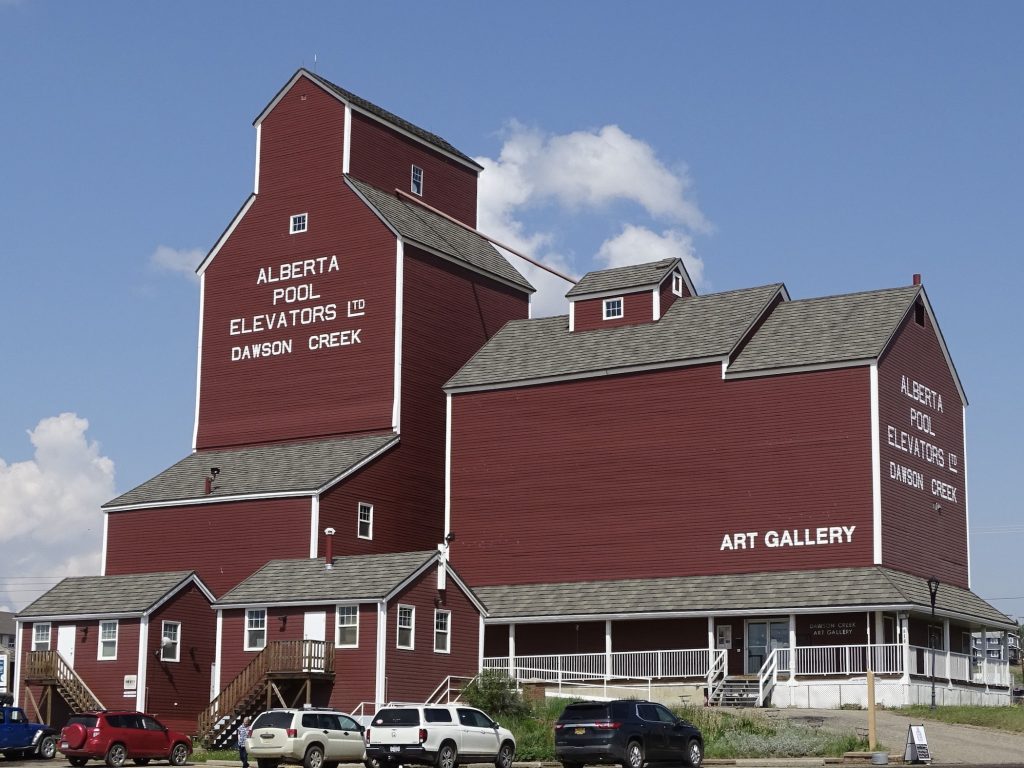
Back on the road, we passed through Beaverlodge, where we saw a giant beaver. No kidding! Then, another 40ish miles down the road, we crossed into British Columbia. At Dawson Creek, MW decided, after several weeks of passing restaurants advertising them, it was time to find out exactly what a donair consists of. We found Buster’s Pizza and Donair to check it out. Turns out, it is a little bit like a gyro, but instead of lamb, it is beef, rice, and seasonings in a loaf. The meat is cooked on a spit and carved off, then served in a a pita with lettuce and tomato. It can come with a sweet donair sauce or tsatziki. MW had the latter. I tasted a bit of the meat, and it wasn’t bad. MW gave the whole combo two thumbs up.
After lunch we finally hit the beginning. I know, it seems like we started long ago, but this was the real beginning…we turned north on the WORLD FAMOUS ALASKA HIGHWAY! Although proposed in the 1920s and discussed throughout the 30s, it wasn’t until the Japanese attacked Pearl Harbor and the accompanying threat to the west coast that the U.S. jumped on the construction. Built with American funds and mostly by the Army Corps of Engineers, the highway was approved by Canada with the understanding that it would be transferred to Canadian authority after the war. Roosevelt, who had been talking about a road for many years, felt it was tremendously important as a route for supplies and troops to Alaska, but in the end, almost everything went by ship. More than 10,000 men were assigned to the task, and construction began in March 1942 in four sections. Think about that. Now it takes YEARS to get anything significant started, but the road was approved by Congress in 2 MONTHS and construction began in 3! Wow! Plus, the entire 1,700 miles was FINISHED on October 28 OF THE SAME YEAR. How long have you been watching an interchange being built in your city? Of course, the road wasn’t anything like our modern highways back then. There were steep grades, few guardrails, and log bridges, and parts had to be rebuilt with wood (corduroy road) when permafrost thaw played havoc with the original surface. Over the years, rerouting and reconstruction have straightened many areas, making it easier to travel and shortening it to 1,387 miles. The original gravel/dirt surface has all been paved since the late 1980s, and so far is in very good shape. (I’ll keep you posted on that as we continue west.) After another hour or so, we reached our final destination for the day, Coffee Creek RV Park. It had started out a bit grey, but most of the drive ended up sunny and beautiful. We started in more open prairie and passed through some gorgeous river country, finally ending up in rolling, forested terrain. Along the way we saw a small herd of elk, a deer, and two bald eagles.
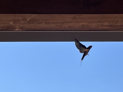
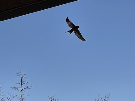
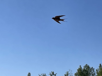
Friday morning it was time to take care of the laundry. The only one in town was over $7 CN PER LOAD, PLUS, you had to buy a plastic card for their machine for $40 CN!!! (I’ve been to many laundromats that use a similar system, and they typically charge $1 for the little card.) When we stopped to check it out on the way through, I spoke with a local women who is stuck, because he is now the only game in town. Don’t you hate businesses who fleece people just because they can? It’s like charging a ridiculous amount for a generator after a hurricane. I’m all for free enterprise, but businesses should operate with a moral compass, just like people. The result was staying at the campground and using their laundry, which was clean and a good price, but took more time due to fewer machines. I sat out on the porch between loads and enjoyed watching a barn swallow swooping around in endless great circles, occasionally passing through the porch. He was so fast that I probably took 100 pics just trying to catch him. While I was working on that, MW took the two remaining older tires on Petunia to Kal Tire in Fort St. John. After our recent tire issues, he had come up with another plan. He would have them mount the new tires on the trailer rims, then buy two cheap rims and mount the old tires there to use as spares. Three on board would, hopefully, keep us from being stranded on a remote highway. After finishing the laundry, I headed to McDonald’s in town for a change of scenery to write. On the way, they called to say the tires were ready, and I confirmed with the young man…new tires on old rims and old tires on new rims, all at 80 psi. “Yep!” Before heading back to Petunia, I popped by to pick them up. Our new tires were mounted on the trailer rims, but the old tires had been put aside for the tire graveyard or wherever they go from there. The new rims were on the order, but I’m not sure why they thought we were buying them. Turns out, the person who took the order just didn’t understand or write it correctly, and the guy on the phone was saying yes to get me off of the call. Ugh! However, the young lady helping me in the store was very good and apologized for the mixup. Thankfully, the old tires had not been carted off yet, so she had the guy go find them and promised to have them ready first thing in the morning. (She said it was the manager who took the order, and she really wished he would just stay in his office! LOL). In the mean time, she double-checked the pressure and loaded up the other two for me to take.
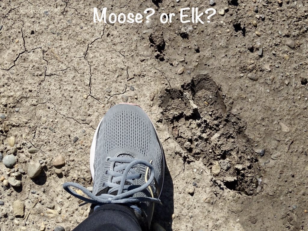
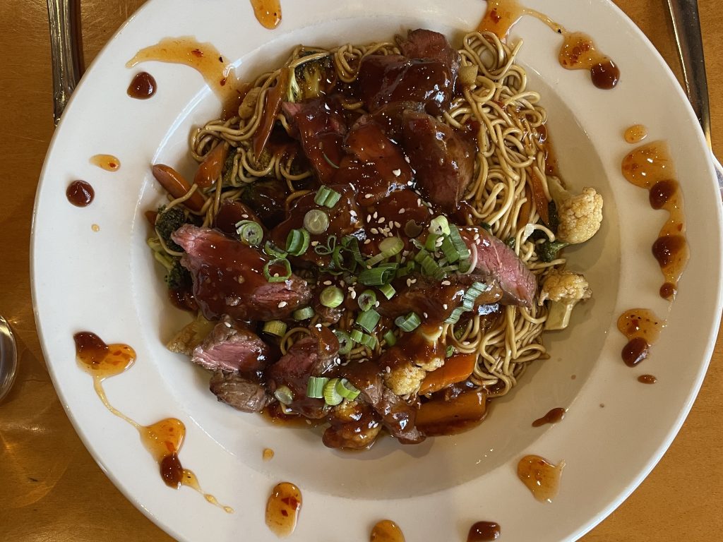
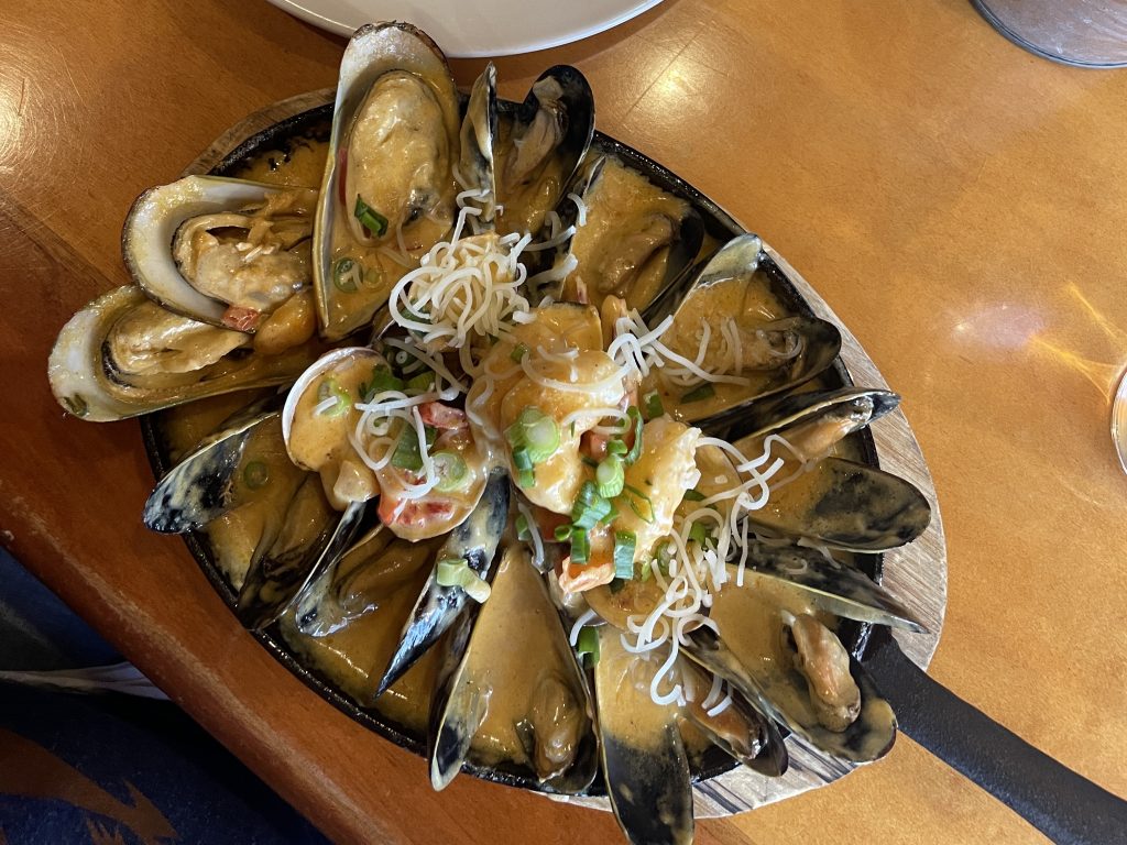
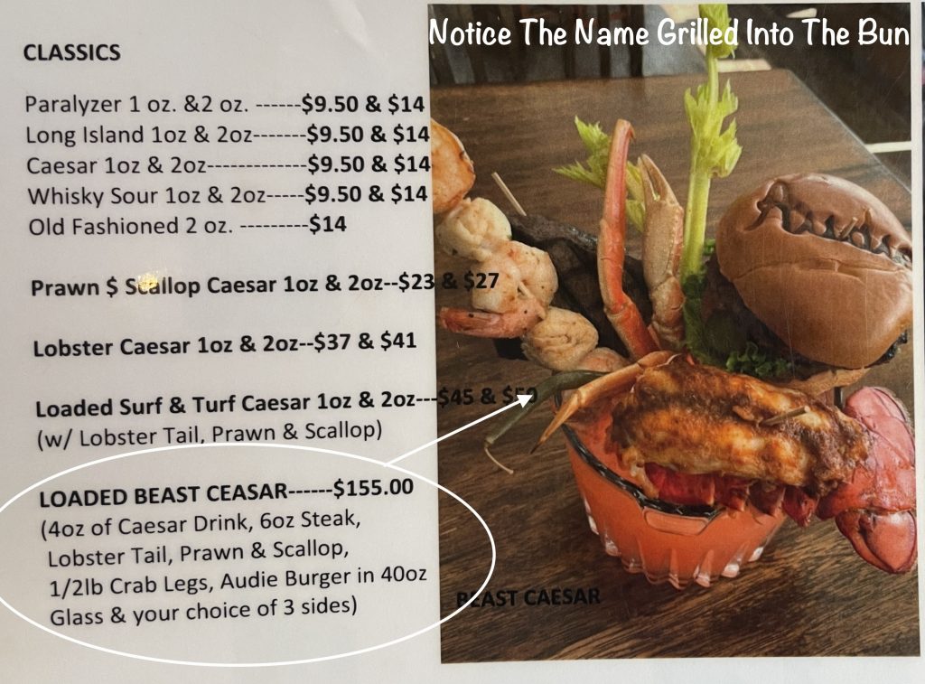
Saturday morning started with quite a bit of writing. Later, while MW put the tires back on Petunia, I took a nice walk in the woods. (The campground owner has about 200 acres and said we could explore.) What started as a dirt road at the back of the campground eventually became cow fields in rolling hills with beautiful views and much less traffic noise. Only saw one deer, but she saw me first, so no pic. I also saw what was most likely mountain lion scat…about 6″ long, segmented, with hair. It wasn’t too fresh, though. Later we headed to town, stopping first at Kal Tire to pick up the other two. Everything was fine this time. Yay! Next we headed over to Audielicious for lunch, which was great. Oddly, this showed up as a Mexican place on the apps, but when you clicked into their website, the first line was “We are a seafood restaurant!” They did have a variety of stuff on the menu, though, including some Philippino fare. We tried the Shumai, which was basically a steamed dumpling with a spicy dipping sauce. Delicious!! Then I had the Mixed Seafood Fricassee with cajun cream sauce, and MW went for the Steak and Noodles…both YUM!! (I’m even showing pics of these, because they were just so pretty!) The coolest thing, though, was not something we ordered. In Canada, they call a Bloody Mary a Caesar. On the menu was a Loaded Beast Caesar. I’ll just put a little pic below along with the description. Too funny! You could feed a group off of that thing!
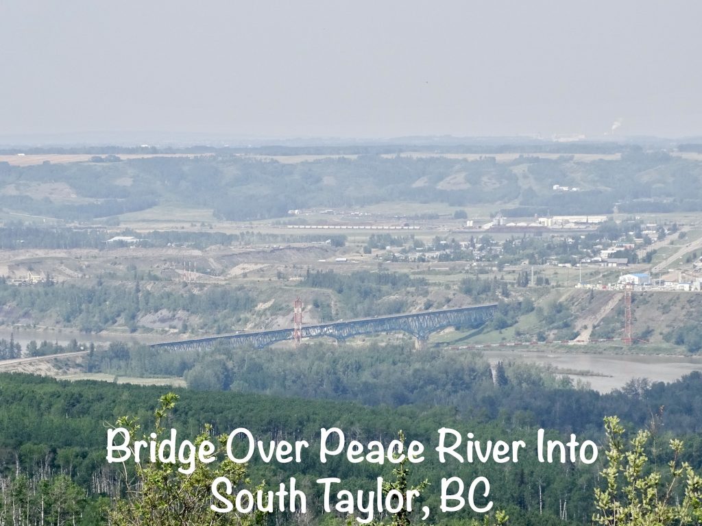
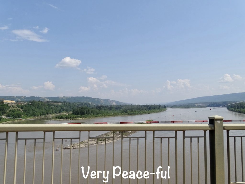
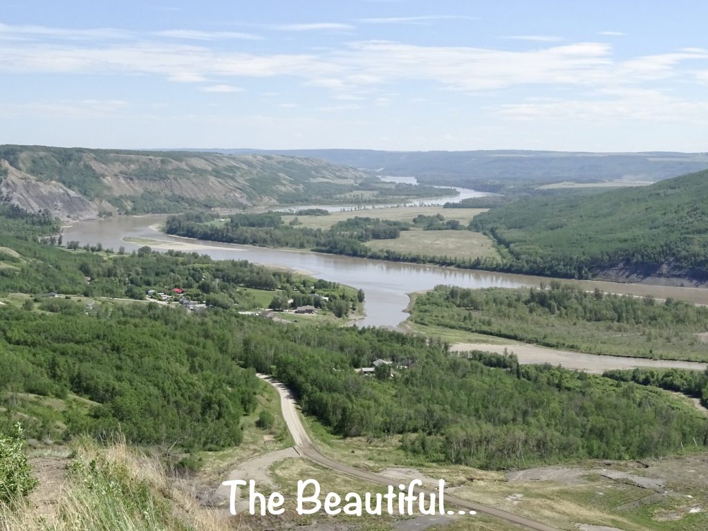
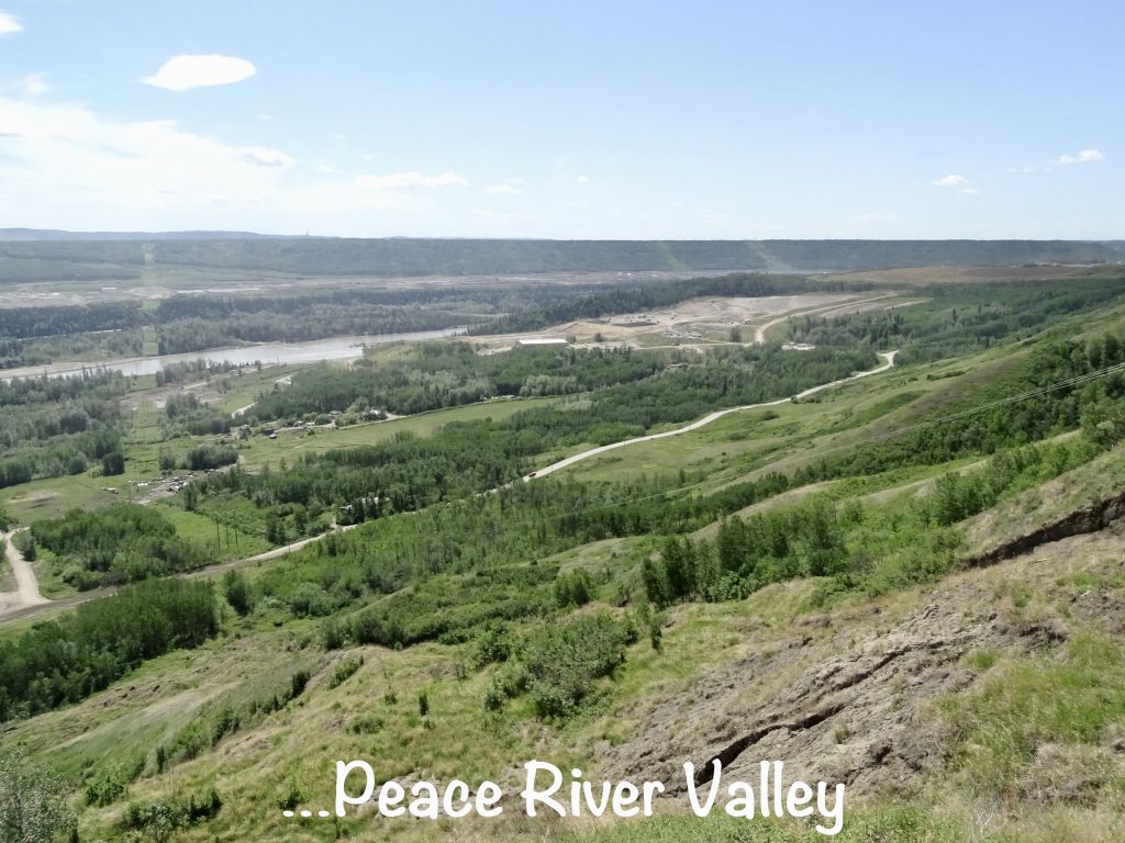
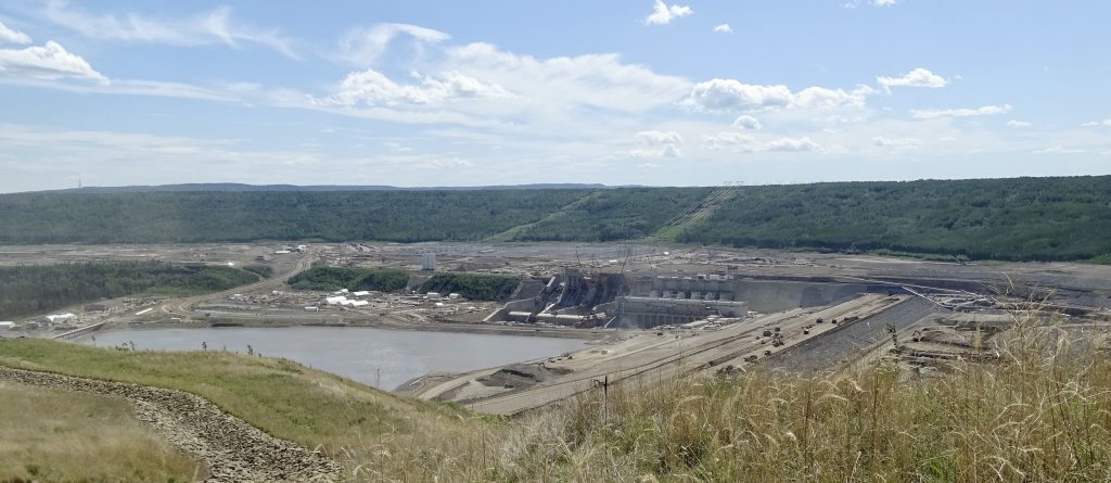
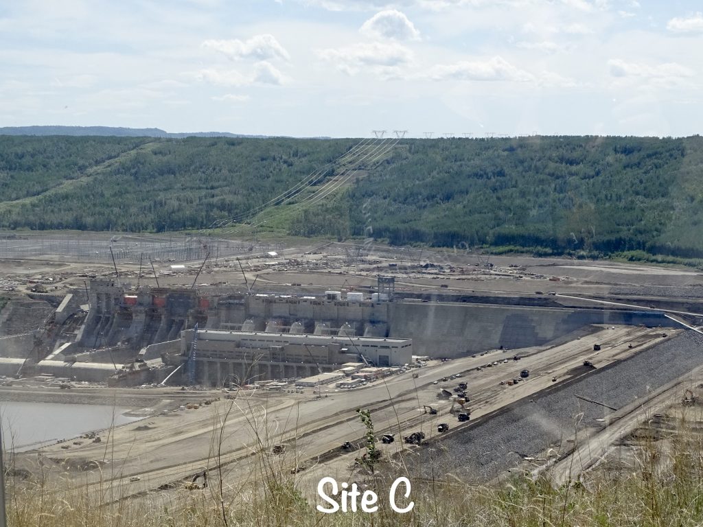
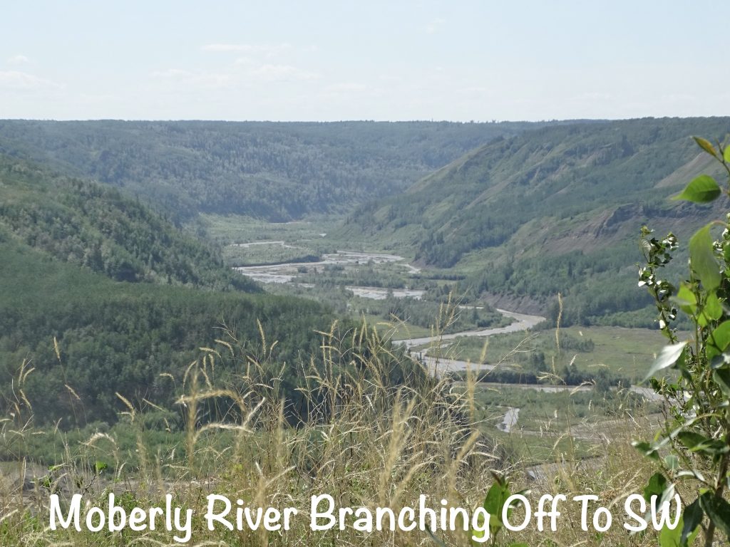
After lunch we headed over to the local ballfields where we thought a baseball tournament was in progress. There was one team playing but nowhere to sit, and we forgot chairs. Bummer! Next we did a church drive-by in preparation for Sunday, then headed down to the Valley Viewpoint south of town to get a view of the Peace River Valley. (My brain has associated the song Peace In The Valley with the Peace River Valley. The Elvis version has been playing on a loop in my head for days.) Then we got to see something not often seen in modern North America. Y’all know that MW LOVES a good dam. I’ve shown you pics of all kinds of them from all over the country. Most of the dams we see were built ages ago…Hoover and Bonneville were finished in the 1930s, Grand Coulee in the 1940s, and Glen Canyon in the 1960s…but today we got to see one that is being built. Slated for completion this October, this dam across the Peace River is currently unnamed and referred to as Site C. It will create a new reservoir south of the Williston Reservoir created by the Bennett Dam 65 miles west and add to the electric power generation capabilities of the area. Although we have all manner of modern equipment today, this gives an inkling of what it would have been like to see some of the huge dams being built. Too cool! There happened to be a couple of folks at the overlook who work at the dam. I asked about people displaced, and they said there were very few because the valley is mostly inaccessible. That’s good. They also said that, once the dam is finished, the resulting reservoir will fill in 3 months! For comparison, they said that Williston took years.
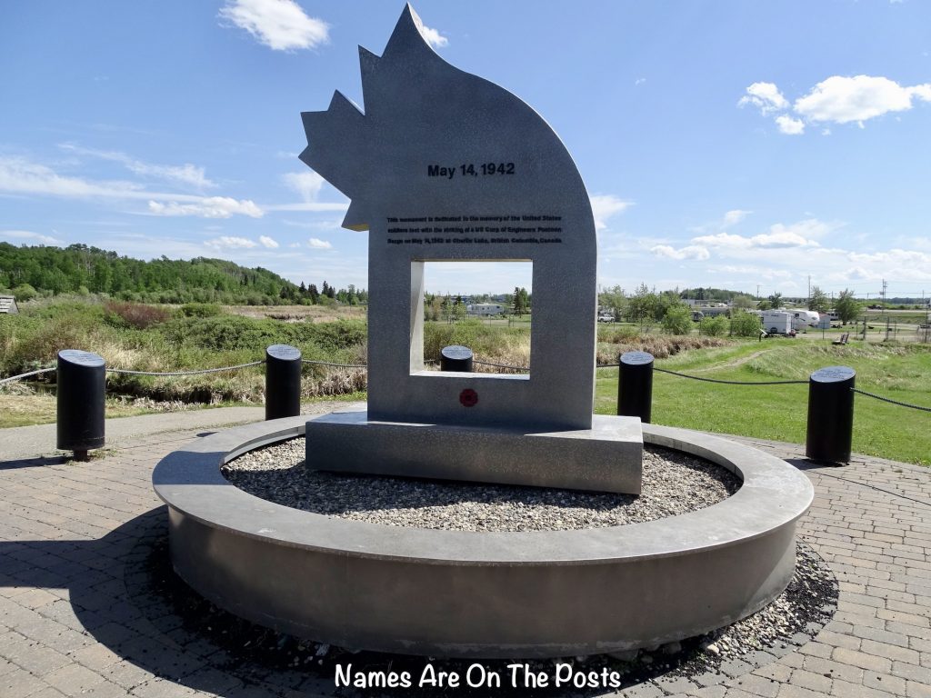
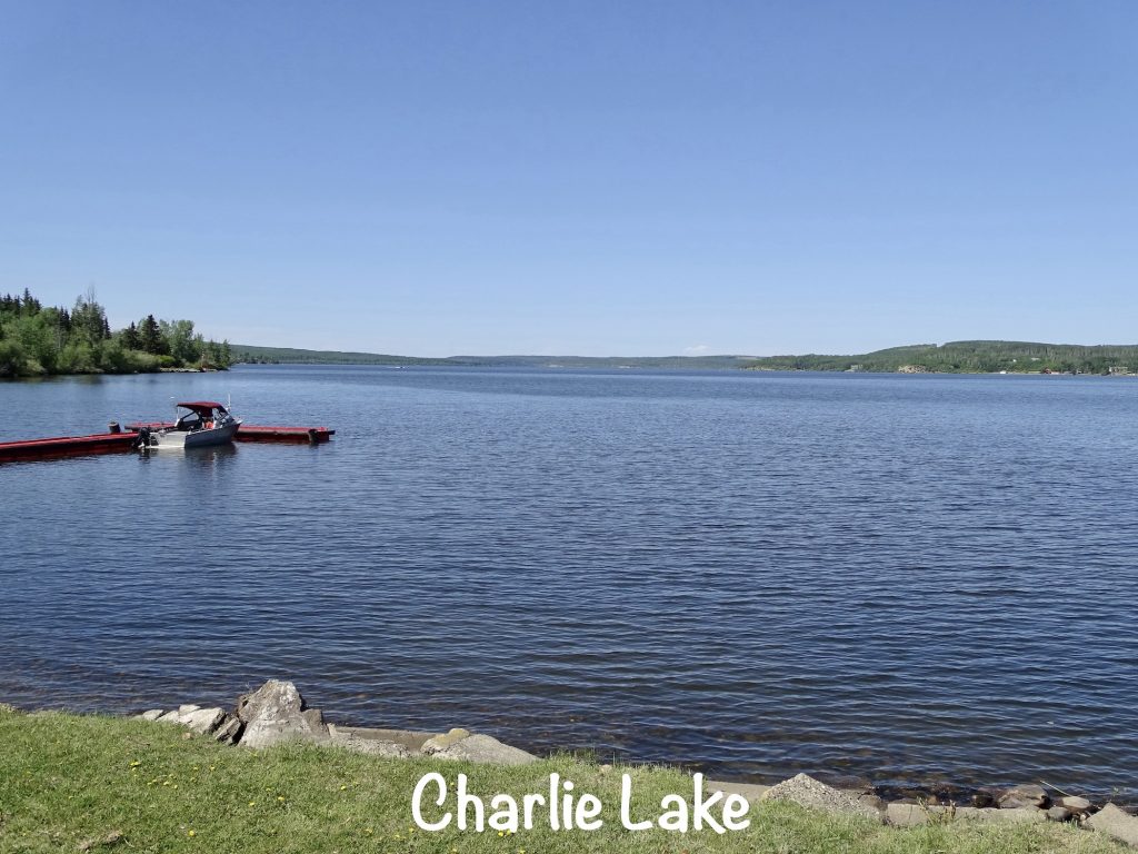
Our final stop for the day was something unexpected. The lady at the Visitor Center told us to be sure to see the memorial to U. S. soldiers at Charlie Lake. Huh? Of course, we had to check it out. As I mentioned above, construction of the Alaska Highway began in earnest in March of 1942. Many soldiers were stationed at Fort St. John, and the 341st Engineer Regiment was located at the south end of the lake. Tasked with moving equipment, supplies, and personnel to Company E’s bivouac site at the north end, a loaded pontoon boat left the landing on the morning of May 14, 1942. By 11:15 AM, they had gone about 8 of the 12 miles they needed to cover, but the water was getting increasingly rough. About then, they realized they were losing fuel in one of the two engines, so the Major ordered a turn to the west shore. In mid-turn, the boat was hit by two waves, which was the beginning of the end. The entire boat went under in less than 2 minutes. A resident had been watching the boat’s progress from the shore as he cooked his breakfast. When he picked up his field glasses to check again, it was nowhere to be seen. Despite a real threat of sinking himself, he quickly launched his small rowboat and, after 15 minutes, reached the boat’s last location. There he found nine men afloat. He could not take them all, so hauled two to shore, then returned for more. In three trips he was able to rescue five of the nine he originally found in the water. The other 17 crewmen were lost. The poor, brave man must have been haunted by that for the rest of his life! The memorial is very nice, flanked by both the American and Canadian flags. When we finished up there, it was time to get back to Petunia.
Sunday we headed into town to catch the service at Calvary Baptist Church. We were welcomed by many of the congregation, and enjoyed a nice sermon by Pastor Doug Janzen about how to live. He said that if we just focus on Mark 12:31 “Love your neighbor as yourself”, most of the big ten are taken care of. So true! Afterwards we headed over to Mr. Mikes Steakhouse Casual (very good steaks) for lunch, then ran a couple of errands before heading back.
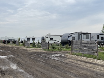
Coffee Creek RV Resort was a pretty nice little year-round campground. Located a few miles north of Fort St. John, there is easy access to everything in town and Charlie Lake. Amenities included a small playground and a clean laundry room, plus very nice shower/bathroom combos. (The only one open had already been remodeled, and there were five in process.) The sites were mostly dirt, but we are seeing that more as we head north. Nearly all were pull-through and level with wooden dividers between. Around the periphery were some back-ins. All were 50-amp with water and sewer and had picnic tables and fire rings. They offer wifi, but the signal strength was not good. Both AT&T and Verizon cell services were fine. We didn’t use over-the-air tv. For this stay in May 2023 we paid $123.70 for 4 nights.
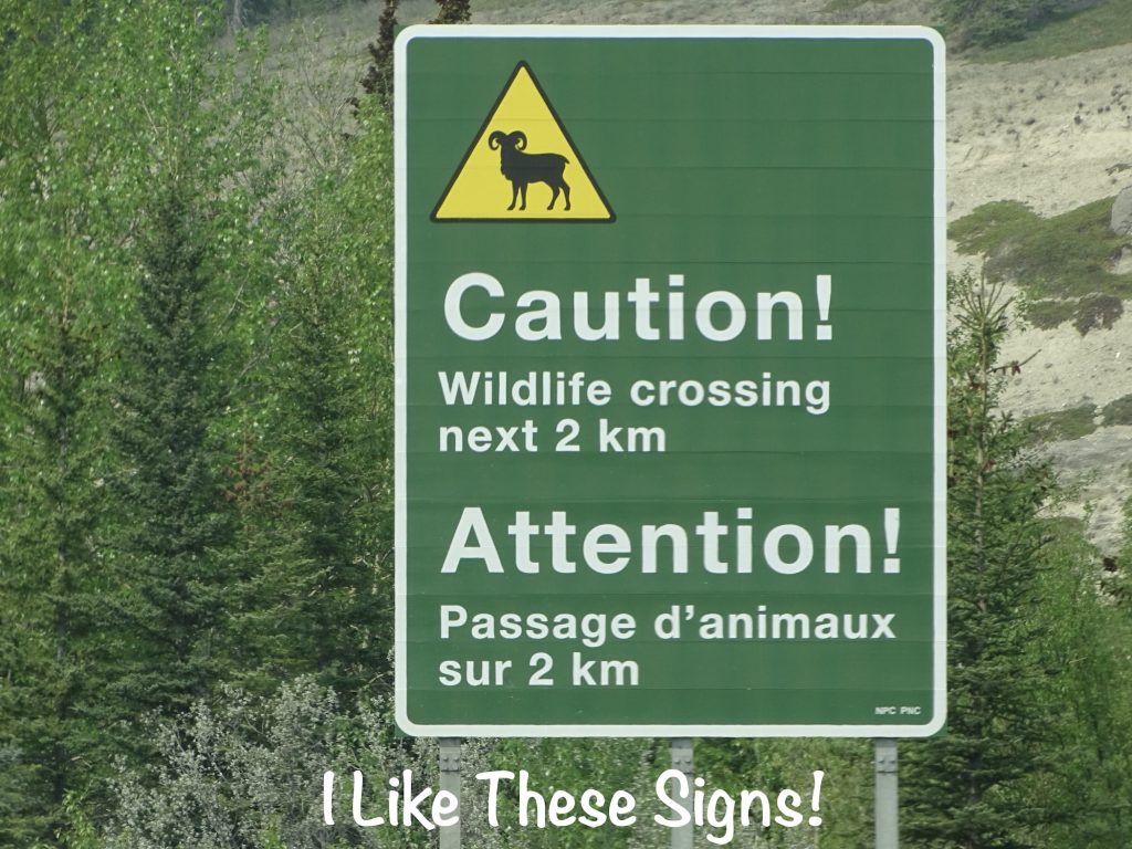
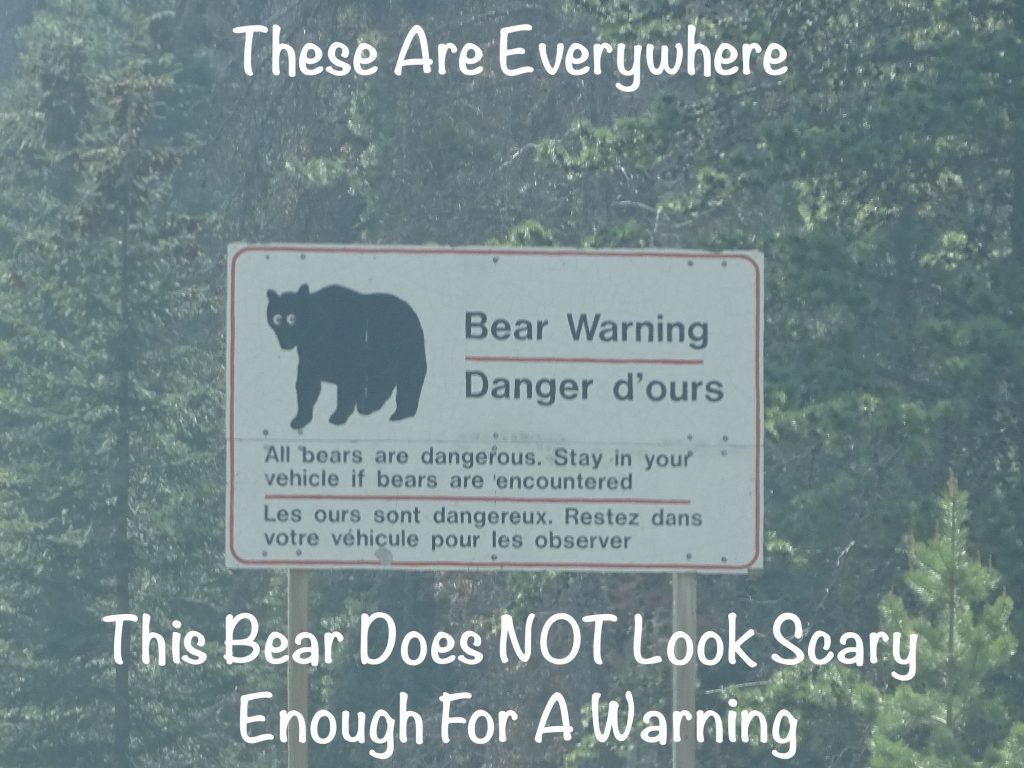
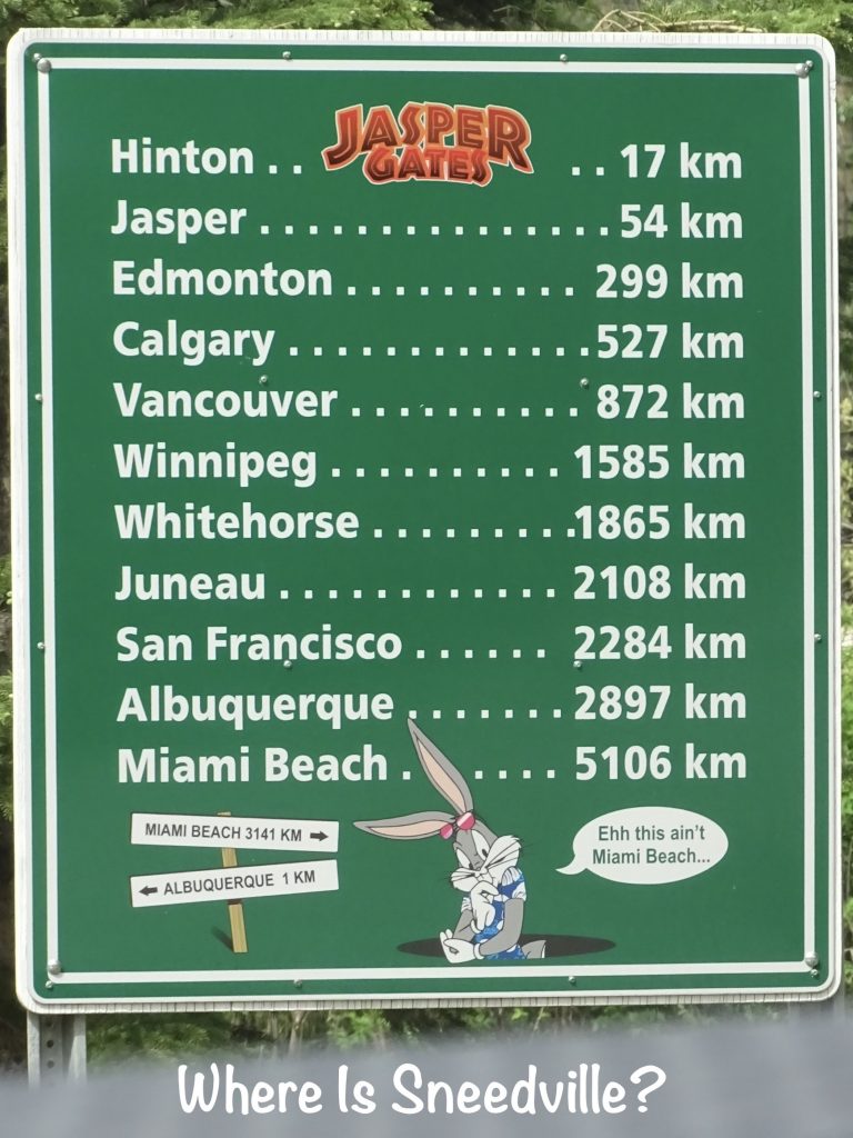
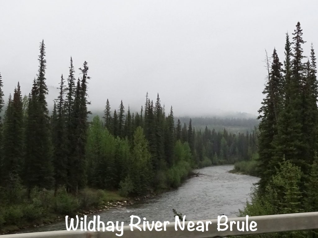
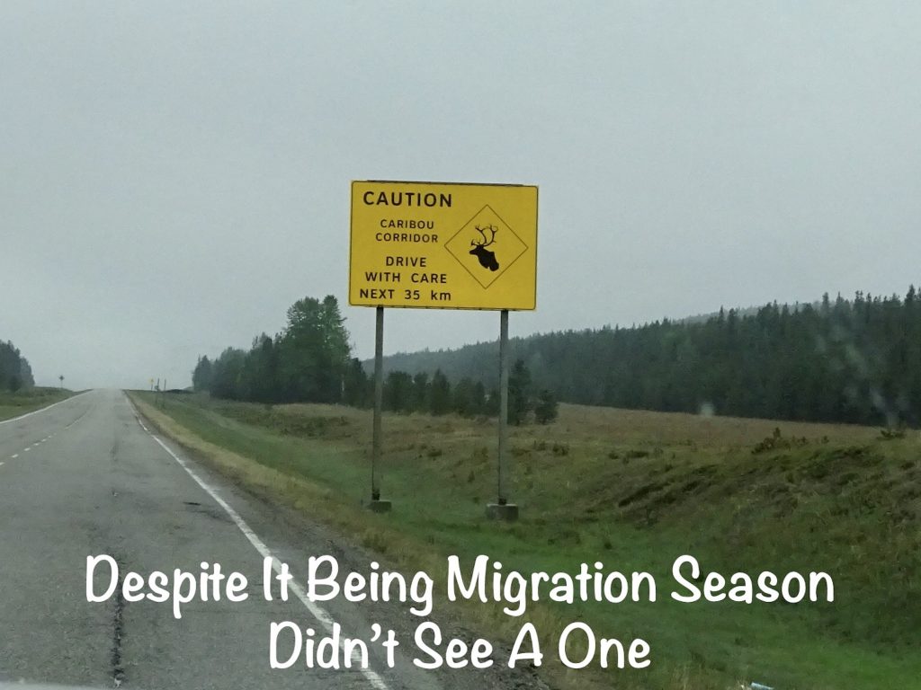
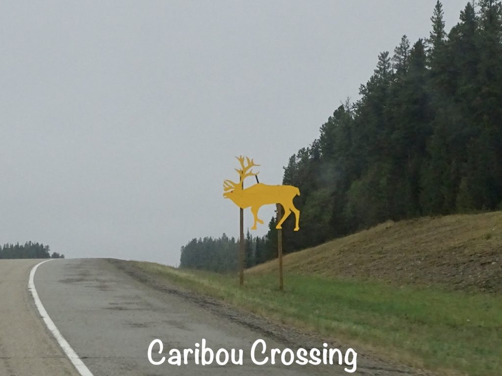
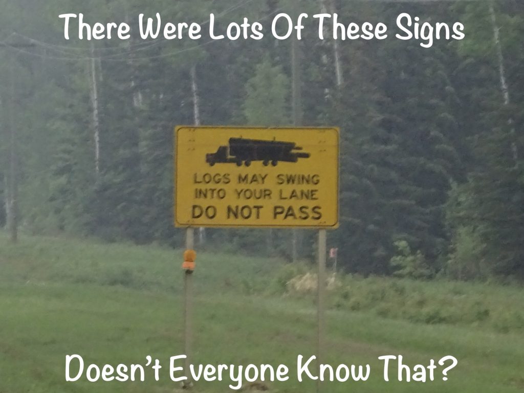
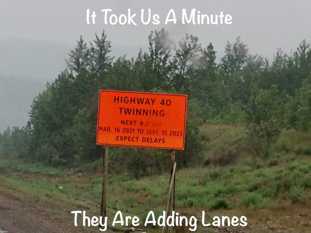
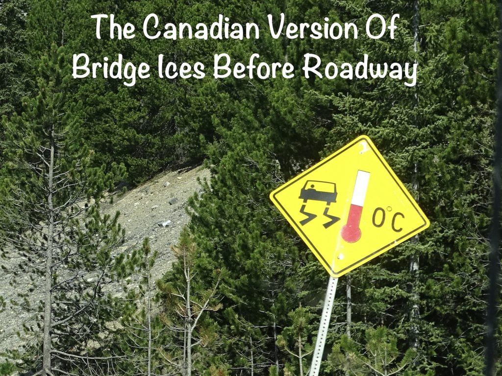
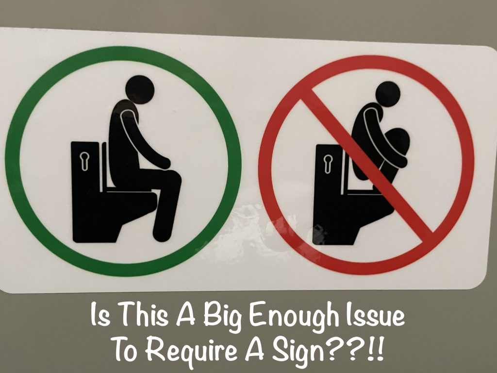
A couple of signs before I leave you…
Whew, that was a long one!! This gets me back to the once-a-week schedule, which should help. Hope you are having great weather to enjoy and getting out to see some sights. Next up for us…more of beautiful British Columbia. See you on the path!
Talisa
P. S. Thank you so much for reading! Use the buttons at the top right or bottom to be notified of new posts, and please SHARE, SHARE, SHARE on social media!