Buckle up, folks! This is a long one…
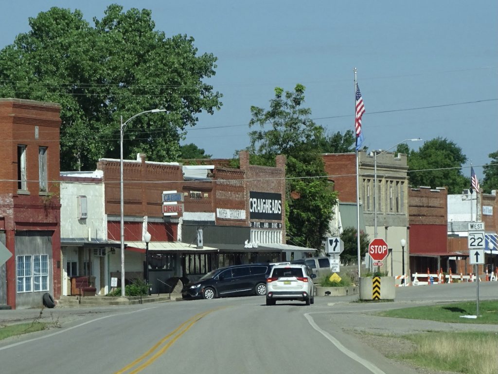
Monday, June 28, dawned with a thick grey overcast. I was really okay with that, because it was COOLER! We were on the road about 8 AM, and our first stop was just up the way in New Braunfels…the largest Buc-ee’s in the known universe (for now, at least). We’ve been there before, so I didn’t add any pics. Truth be told, I think Mr. Wonderful (MW) was just getting a little melancholy about heading out of Buc-ee’s territory and needed a final fix. First, though, we tried to assist a lady with a flat tire. She had three of the cutest granddaughters in the car and was trying to get the spare out of the trunk. It had some type of plastic screw on top to hold it in place, and that was broken. MW did his best, but it was going to require other tools. She said her fiancé should be there soon, so we made sure they didn’t need anything and went on our way. After getting him some coffee and a few snacks (I did manage to get out of there with nothing, but it was TOUGH!), we were on the road again, taking I-35 over to TX-21 east. Since that is the way we came, I was able to do a little work without feeling like I was missing out on the scenery. The next stop was Rack Room Shoes in Bastrop, Texas. I had been looking for a pair of Skechers slip-ons that Jennifer Jones said are the most comfortable shoes ever. I finally found them at Rack Room and was able to order online and pick up in the store. It was on our route and easy to get in and out of, so BONUS! The only interesting thing we noted before lunch was a decent-sized herd of buffalo grazing along the route. Further up TX-21, in Caldwell, we stopped at our plan C, Whataburger, for a sandwich. Plans A and B did not have anywhere around to park, and you couldn’t really tell that from the satellite image. That sometimes happens when you are towing a large trailer, so you just punt. Besides, MW was going to lose access to his beloved burger joint soon, too. I had the grilled chicken sandwich, which tasted good, but what is the point of attempting to order something that is a little better for me than a hamburger if it is going to be covered with 3 tablespoons of what looked like a mayonnaise-based sauce?! I scraped most of it off, and next time, I will pay closer attention. We continued northeast on TX-21. Our prior route turned off south of College Station, so it was fresh road from there on. Up to that point it had sprinkled on us once or twice, but the rain actually started pretty heavy about there.
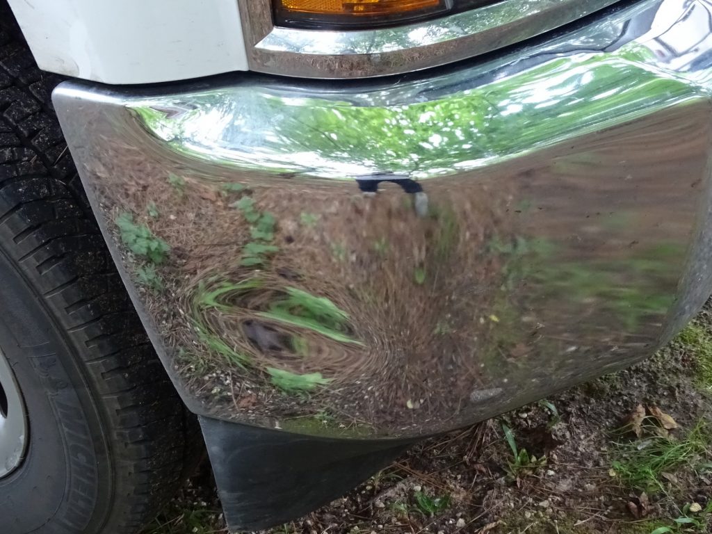
Just north of College Station, we stopped for gas, and while sitting at the pump, and old guy backed into our truck. I was in it at the time, and seeing him coming fast, did my best to stop him…by yelling…in the truck…with the windows closed. STOP…STOP…I SAID STOP…(crash)… F***! Needless to say, he didn’t hear me, and I was so busy yelling that I didn’t think to simply blow the horn. The impact rocked Brutus and Petunia pretty good, and MW and I both thought we would be looking for a repair shop. Apparently, though, he hit us in a spot on the steel bumper that already had a small dent (from our shakedown cruise with Petunia a couple of years ago). We had no new damage. No kidding. He had a broken tail light. MW felt like the guy was just happy we didn’t call the police and interrupt his work day.

The Football-Looking Dent is Exactly the Same As Before He Hit Us – Crazy!
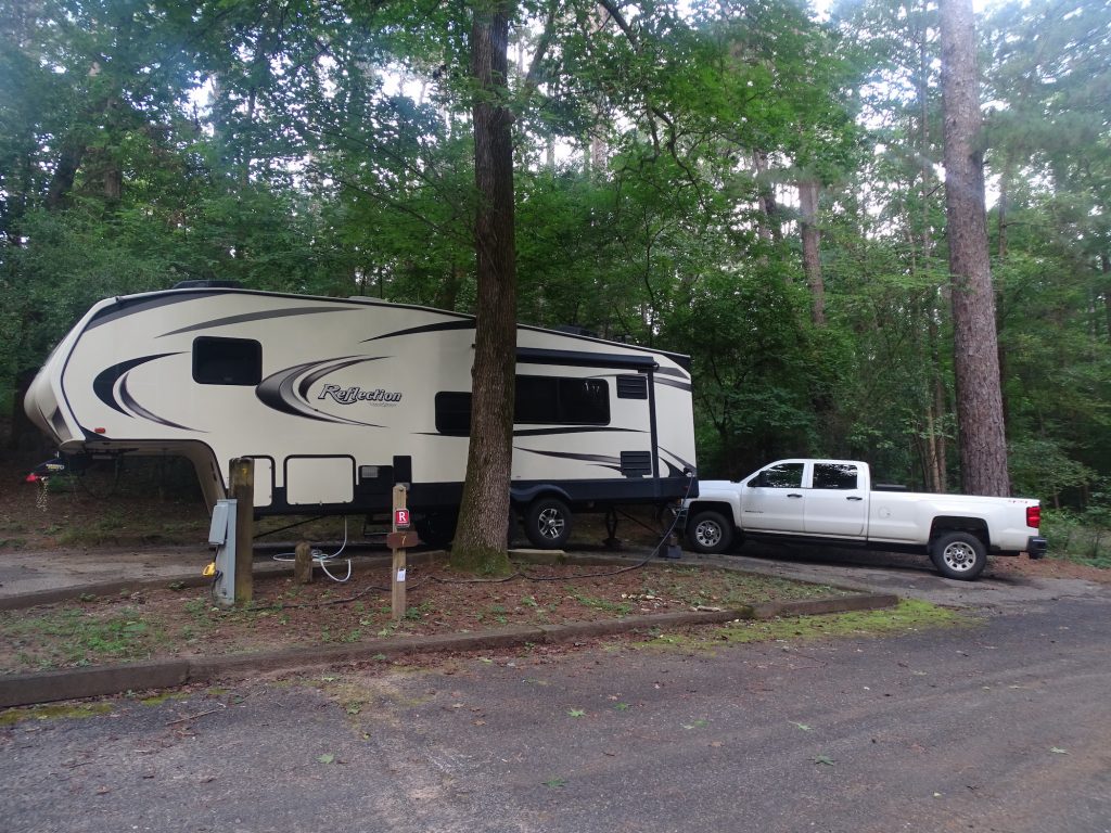
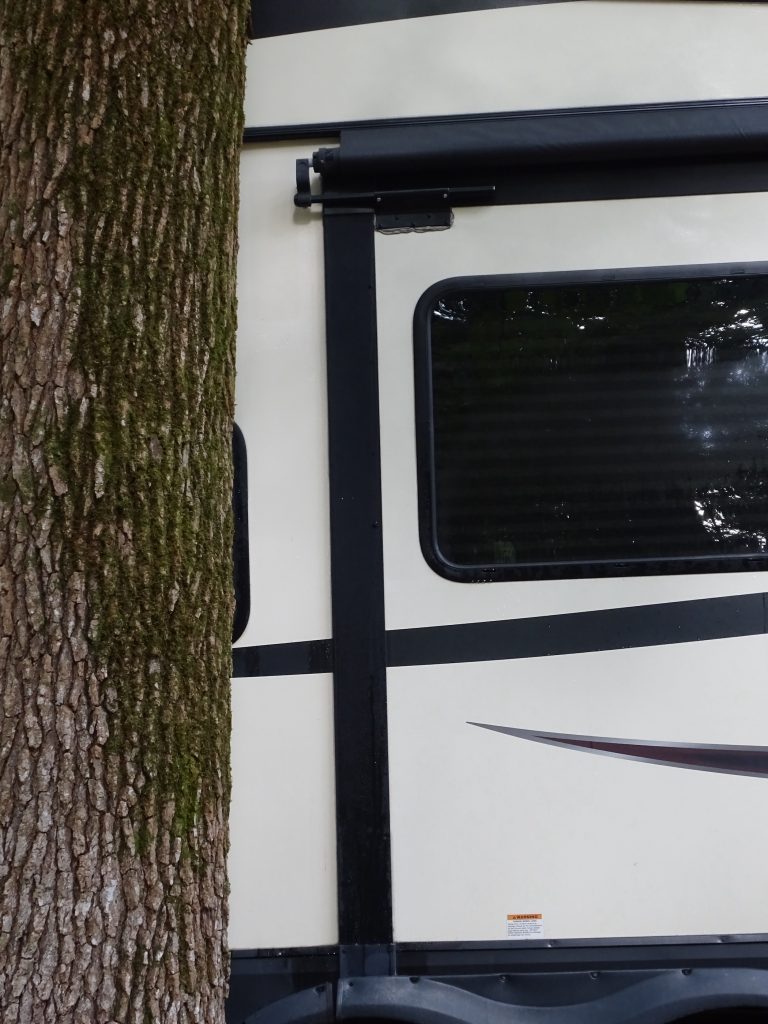
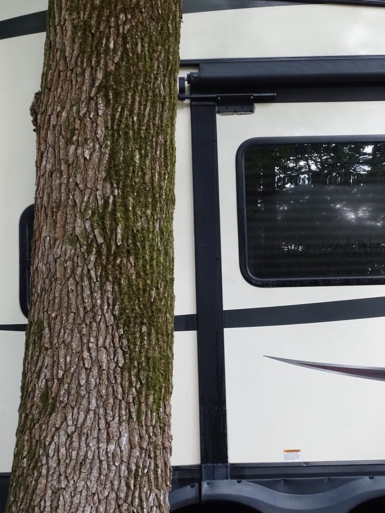
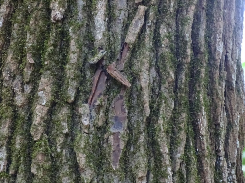
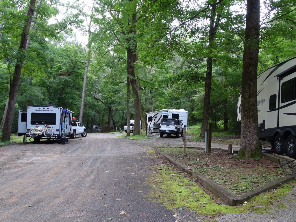
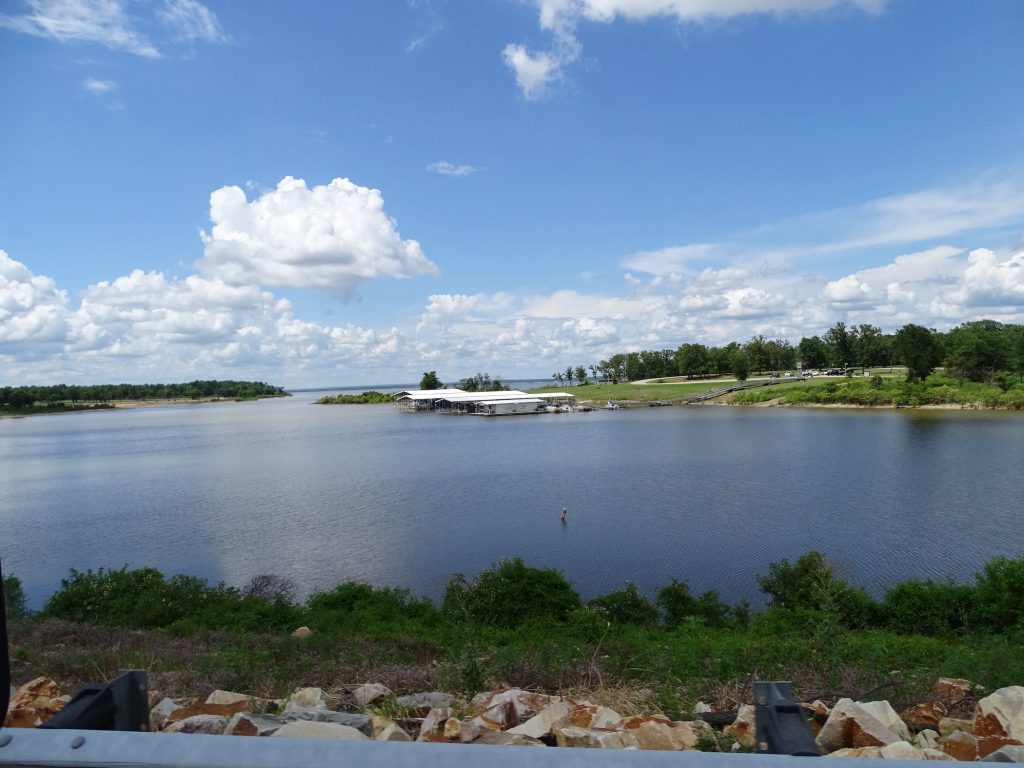
South of Madisonville the rain became torrential off and on and slowed our progress. We arrived at our destination, Mission Tejas State Park about 2:30 PM. Set-up was a challenge. We had a pull-through site, but it was a hill with a brushy tree to the right where you had to swing wide and a giant tree just off the side on the left. It was also about 3-4″ off level. I leveled it up on our long board, which is just two 2 x 6s screwed together with the ends cut at an angle. (When there is a big difference, we use that to raise it up a chunk, then add the regular levelers if it needs more.) Everything looked good, and I took special care to make sure the slide would clear the giant tree. Well, at least I thought I did. MW watched as I put out the slide. He said it wasn’t until it was about 6 inches from the tree that it was evident it would hit. Apparently he was out there hollerin’ for me to stop and pushing on the side of the slide like Superman. Meanwhile, I’m inside with the air conditioner running and the slide noise, basically oblivious until the slide started to resist. (In the excitement, MW forgot that the slide stop signal is hitting the side of Petunia.) The roller arm for the slide awning caught the edge of the tree bark, and I stopped about an inch before full extension. The perfect solution, for both extending it another inch and retracting it without damage, would be to just notch out a little of the bark. Because of the slope off of the site, though, there was just no way to get up that high. After finally getting her level and set up on this site, neither of us were in any mood to jockey everything around, so we decided to just pull the slide back in. (In our model it doesn’t block anything but my desk.) On the bright side, while I was trying to tear up the slide, it wasn’t raining. That’s something, I guess. Needless to say, we were both ready to relax for the afternoon.
Not an Easy Spot
What I THOUGHT Would Happen What ACTUALLY Happened
I’m Sure My Geometry Teacher is Sorely Disappointed
Wounded Tree Am I Being Watched?!
SQUIRREL: I received a letter recently from an American soldier, Sergeant Sarah Howell. It seems that the good Sergeant is serving in Afghanistan and “desperately” needs my help. You know I’m always one to help our military guys and gals, so “What do you need, Sarah?” Apparently, during a recent rescue operation, they discovered some boxes filled with money in a variety of currencies in a farmhouse. She and her fellow soldiers agreed that some part of it should be shared by them. After all, they found it. Turns out that the Sergeant’s portion comes to $48 million, and she has already gotten a British doctor working with the Red Cross to take it to a secure location, although he believes it is the personal effects of a dead American. So, the long and short is this: she will give me 40% if I will intercept the package. Oh, and she has apparently been shot and survived two suicide bombings by the grace of God. I would be helping a wounded service member! I do have a few questions: 1) Who keeps money in a bunch of different currencies totaling multiples of $48 million in boxes in their farmhouse? 2) How many cubic feet is that much money in actual currency? 3) How much does it weigh? ($48 million in $100 dollar bills weighs a little more than 1,058 pounds) 4) Why do the soldiers feel that a part of it belongs to them when they found it in someone’s home? 5) Do you get a finder’s fee for that sort of thing? 6) Why only a part of it? 7) Are they just trying not to be greedy? 8) Presumably the Red Cross dude has several large, very heavy boxes of money stuffed somewhere. Wouldn’t he question why someone had that much crap when they were deployed? (I think all MW had was a duffle bag.) So if God is really watching out for her, she can’t be doing anything wrong, can she? What do you guys think? I mean, $19.2 million would sure come in handy! (Who really falls for this crap? This one is quite creative, though, and at least it is written by someone with a command of the English language.)
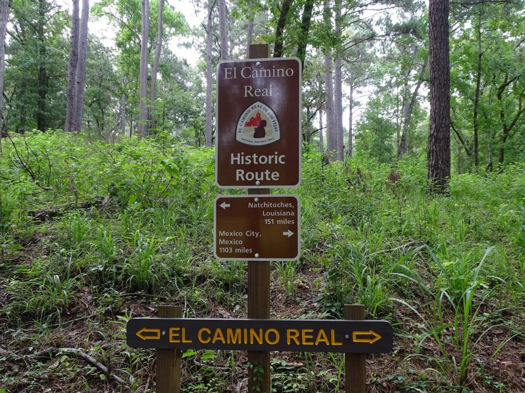
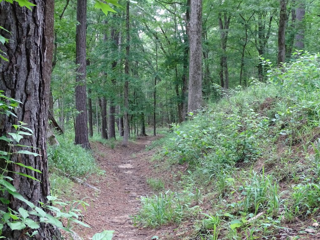
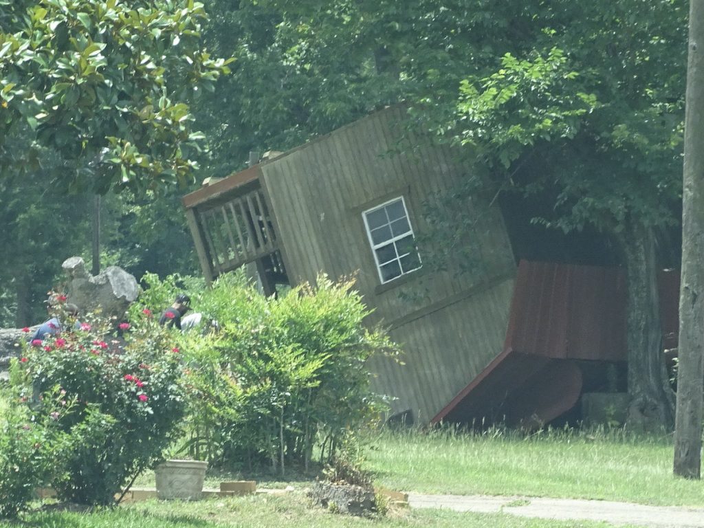
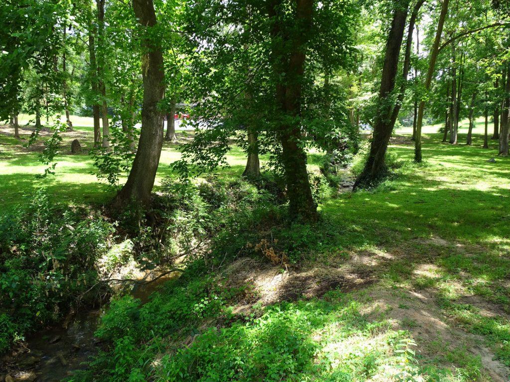
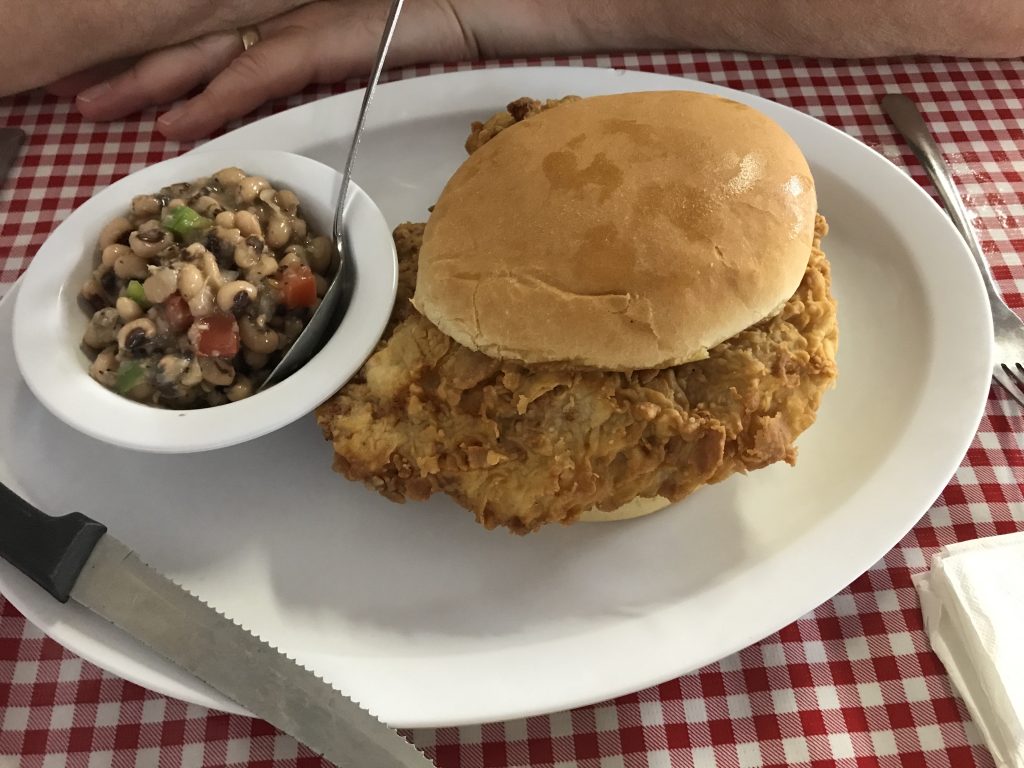
Tuesday morning we started with a nice walk around the park, which included taking a few steps on the El Camino Real de los Tejas. (More about that below.) Later we headed out for a drive, first towards Alto, Texas. Before getting to town, we saw something that I had never seen before and had me totally stumped. A barn had been rolled over, presumably by high winds, onto its roof…intact. Crazy! I’ve just got to say, though, if you’re thinking about building a barn, I suggest finding out where this one came from. In Alto, we found Miss Mollie’s Diner for lunch. You could order typical diner fare off of the menu or have the lunch bar. We opted for the latter, and the chicken fried steak would make any southern grandma proud. They also had yellow squash cooked like you would fry okra. I stuck with green beans (trying to get more vegetables that aren’t potatoes), but MW let me taste his. That just needs to be a THANG! Delicious!
The Historic Trail A Walk in the Woods
Perfect… …Just Upside Down
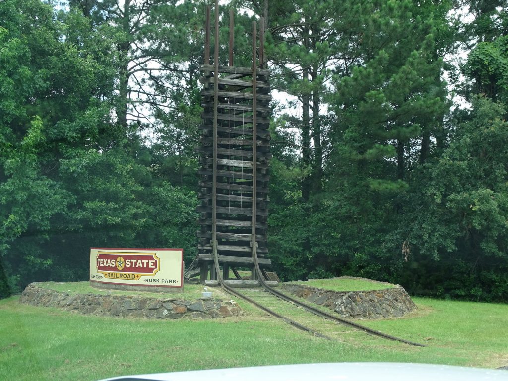
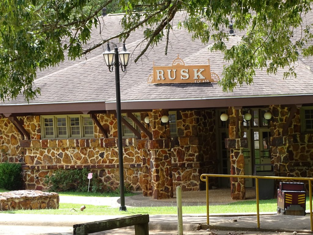
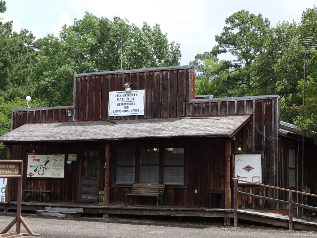
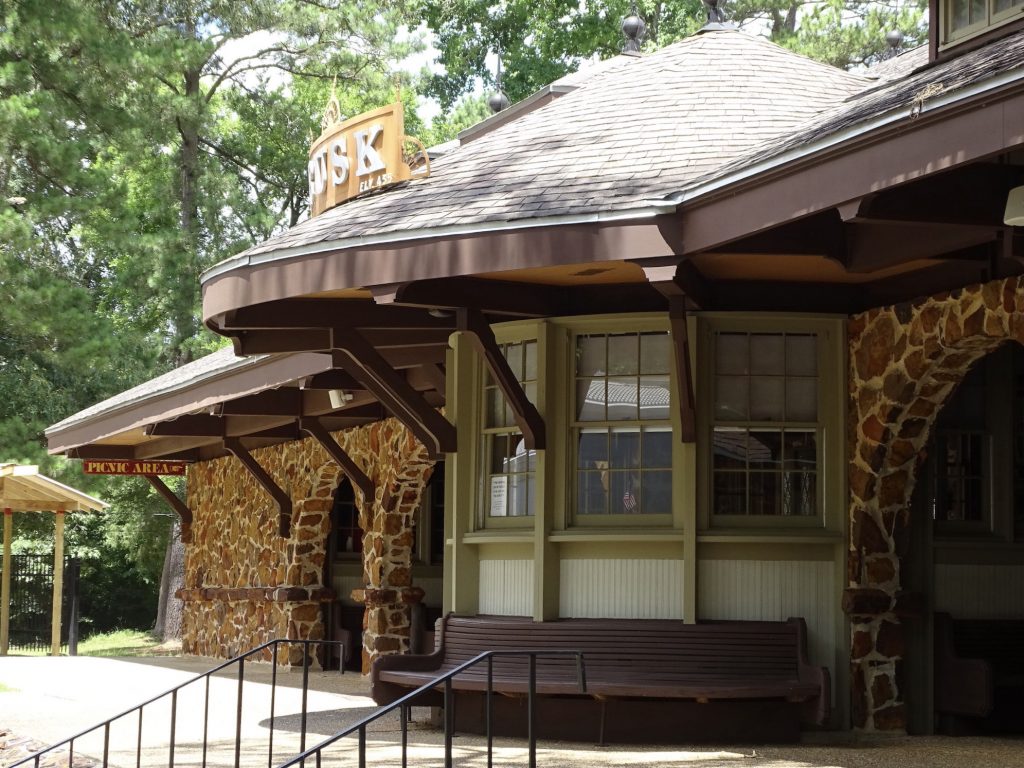
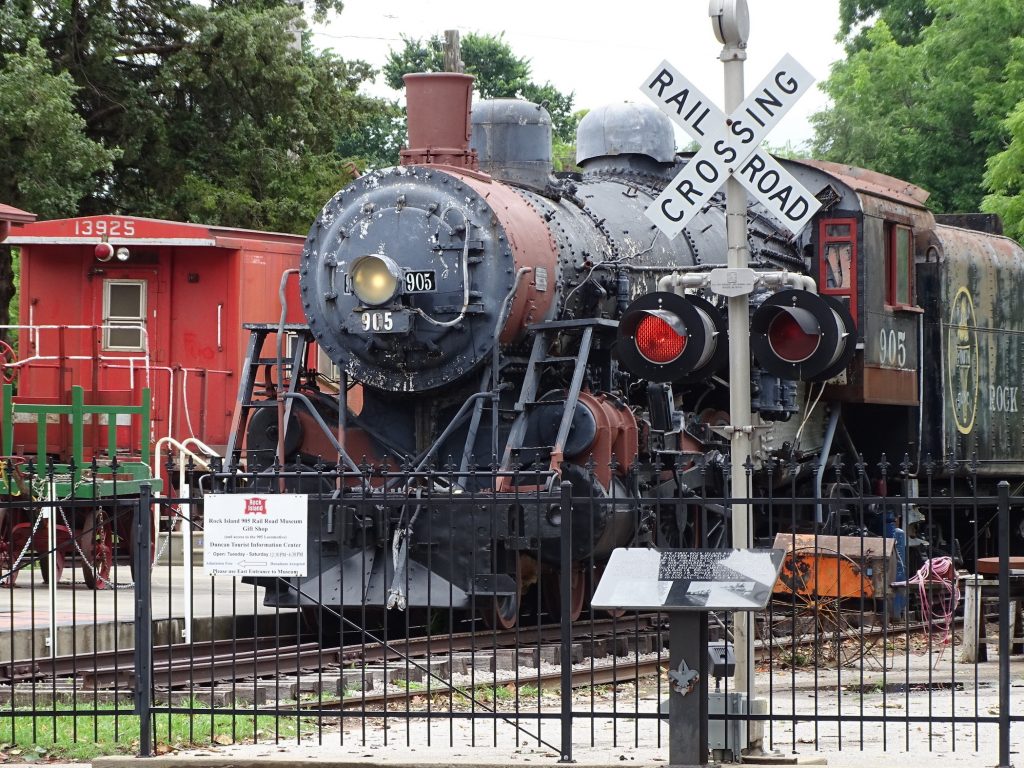
After lunch we went to check out Rusk Park and the Texas State Railroad. On weekends they run several trains between Rusk and Palestine, but sadly, none during the week. MW was disappointed, because you know he LOVES a good train ride! Built in 1883 by inmates, the railroad was designed to haul raw materials from Palestine to a smelter at the prison in Rusk. The trips ended in 1921, but the railroad has been used since then by several private companies. The Texas State Railroad Authority has owned it since 2007 and currently operates a scenic tourist line.
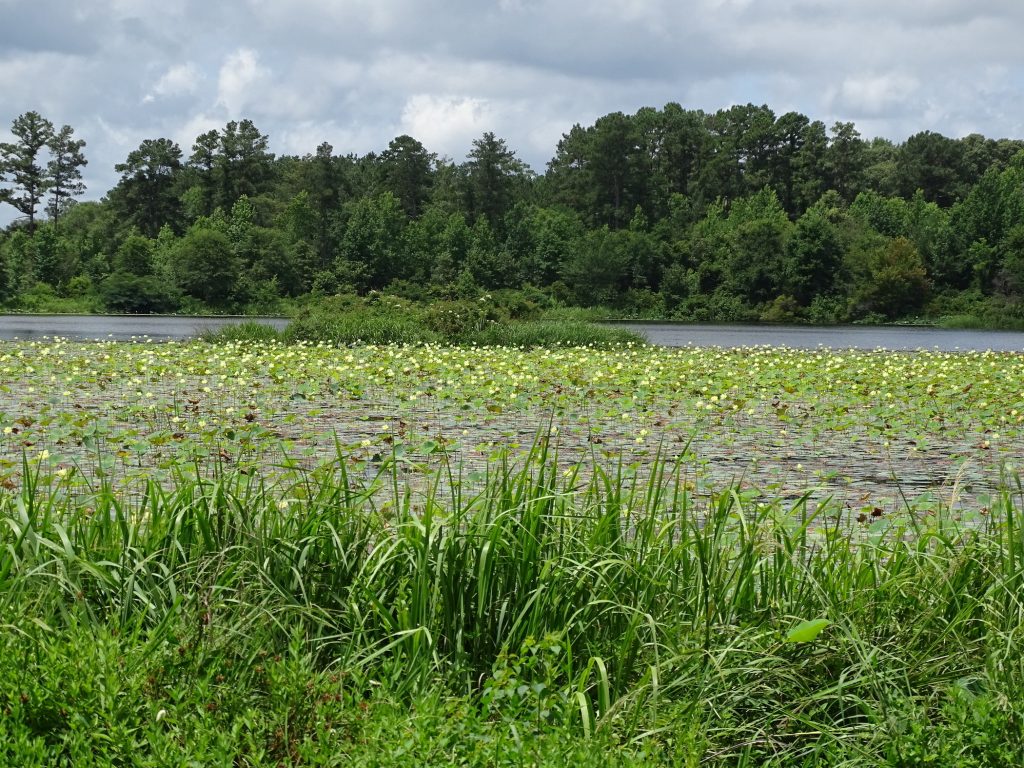
Cool Entrance They Have a Little Lilly Problem
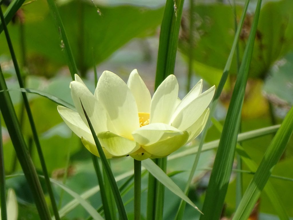
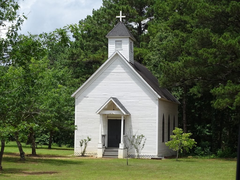
They Are Beautiful, Though Chapel in Rusk Park
Rusk Train Station Office
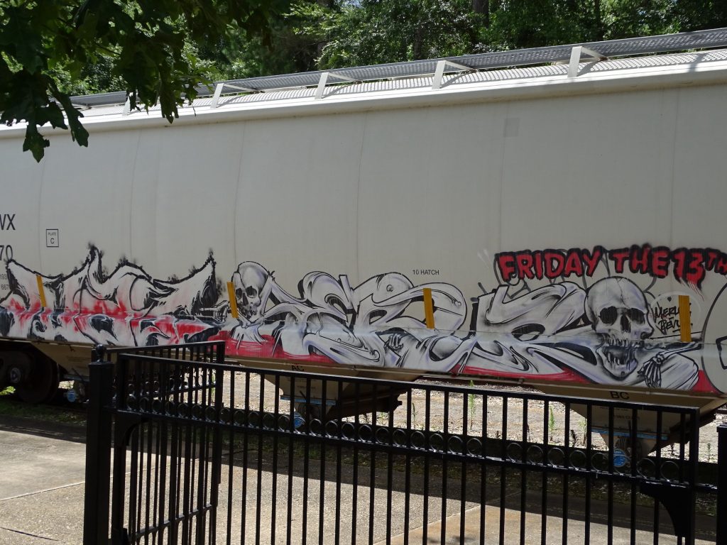
Freight Train Coming Through…Serious Art Skills Rear of Depot
I was tempted. Do they still hang horse thieves? Waitin’ on the Train
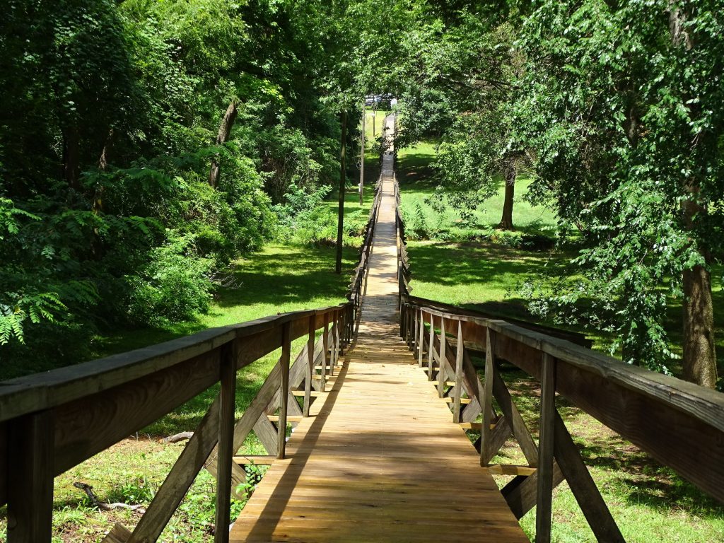
After looking around, we headed back in to Rusk to check out another cool thing…the Rusk Footbridge. The original bridge was built in 1861 to allow access across the little valley to town during the rainy season when the creek flooded. It is 4′ wide and 546′ long, and is believed to be the longest footbridge in America. We took the walk across despite the steamy weather, then headed back to Petunia. On the way in, we checked out the Rice house and finished up the park pics in the rain.
Another Train…This One I Liked
Rusk Footbridge Creek in the Valley
El Camino Real de los Tejas was the Texas segment of a road network radiating out of Mexico City. Called a “Royal Road”, this route connected the city to what is now Natchitoches (pronounced NAK-e-tesh), Louisiana. Due to weather, relationships with native tribes, and other factors, there ended up being several routes over time. It is amazing to stand in the woods on a path that we know was traveled by Spaniards in the 15th century and natives prior to that. After Mexico gained its independence from Spain, it offered land grants to attract settlers to the remote area that is now Texas. The Real (pronounced ree-al) also brought settlers from the United States with the lure of cheap land in the Mexican territory.
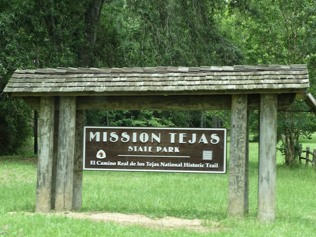
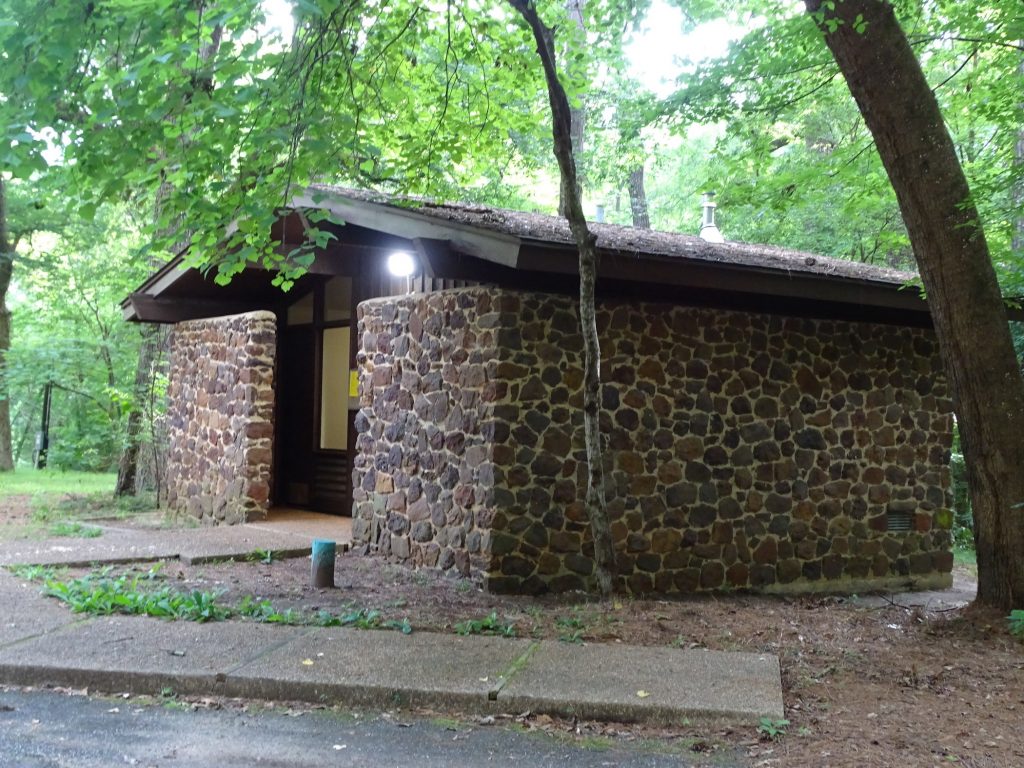
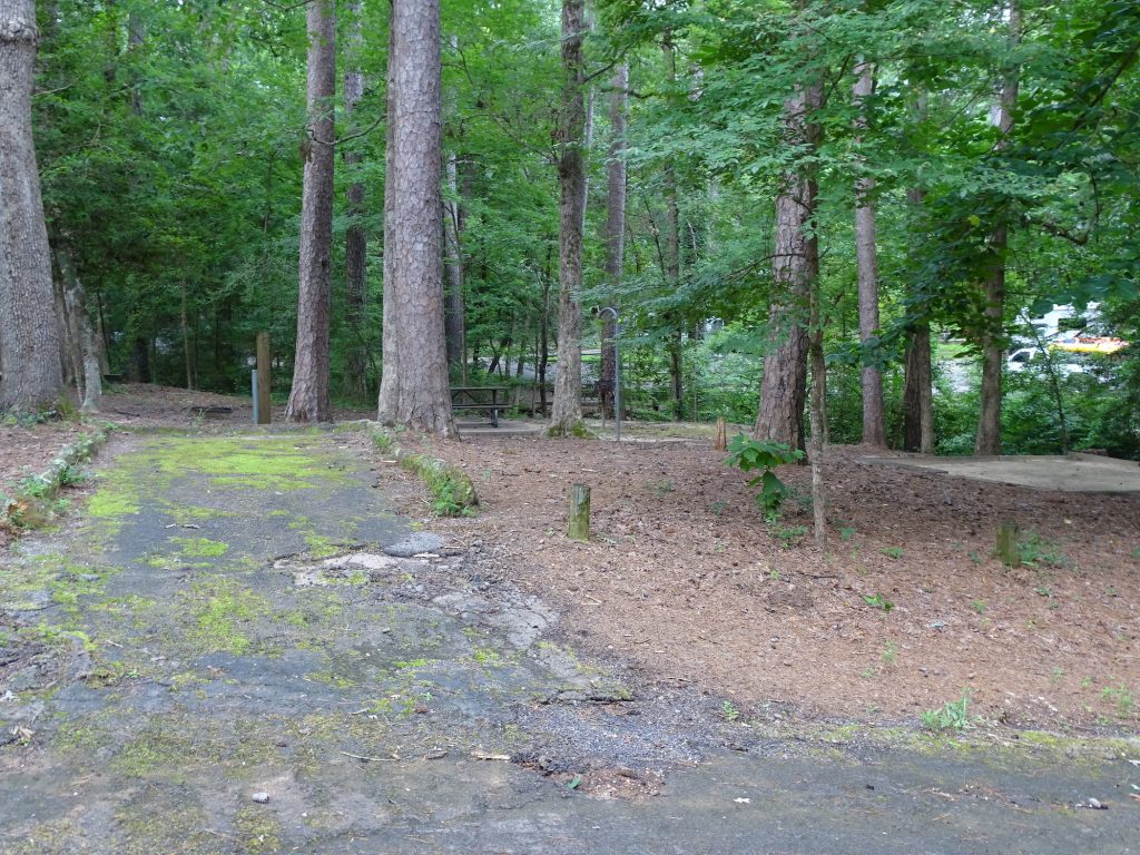
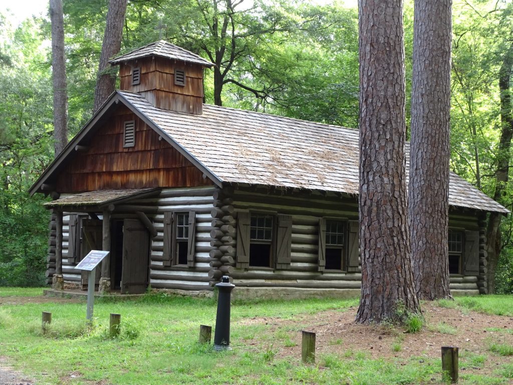
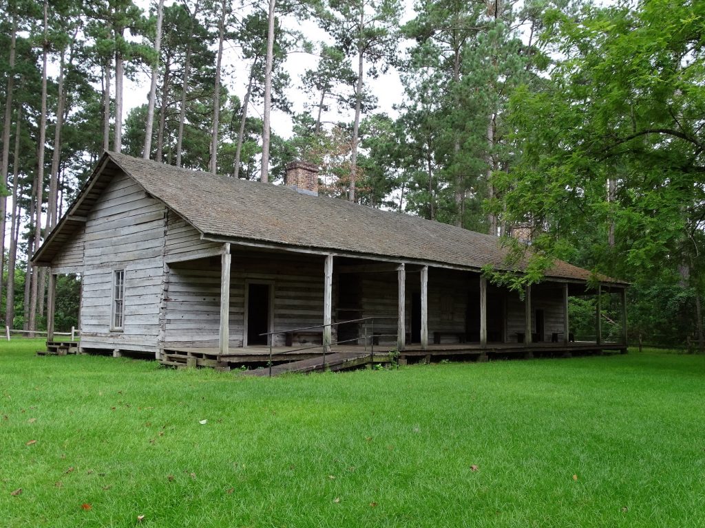
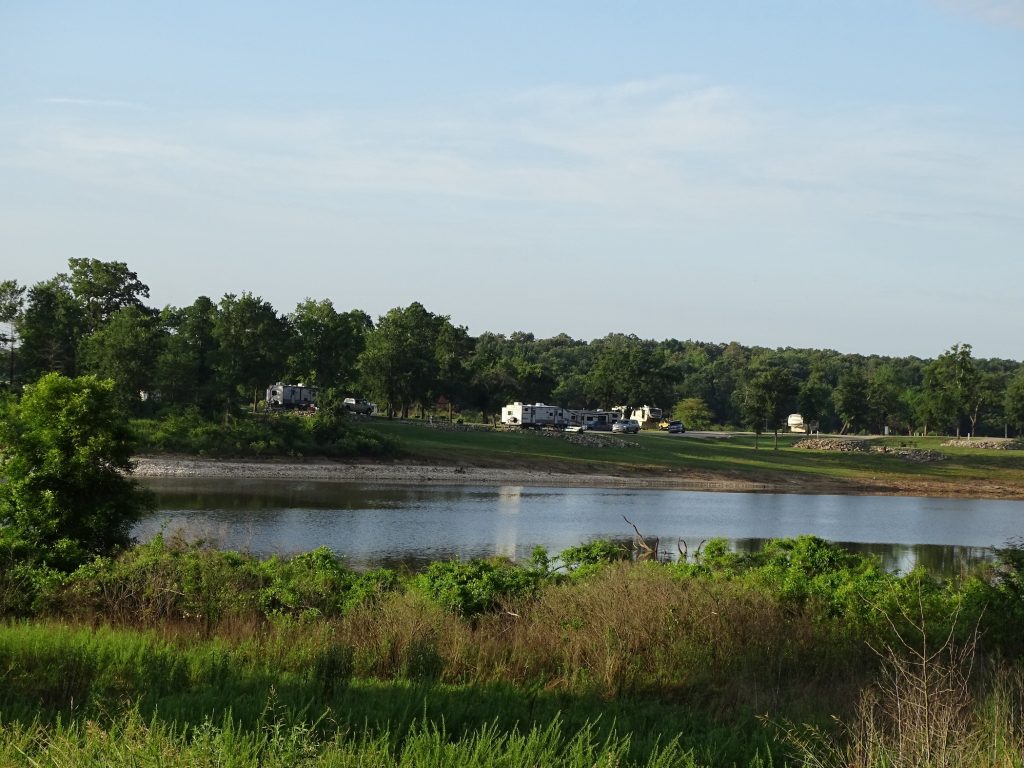
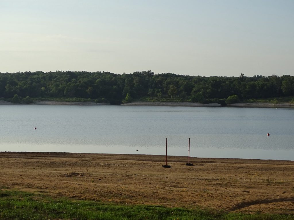
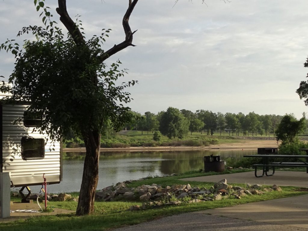
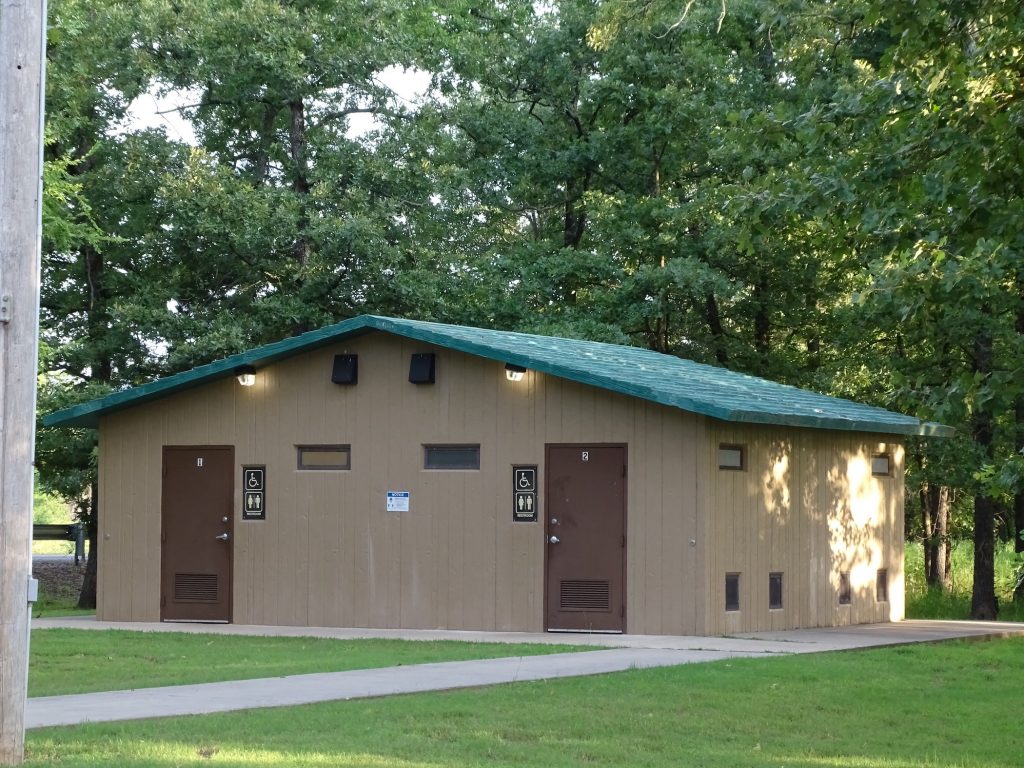
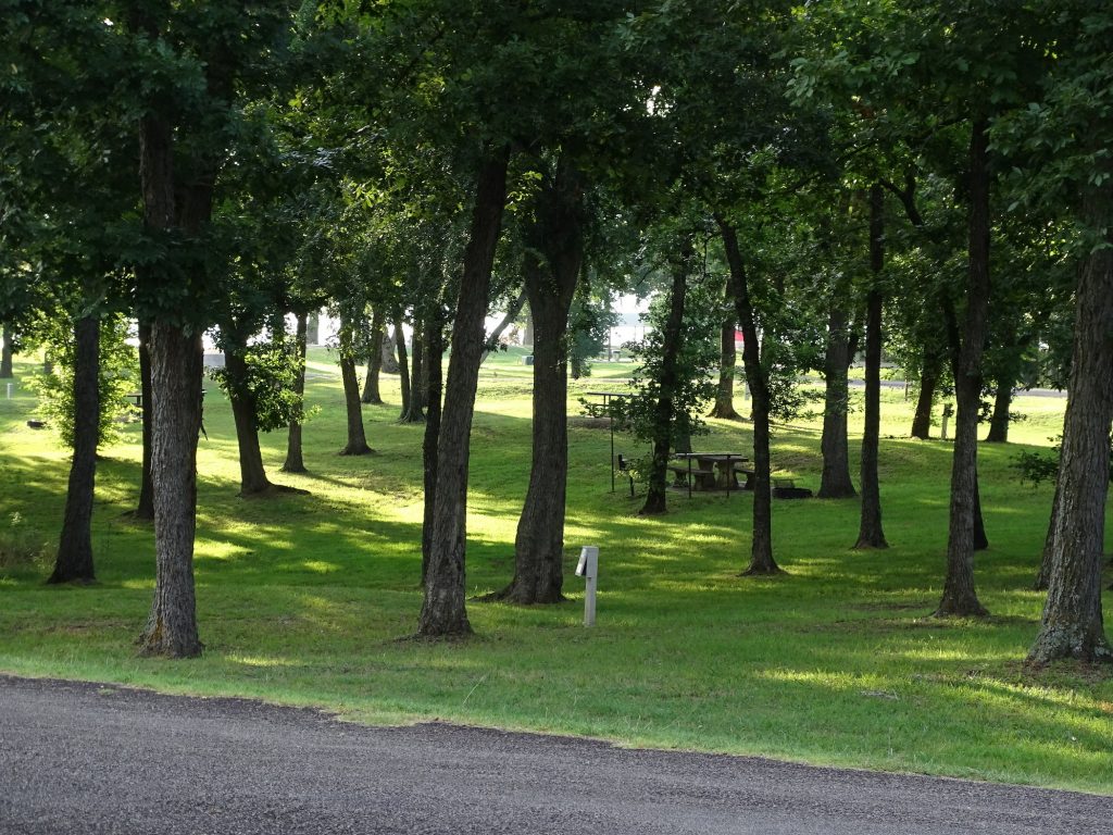
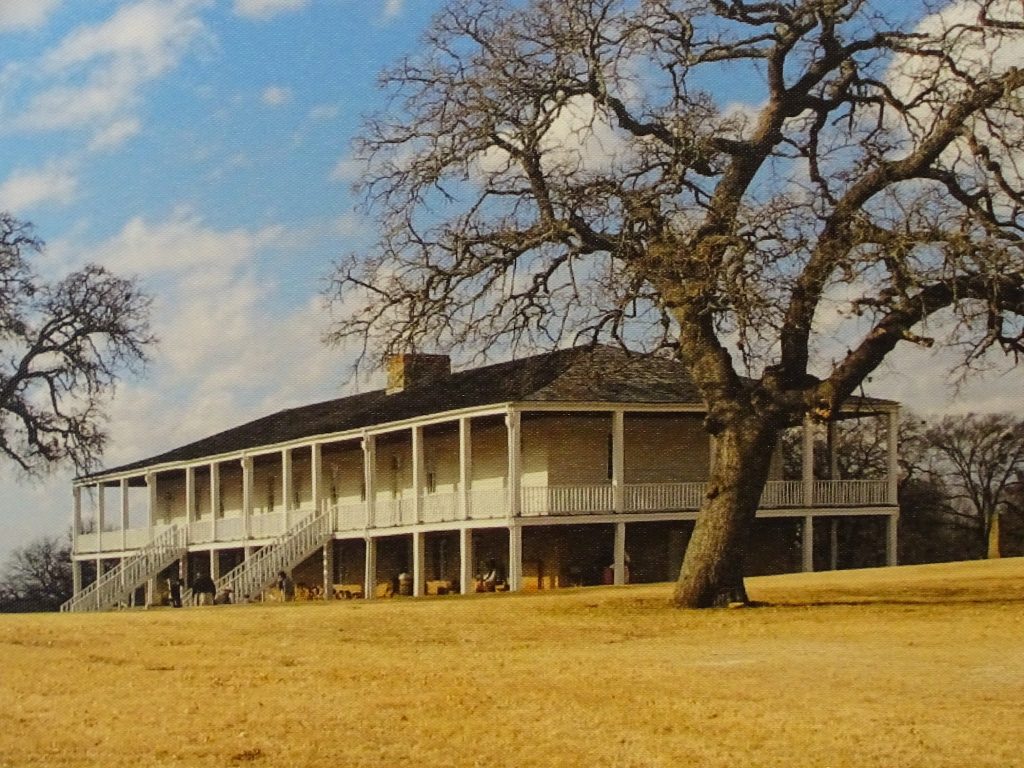
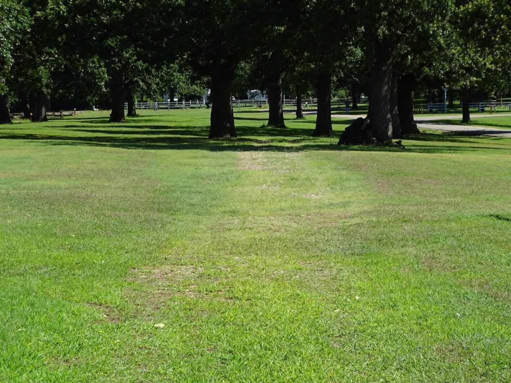
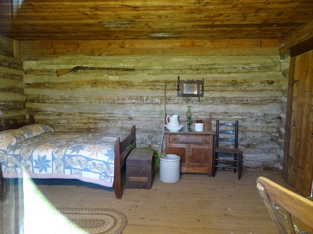
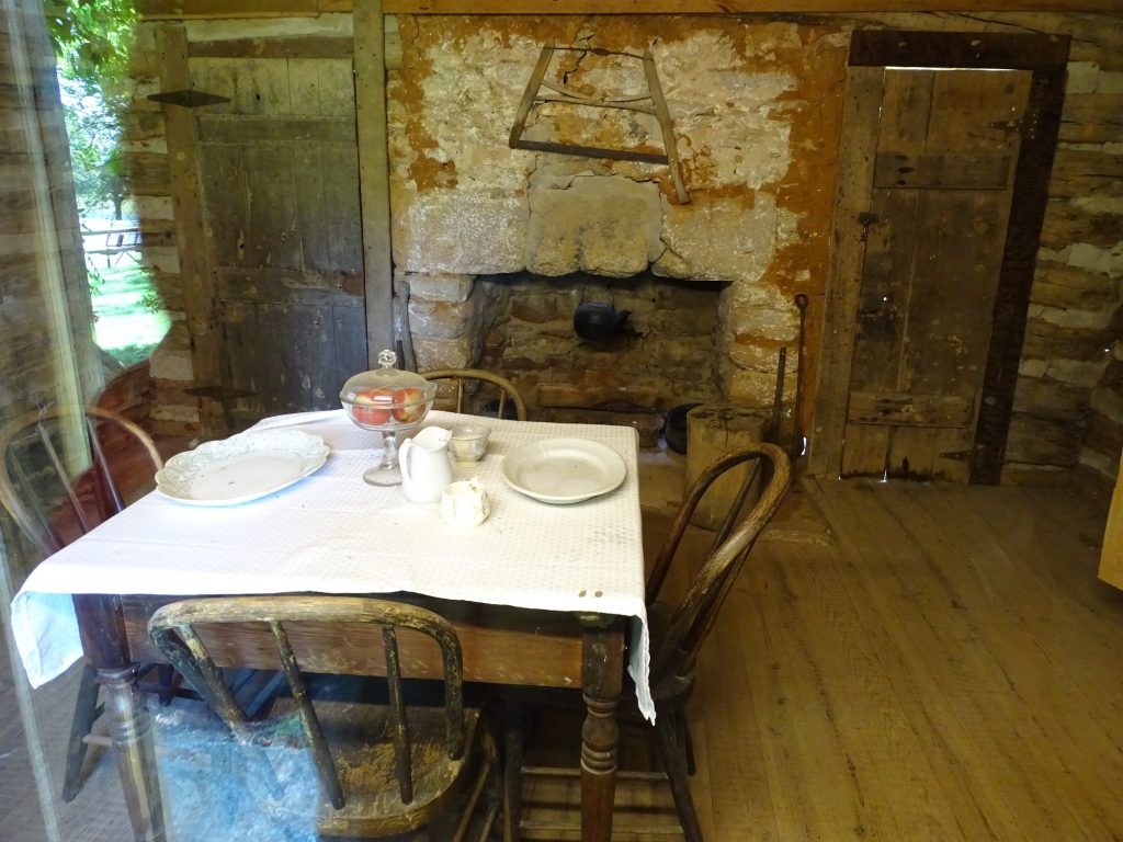
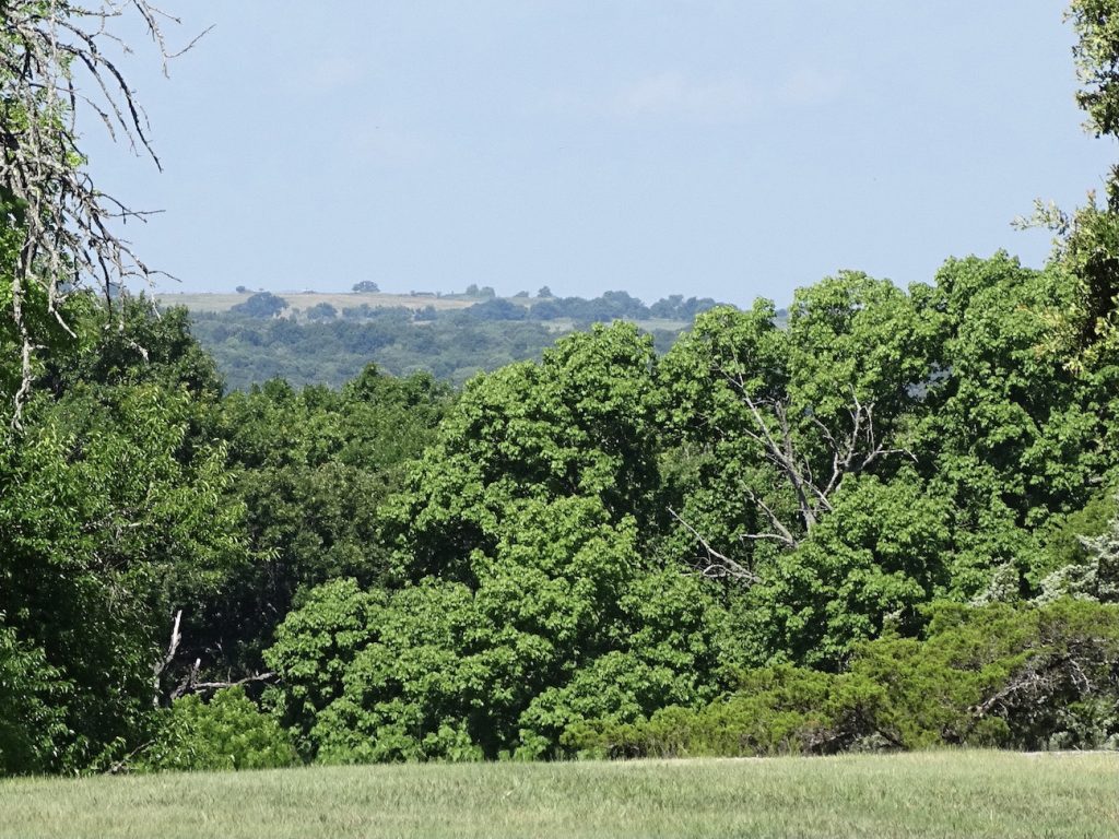
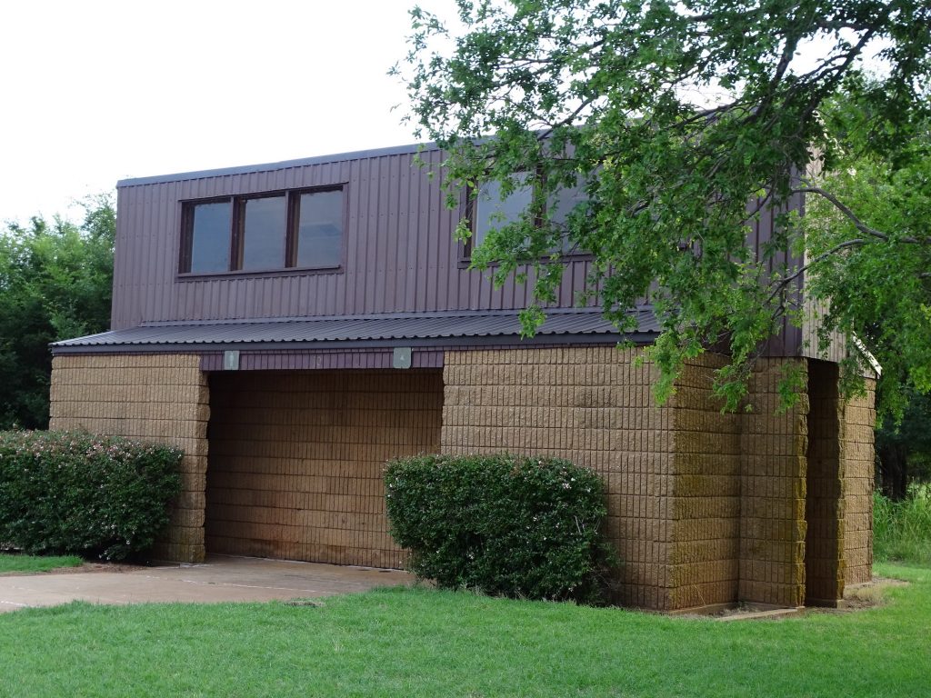
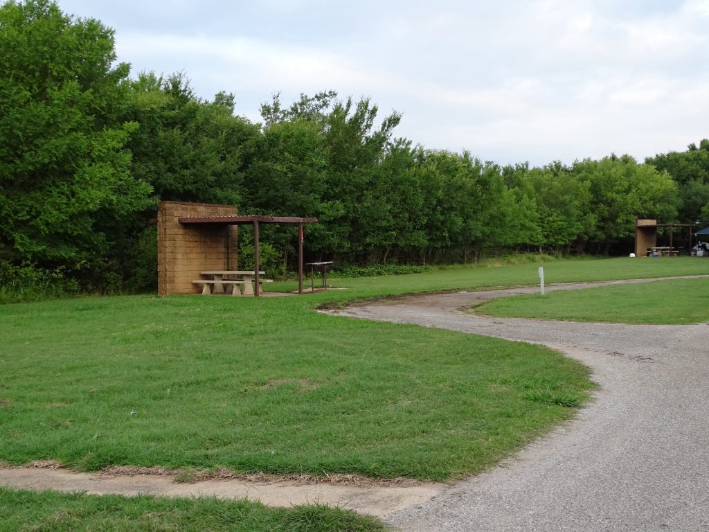
Mission Tejas State Park, located at the north end of Davy Crockett National Forest, is a small, beautiful park built by the Civilian Conservation Corps in 1934. It is in the Pineywoods of East Texas, but these aren’t pines like we have back in Georgia. They are HUGE! Over 8 miles of trails provide ample hiking opportunities, and there’s also fishing, camping, geocaching, and exploring the historic site. In addition to the historic trail, there is a representative mission building near the location of the Spanish Mission San Francisco de los Tejas that was founded in 1690. You can also walk through the log home of Joseph Rice, which once served as a stopover for travelers on the Old San Antonio Road about 16 miles southwest of its present location. The campground has 15 sites with 30-amp electricity and water and two with water only. As I mentioned before, there are giant trees in inconvenient places, so this park is not a good fit for the longer RVs. The bathhouse was clean and not too hot, and the park was quiet, heavily wooded, and shady. On the way in we were surprised that the grassy areas looked like they hadn’t been mowed at all. Turns out, they hadn’t. They were working on reseeding lost grasses. The campground area was mowed, though. For our stay in June 2021, we paid $22.50 for two nights. (The Texas State pass eliminated the Entrance Fee of $3 per person 13+ per day. It also seems to give us some kind of discount off of the site fee, too, since it is advertised at $15 per night.)
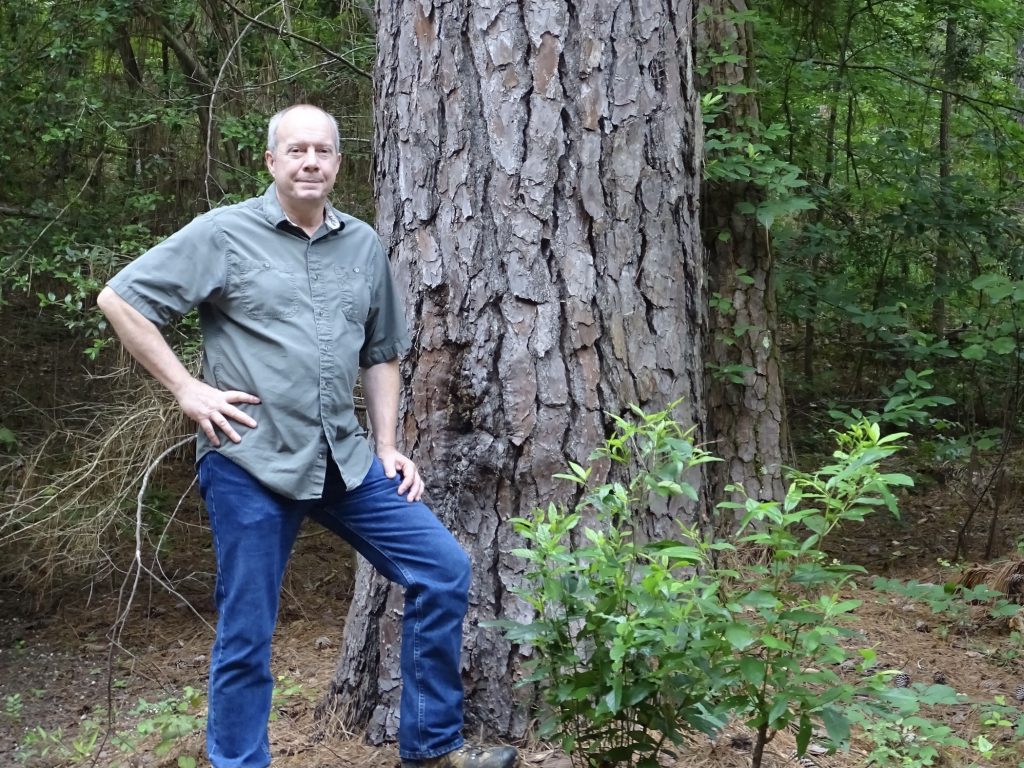
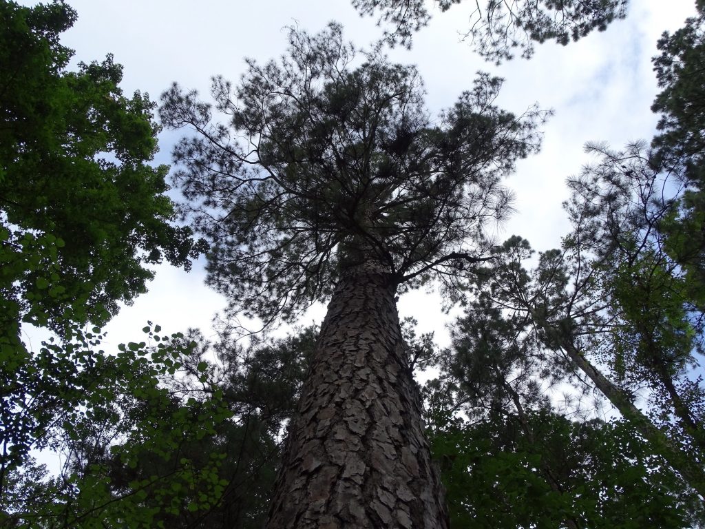
Seriously HUGE Pines Very Tall, Too
Campsite Bathhouse
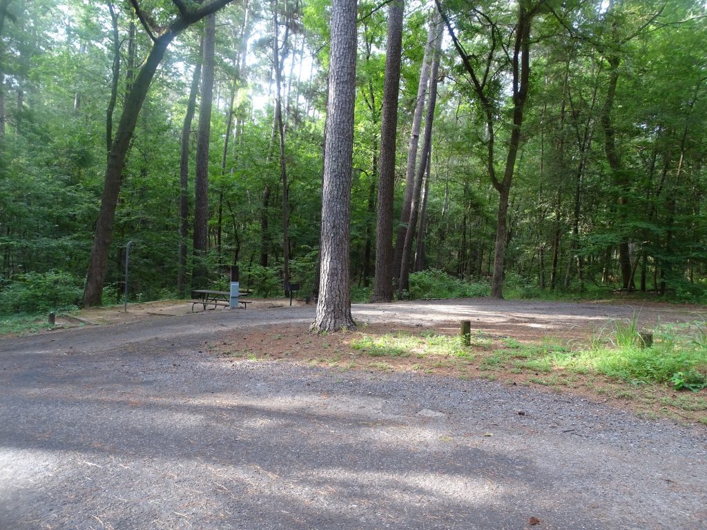
Campsite Campsite
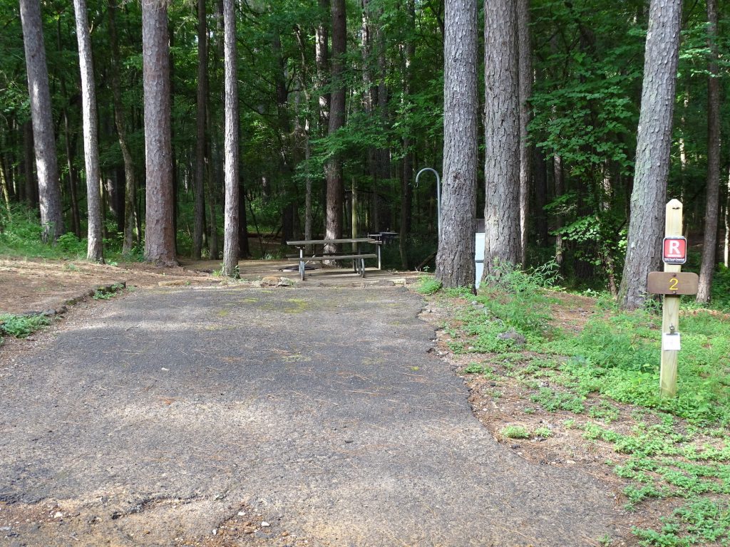
We are the near right. With the guy on the left parked in his site,
we would not be able to work the angles to drive out and miss the curbs and trees.
Luckily, he was gone when we left.
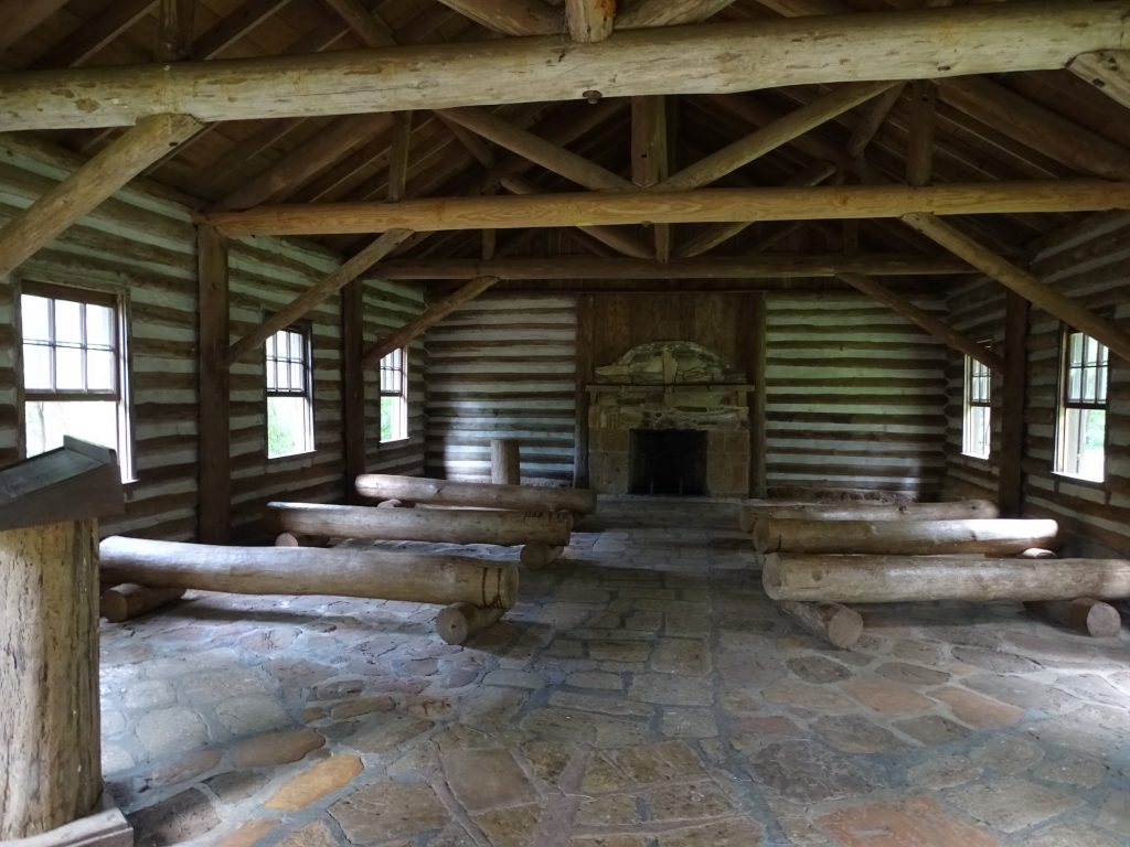
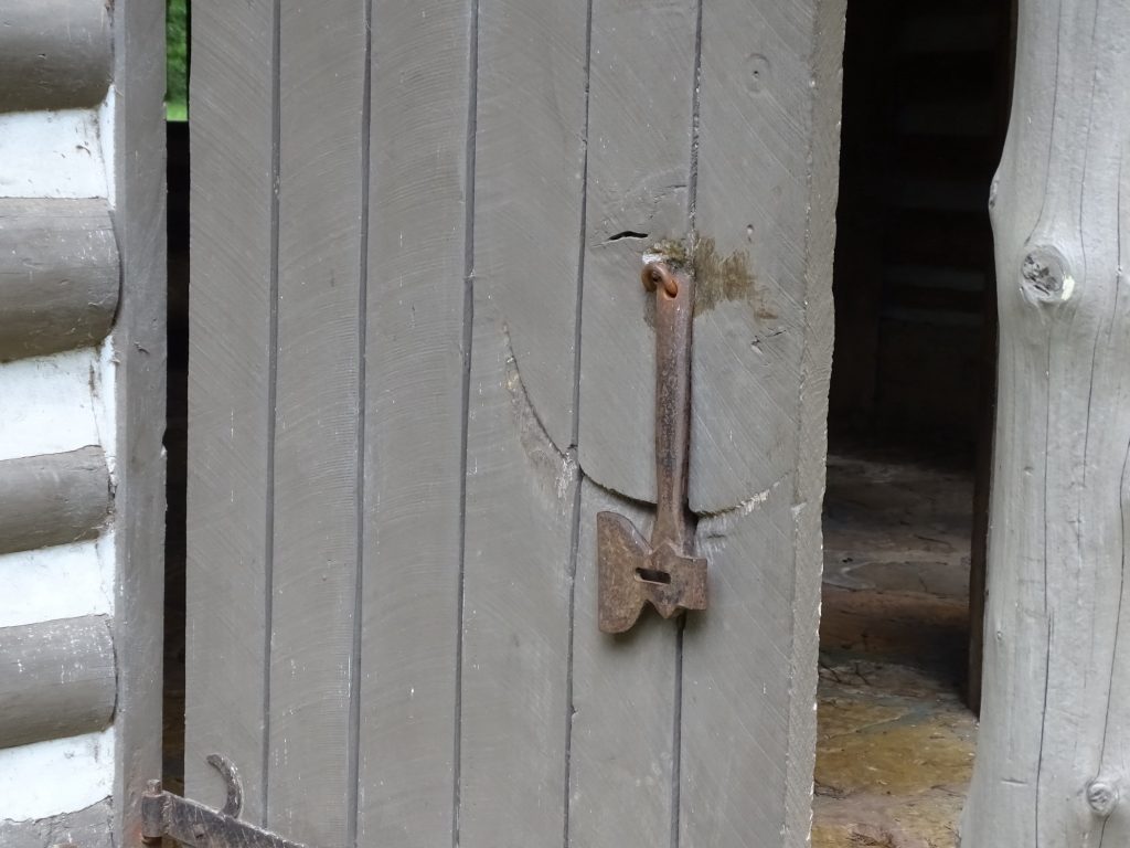
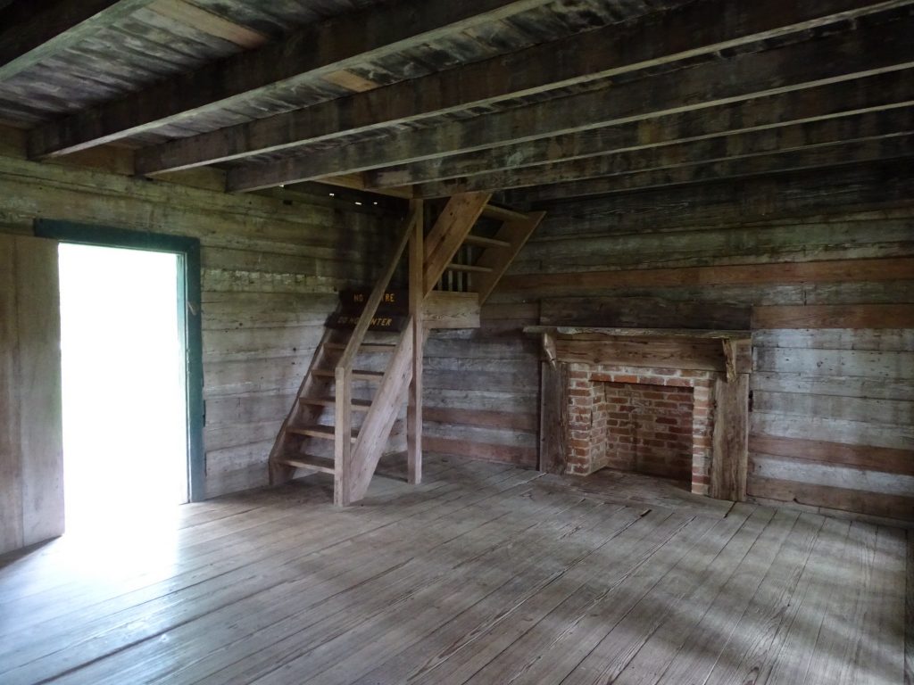
Representative Mission Built by CCC Inside the Mission
Check Out That Cool Door Latch
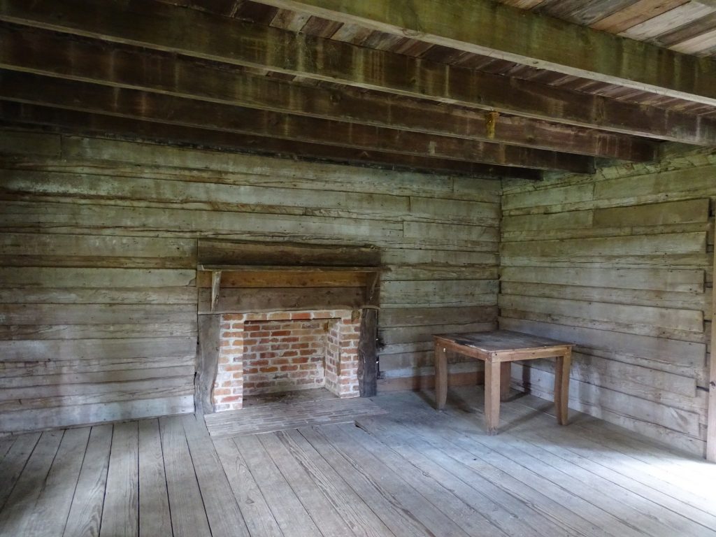
The Rice Home Inside
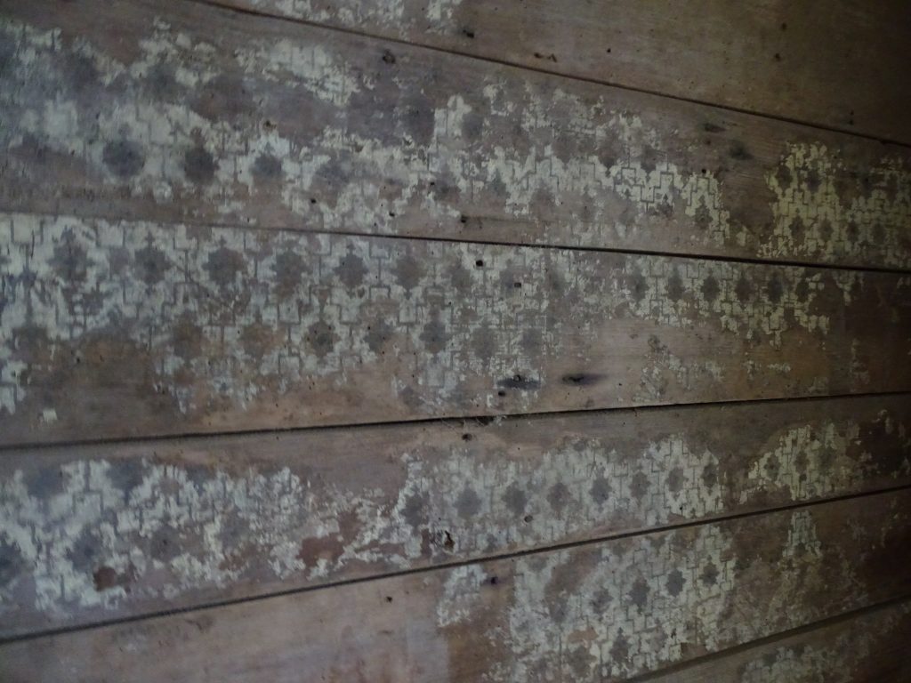
Inside Original Wallpaper
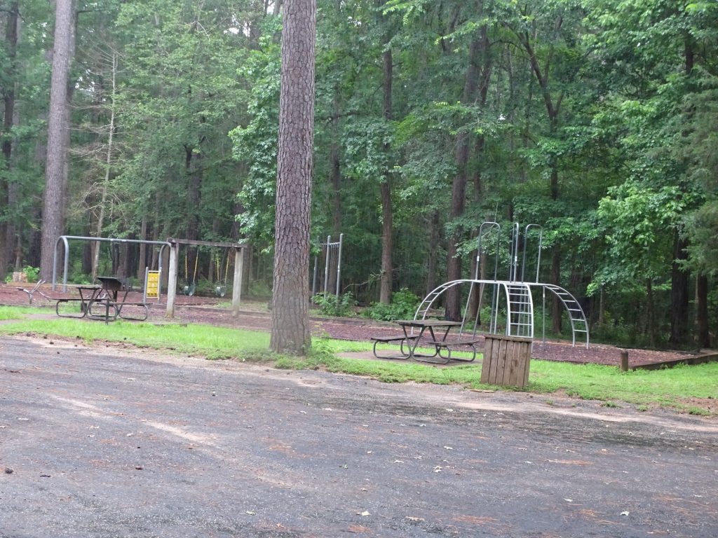
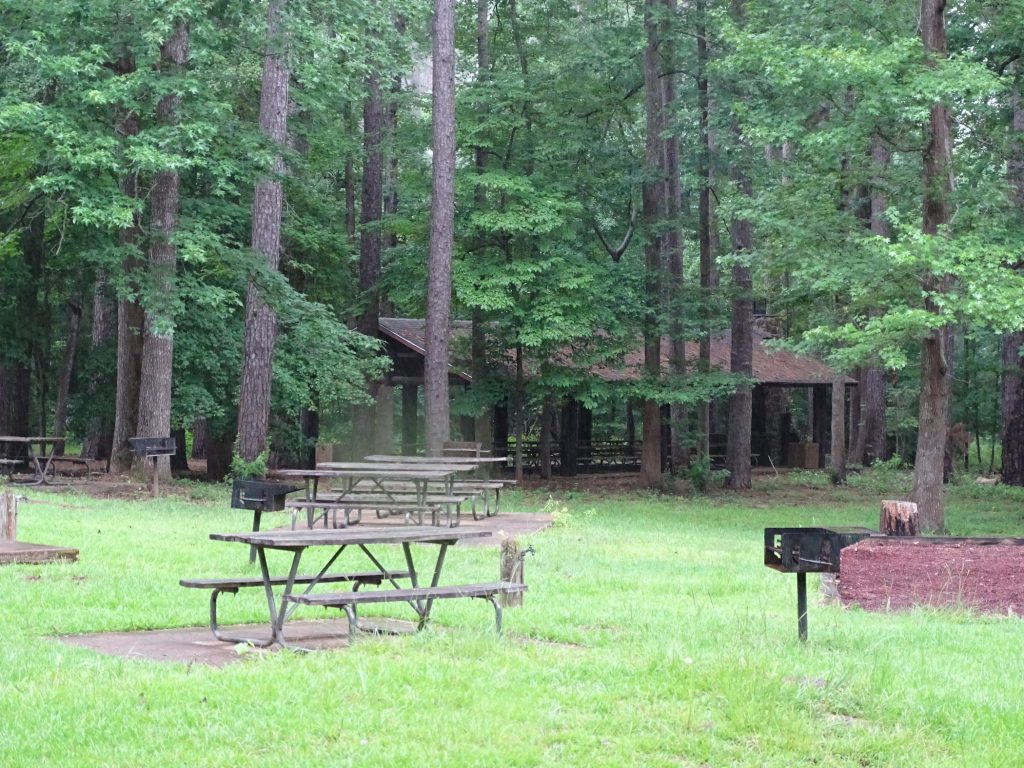
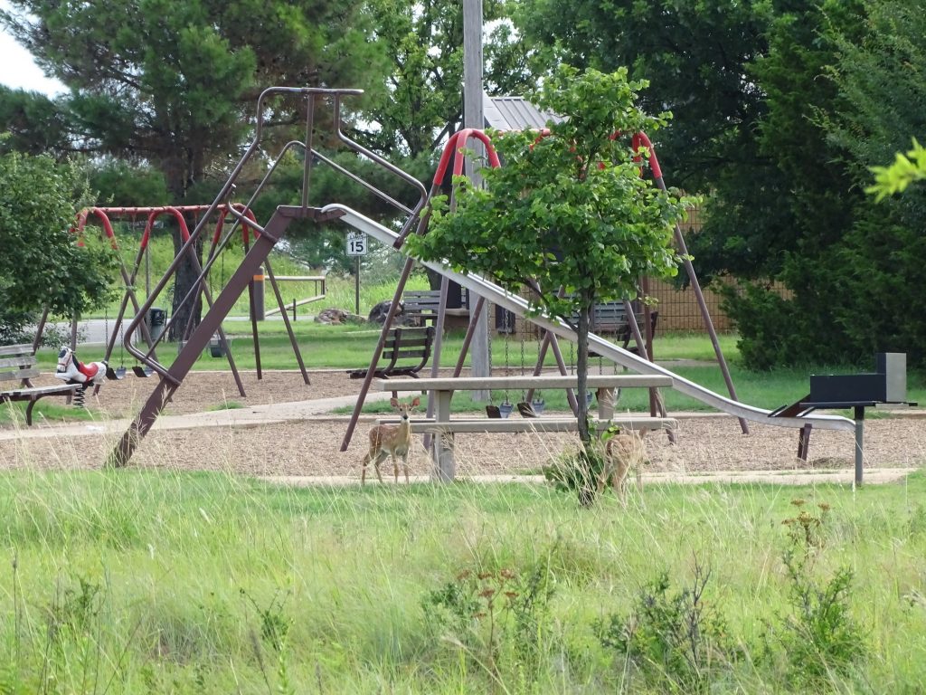
Playground Picnic Area and Pavilion
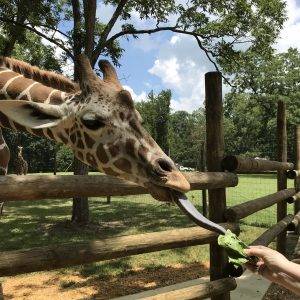
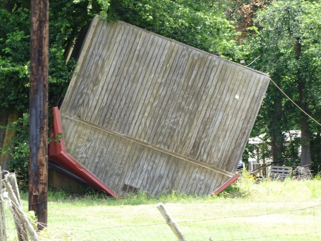
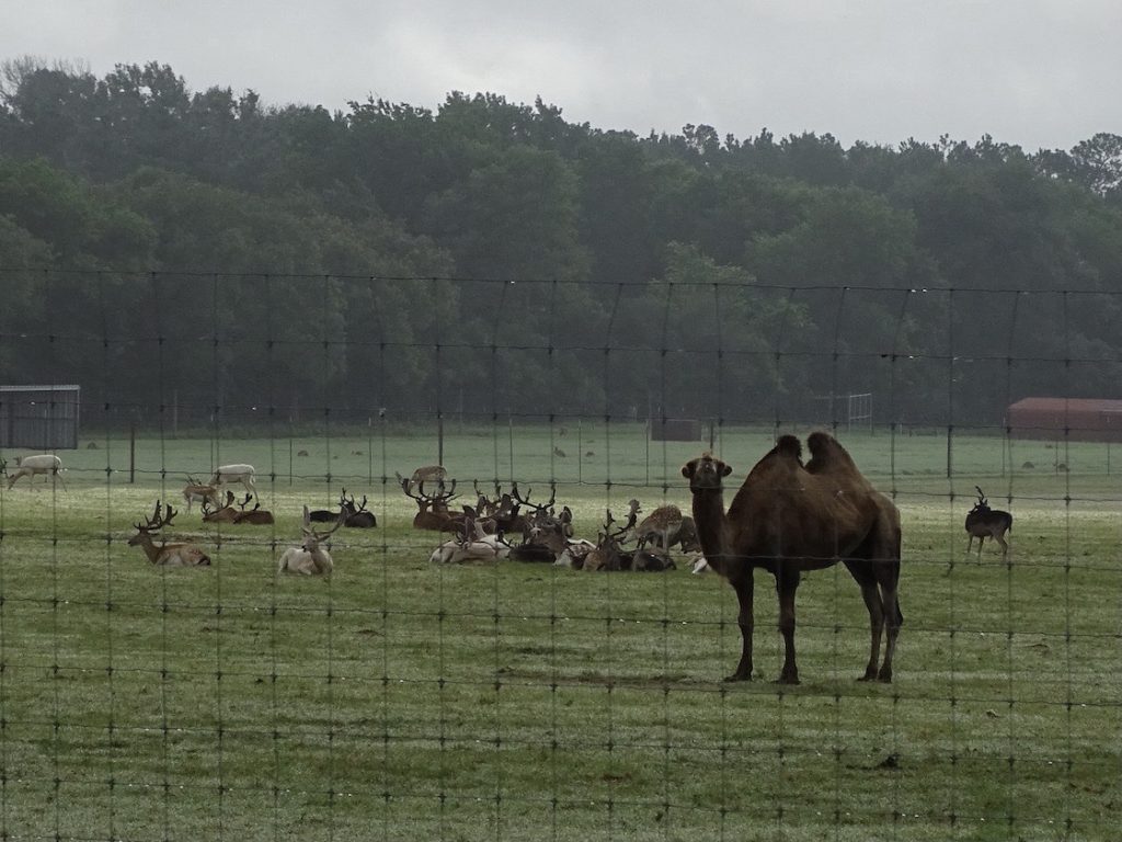
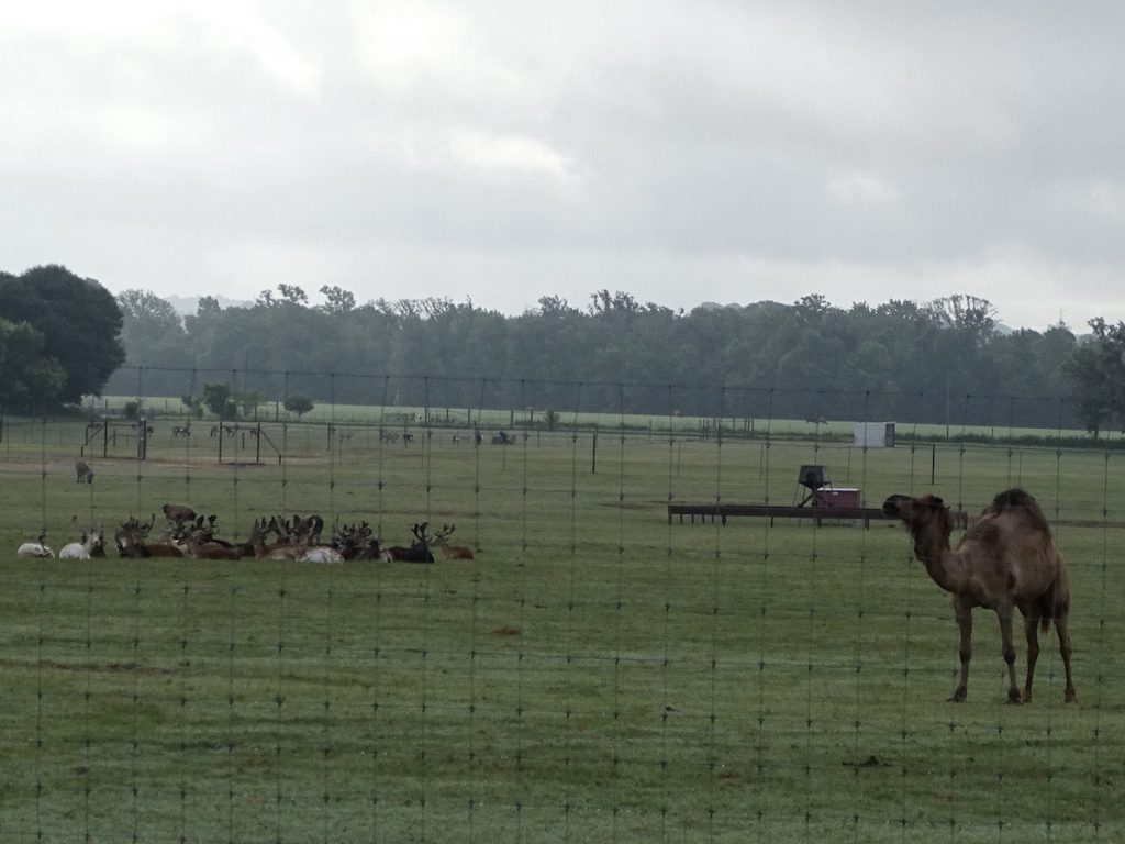
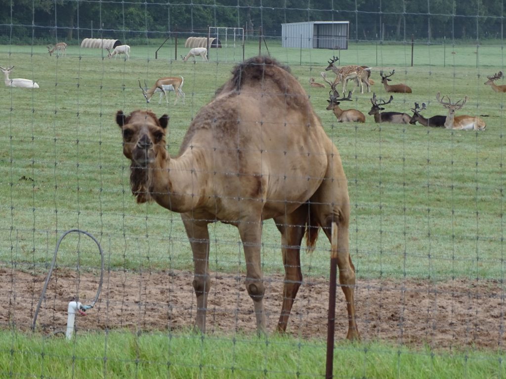
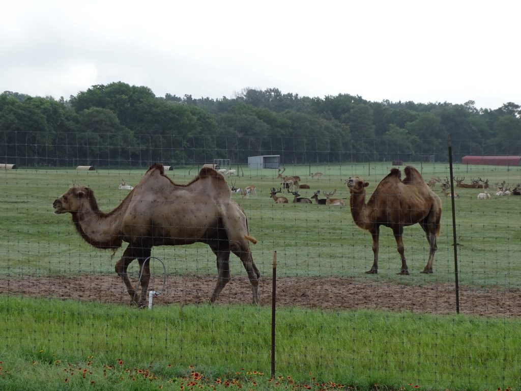
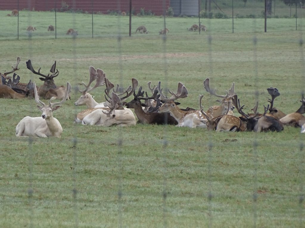
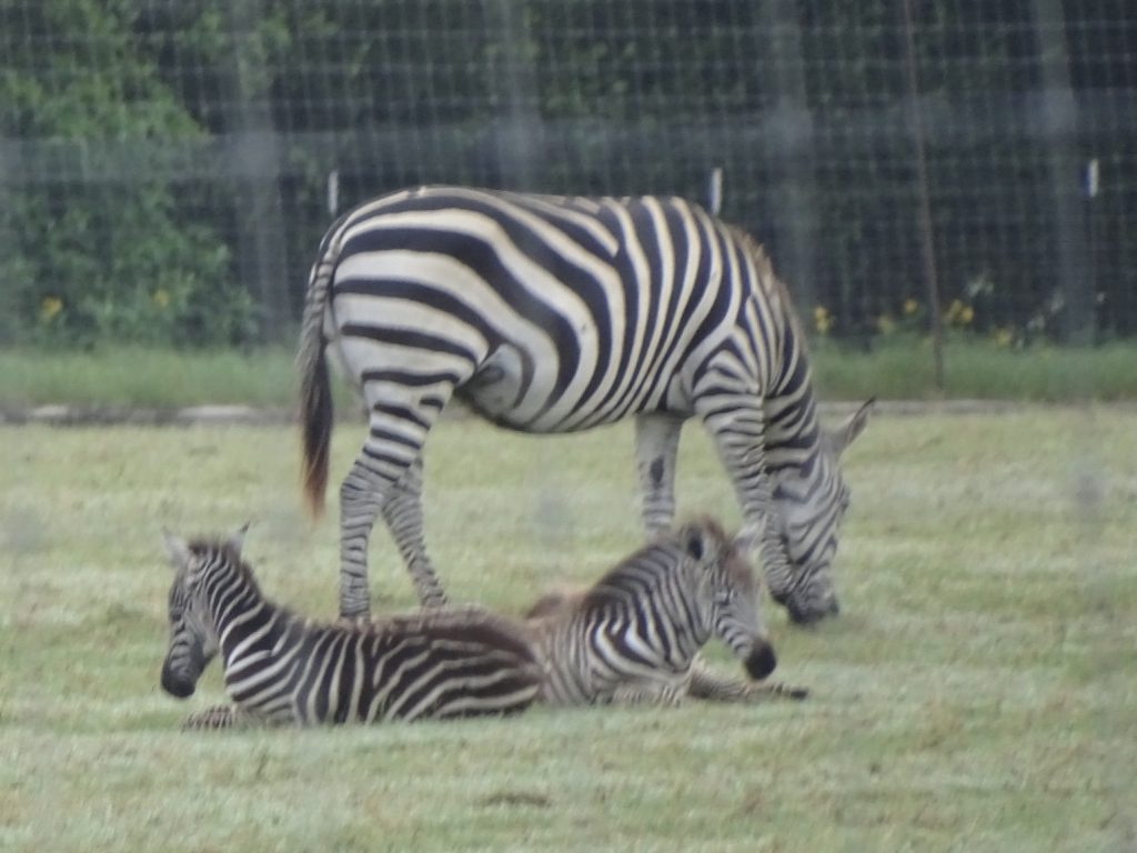
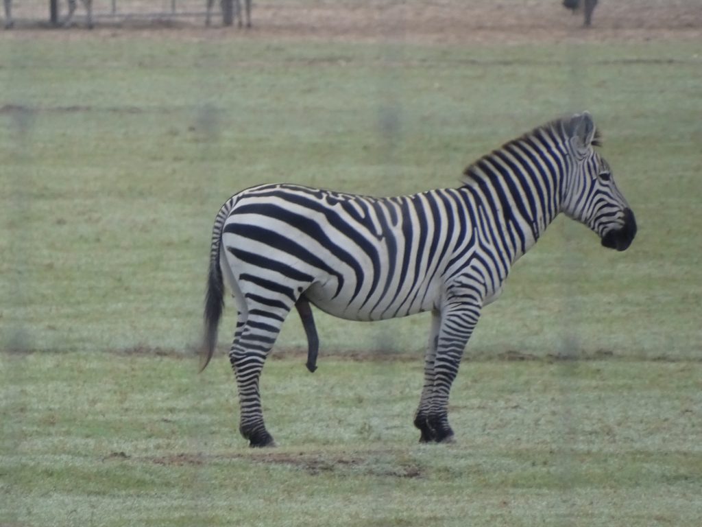
Our Wednesday morning did not start typically. Otherwise, a trip to the laundromat would have been on the schedule. In order to keep from changing more reservations after our protracted stay in Texas, we used this week to catch up to our original plan. That included shortening our stay at Mission Tejas and heading north. We were on the road about 8 AM, taking FM-227 over to Grapeland and turning on US-287. Just a few miles north, I caught a glimpse of something off to the right and did a double take. “Wait, that’s a zebra! And a pot-bellied pig! And a camel!” MW turned around at the next available place to go check it out. It turned out to be Grapeland Safari, a wild animal park. As soon as we pulled over in front of the field, the camels started to amble our way. Everyone else just continued to mind their own business. The humidity was so high that I had a devil of a time getting pics. The lens kept fogging up. I finally figured out that, if I pulled it back inside Brutus and shot from there, it worked a little better. Glad that lens is well sealed or it would be filled with water, for sure!
Hey everybody….it’s PEOPLE!!! They may have FOOD!!!
How YOU Doin’? It’s HUMP DAY!! For Gosh Sakes, Elmer, Would You Leave Them Alone and Quit Quoting TV!
Fallow Deer Indian Antelope
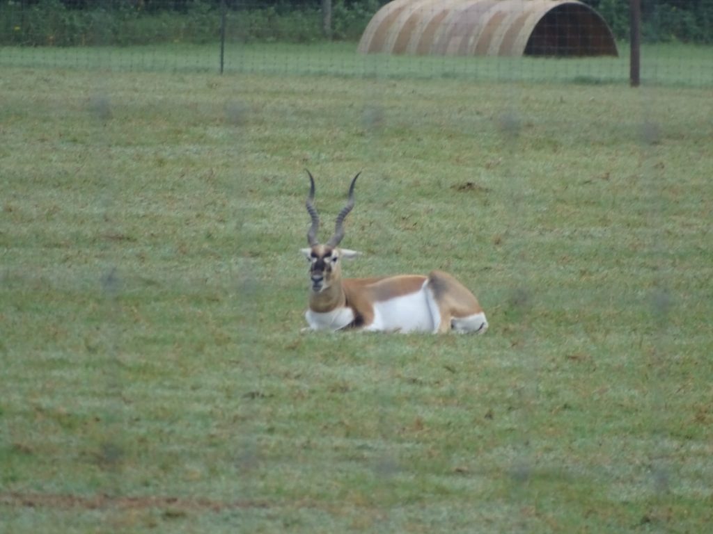
Mom and Babies Clearly…Dad
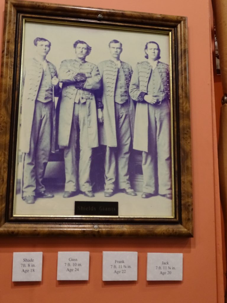
We continued north through Elkhart and Palestine, then caught TX-19 up through Athens and Canton. The ride took us out of the Pineywoods and into land that was mostly rolling, more open, and very beautiful. At Emory we headed up US-69 to Greenville where MW picked out Snuffers for lunch. This place specializes in burgers and cheddar fries. We decided to forgo the latter, but neither of us could resist the burgers. I had the Dr. Pepper BBQ Bacon Burger medium-rare, and I’ve just gotta say…BEST. BURGER. EVER!!!! They use poppy seed buns, which I particularly like. MW had the Bacon Guacamole Cheeseburger that he says was also delicious. (Could not possibly have been as good as mine, though.) Next we headed over to check out the Audie Murphy/American Cotton Museum. The exhibits begin with cotton and local information and work around to Murphy. Among the interesting people from the area, Hunt County was home to the “Texas Giants”. Four of the nine sons of John & Penelope Shields, Shade, Gus, Frank, and Jack all stood over 7-1/2′. In fact, Frank and Jack were only a hair under 8′ tall! They became famous in the 1880s when they toured with the Barnum and Bailey Circus.
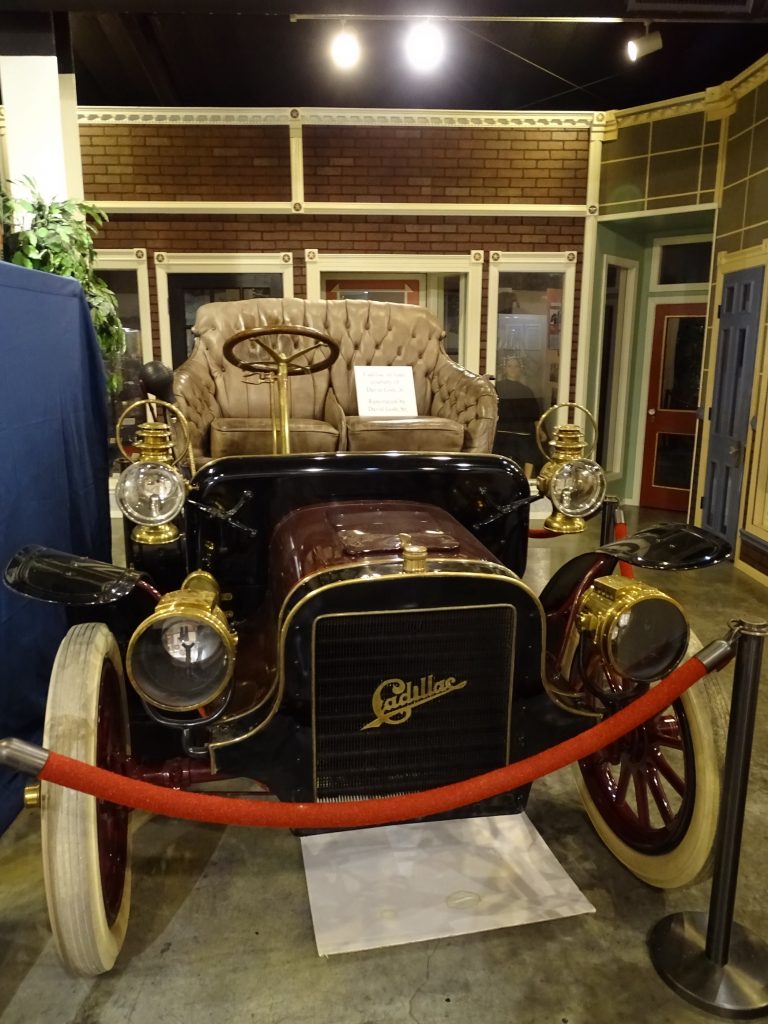
I Believe This is Proof of Vampires in Texas? Old Model Cadillac
The “Texas Giants”
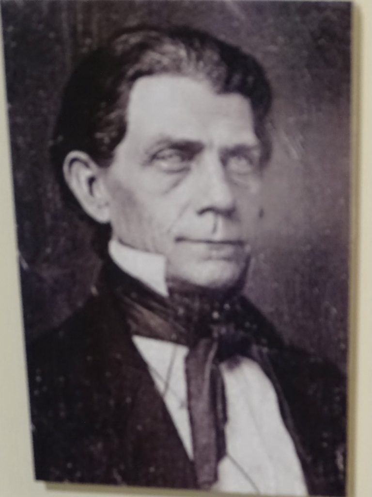
Another famous resident was Monty Stratton. A professional pitcher with the Chicago White Sox, Monty’s career was cut short when, in 1938, a hunting accident required his right leg to be amputated. Fitted with a wooden leg, he returned to the Sox and worked as a coach and batting practice pitcher. Later he organized a minor league baseball team in Greenville and worked hard to pitch again, compiling a nice minor league record for several seasons. After WWII, MGM felt that his inspirational story could be helpful to veteran amputees, so they began work on “The Stratton Story“, using Monty as a technical consultant. Ronald Reagan really wanted to play the lead and lobbied hard, but Warner Brothers, where he was under contract, didn’t believe the picture would fly and would not loan out their star. Bad call. Jimmy Stewart ended up playing Monty with June Allyson in the role of his wife Ethel. The movie turned out to be the highest grossing picture of 1949 and won several awards.
Those of us born in Georgia tend to think that our state is the big daddy in cotton, and that’s true when compared to the next highest producer. However, Texas produces more than twice as much of the soft stuff as Georgia every year. A fact that I find very interesting, since I don’t recall ever seeing a cotton field in Texas, and you guys know I’ve driven around a LOT of Texas! They must have them hidden somewhere, though.
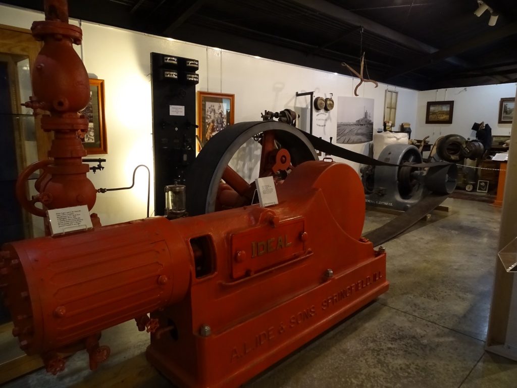
Steam Engine from the Cotton Compress in Greenville, Texas
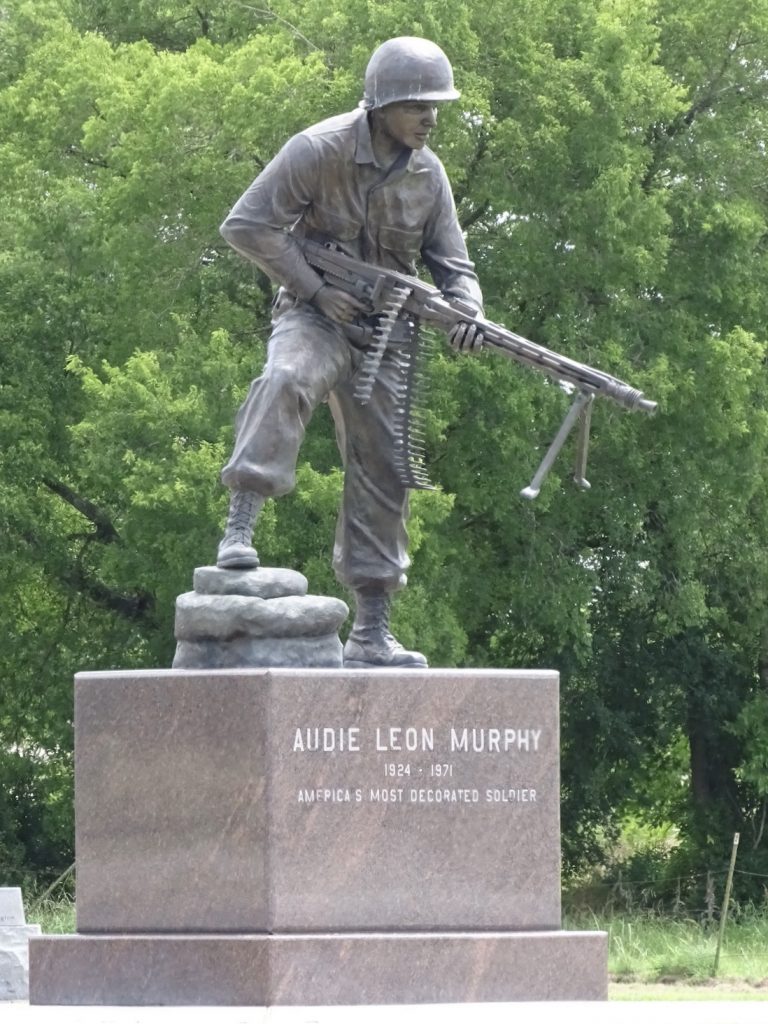
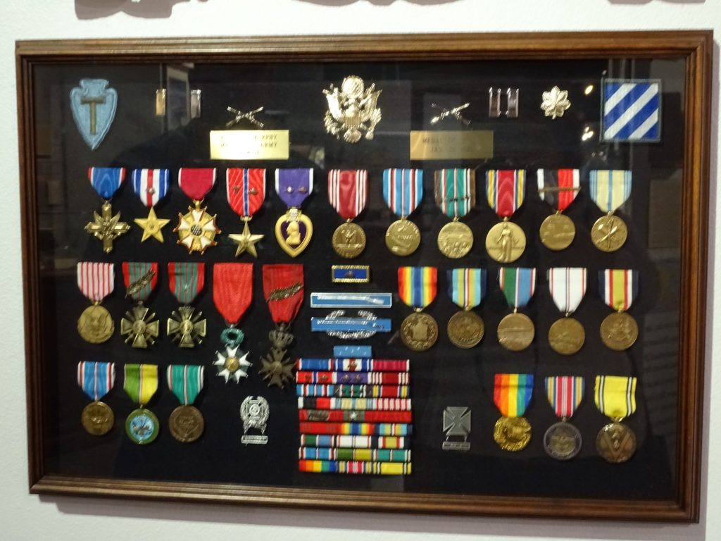
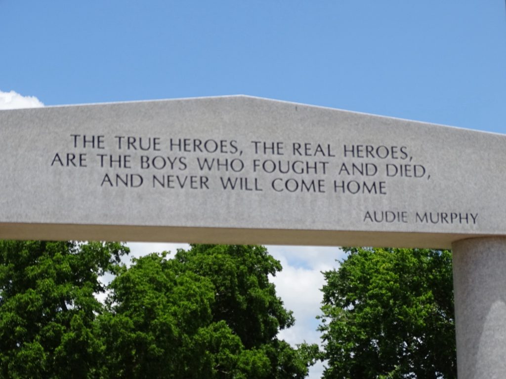
I already talked about Audie, but learned a few things at this museum. After WWII, he suffered from what we now know as PTSD, but was then called battle fatigue or shell shock. He struggled with sleep, and kept a gun under his pillow for years. Despite that and in addition to his successful movie career, he branched out in several directions. From 1962 to 1970, he wrote 16 songs, many of which were recorded by well-known artists like Roy Clark, Dean Martin, Porter Waggoner, and Jimmy Dean. He was in a television series called “Whispering Smith” about a detective in Denver in the 1870s. He was also a poet (my favorite is below) and a Freemason, holding a variety of posts. I’m not sure where he found the time for it all, but he was a truly gifted man. There is a monument on top of Brushy Mountain where Audie Murphy died on May 28, 1971. He was headed to a business meeting in a small plane that crashed, killing all aboard. Several years ago when hiking on the Appalachian Trail, MW came upon the marker for the crash site.
Technically NOT the Most Decorated Overall – Just of WWII
| FREEDOM FLIES IN YOUR HEART LIKE AN EAGLE |
| Dusty old helmet, rusty old gun, They sit in the corner and wait. Two souvenirs of the Second World War That have witnessed the time and the hate. Mute witness to a time of much trouble Where kill or be killed was the law. Were these implements used with high honor? What was the glory they saw? Many times I’ve wanted to ask them… And now that we’re here, all alone, Relics all three of that long ago war. . . Where has freedom gone? Freedom flies in your heart like an eagle. Let it soar with the winds high above Among the Spirits of soldiers now sleeping. Guard with care and with love. I salute my old friends in the corner. I agree with all they have said . . . And if the moment of truth comes tomorrow, I’ll be free, or by God, I’ll be dead! . . . Audie Murphy, 1968 |
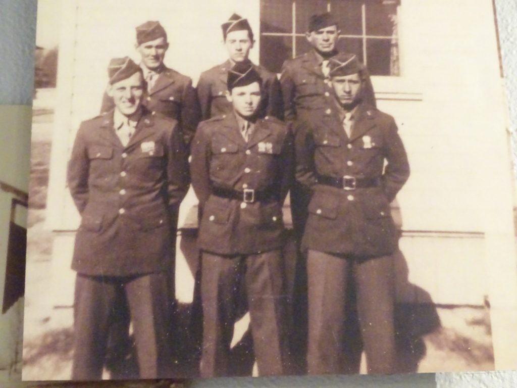
17-Year-Old Murphy Front and Center His Decorations
Truth! Always Humble
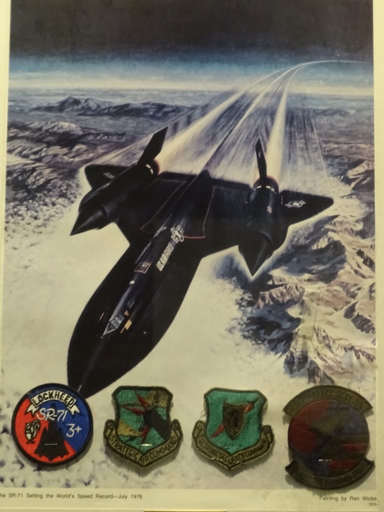
Just Because It’s My Favorite Plane EVER!
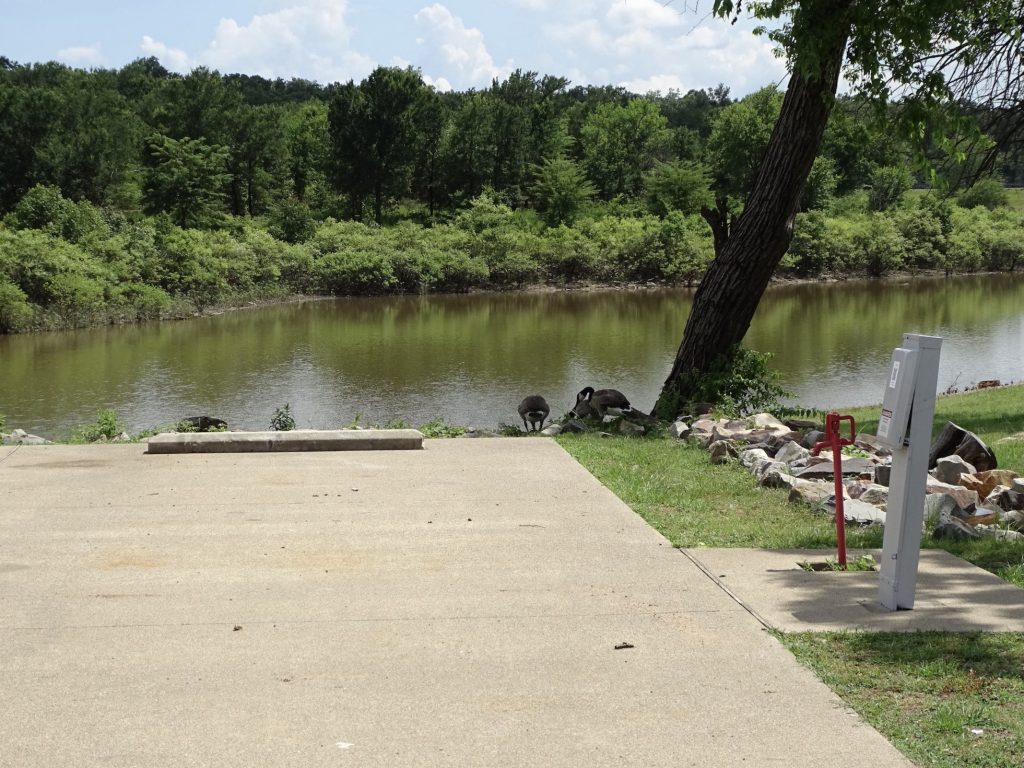
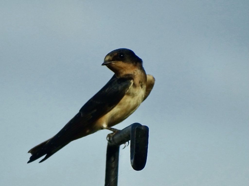
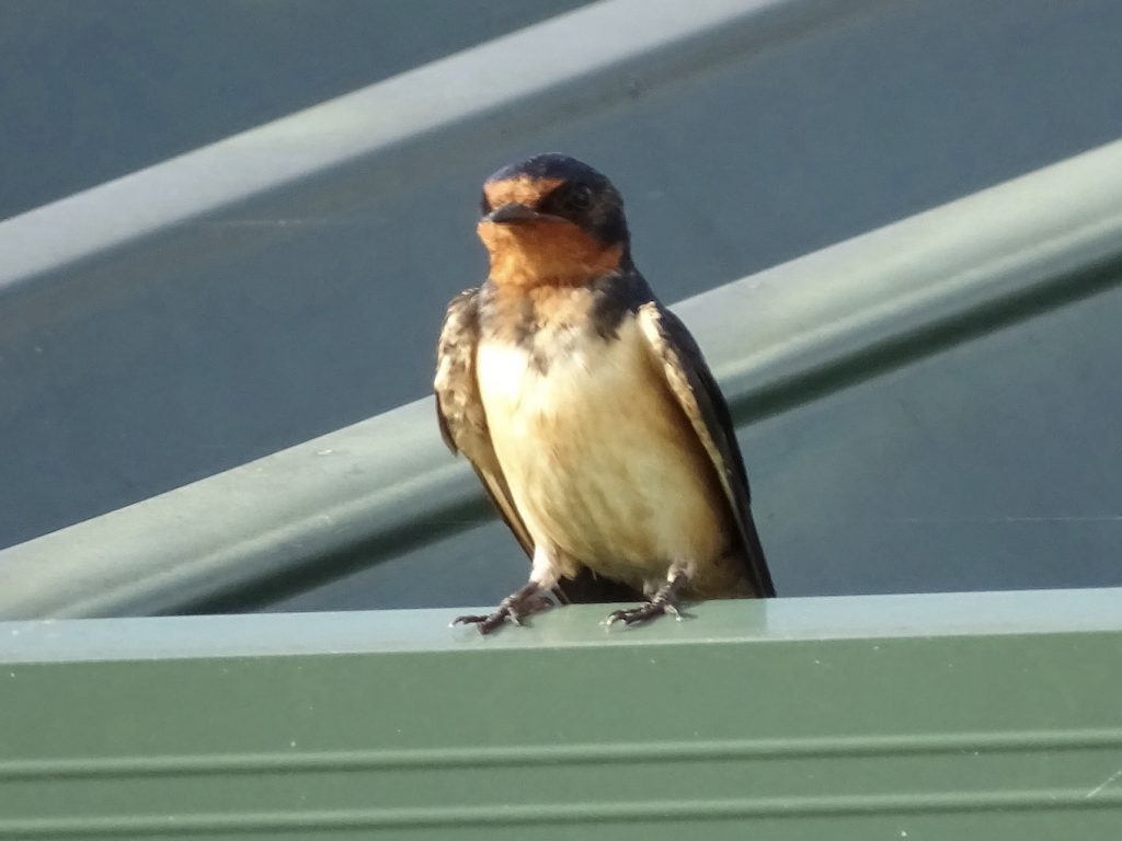
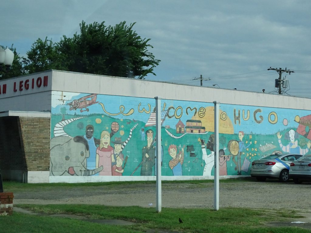
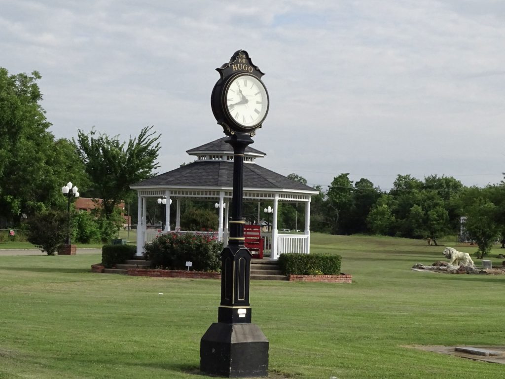
When we were through looking around, we headed out of Greenville on TX-224, then headed north on TX-19. Just after Arthur City, something remarkable happened. We hit “Ooooooooooooooklahoma where the wind comes sweepin’ down the plain”. Did you sing with me? Honestly, I was just hoping that the wind would be cooler, but that didn’t happen. Just across the line we passed through Hugo and made it to our destination for the night, Kiamichi Park on Hugo Lake. Our site backed right up to the water, and a dozen or so Canada geese were hanging out there when we arrived. They wandered on off down to the water as we were backing in. There were also birds nesting in the picnic table cover. I enjoyed watching them zooming out and in constantly. I think they were barn swallows. By the way, the slide went out fine, so I guess I didn’t break it.
Giving Up the Site, But Not Happy About It
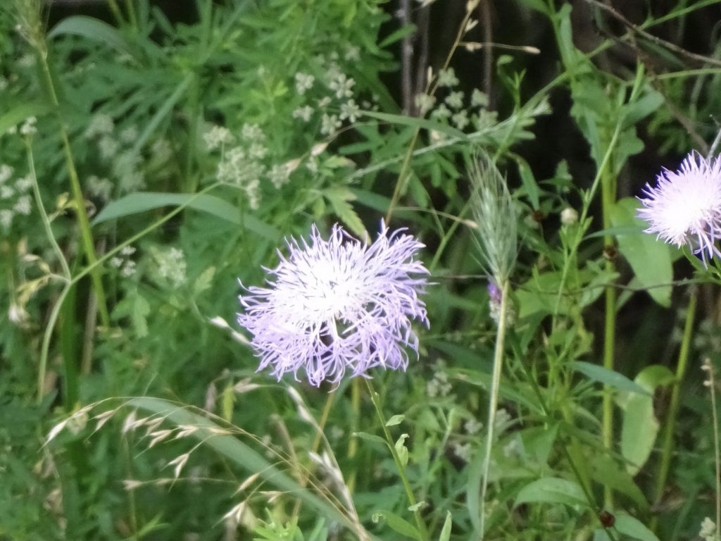
Lots of These Growing in the Park – Possibly Basketflower
Thursday started with a headache for me, but thankfully it was better by the time I actually had to get moving. MW was out changing the oil in Brutus at about 6 AM and just as quiet as a mouse. We don’t particularly care for one night stays, but this one was necessary. After today, we will be back on our previously scheduled program and sit tight through the holiday weekend. Before hooking up, we took a ride around the park for you guys.
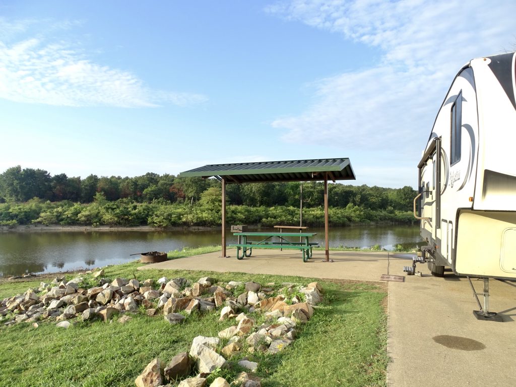
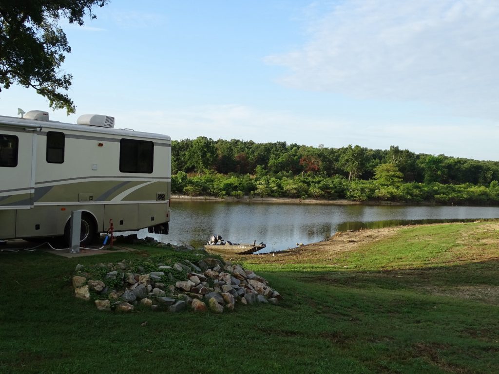
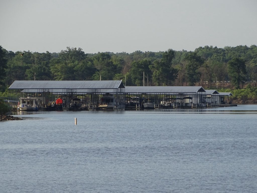
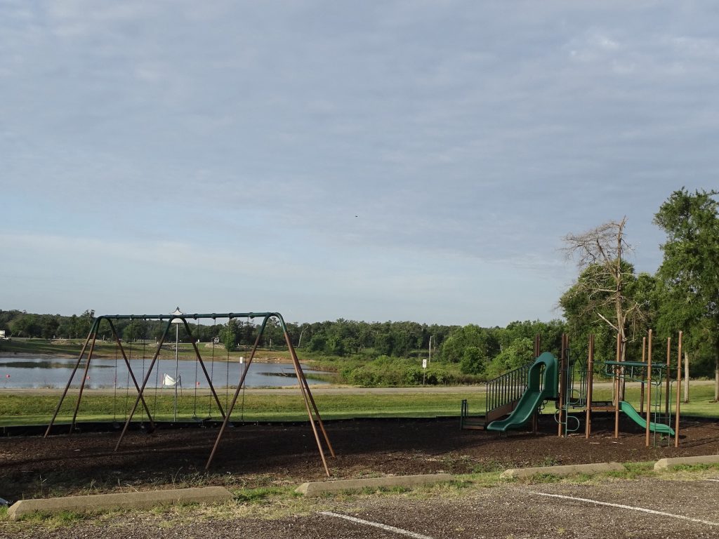
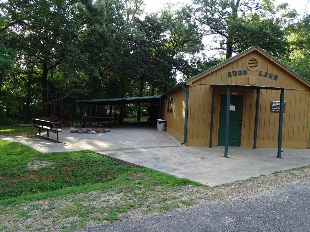
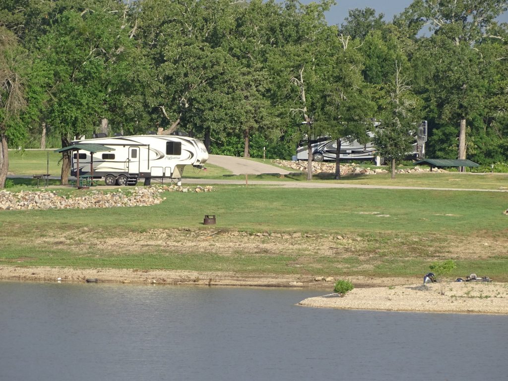
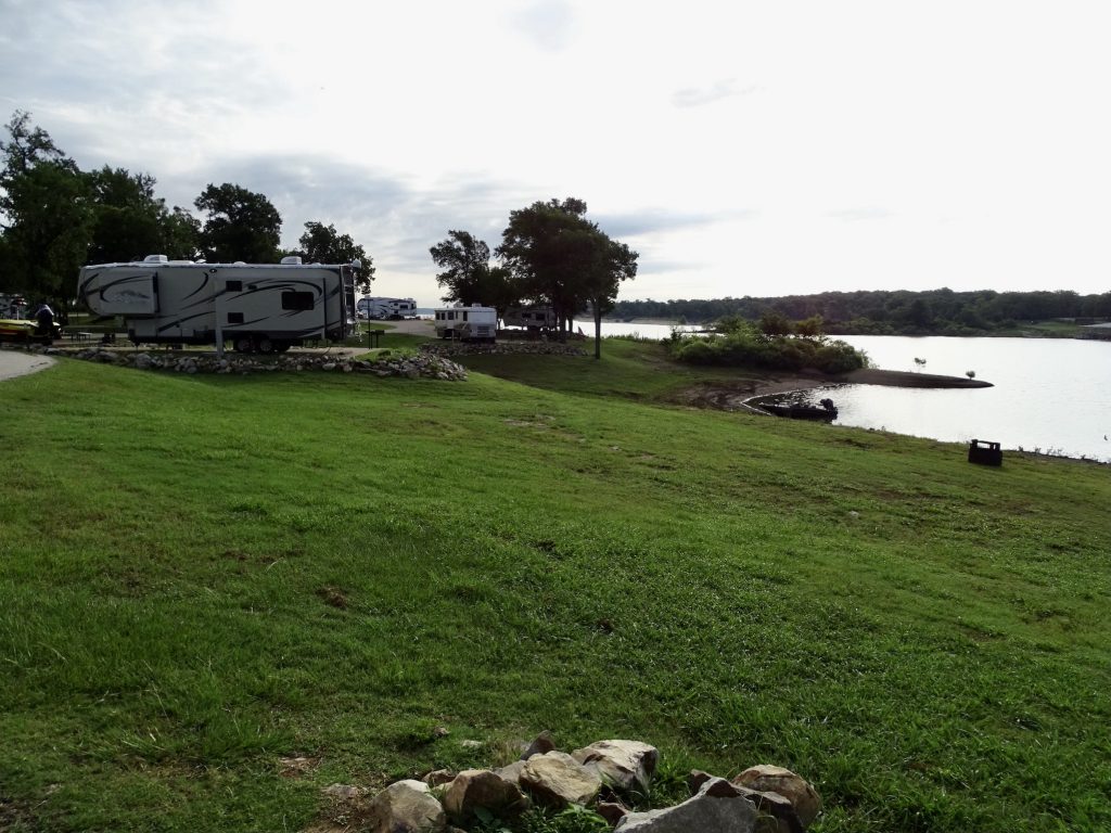
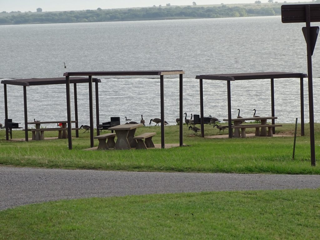
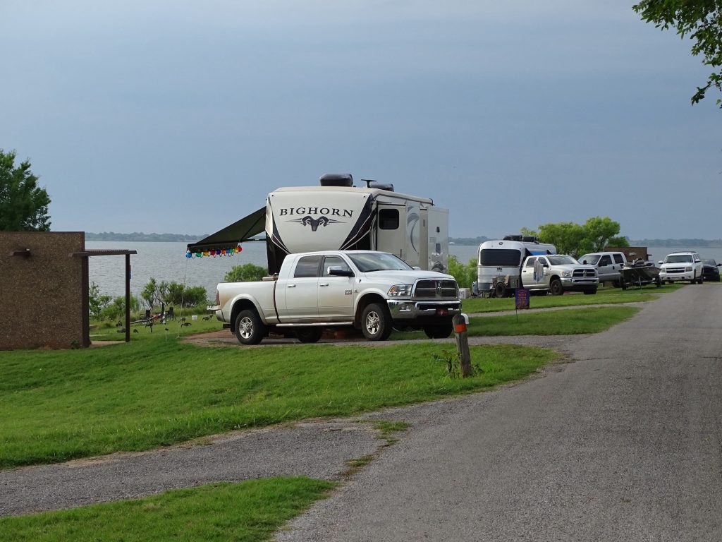
Kiamichi Park is a 25,000 acre Corps of Engineers development on Hugo Lake on the Kiamichi River. It is a beautiful park that we would definitely enjoy going back to. The nearest town is Hugo, Oklahoma, which has quite a few restaurants and shopping opportunities. The main recreation at the park centers around the lake with fishing, water sports, and swimming, but there are also miles of paved roads for biking, jogging, and sight-seeing. They have wooded trails for hiking and horseback riding, a playground, reservable picnic shelters, and a picnic area. Bow hunting is allowed in the park, and they have an archery practice range and a 3,000-acre deer management area. Accommodations include a group camp loop with 11 sites and a large shelter with tables and grills. The campground offers 85 sites. We didn’t drive every loop, but the sites we saw were nice. Our site was on the J-loop (J-04) where the sites were paved, level, and backed right up to the lake. Each had a covered picnic table, fire ring, 50-amp electric and water. There are also equestrian sites available on the R-loop that include 13 horse stalls. The bathhouses offered private rooms that were fairly clean, but hot. For this stay in June 2021, we paid $22.00 for one night.
View from Our Site to the Marina Backed Right Up to the Cove – Site J-4
Bring Your Boat Right to Shore Site J-11
Campground From Across Cove
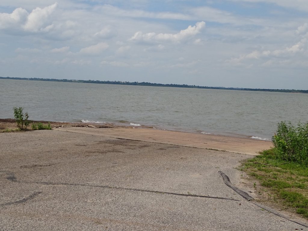
Petunia on RightBeach
Site J-13 Private Bathrooms
Marina Across the Lake Playground
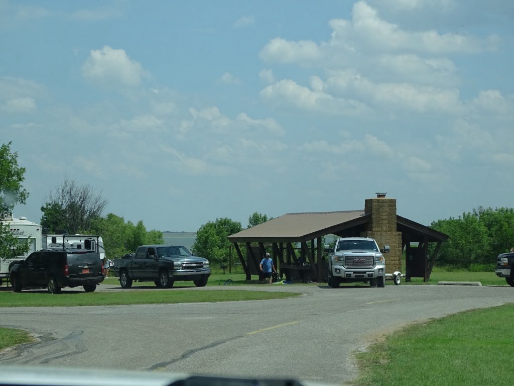
Pavillion Group Camping Tent Site
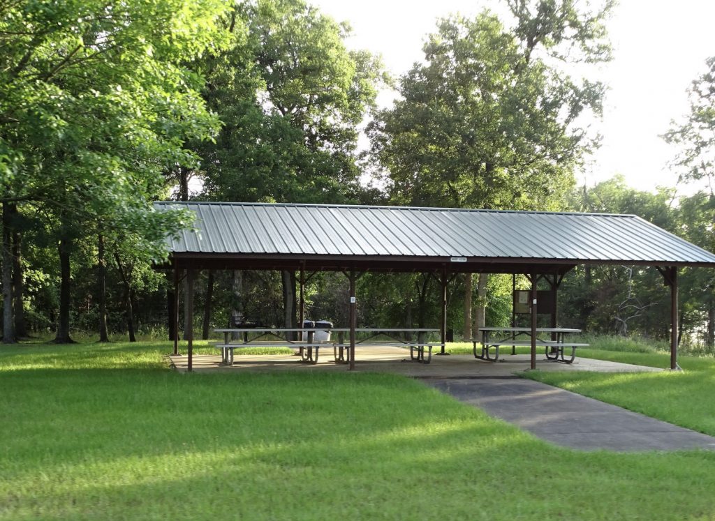
Group Camping Shelter with Tables & Grills Petunia
View from Our Site
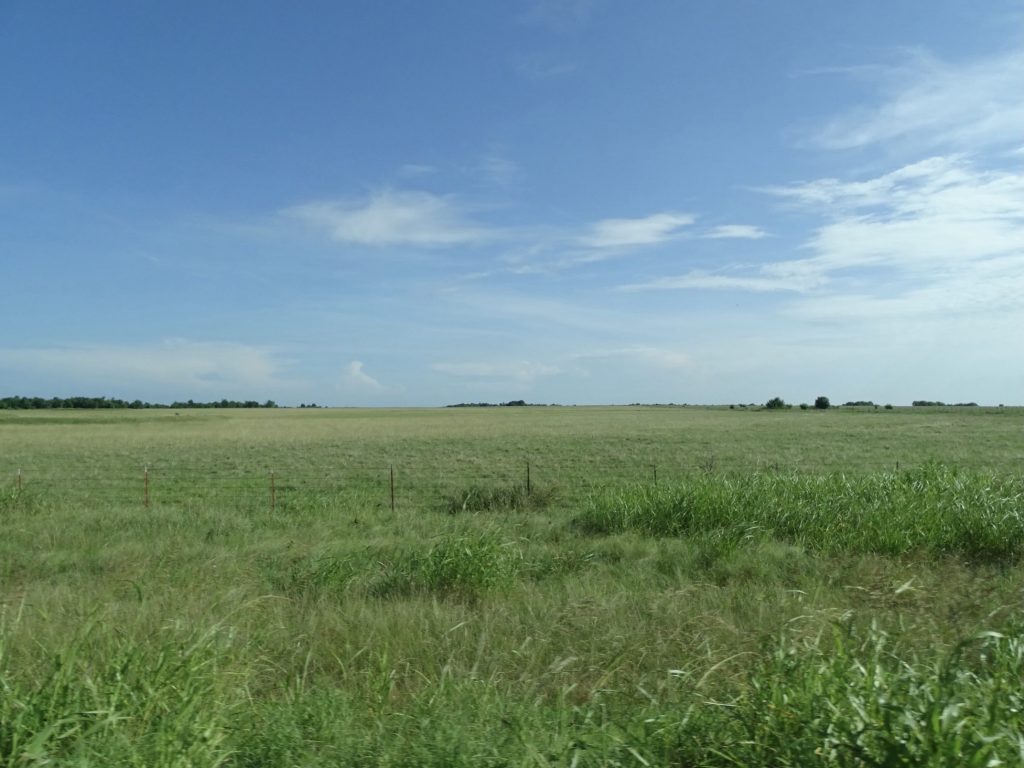
We hit the road around 8 AM, heading west on US-70 through Hugo and over to Bokchito, where we turned north on OK-22 up to Caddo. The land alternated between flat and slightly rolling, and was mostly grassland.
Hugo Hugo
Near Caddo Near Caddo
Might Be A Nice Drive Caddo
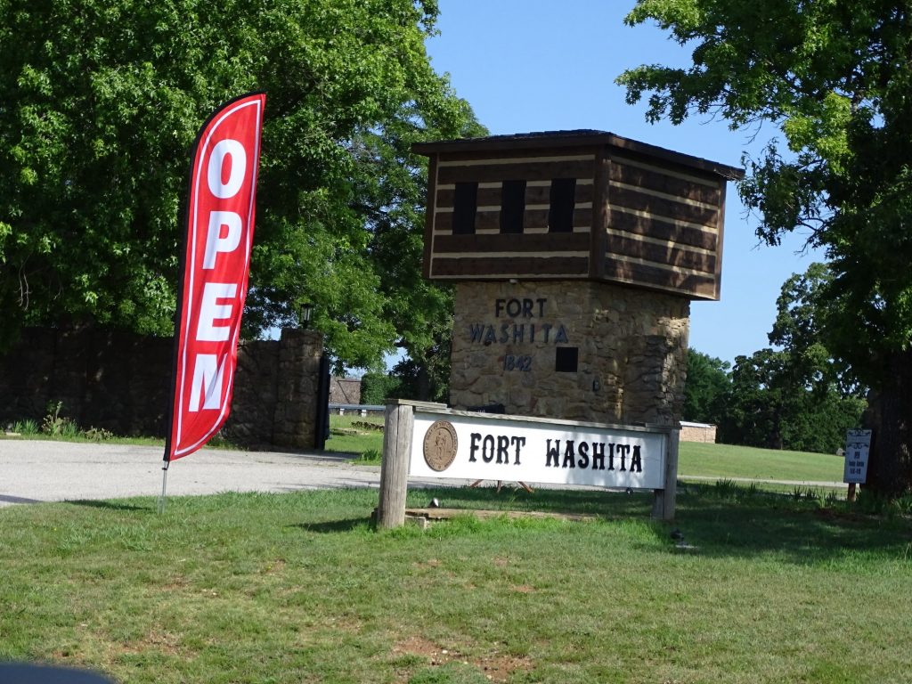
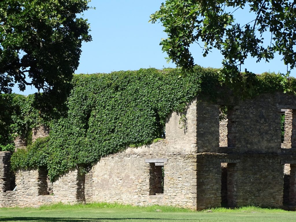
We turned west again at Caddo, and zig-zagged a little to get over to our first stop of the day, Fort Washita near Bee, Oklahoma. Built in 1842, this fort was the southwestern-most military post in the United States at the time. They were tasked with keeping the peace between the Chickasaw and Choctaw Nations and deterring outside threats to the Chickasaw tribe. During the Civil War (or the War of Northern Aggression for most of my relatives), the fort was occupied by Confederate forces, then virtually destroyed when they fled to keep the Union forces from occupying it (a common practice for both sides). After the war, the fort was granted to the Chickasaw Nation, but later taken back by the Dawes Commission and granted to the Charles and Abbie Davis Colbert family. Acquired in 1962 by the Oklahoma Historical Society, it was restored as a historic site and museum, and is currently managed in partnership with the Chickasaw Nation. Some of the buildings are just ruins, but several remain. They are said to be haunted by a headless spirit named Aunt Jane and several other ghosts. Sadly, ghost hunting was responsible for a tragedy. The South Barracks reconstruction was completed in 1972. Originally built in 1849, the building was 120′ long and 30′ wide with a veranda all the way around. In 2010, three young men, Skylar Forster (19), Travis Wayne (18), and Brandon Dean Perkinson (18), got drunk and decided to look for ghosts. They broke into the park at around 2 AM, taking more beer with them. Once inside the barracks building, they used toilet paper to light a fire in a fireplace on the west side. They left shortly after, and claimed not to know that the fire they started burned the place down until the next day. Perkinson immediately went to the police. He was charged with misdemeanor breaking and entering, with a potential sentence of 1 year in jail and a $1,000 fine. Forster and Wayne were charged with second-degree arson, with a potential sentence of 25 years in prison and a $20,000 fine. I found an article about the change of venue to another county, but could never find what they actually got. The guy at the park office said their attorneys claimed at trial that they accidentally broke into the park and accidentally set the fire, so they were not guilty. No one “accidentally” breaks into a place! He said they each received 30 days in jail. If that’s true, that is criminal!
Witness Photo Published on ABC KTEN

Welcome! Bachelor Officer’s Quarters Ruins
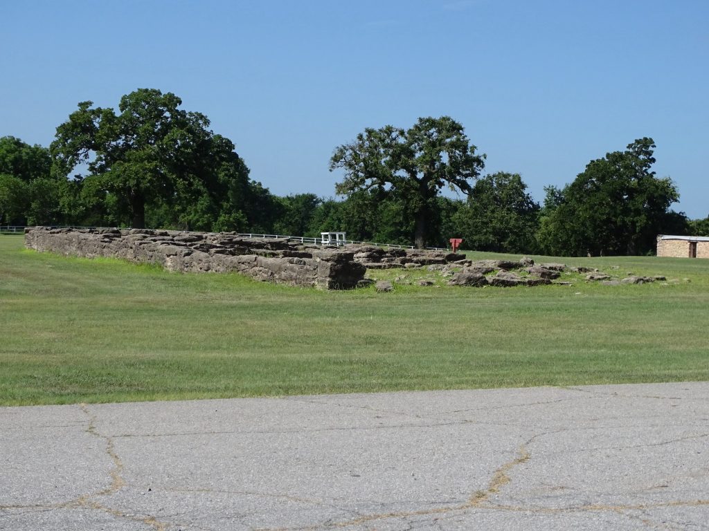
South Barracks Ruins What it Looked Like Before Fire
(Photo from Office)
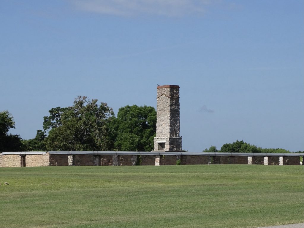
Old Military Road West Barracks Ruins
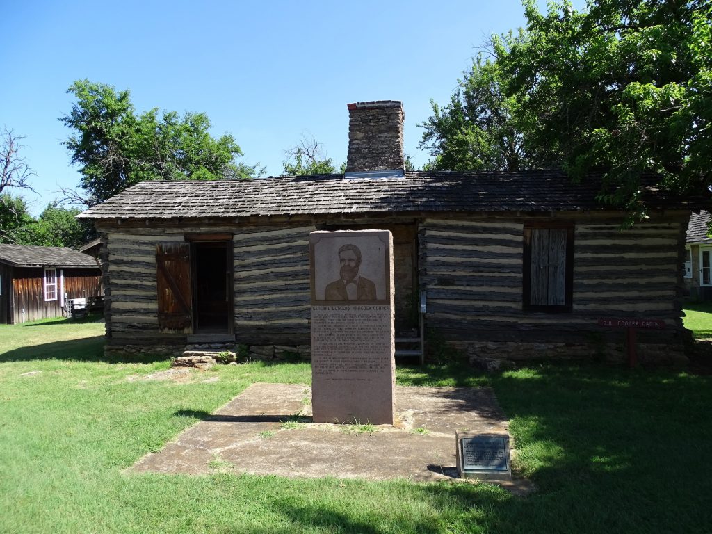
D. H. Cooper Cabin – Chickasaw-Choctaw Agent and Confederate General
Buried on Fort in Unmarked Grave
Bedroom Kitchen
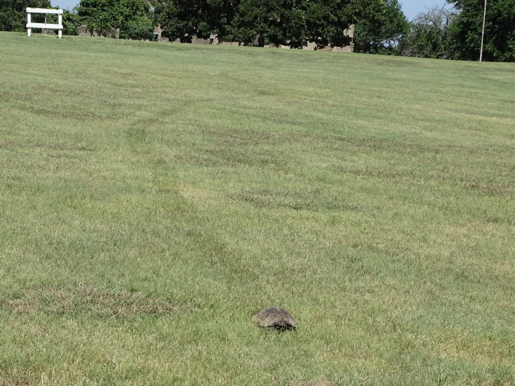
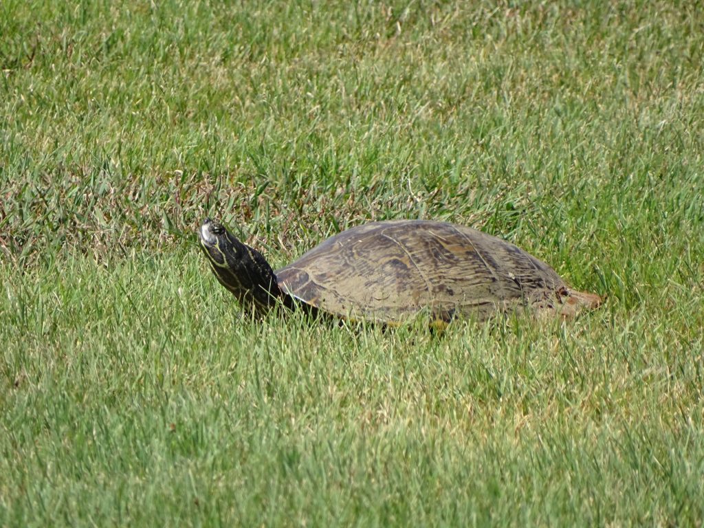
As we were leaving the park, we saw something unusual, but I’m still wondering how it relates to ice cream.
Turtle Tracks Not Chocolate and Caramel
Beautiful View from Fort Washita
Quite a bit of Oklahoma is Indian reservations. We started in the Choctaw Nation (almost 7 million acres, third largest tribe, second largest reservation), passed through Chickasaw Nation (almost 4.9 million acres, 13th largest tribe), and ended up in Kiowa/Comanche/Apache Nation (almost 3 million acres). Unlike some of the reservations we’ve passed through, there seem to be lots of outsiders living in these. I read that many of the reservations are actually “checker-boarded” with property that was handed out during various land programs. After doing a little research, I found out that in Oklahoma it is mostly because of the Dawes Commission in 1893. After moving the Indians west and assigning them land, the government, once again, fiddled with the stew. The purpose of the Commission was to convince the Five Civilized Tribes to cede tribal title to their land and divide it into individual allotments. (This had already been forced on other tribes in the Dawes Act of 1887.) Once again, the tribes were stripped of their communally held national lands. In the process, the Commission decided how natives could claim tribal ancestry and how former tribal slaves would fit into the mix. Once lots were distributed to all tribal members, the government declared the remaining land “surplus” and sold it to settlers. Some Tribe members who received an allotment also sold their land to settlers. The ultimate result was that the five Indian nations lost most of their national land bases (although they did receive some money for it). The tribes have been trying to end the sales of tribal lands to outsiders since the 1970s.
We hit the road again heading west, and our next objective was lunch. In Madill, we found the Country Kitchen. It didn’t look like much when we walked in…a dark dining room with a counter in the back. The food was good, though. I had a BLT that was pretty basic and a side salad that had spinach in it…bonus! MW had a pork cutlet sandwich that was actually two meals and very good. It was the black-eyed pea salad, though, that he said was AWESOME! (Yes, with emphasis.)
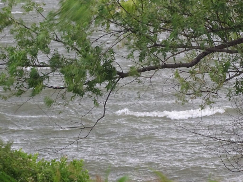
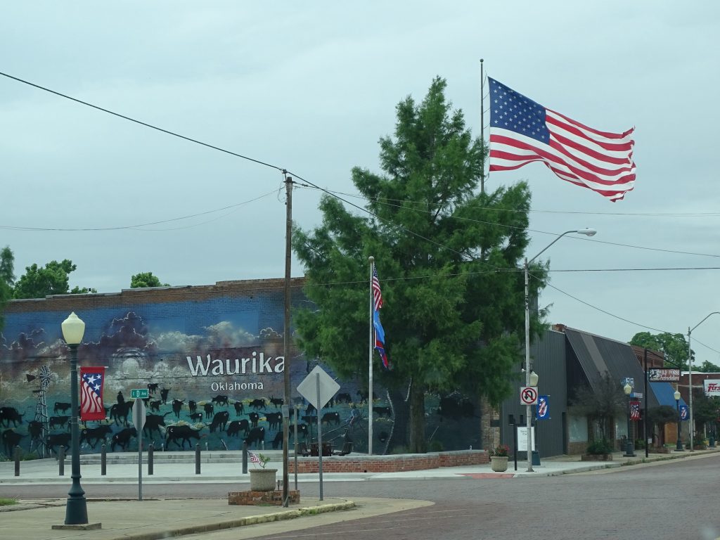
The rest of the trip was uneventful as we headed west on US-70. At Waurika we turned north on OK-5 and made our final destination, Kiowa Park on Waurika Lake, around 2 PM. The level, pull-through site made set-up easy, and we settled in for a nice afternoon. It was hot and humid when we arrived, but within a couple of hours the wind was howling and we could see big storms coming straight at us across the lake. The water that was peaceful and relatively smooth an hour ago was now crashing up against the shore. Our neighbors had a little pup tent set up and stuff all over their picnic table. At first it looked like they were going to stay outside, and I was going to bring them in Petunia. They decided to load up into their car, though, which was smart. Amazingly, the tent stayed put. Props to whoever staked it down. For about 45 minutes, we got a pounding. After that it was just waves of rain passing through until the next morning. I made a couple of videos for you below.
Headed Our Way Poor Visibility and Big Rain

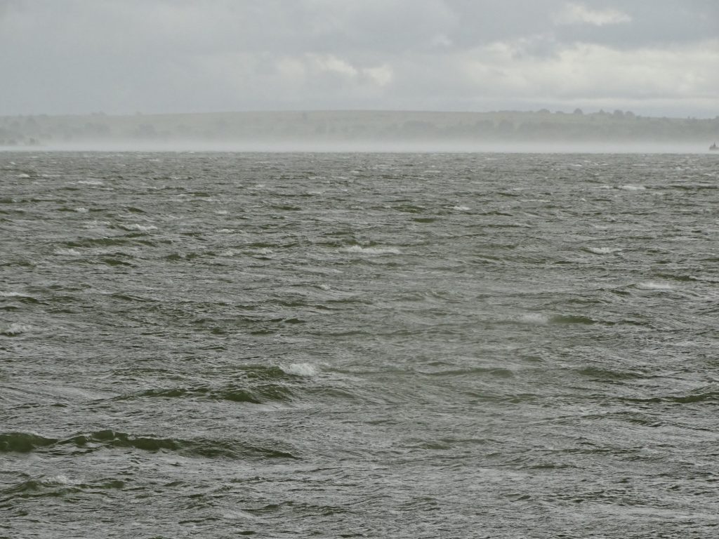
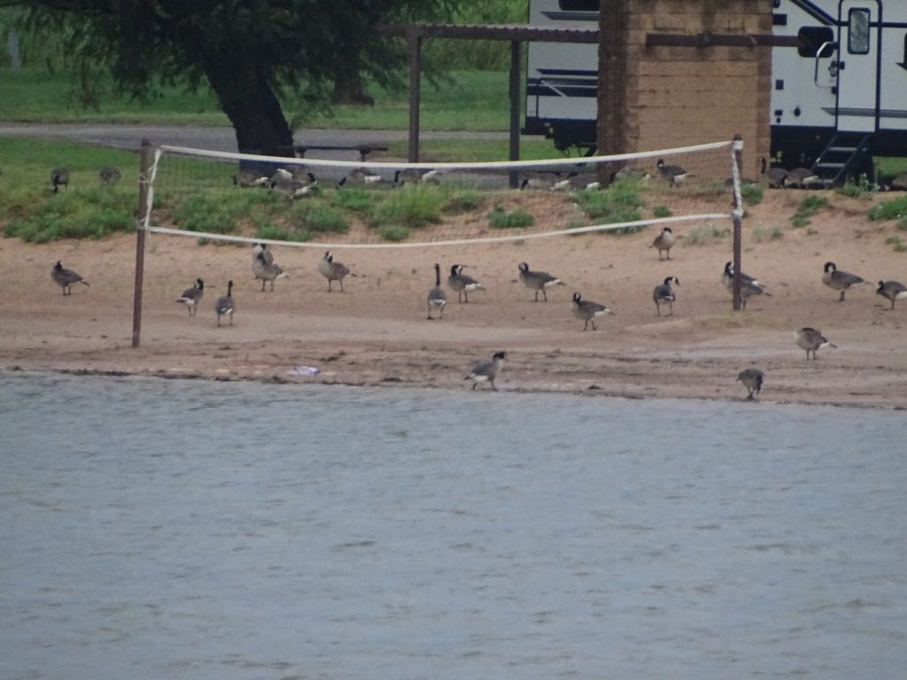
Big Waves on the Lake Apparently Geese Play Volleyball in the Rain
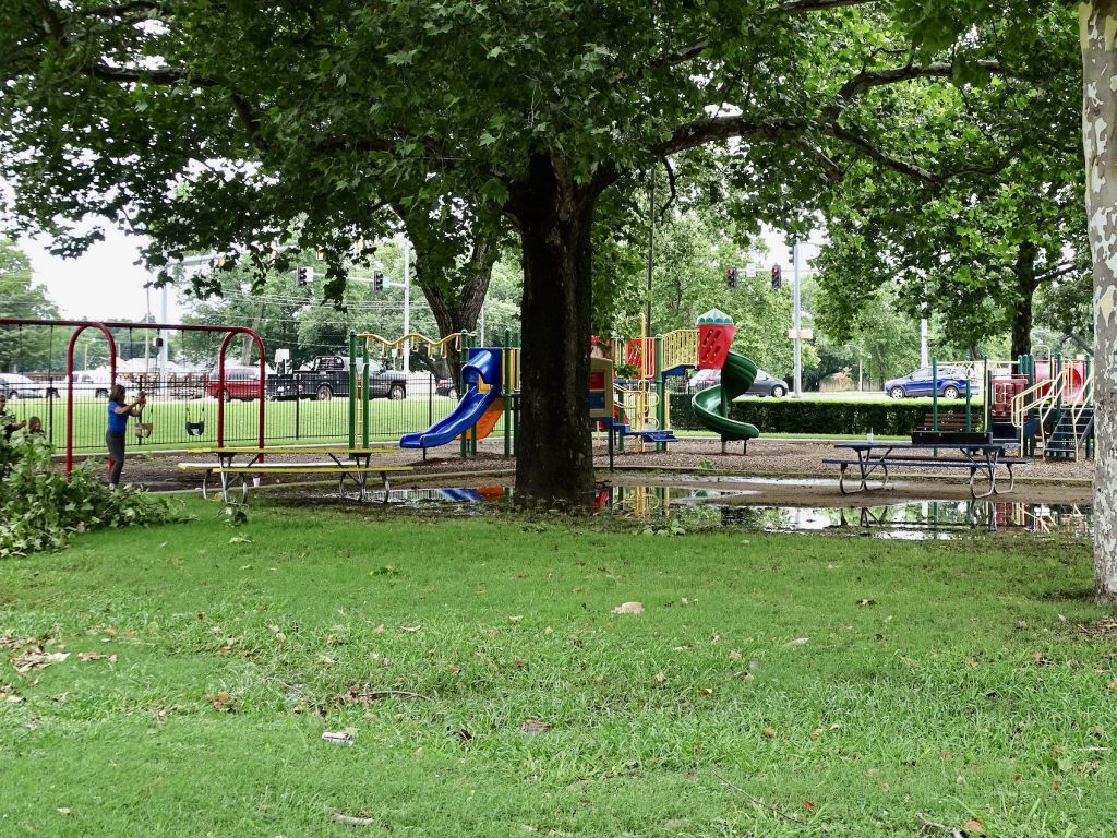
Friday morning started with sleeping in. Well, until 7:30 AM. I’m usually up earlier, but it was still raining, and rain makes me sleep like a baby. Even in thunderstorms and high winds. Mom thinks it’s because she used to go out on the porch to watch storms with me when I was a baby. That’s possible, I suppose. Whatever the reason, it is still the absolute best sleep for me, so bring on the rain. After talking to my sister for a bit, I got my act together to head up to Duncan to take care of chores. The first stop was Southside Laundry, which was clean, had plenty of machines. There were only a few people in the place, so I got all of my loads going and sat down to get a little work done. About a minute later, an old guy sat down beside me and started talking. He was clearly lonely, so I just had to stop and visit with him. No more work. Once the chore was done, I grabbed a bite at Napoli’s Italian Restaurant and got a little work done. (The calzone was delicious and left plenty to take home.) After a couple more errand stops, I headed back to Petunia, stopping to check out Fuqua Park on the way.
Learned Something New Fuqua Park Playground
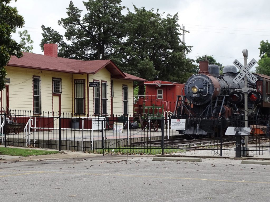
Train Station at Fuqua Trains
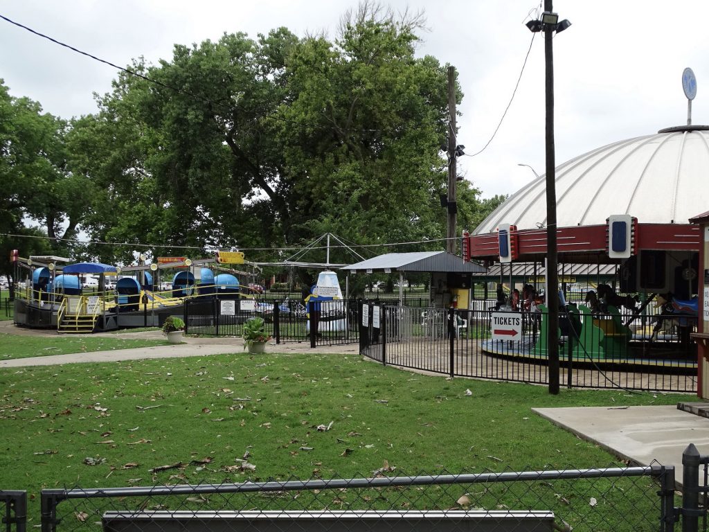
Kiwanis Kiddieland at Fuqua – Open 4 Nights a Week
Pretty Neat – About Five Different Rides
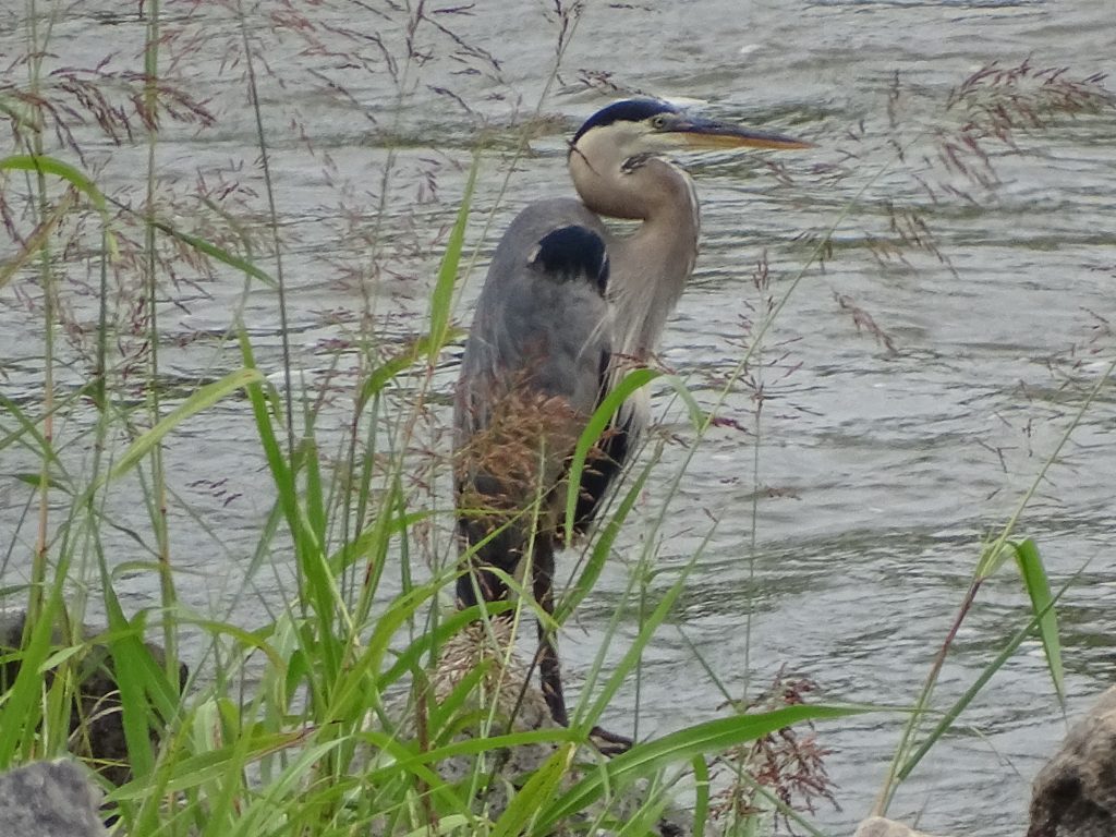
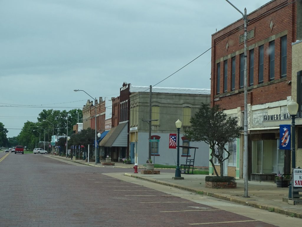
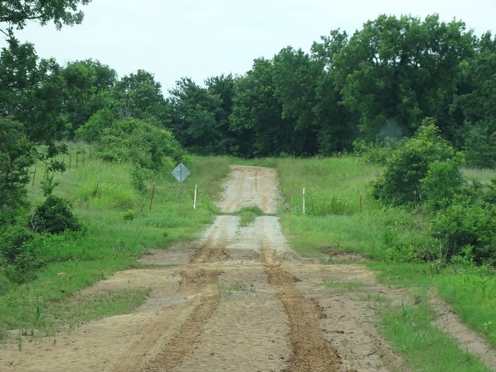
Saturday’s activity was a little road trip around the area. The first destination was the dam. You know MW isn’t going to miss out on that. This area is really pretty. In some places the land is absolutely flat and you can see forever, while in others it has little rolling hills dotted with short trees. It is still mostly cattle country, and where crops are grown, it is typically hay. You also see oil wells spotted around. We checked out the back side of the dam where a few guys were fishing. They must be onto something, because there were quite a few great blue herons standing in the water’s edge fishing, too. Next we headed down to Waurika to have lunch at Bill’s Fish House. MW found this place on TripAdvisor, and honestly, if we’d just been driving by, we wouldn’t have stopped. Mainly because there was no sign…AT ALL. It was in what appeared to be a ranch-style house with no landscaping. We walked in the door and were standing in a hallway with a couple of bulletin boards and a second door in front of us. Still no signage. Perplexing. Through the second door was an actual dining room and people working. That was good, because I was starting to think we were wandering around in someone’s home! The restaurant was started by Bill in 1962, and continued after his death, first by his wife, then his kids, and now his grandkids. The catfish and slaw were really good, too. After lunch we drove a big loop west to get back to Petunia, ending up on a LONG GRAVEL ROAD! WITH A TREE OF DEATH!! NO KIDDING!!!
From the Dam Here Fishy, Fishy, Fishy
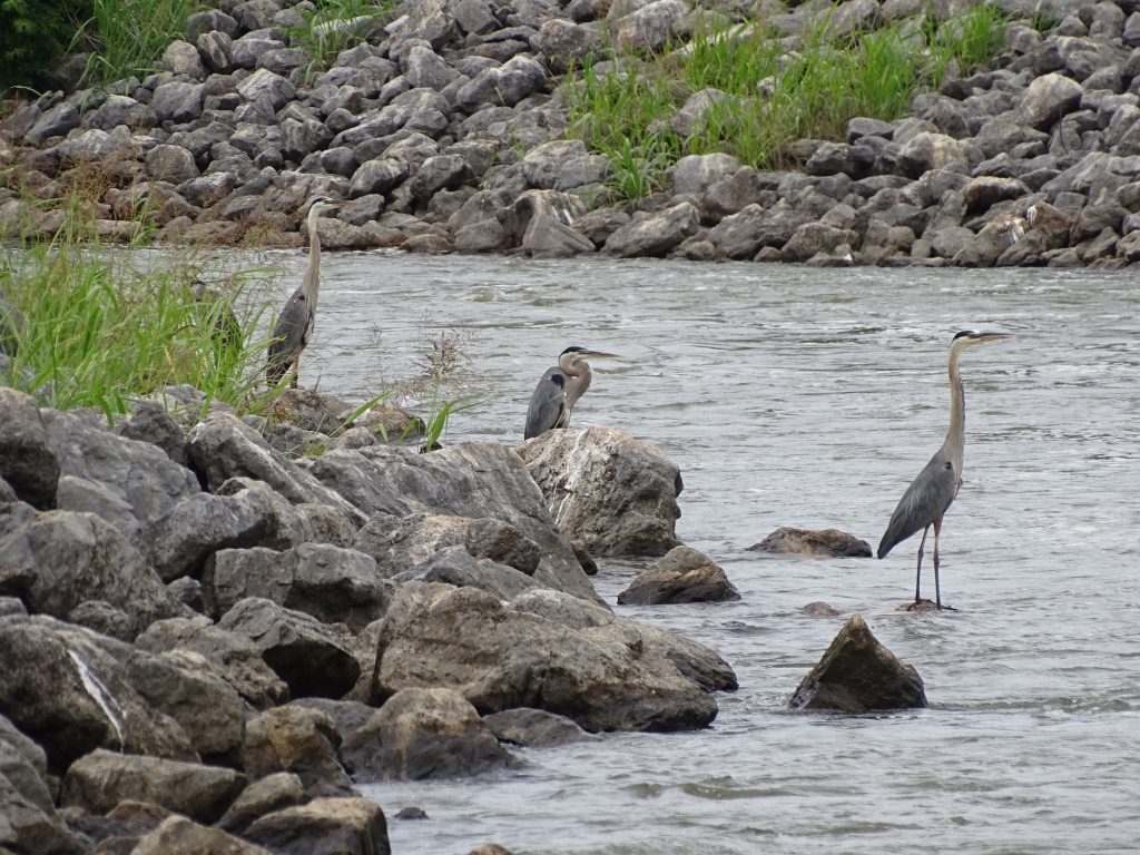
Isn’t He Beautiful?
Waurika Lake Welcome to Waurika
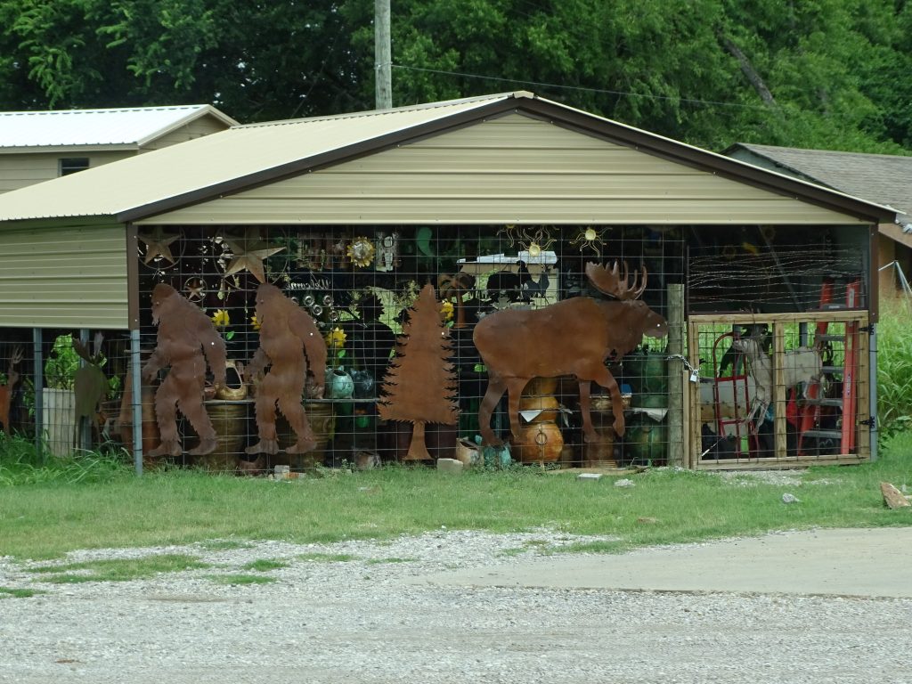
Downtown Waurika Mr. & Mrs. Bigfoot and Their Pet Moose
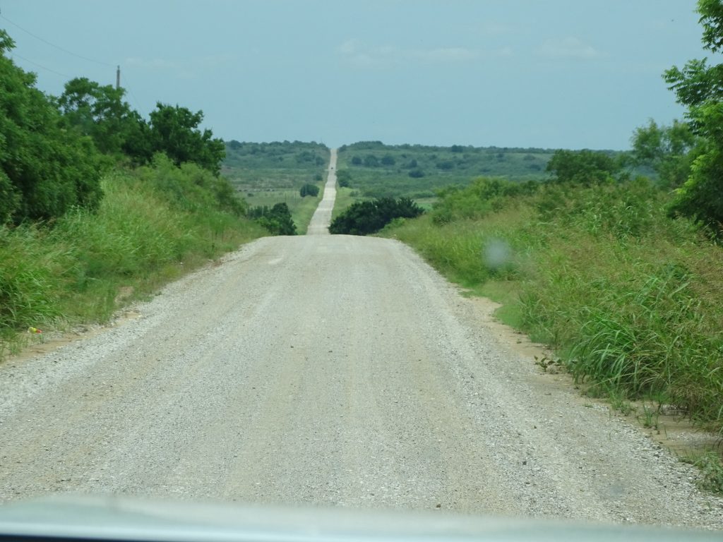
The Roads are SO Straight Awwww…They Decorated for the Fourth
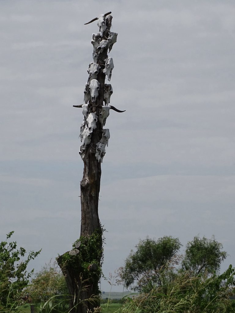
TREE…..OF…..DEATH!!!!
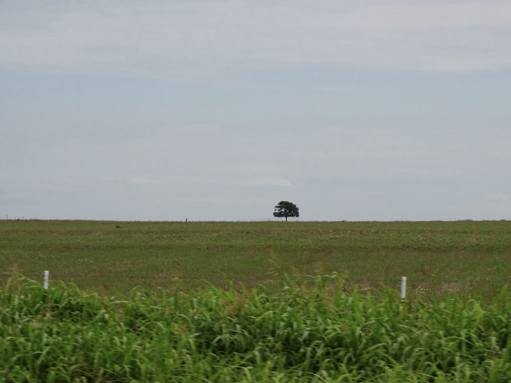
Temple, Oklahoma Lonesome
Sunday it was pajamas, church, and some writing. That’s pretty much it. I need a good pajama day every once in a while.
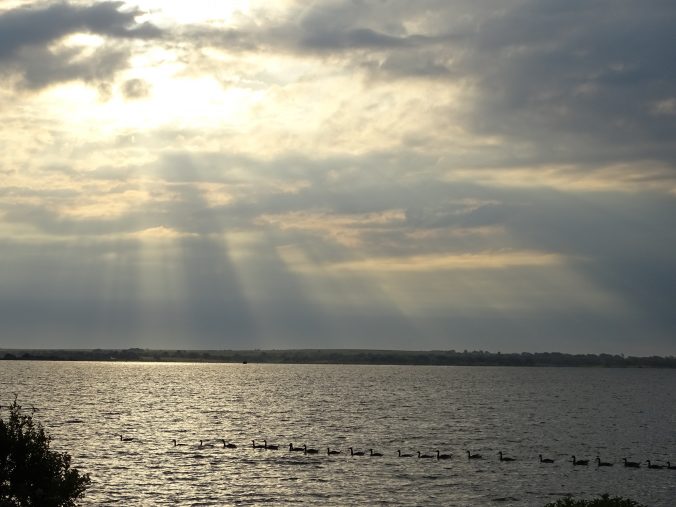
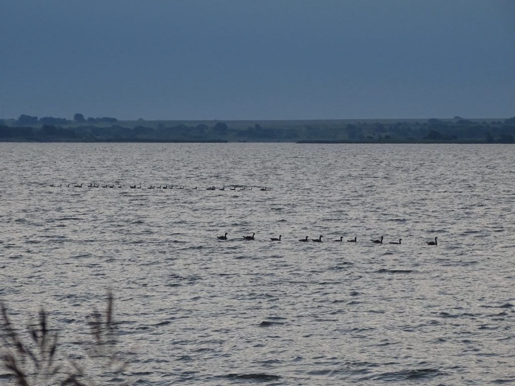
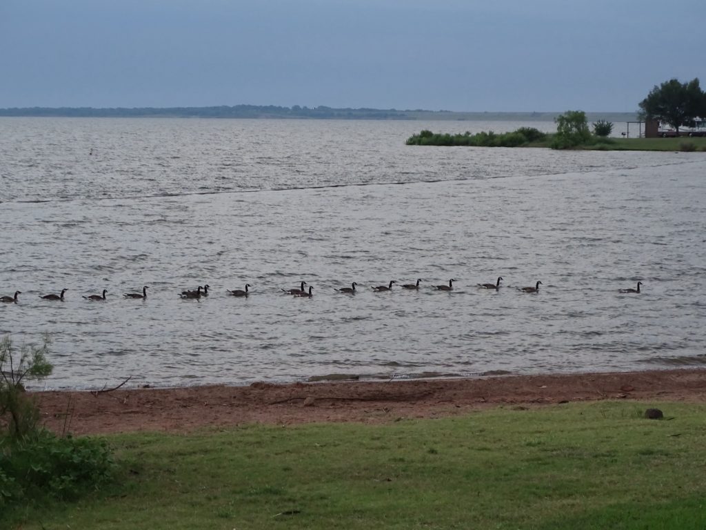
For the few days we’ve been here, we’ve been goose watching. There are hundreds of Canada geese roaming around this park, and they have developed what seems to be a routine. In the mornings, they come floating across the lake. We figure they must start before dark, because the arrival begins just about first light at the beach. They come in lines, some long and some just a few, but it is like a march on a parade ground. Once they arrive, they spend the morning checking around various campsites and picnic tables for droppings from the humans. If it gets too crowded for them, they get back into the water and head down the shoreline, again in lines. They usually come back, and then in the evening, after everyone settles down, they float back across the lake to some hidden place for the night. I have to admit, I loved watching them. REALLY don’t like the mess they leave, though. Thankfully, they didn’t hang around our campsite at all.
Morning Flotilla And Arrival
Breakfast Late Arrivals
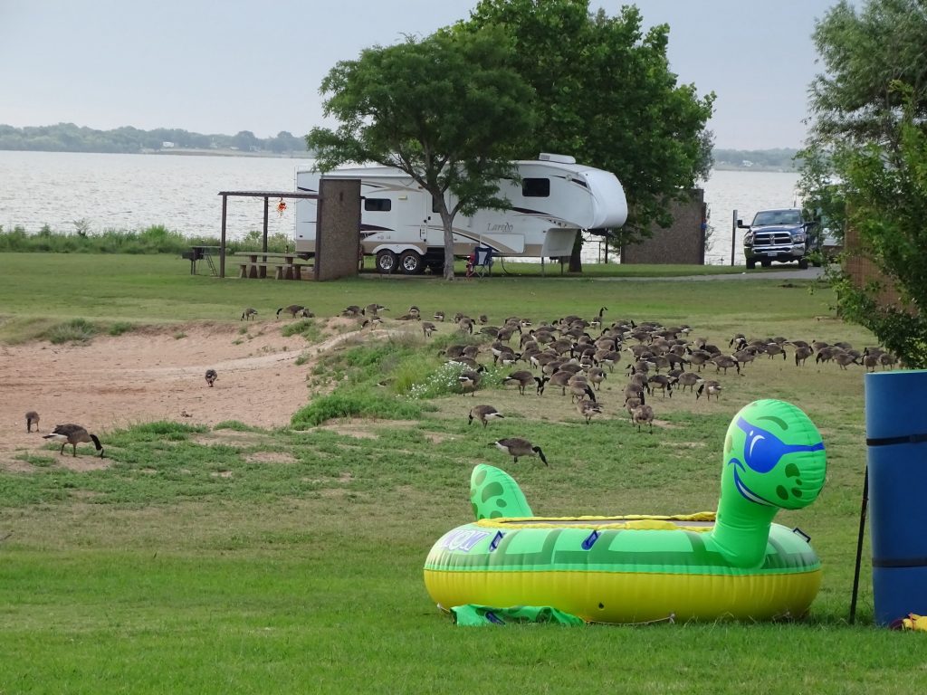
Oops…Too Many People…Time to Float a While
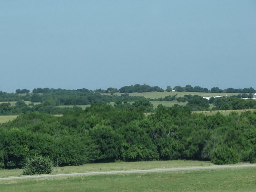
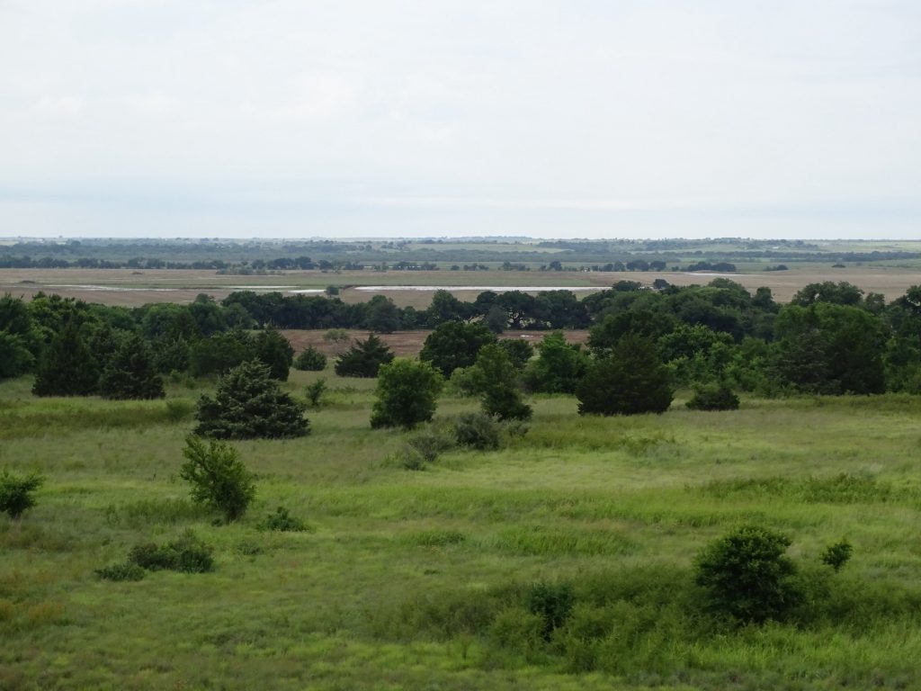
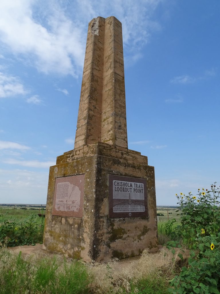
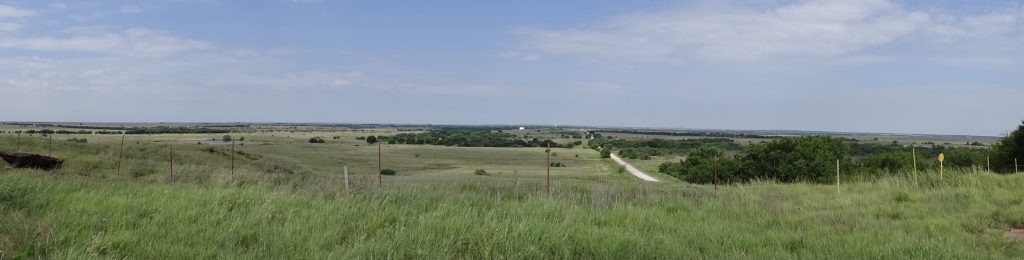
On Monday we woke up to less humidity, which made it perfect for a nice, long walk. (The weather was in the low 80s on Friday after all of the rain, but went back into the upper 80s after that. The humidity has been pretty high, though, which made it a bit sticky.) Later we headed out on a little road trip to the east of the lake. The first stop was a Chisholm Trail monument off of a dirt road. The famous trail is named for Jesse Chisholm, who you would think was a cattleman and a cowboy. Not so. Jesse was a half Scottish half Cherokee native of Tennessee. As a child, he moved to the Cherokee Nation with his mother, then later married and moved to the Creek Nation where he traded furs and eventually set up a trading post. He spoke more than a dozen Indian dialects plus Spanish, and early on also worked as an interpreter and guide. It wasn’t until after the Civil War that he marked what would later become the iconic trail, using it as a means to get his goods to various trading posts. Later when Texas cattlemen were looking for a route to drive huge herds to the railhead in Abilene, they used Chisholm’s trail, later renaming it the Chisholm Trail. Over the years millions of longhorns were driven up to Kansas on the trail that basically runs from Austin through Waco and Fort Worth, then crosses the Red River and passes through central Oklahoma and into Kansas. The drovers used a series of landmarks to keep on track. One of those is a hill in the otherwise flat land about 2 miles east of present day Addington, Oklahoma.
I’m Watching You!
Panorama from the Hill
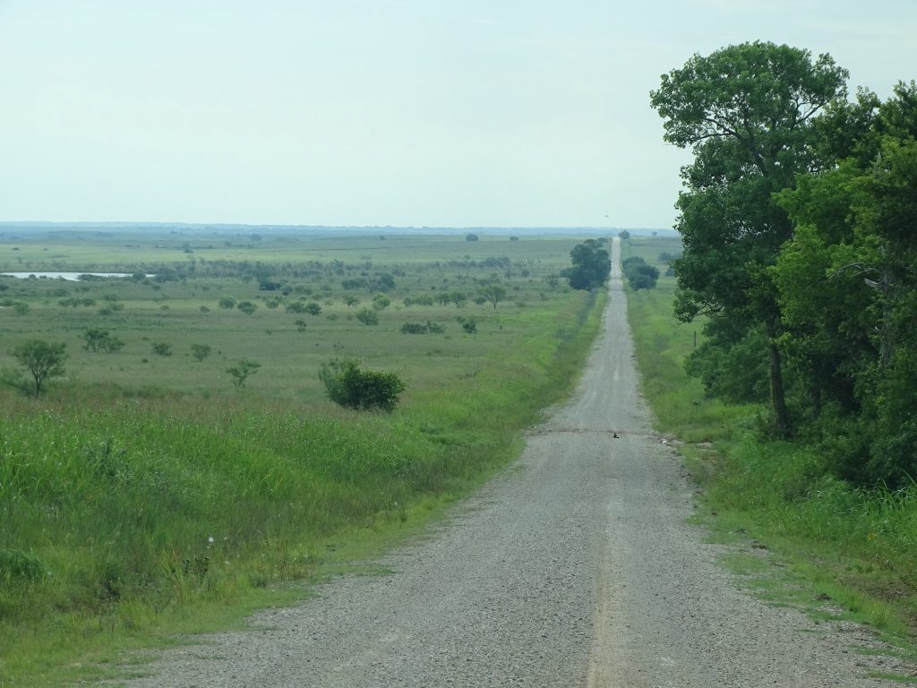
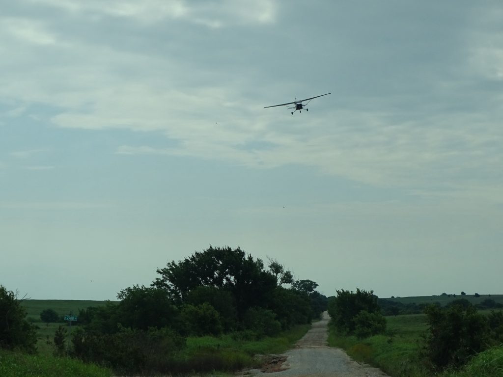
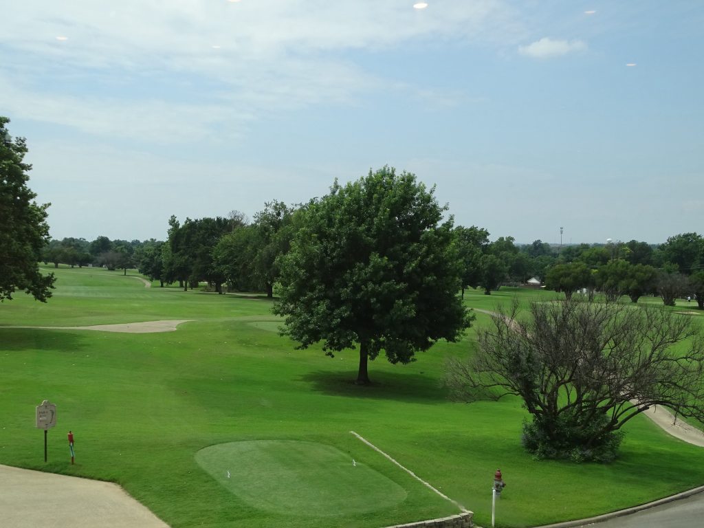
As we pulled back out onto the dirt road, I noticed a dead cow right at the fence. So sad. Poor thing’s skull might end up on the tree of death. As we were driving east on the dirt road, a plane came over the horizon that seemed to be following the road and was very low. As it got closer, it was descending and flashing its lights at us, making us wonder if the pilot was in trouble. It disappeared over the hill behind us, still seeming to descend, so we decided to turn around to make sure the guy didn’t crash. As we topped the little rise, we saw him, still very low, way down the road, so we assumed he was okay. We turned around again, and after a bit, the road seemed to get smaller and had grass growing up in the middle. We were thankful for 4-wheel drive and that we didn’t have Petunia behind us. Eventually we made it to OK-89 and turned north to OK-7 and turned towards Duncan. Our original plan was to eat at Aces Sports Grill in the Chisholm Trail Casino, which had great reviews. Sadly, we walked through the doors and were greeted by the smell of cigarette smoke. Neither of us can handle that, so we turned around. Plan B was Wishbone Scratch Kitchen at Duncan Golf & Tennis Club, which turned out to be a nice place with a view. MW ordered the Skillet Cheese Fries that had the added bonus of smoked chicken and jalapeños…yum! Then I had the Fish Tacos and he had the Meatloaf Melt. My tacos were pretty good with a little sweet and a little spice. His sandwich was a little dry, and he wouldn’t order it again. They had really good slaw that was just a touch too salty, but had a very interesting, savory flavor. We’d go again, for sure.
The Long and NOT Winding Road Descending Towards Us
Grass in the ROAD! View for Lunch
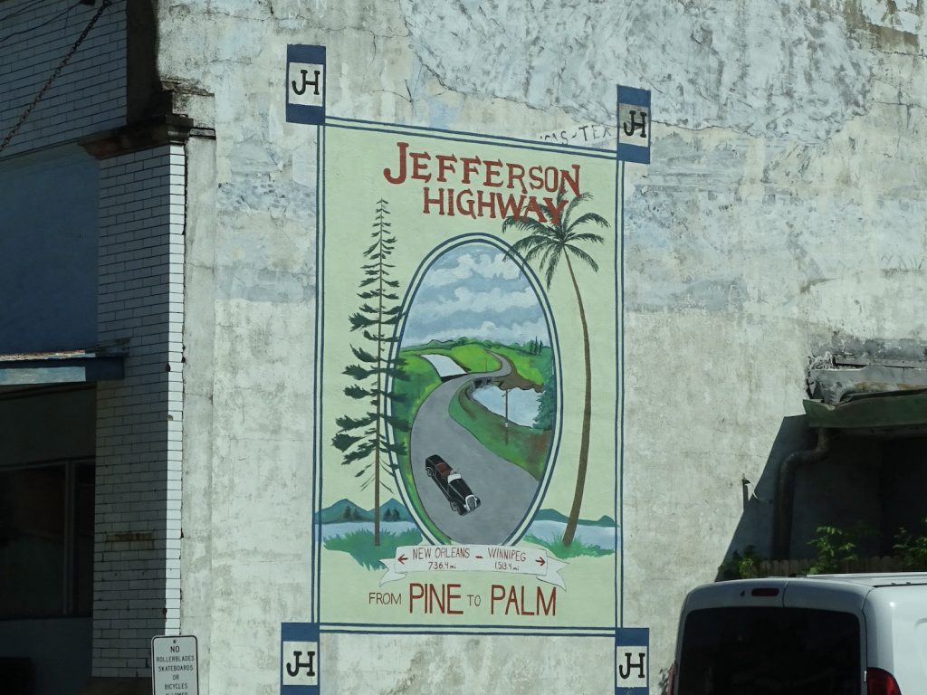
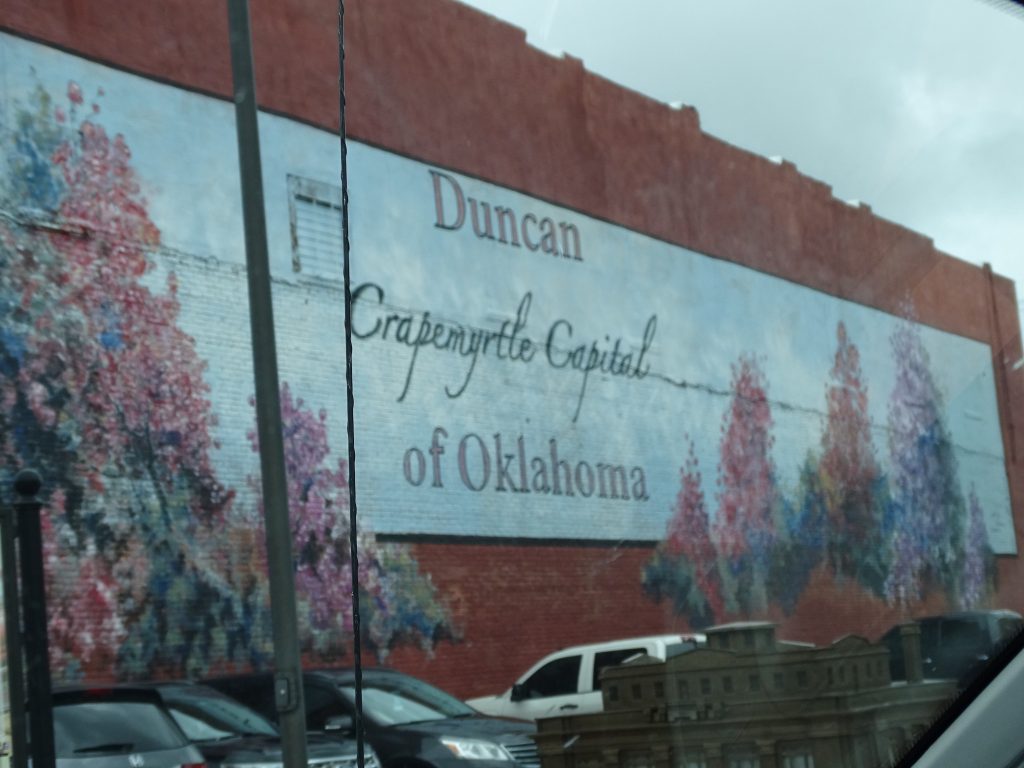
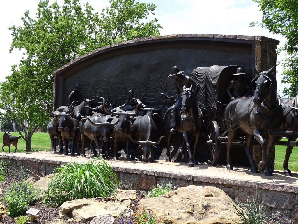
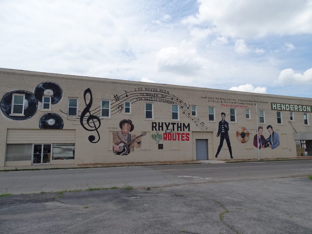
After lunch, we stopped by the Chisholm Trail Heritage Center. We knew it was closed, but wanted to check out the life-sized monument out front. They also had a cool sidewalk inlay that showed the route of the trail, including the start, finish, and all of the waterways crossed. Next we headed downtown to check out a cool mural. It seems that Hoyt Axton’s mother, Mae, was the author of Elvis’ famous song “Heartbreak Hotel”. She wrote it on a napkin while sitting in the lobby of a little hotel in Duncan, Oklahoma. The building is no longer a hotel, but there is a cool mural with Mae, Elvis, and Hoyt down the side.
“On the Chisholm Trail” by Paul Moore
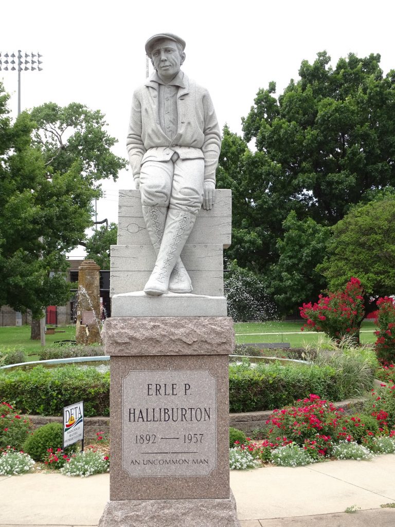
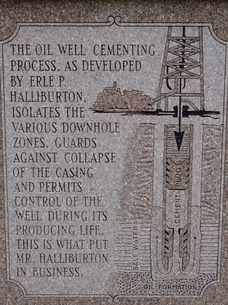
Next we went over to Fuqua Park so MW could check out the trains, then across the street to see another statue. We’ve probably all heard of Halliburton Company, but I didn’t know that its foundation was laid in Duncan, Oklahoma. Erle P. Halliburton was born on a farm near Henning, Tennessee, in 1892. After kicking around in several jobs and serving 5 years in the Navy, he went to work for Perkins Oil Well Cementing Company in California. Mr. Perkins was not too keen on Erle’s constant suggestions for improving his process, so he was fired. Later in life he said “the two best things that ever happened to me were being hired, and fired, by the Perkins Oil Well Cementing Company.” With his wife, Vida, he moved first to Texas, then ended up in Duncan, Oklahoma. There Erle patented a new method of oil well cementing that was later tested in the oil fields of Texas and Oklahoma. In 1919, using the new method, he established the New Method Oil Well Cementing Company, which became Halliburton Oil Well Cementing Company in 1922 and Halliburton Company in 1961. He didn’t stop there. He founded Southwest Air Fast Express in 1928, and in 1938 invented the aluminum suitcases that are still sold by Zero Halliburton. He died at the age of 65, but not before being granted 38 patents for oilfield services and tools and miscellaneous inventions. He lived to see his oil field services used on all seven continents and offshore and was the largest employer in Stephens County, Oklahoma. There is still a HUGE Halliburton facility east of Duncan today.
He Truly Was That In Case You Want The Technical
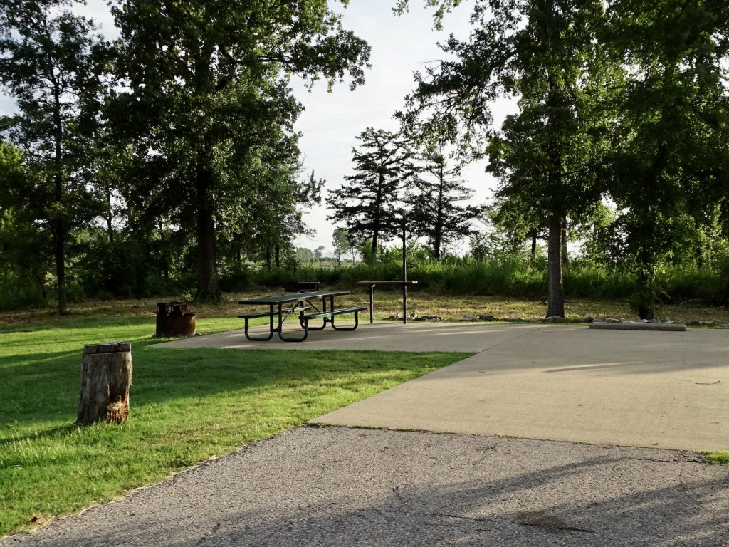
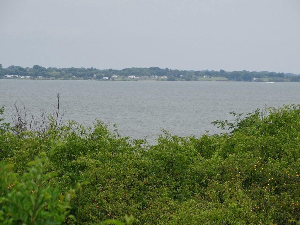
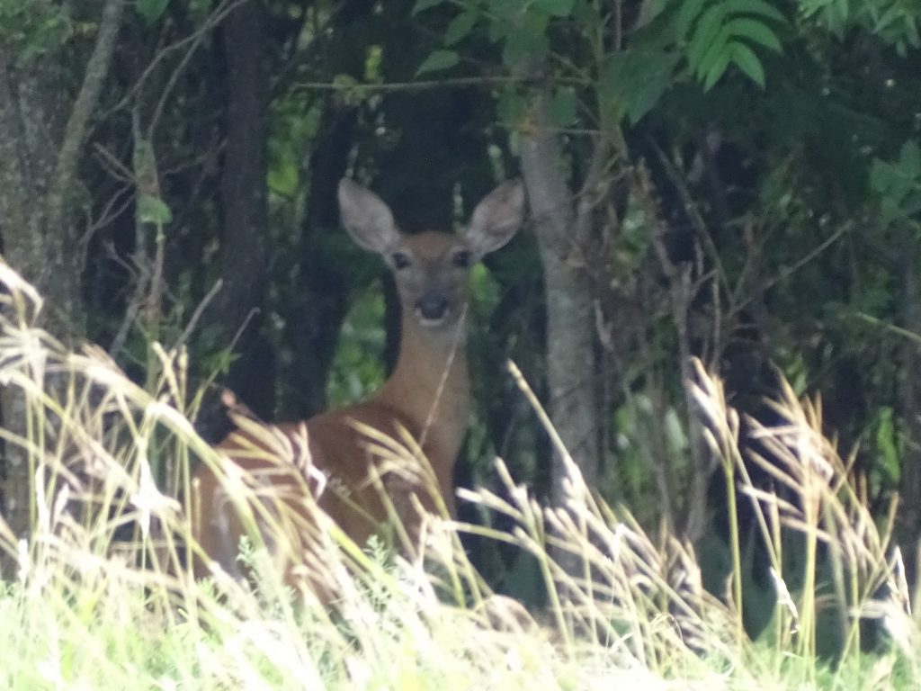
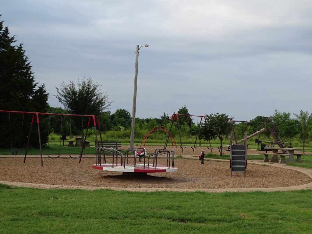
Kiowa Park I is near Hastings, Oklahoma, on Waurika Lake in the southern part of the state. Although they allow hunting in season, the lake is the center of activity, with boating, fishing, and water sports. The park has a large beach area, two boat ramps, a dock, and playground. The campground is spread out in loops along the lake, and the 30-amp electric and water sites are fairly well-spaced. Most have a lake view, but there is not much shade, and there are grills and sheltered picnic tables. There are quite a few pull-throughs that face the water, though, and the lake almost always gives you a good breeze. The bathhouses are older and were very hot and not kept very clean. Although the lady at the gate said they were cleaned daily, they were covered with dead bugs. The beach is open to day use, so that facility gets trashed pretty quick. Also, some of the campground loops only have toilets and no showers. They also have a group camping area that is set up as two separate loops with a large pavilion in the middle of each. The surrounding park is all grassland and low trees, and in addition to the geese along the lake, deer and rabbits are seen regularly. We were there over the Fourth of July, so it was full and a little noisy, but we would definitely go back. For this stay in July of 2021, we paid $90 for five nights. It is one of the cheapest parks we have stayed in at $15/night with water and electric.
Petunia from the Beach Bathhouse
Pull-Through Site Picnic Area
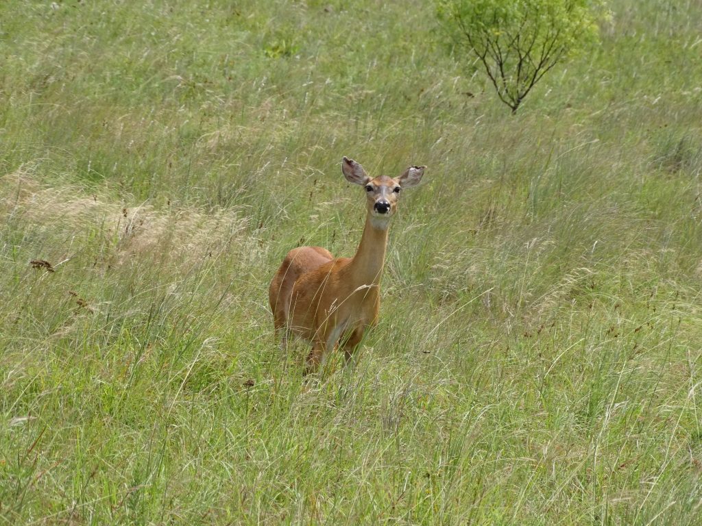
Playground See Him Looking at You?
Pull-Through Sites on the Water Boat Ramp
Group Camp Circle You Guys Leaving So Soon?
Whew, I told you it was a lot. My fingers are hurting! Next up…A Canyon, Amarillo (Yes, In Texas), and a Creek with Coyotes. See you on the path!
Talisa
P.S. Hit the follow button below to be notified of new posts and please SHARE, SHARE, SHARE on social media!