QUOTE FOR THE WEEK: “Always be a first-rate version of yourself, instead of a second-rate version of somebody else.” ~ Judy Garland
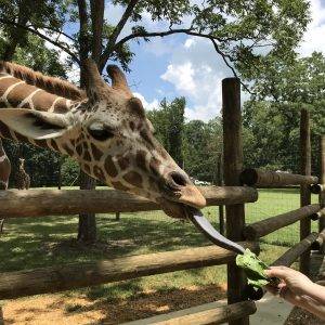
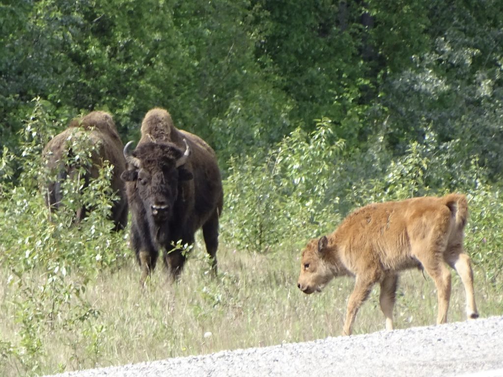
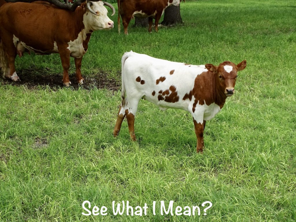
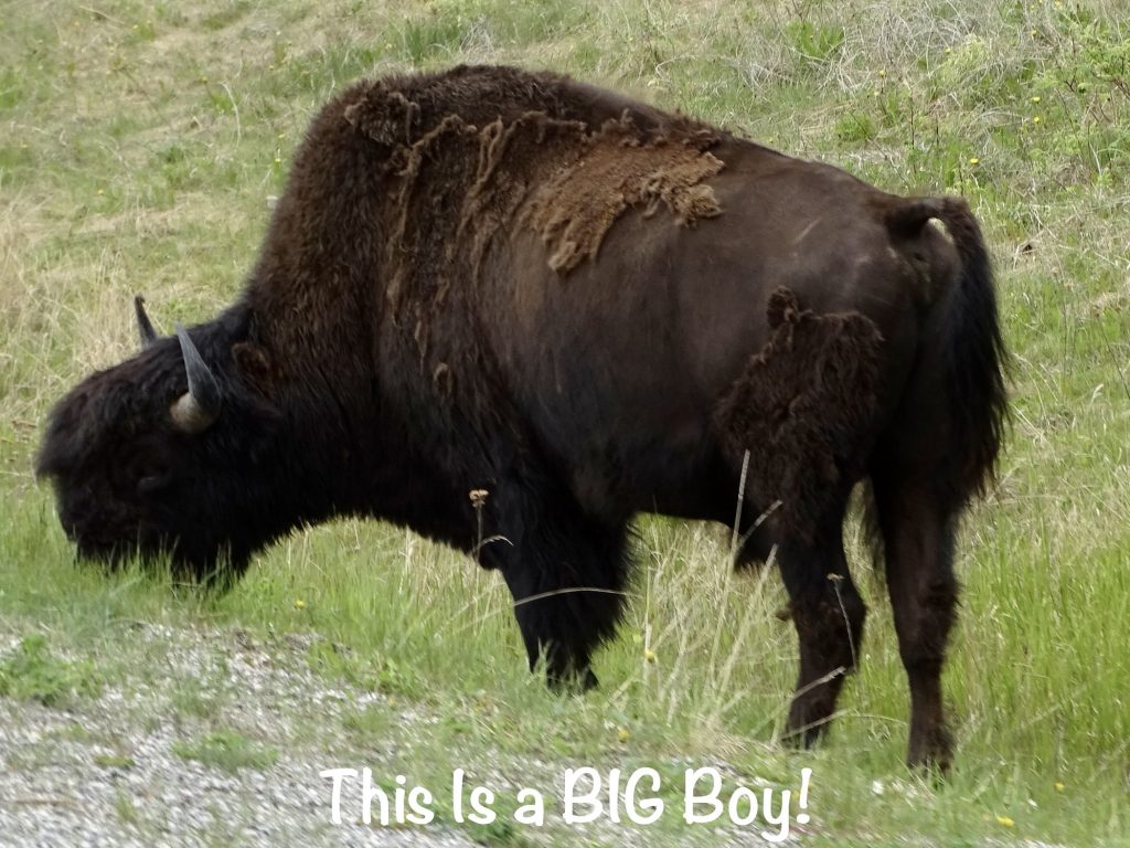
On Monday, June 6, we didn’t have too far to go, so took our time getting up and out. After everything was hooked up and ready, we went to the cafe to have breakfast…a bison burger. Yes, you read that right. I just couldn’t help myself. Coal River’s was so good that we both needed one for the road. Afterwards, we said our goodbyes and headed further north on the Alaska Highway. Just a few miles up the road we ran into a large herd of wood bison with at least four little ones. Bison young are precocial and can protect themselves by kicking and running soon after birth, often the same day. They look like adorable, little hairy cows. I joked that we should take one back to Sneedville. Some of the neighbors might have questions when it grew a bit, though. LOL.
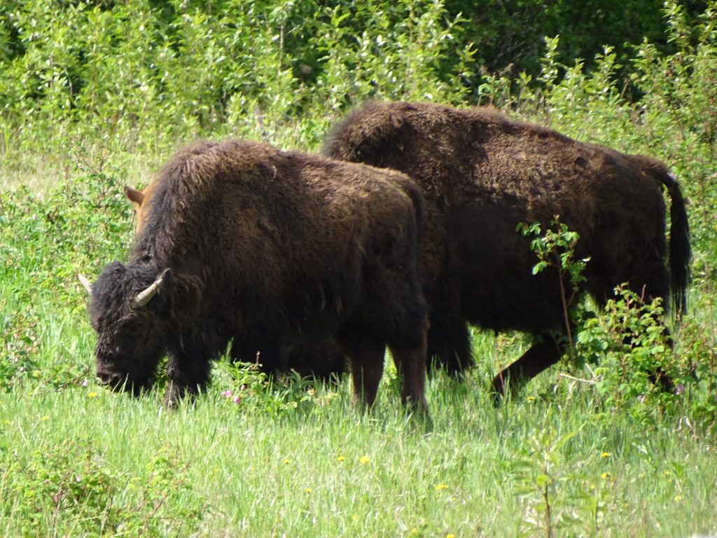
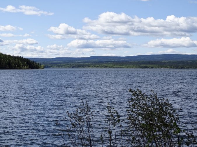
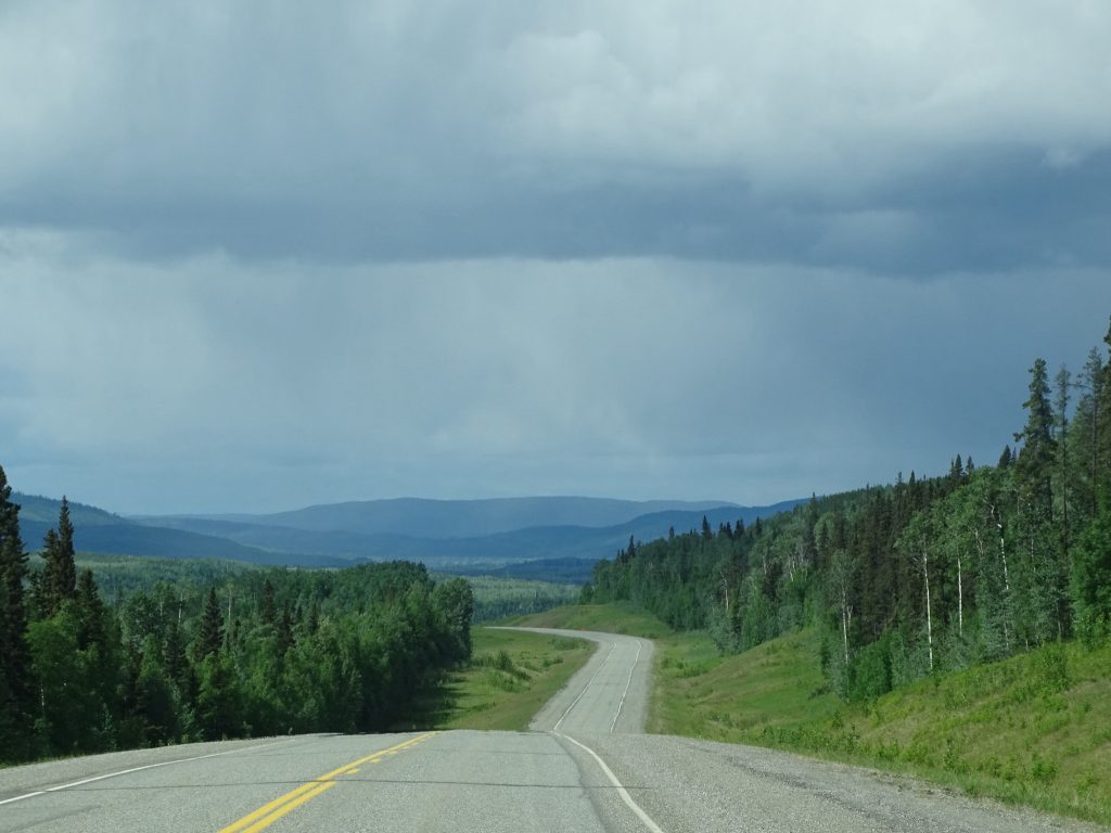
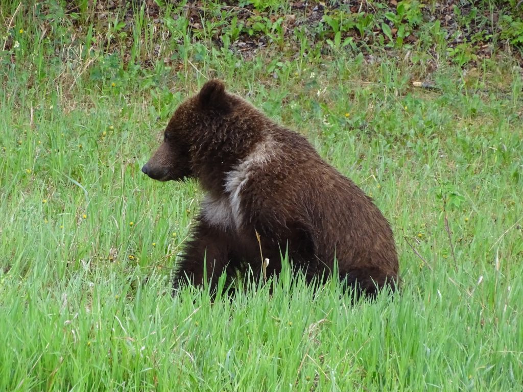
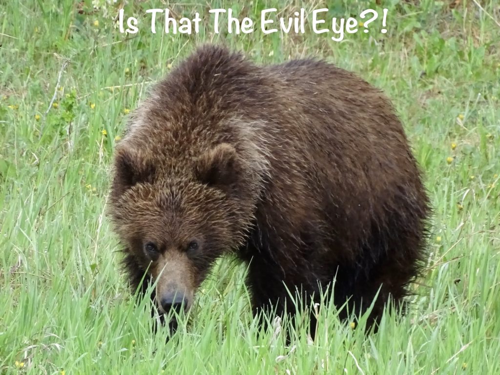
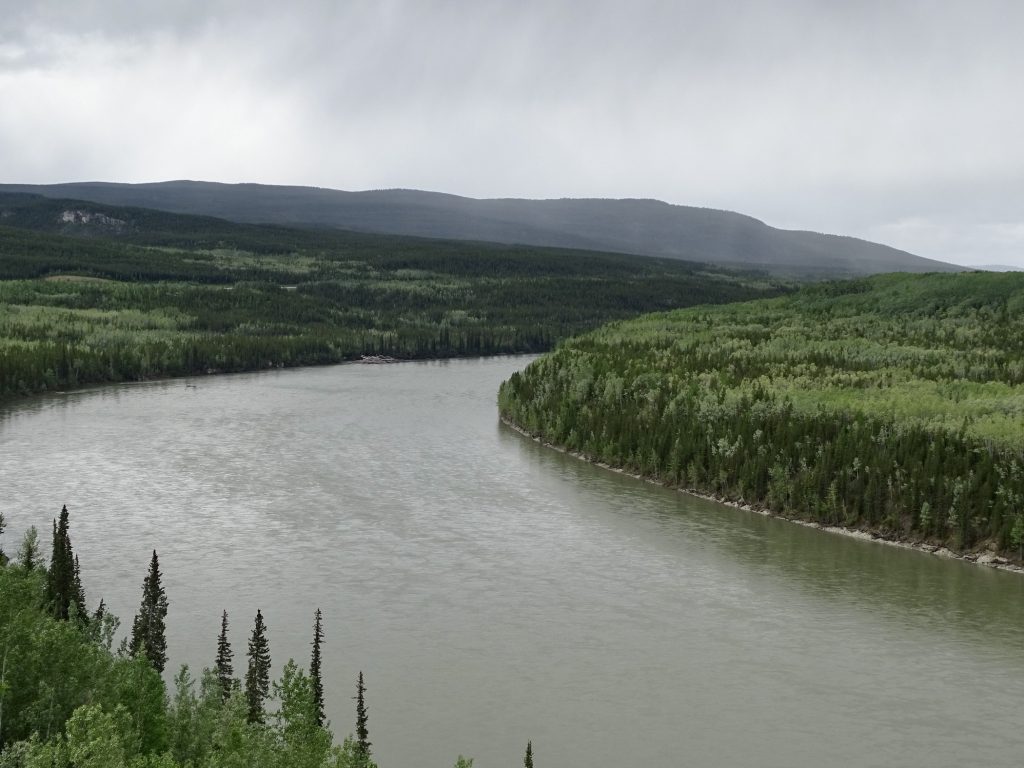
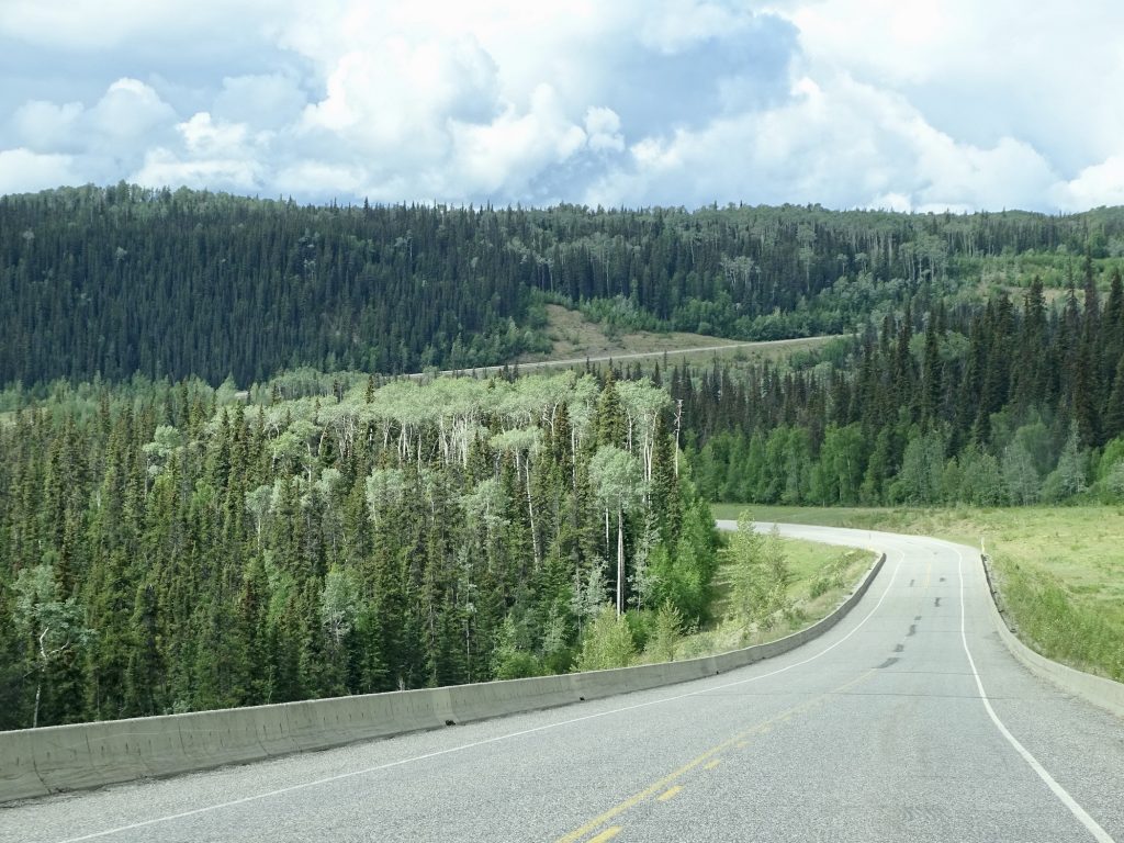
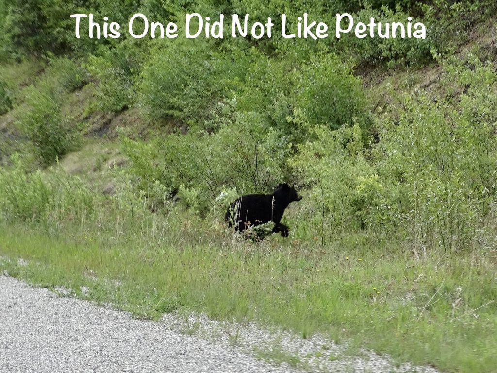
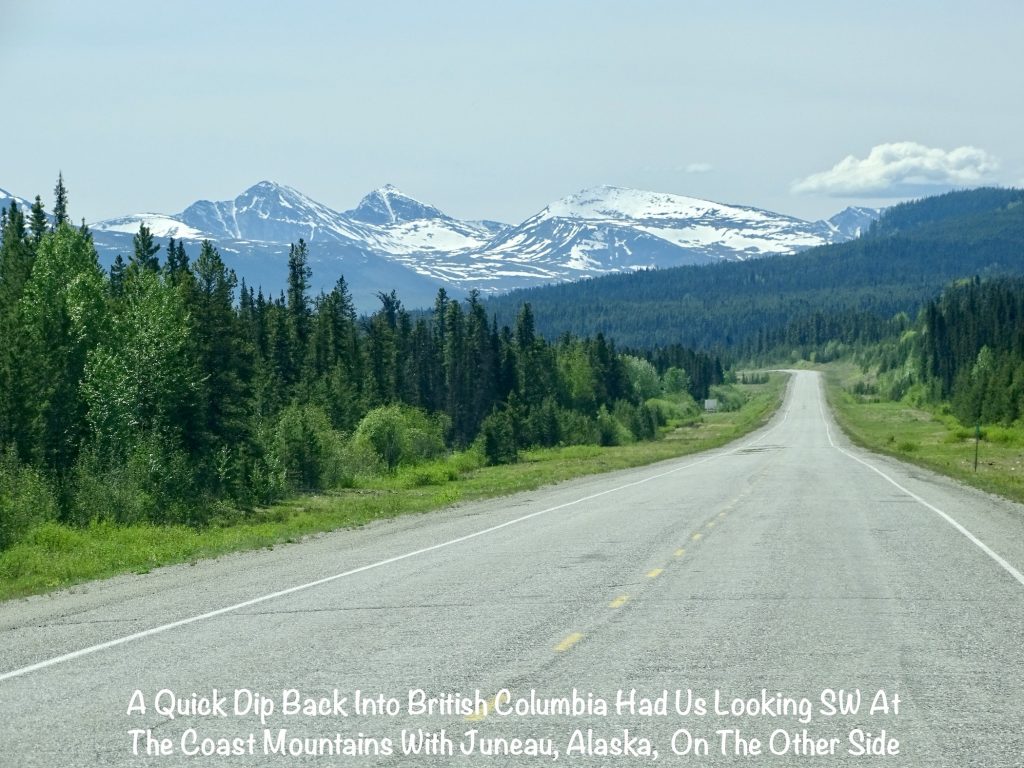
It was partly cloudy when we left, but there were some very grey and stormy-looking clouds before too long. Thankfully, we only hit a bit of drizzle and no real storms. I told Mr. Wonderful (MW) that a grizzly bear, fox, wolf, and mountain lion were on my list. He said “good luck with that”. About 10 minutes later we came upon the prettiest grizzly relaxing by the road. He had a white collar from his shoulders around to his chest, which we thought was unusual. MW pulled off so I could get pics, and the beautiful fellow hung around for a little photo session. Further down, we saw another grizzly in the edge of the woods digging at something. Our only actual stop for the day was at the Liard River overlook, where we stretched our legs and enjoyed the view. Before stopping for the day, we passed three more herds of bison, a fox trotting along the road with a stick in his mouth, and a black bear. We checked in at the Downtown RV Park, where the guy called us “three day Jones”. That just goes to show you how many people pass through here and stay only one night. Once set up, we did a little stocking up at the grocery store, then drove through town.
On Tuesday I slept late, thankfully. As I told you in the last post, we now have very little actual darkness. I am adjusting, but still have occasional trouble getting to sleep. I know, I know…we could put towels or something over the windows, but I also get really hot at night and can’t sleep without the fresh air. (I am NOT a DIVA. Stop thinking that!) As it is now, we pull the shades down, but leave a little bit open along the bottom to allow for air circulation. Monday night I finally got to sleep around 11 PM and was sleeping soundly when the explosions began. Someone decided that 2-1/3 hours of light was just too much, and set off fireworks after midnight. Ugh! The day ended up being grey with rain off and on, which was perfect for pajamas. I took care of some actual work and writing, and MW took a walk during a break in the rain. That was really about it except for some tv in the afternoon. I’m glad we built in time for “nothing” days, since I need them occasionally.
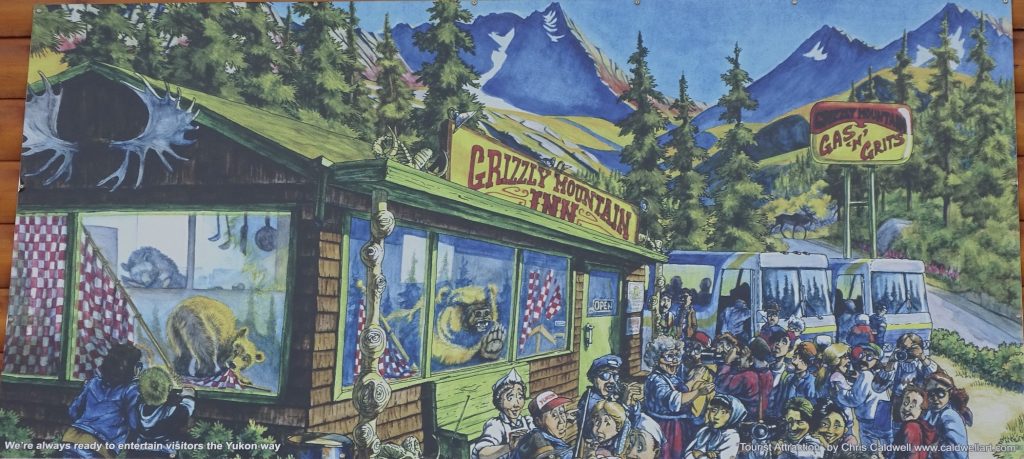
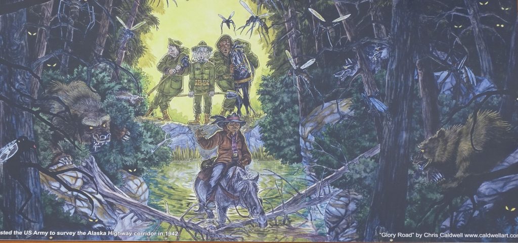
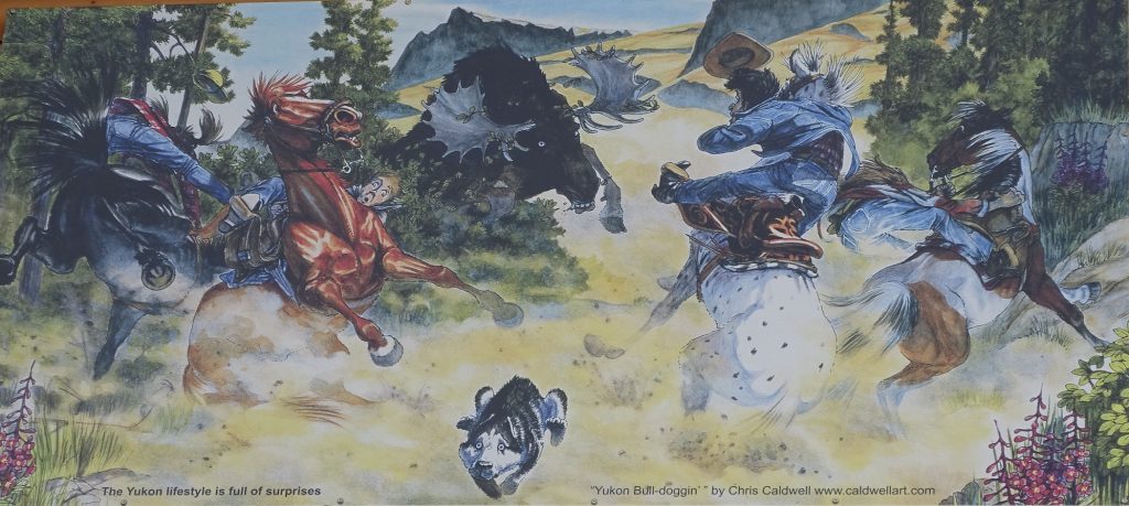
Wednesday morning I finished up some tax work (yes, there are still people who have not given me everything) and did a little cleaning before getting dressed. Later we walked over to Andrea’s Restaurant, a diner in a local motel, to grab a bite. There are quite a few murals by Yukon artist Chris Caldwell around the exterior of the hotel with funny takes on the gold rush, Alaska highway tourists, etc.
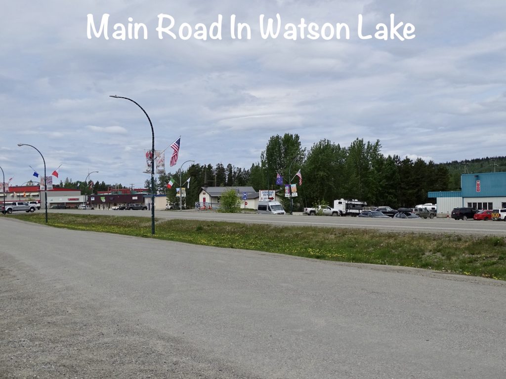
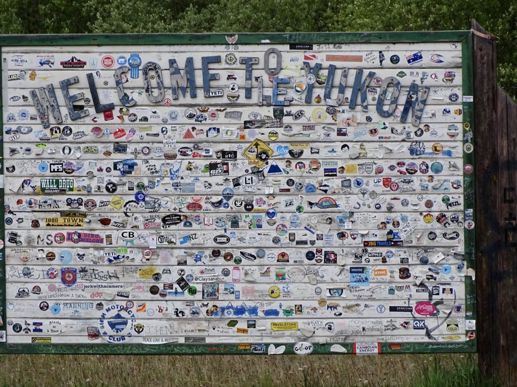
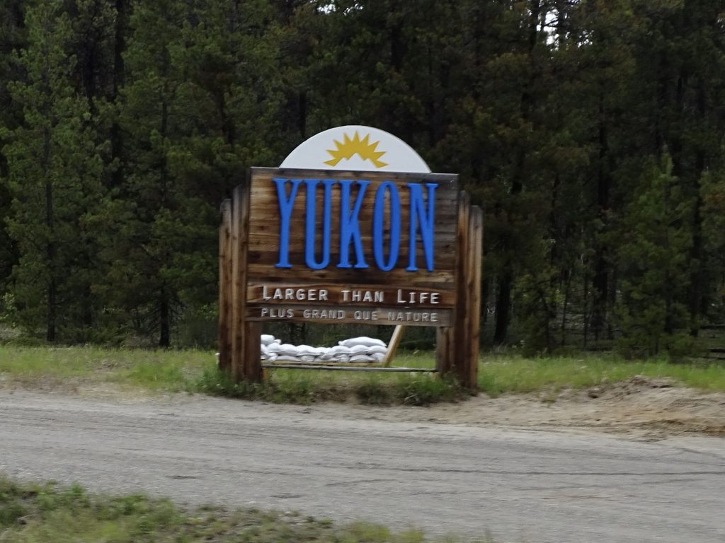
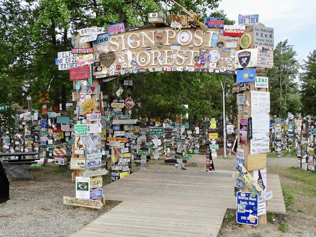
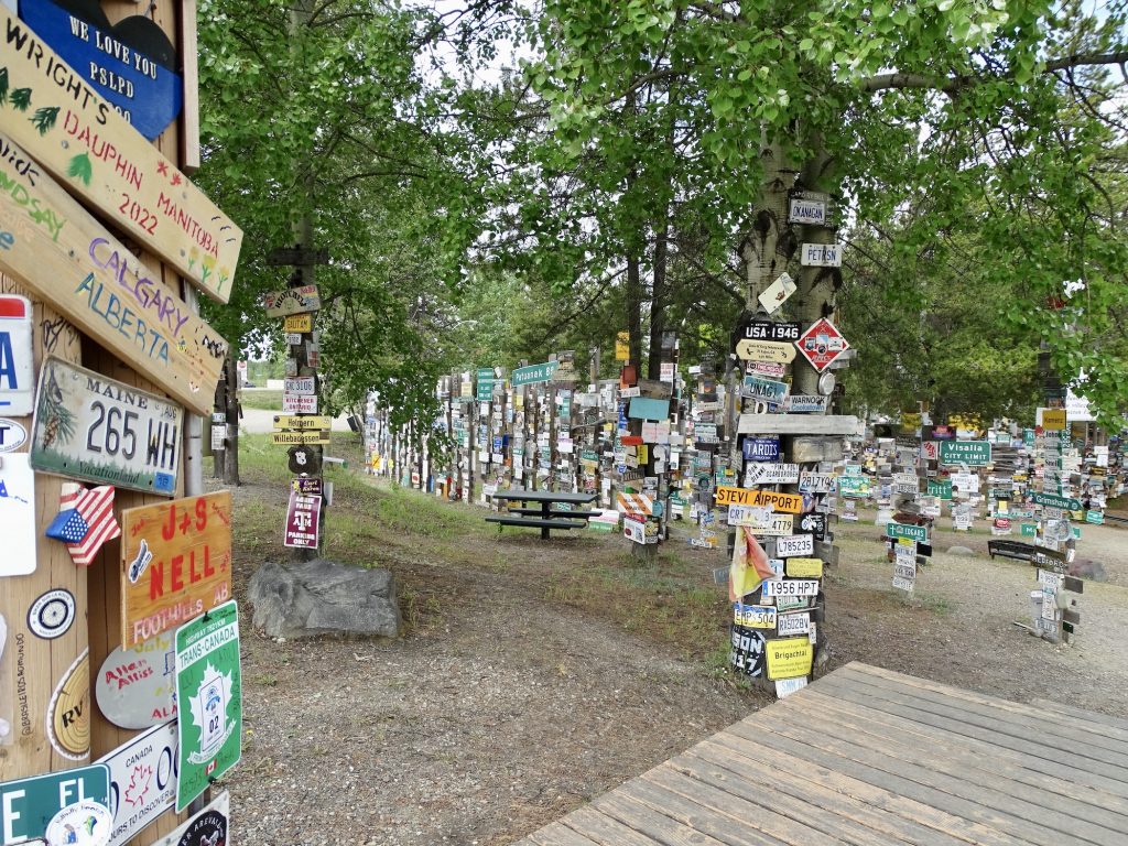
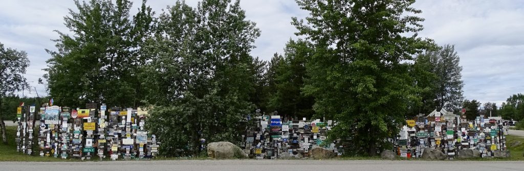
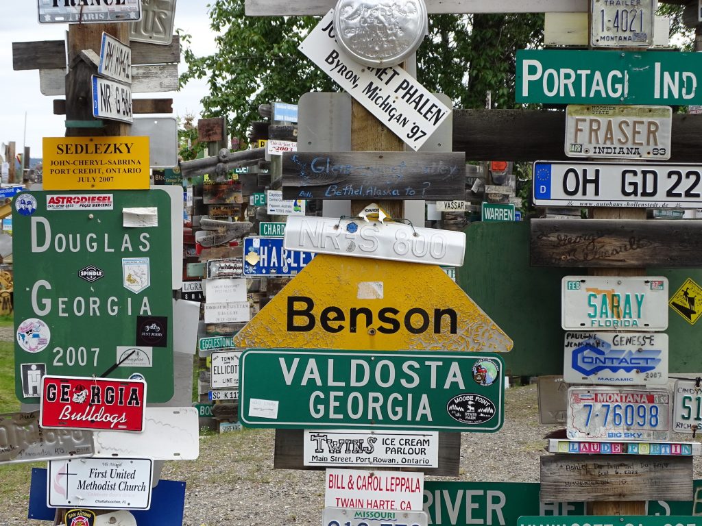
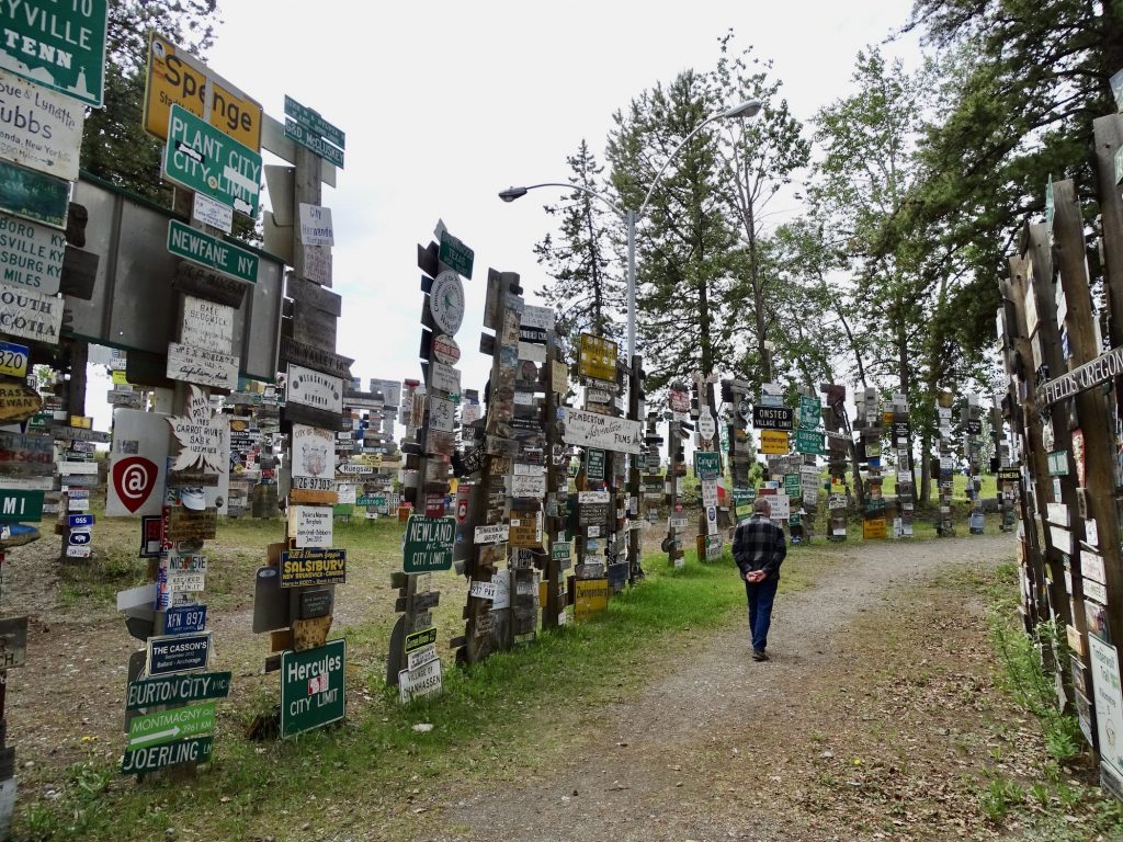
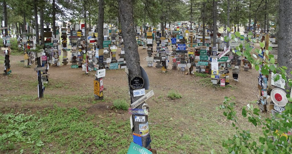
Watson Lake is the first town on the Alaska Highway above the 60th parallel and the “Gateway to the Yukon”. The area has a population of around 1200, but you can walk the town on the main road, end-to-end in about 10 minutes. That is what we did after breakfast to go check out the main attraction, the Sign Post Forest. U. S. Army Private Carl Lindley, of the 341st Engineer Company, was injured during the building of the Alaska Highway in 1942. He was sent to what would become Watson Lake to recover and given light duty maintaining directional signs. He decided to pay homage to his part of the world, and added one to Danville, Illinois, almost 2,700 miles away. Today one man’s homesickness has grown into a literal forest of over 100,000 signs from all over the planet. This world-famous landmark, which was even featured on a KitKat wrapper, is pretty cool. It would probably take days to read all of the signs that range from homemade pieces to license plates to street signs. You can even leave your mark with your own sign. After spending a while wandering through and reading signs, we headed over to the Visitor Center next door. There we watched a movie about the building of the Alaska Highway and took in the related exhibits. Later we traded some dvd movies in the RV park office, and I walked over to the grocery store for a couple more things.
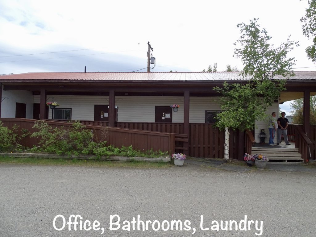
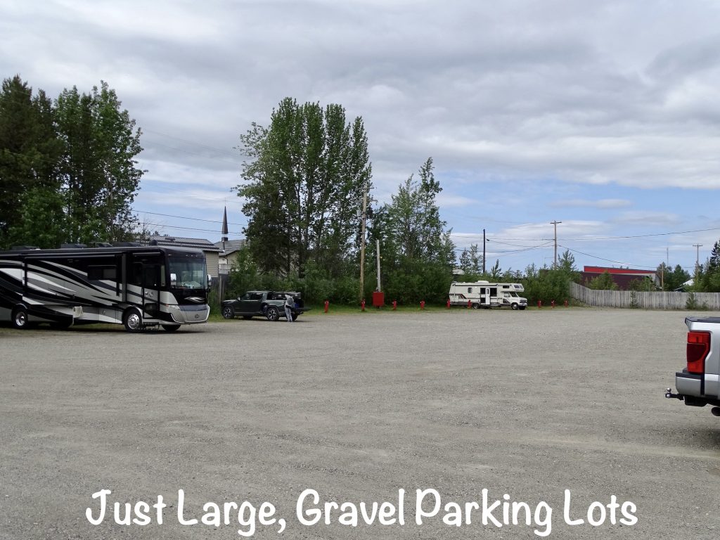
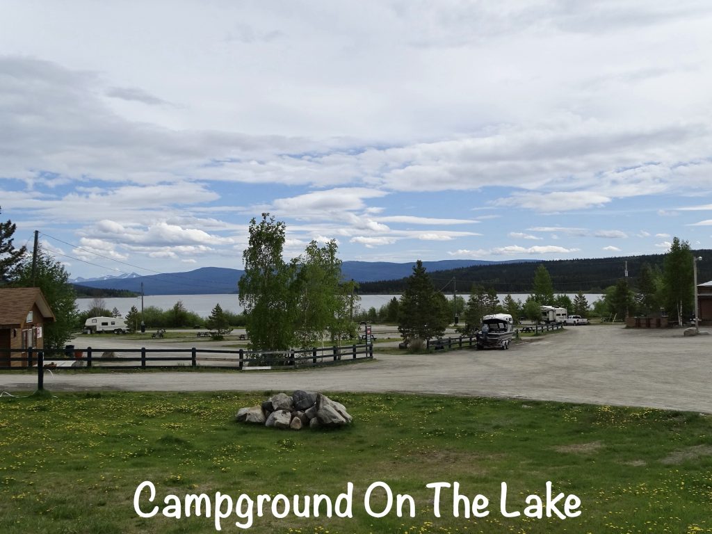
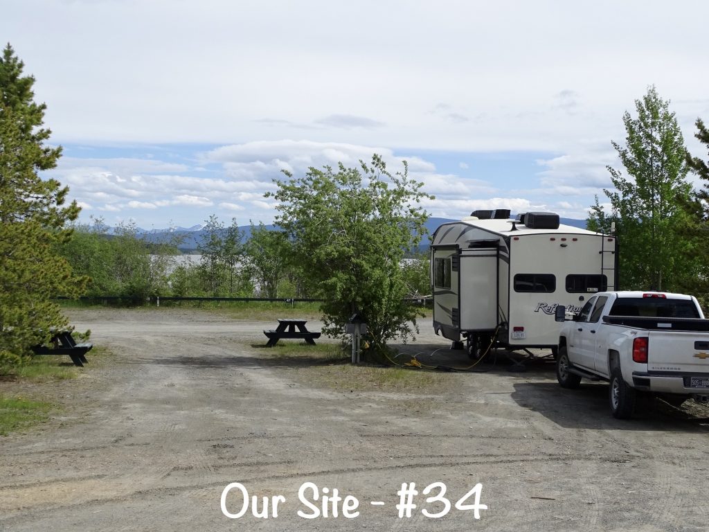
The Downtown RV Park was better than I expected. It is right in Watson Lake across the side street from the grocery store. The main building includes the office, men’s and women’s showers/bathrooms, and a nice laundry with several machines. Everything is clean and well-maintained, and the Scottish guy running the place is a hoot. The campground is basically two large, mostly dirt, parking areas. The main lot is really stacked in and looks a little like an RV store when they are all full. Spacing in the other lot is a little looser. Sites are a combination of 50-amp or 30-amp, and pull-through or back-in. There are a few full-hookup, but most are water and electric with cable tv. Oh, and there was a coin-operated RV wash on site, but you need to get the loonies from the office. (Apparently, it doesn’t like the newer ones, so he keeps a bunch of older ones on hand.) Cell data and voice signals were strong for Verizon, and our AT&T phone would make calls, but did not want to bring up any internet sites. For a quick stay on the way to Alaska, we would stop here again. On this visit in June 2023, we paid $139.50 for 3 nights.
SIDE NOTE: I’m REALLY missing state parks! The provincial park campgrounds in Canada look great, but most don’t have any hookups. While we could certainly boondock overnight, our rig and habits are not set up for 3-4 days without electricity. The people we’ve met, and the scenery have been terrific so far, but I will enjoy parking in the woods somewhere for a few days when we hit the lower 48.
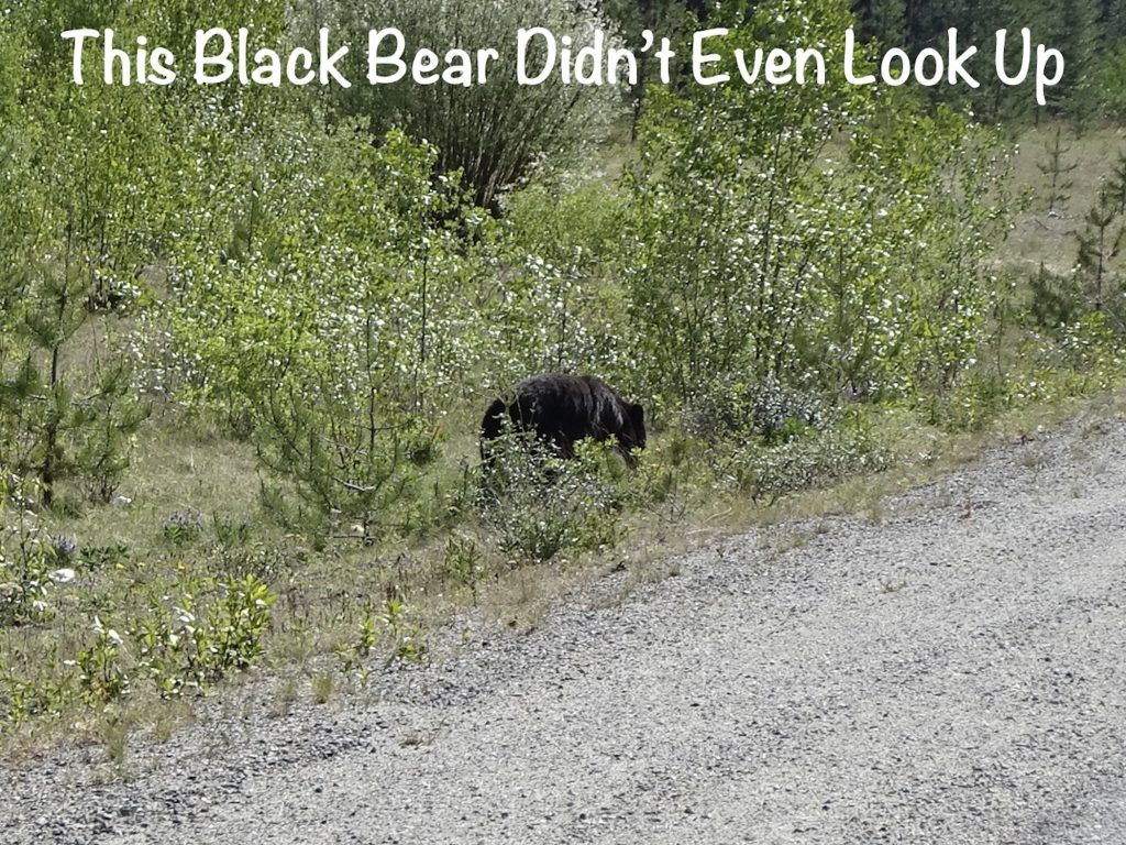
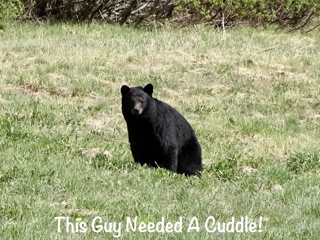
Thursday we got on the road a little before 10 AM and had gone almost an hour before we saw the first animal, a black bear. There was no real slowing down at that point, but I did catch a quick shot backwards. MW and I had just been wondering what happened to all of the wildlife, then saw him. Before lunch we stopped at an overlook with a bunch of swampy stuff below. Sadly, no moose. Our plan was to top off and get lunch at the Continental Divide Lodge, but when we arrived, there were signs on the pumps and the door saying “cash only”. I didn’t have enough cash for fuel or food, so we decided to backtrack a couple of miles.
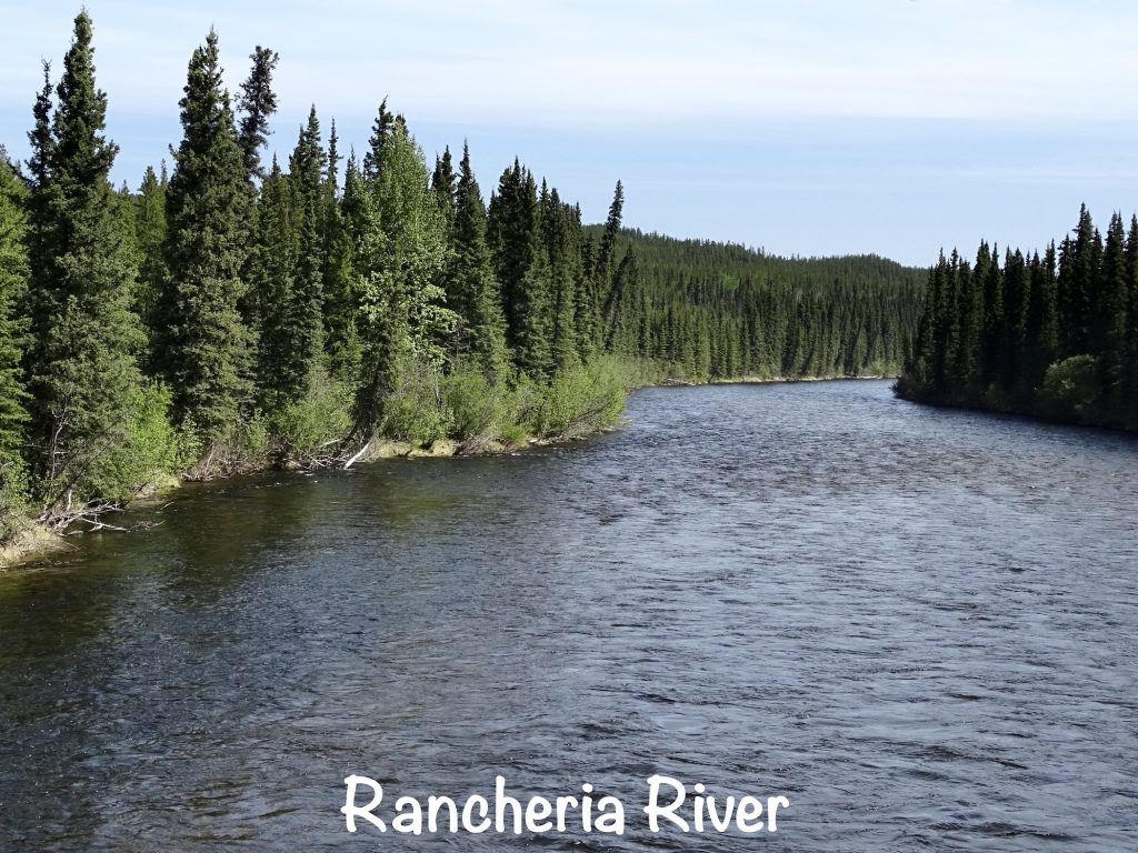
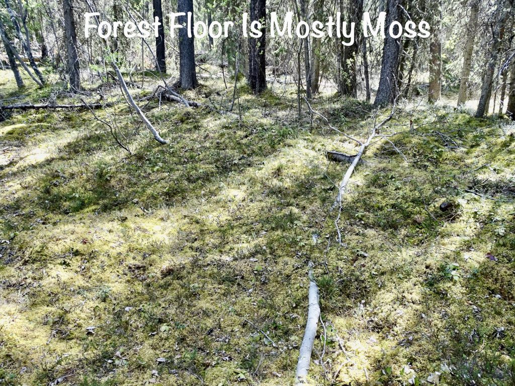
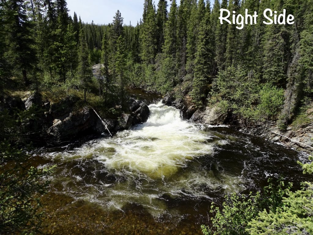
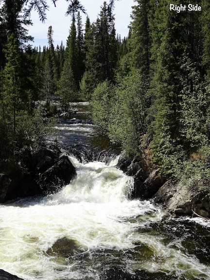
We pulled in at the Rancheria Falls Recreation Site to have a picnic and take a little hike. Of course, the trail had a “closed” sign on it. What? It’s a walk in the woods. How do you close that? We had our sandwiches and watched as several folks walked right past the signs. I figured if the issue was an angry moose or grizzly bear mom with cub hanging out down there, we would have heard screams by the time we finished eating, so it must be safe, right? It was about a 1/3-mile walk on easy trails and boardwalks surrounded by a boreal or snow forest of black and white spruce. It takes about 3 times longer for a boreal forest to mature, since the growing season is so short. We’ve heard a lot about forest fires in the past few weeks, with such an active early season in Canada this year. Of course, there are lots of terrible things that come out of fires that get too close to populations and crops. In the boreal forest, though, the fact is that periodic fires are necessary for rejuvenation. Just before the falls, the Rancheria River splits around an island where two separate water falls are created. The boardwalk passes on the down-river side for a pretty nice view of both.

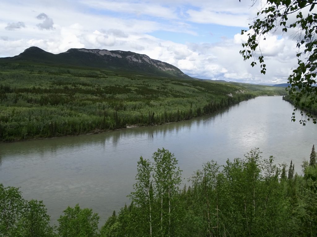
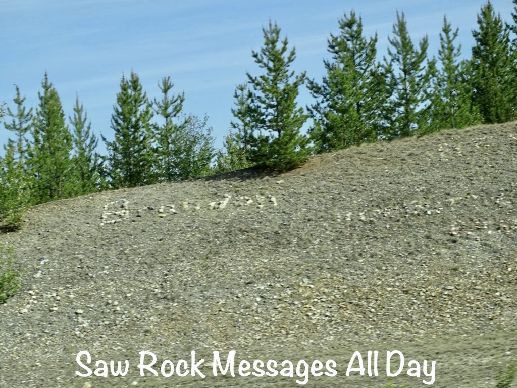
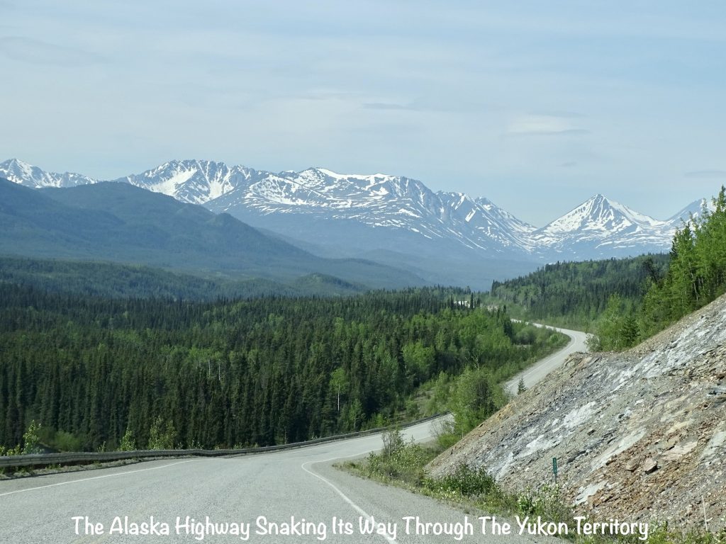
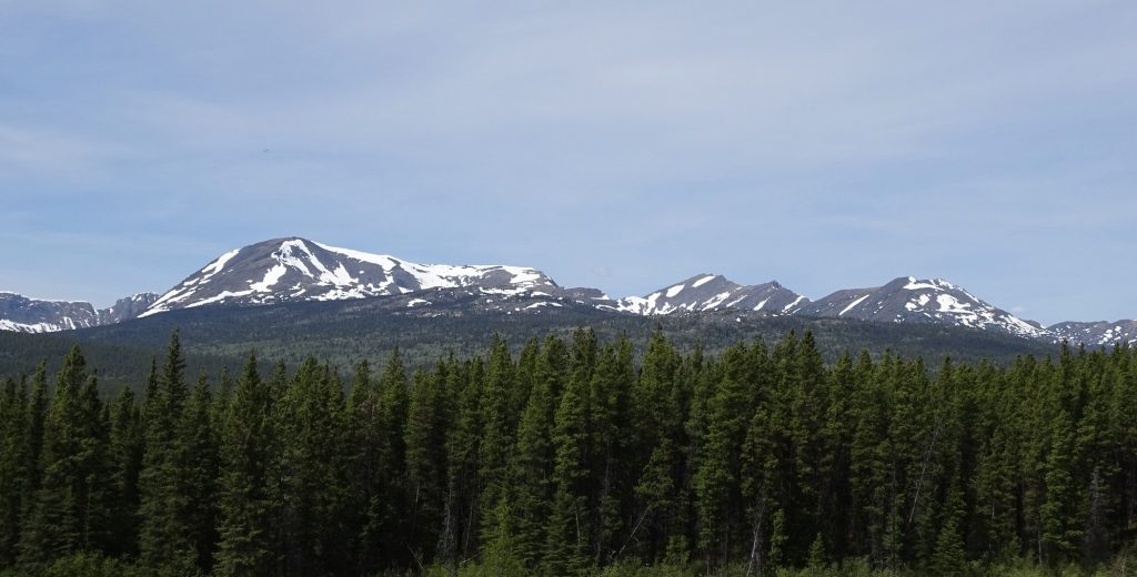
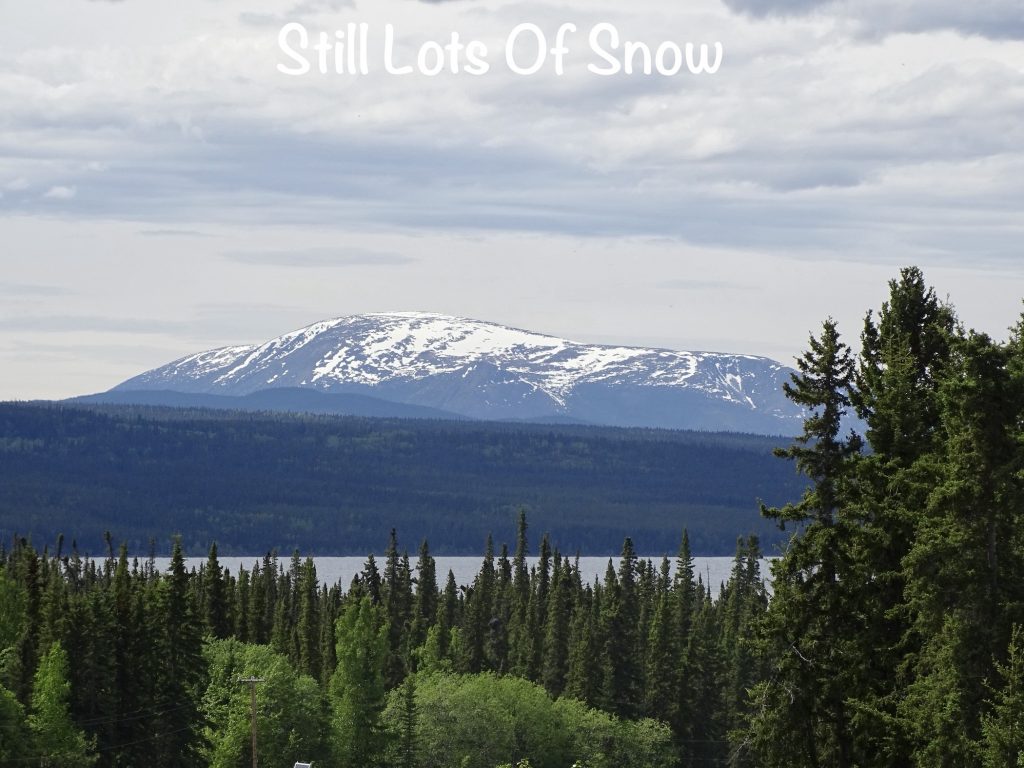
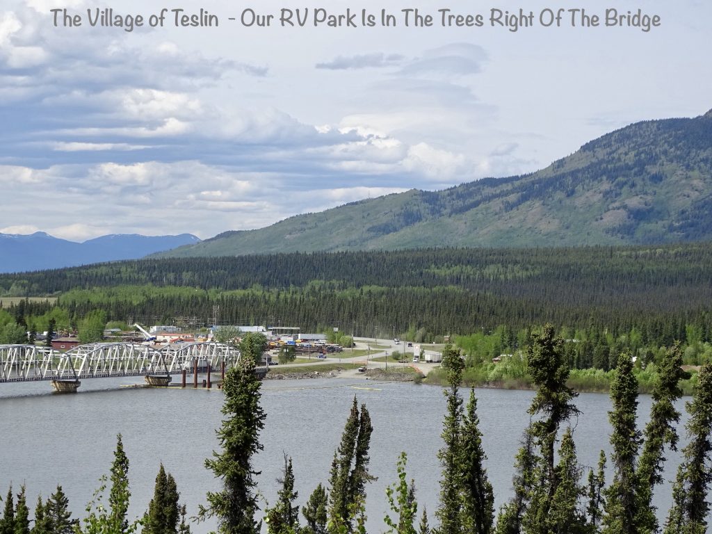
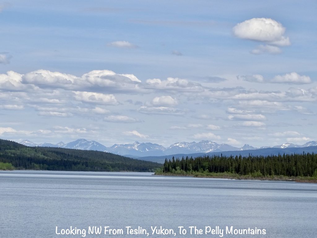
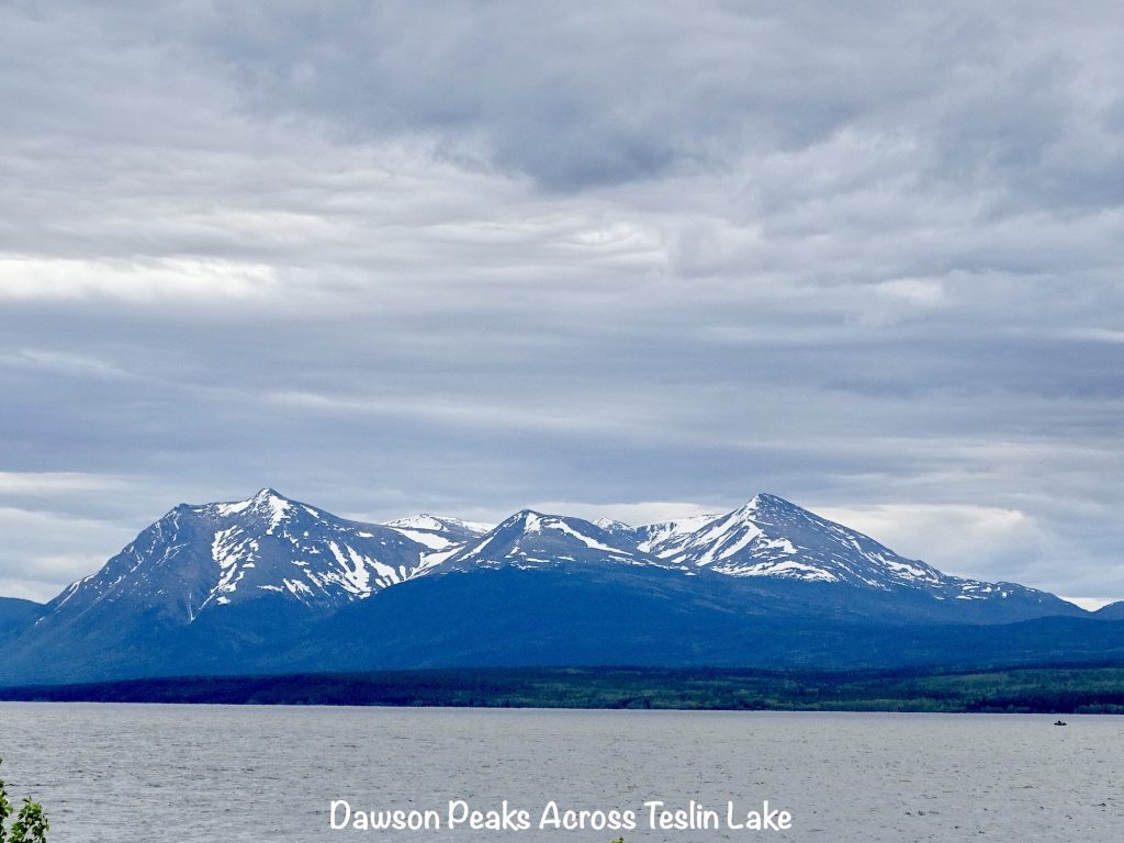
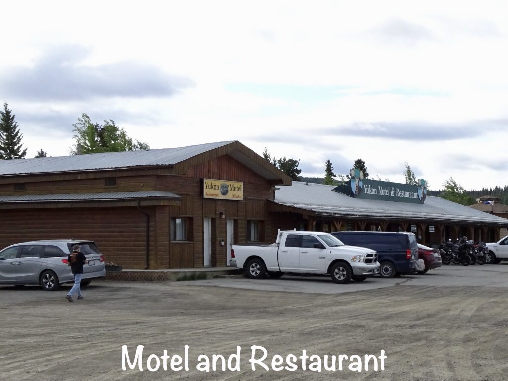
Refreshed from our walk, we parked our butts back in the truck and continued north. About 20 minutes later we ran across our second black bear. This one was walking along the side of the road, and MW was able to pull off. I stepped out on the running board, and the bear stopped for a second, then took a couple of steps towards me. Hmmm. He stopped again, made a little circle like a dog before bed, then laid down, still looking at me. Awwww. Honestly, one of those crazy people you see at Yellowstone would have seen it as an invitation to a belly rub party. As tempting as that was (kidding, Mom), I just took a couple of pics, then we headed on up the road. In the final leg, we saw a grizzly heading into the woods, too. Before getting into Teslin, Yukon Territory, we stopped before the river at the overlook. They are in the process of building a new bridge over the Nisutlin Bay Inlet on Teslin Lake. It was a beautiful day with gorgeous scenery from rolling hills to snow-capped mountains in the distance. Throughout the day there were a lot of rocky hill cuts along the highway, and all along the way people had put their names, other messages, or artwork in rock on the hills, which was neat. It reminded me a bit of the railroad tracks in the desert, I believe in California, last year. After getting set up at the Yukon Motel & RV Park, we relaxed for a little while, then checked out the restaurant there for supper. No big winners there, but something odd…MW’s roast beef dinner was basically sliced deli roast beef heated up with gravy on top. We’ve never seen that before.
SQUIRREL, WELL LARGER THAN THAT: On the Alaska Highway, we saw signs saying “Report Wildlife Collisions” with a phone number and a picture of a bear. I have a couple of questions: 1) Cell coverage along that highway is mostly nonexistent, so how exactly am I going to make that call? 2) If I hit a bear that doesn’t die, my vehicle is disabled, and by some miracle I’m able to let them know, will ANYONE get to me before the giant angry beast breaks into the truck and shreds me up for supper?
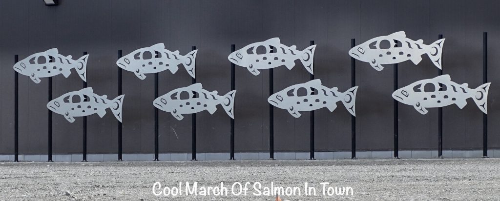
The Nisutlin Bay is home of the Nisutlin River Delta National Wildlife Area, an important staging area for migratory water birds from all over the world. Water levels drop over the drier summer months, exposing mud flats that are perfect feeding areas. Thousands of ducks, geese, swans, and shorebirds stop through on their trip south in the fall, which must be something to see. It is also a spawning area of chinook salmon. They enter the Yukon River at the Bering Sea in Alaska 1,840 miles to the northwest in May, June, and make it into the Yukon Territory around mid-July. Amazingly, during their entire journey up river, they do not feed at all and swim continuously. When they finally make it to the place they were born, they get busy. The female lays somewhere around 5,000 eggs, and the male fertilizes them. Then they die. Wow. I think the lesson there is that hard work while dieting makes you die! Let’s go with that. The eggs hatch and those babies spend a year in the local waterways before beginning the reverse trip out to the Bering Sea where they will live for 2 to 6 years before beginning their return to the Delta. The area has been fished for generations by the Tlingit (Kling-it) First Nation, and tribal elders tell of a time when the returning salmon were so thick you could almost walk across the rivers and creeks on the surge. That is not the case today; the numbers have declined rapidly. Since 1993, the local tribe has voted for Conservation Closures on fishing during spawning season, and in 2010, despite it being a traditional way of life and major food source for its citizens, they didn’t fish for salmon at all. There are many reasons for the decline, but high among them is the amount of commercial fishing in the Yukon River before the fish make it home. Hopefully their efforts will pay off and future generations will be able to enjoy the catch.
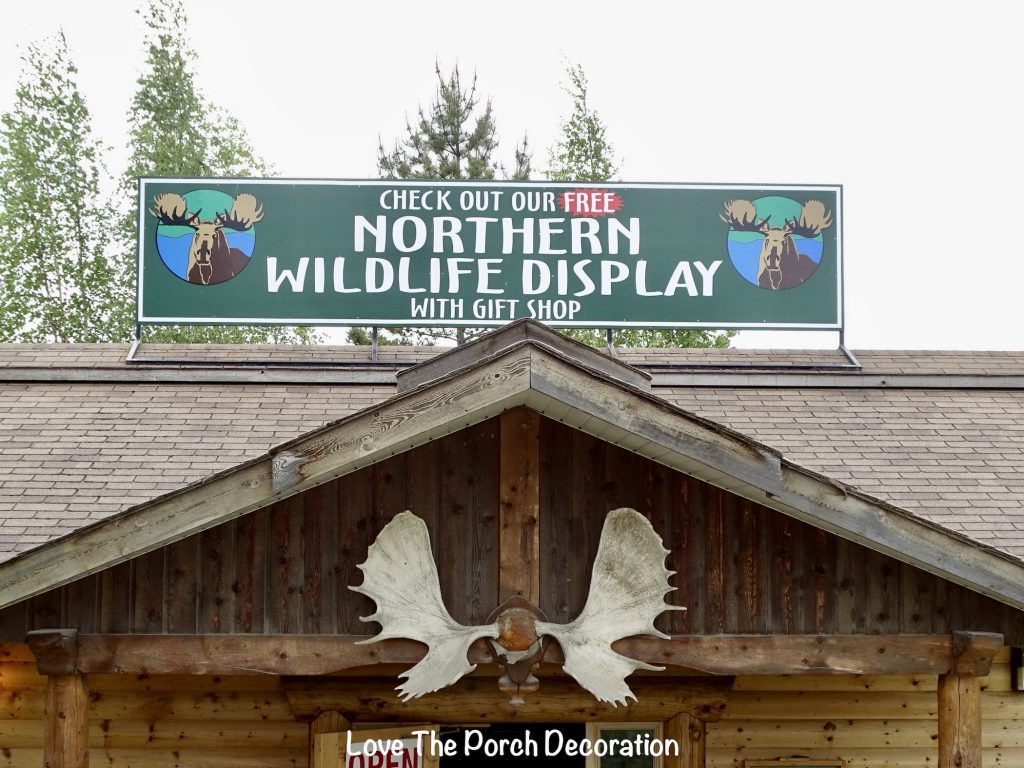
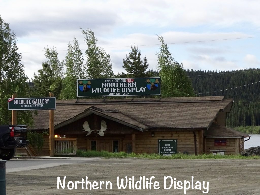
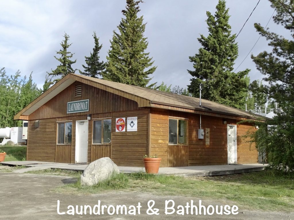
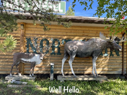
The next three days were pretty quiet. Friday, of course, was laundry day, and the campground had a nice facility for that. Later we walked over to the Northern Wildlife Display at the RV park. They had a lot of really nice dioramas of the animals from the Yukon and a gift shop. The taxidermy was amazing! We also walked across the street to check out the only other store in town. Lunch was sandwiches at the park restaurant, then a bit of work for me. Later I took a good bike ride around Teslin, before coming back to relax.
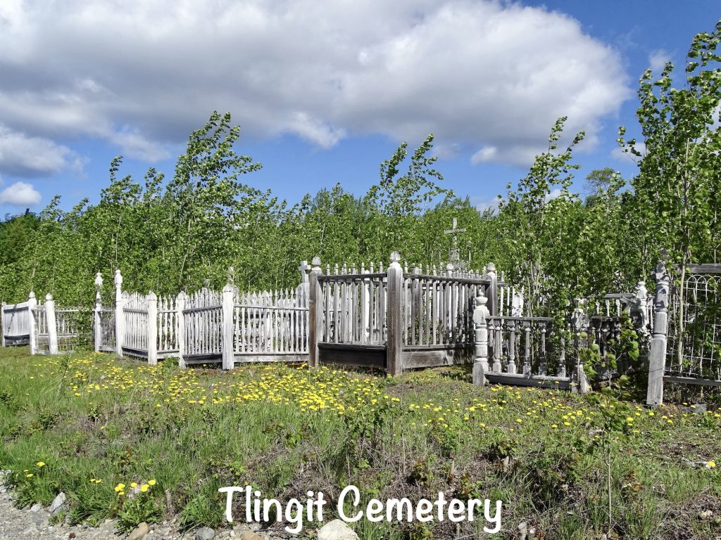
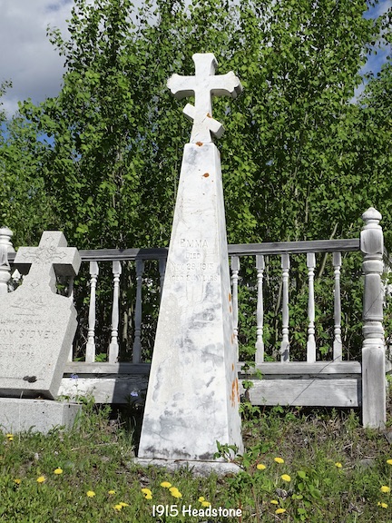
Saturday I was slowed down with a migraine, but thanks to modern medicine, we headed out before lunchtime for a nice, 2-mile walkabout using the town walking tour guide. Along the way we checked out the Tlingit cemetery.
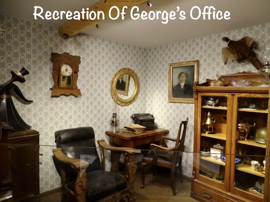
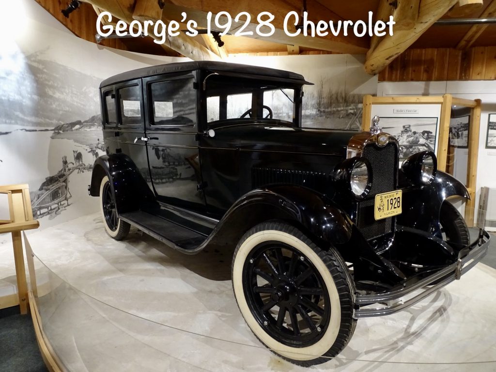
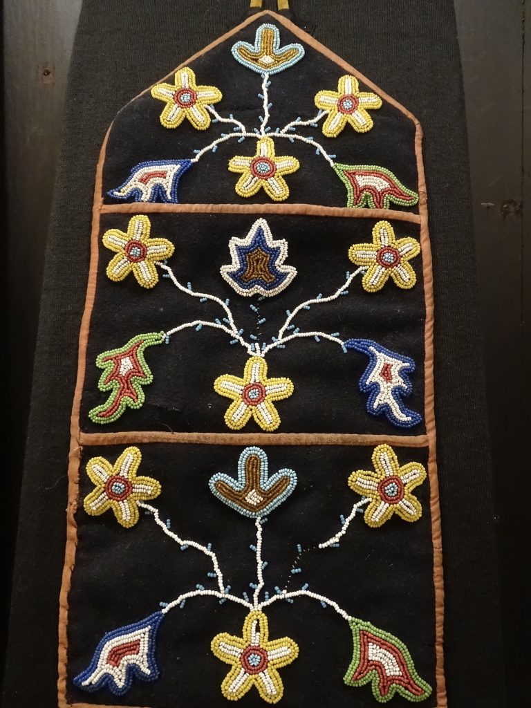
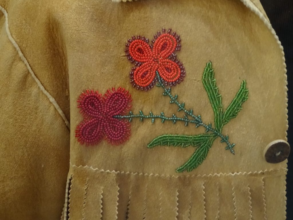
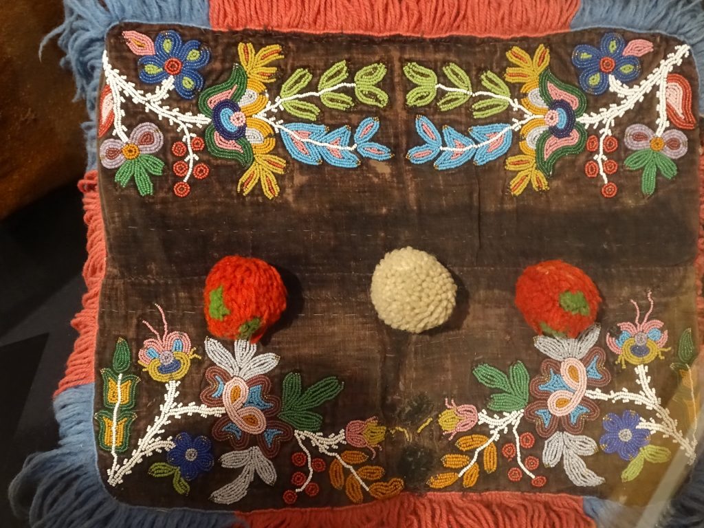
Next we stopped in at the George Johnston Museum. The Teslin Tlingits are one of the largest First Nation populations in the Yukon, and this place tells of their heritage with the largest collection of artifacts in the Yukon. Being from the southern U.S., we tend to think everyone is holing up in the cold weather, just waiting for it to pass. These exhibits tell of how the winter is one of their busiest times, hunting, fishing, trapping, etc. The Tlingit are historically a nation of lake travelers, and much of that movement was done in winter when they could easily haul sleds up and down the 60-mile waterway. There are also displays of handmade tools and other items, plus crafts, including the amazing beadwork designs which were used on everything from coats and blankets to moccasins. The museum also tells of George, the museum’s namesake, who was a Tlingit leader, trapper, entrepreneur, and photographer. He opened the first Teslin native general store selling groceries, candies, and native handicrafts. He was locally famous for his bringing the first car to Teslin…a 1928 Chevrolet that he purchased in Whitehorse and had delivered on the steamboat Thistle. There were no roads leading to or in town at the time, so he built a 4-mile stretch through the community, later to become part of the Alaska Highway, then became the first taxi service in the area. In the winter, he drove his shiny black car all over the lake, too, fishing and hunting. Then, when he realized the animals he was hunting could see him coming, he painted it white using house paint. At one point the car actually broke through the ice, and they had to wait until the spring to fish it out and get it running again. George traded that car in for a pickup truck, but the dealership kept and restored the original, then donated it to this museum later. The thing George is most famous for, though, is documenting the Tlingit life. Using a camera purchased through mail order, he took pictures of the local people of Teslin and Atlin, British Columbia, from 1910 to 1940. The scenes show their everyday life as it was before the Alaska Highway and the invasion of the outside world. You can see many of his photos at the museum.
While we have looked at the Alaska Highway as a marvel, it was also the end of a way of life for the First Nations. On the good side, it gave them easier access to stores, education, and health care. But there was also a LOT of bad. With outsiders came diseases they had never been exposed to. Of the 135 Tlingit people in Teslin when the road came through, 129 contracted measles, three dying. They also had four killed by meningitis. The other thing the museum doesn’t talk about, but it can be seen in some of the photos is the detritus left behind by the road construction. All along the highway there were mounds of trash and debris, broken down equipment, run down temporary housing, and everything else you can imagine. It all just rotted in place, which must have been heartbreaking for the people who had lived in and loved the area for generations.
Next we took a look at the old Teslin Radio Range building. During the 1930s and 40s, low frequency radio ranges were the main navigation system for aircraft. This one was originally located about 4 miles from the current airport. In 1940, the Canadian Government upgraded several of these stations in an effort to assist the U. S. with delivery of Lend-Lease aircraft to Russia via the Yukon. The new Aeradio Navigation Range emitted both continuous- and long-wave that would guide air traffic until the late 1960s. Pilots called it “Flying the Beam”, and it must have been terrible! As you were approaching the beacon, two different morse codes were coming in at the same time. You were on target when they came through as one, uniform tone. Anything else meant adjustments. Between dits, dahs, tones, and ridiculously loud cockpit noise, it’s amazing that any of the pilots could hear in later life at all. This display also had information about the Teslin airport and communications center, which was planned in 1939 to assist civilian traffic to the Orient. After the U. S. joined the war, the route was taken over by the Royal Canadian Air Force, and the planned airport became a war time base. The airports along the Alaska Highway route were essential in getting construction supplies.
Before returning to Petunia, we stopped by the Kimmy’s Yum Yum food truck, where we picked up late lunch. MW had a burger, which was good, but mine was more unique. I had a slaw dog (they looked at me a little funny for requesting just slaw and mustard on my dog), but they serve it on naan…a totally different taste.
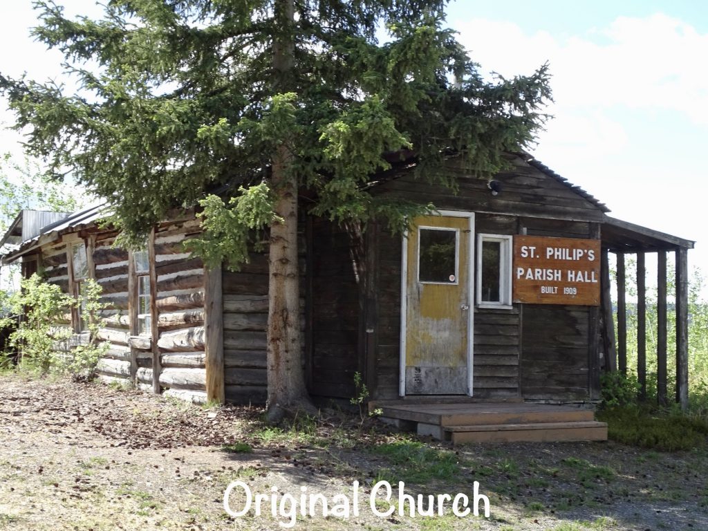
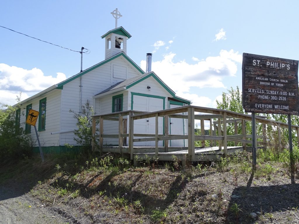
Sunday was laid back, starting with breakfast at the park restaurant. On the walk back to Petunia, we saw a bald eagle watching for a nice fish catch on the lake. Later we headed over to St. Philip’s Anglican Church, where we had a wonderful experience with the small crowd. Due to their size, they have two services a month, and we were blessed to be there on the right day! The priest, Sarah Usher, is technically retired, but donates her time to this little church in her husband’s home town. She spoke on keeping the faith…the faith of Matthew when he got up and followed Jesus, the faith of Abraham when he believed he would have a son despite his advanced age, the faith of the bleeding woman when she touched the hem of Jesus’ clothing, knowing she would be healed…all terrific examples in a useful message. I also enjoyed hearing the Lord’s Prayer spoken in native Tlingit. I was told it is the second hardest language in the world to learn, the first being one of the African clicking languages. After the service, she had coffee, tea, and cookies for the entire congregation, all eight of us, and we hung around talking for another 25 minutes or so. It was such a nice morning! The rest of the day was spent relaxing and doing a little writing.
Yukon Motel & RV Park sits on the shore of Nisutlin Bay within walking distance of everything in Teslin, Yukon Territory. The property includes a store/gift shop, restaurant, post office, gas station, and the Northern Wildlife Gallery. They have propane available onsite, an ATM, dump station, bathhouse, laundromat, and free wifi. Lodging options are a motel and the RV park, the latter with 40 pull-through and 20 back-in sites. All sites had water, but only 15 had 30-amp electric. The rest had 20-amp. The laundromat, bathrooms, and showers were older, but very clean. Cell signal for Verizon was moderate, and of course, no over-the-air tv. There is noise from the bridge construction, and once that is complete, you will definitely hear vehicles coming across the new one at night, but it isn’t too bad. While not a destination park, this is not a bad place to park when passing through. For this stay in June 2023 we paid $150.25 for 4 nights.
Well, that finishes another week. Next up…Giant Food, Rough Road, and the Klondike. See you on the path!
Talisa
P. S. Thank you so much for reading! Use the buttons at the top right or bottom to be notified of new posts, and please SHARE, SHARE, SHARE on social media!